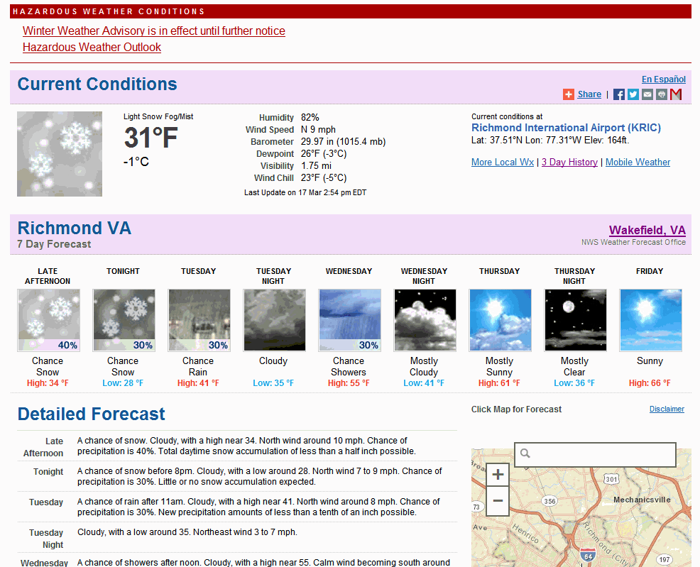
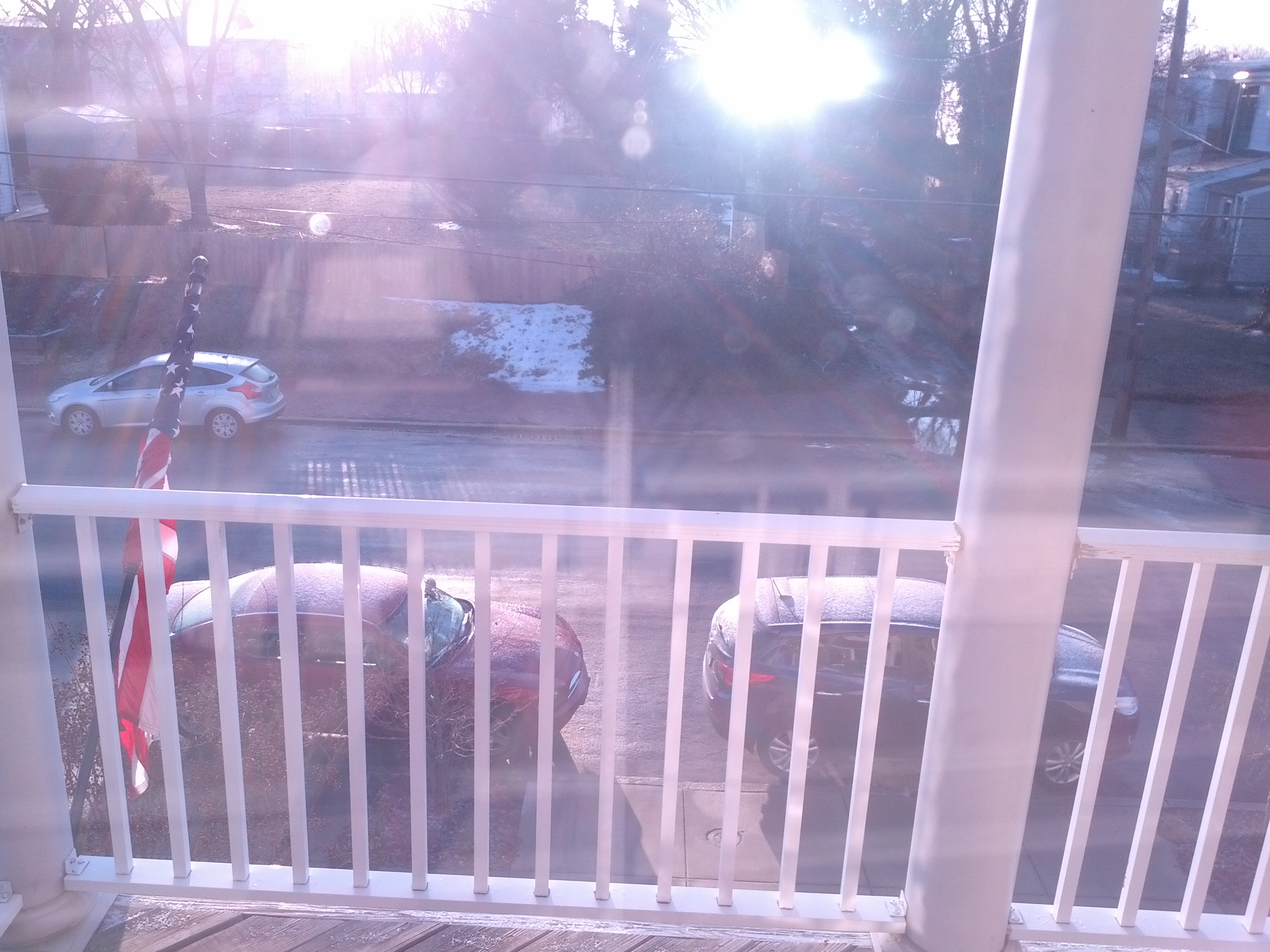
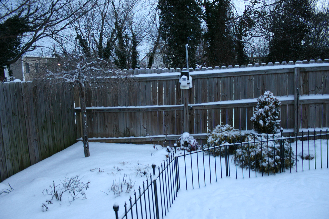
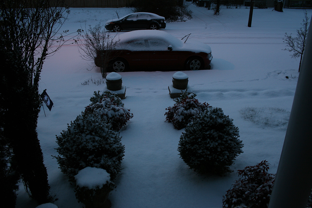
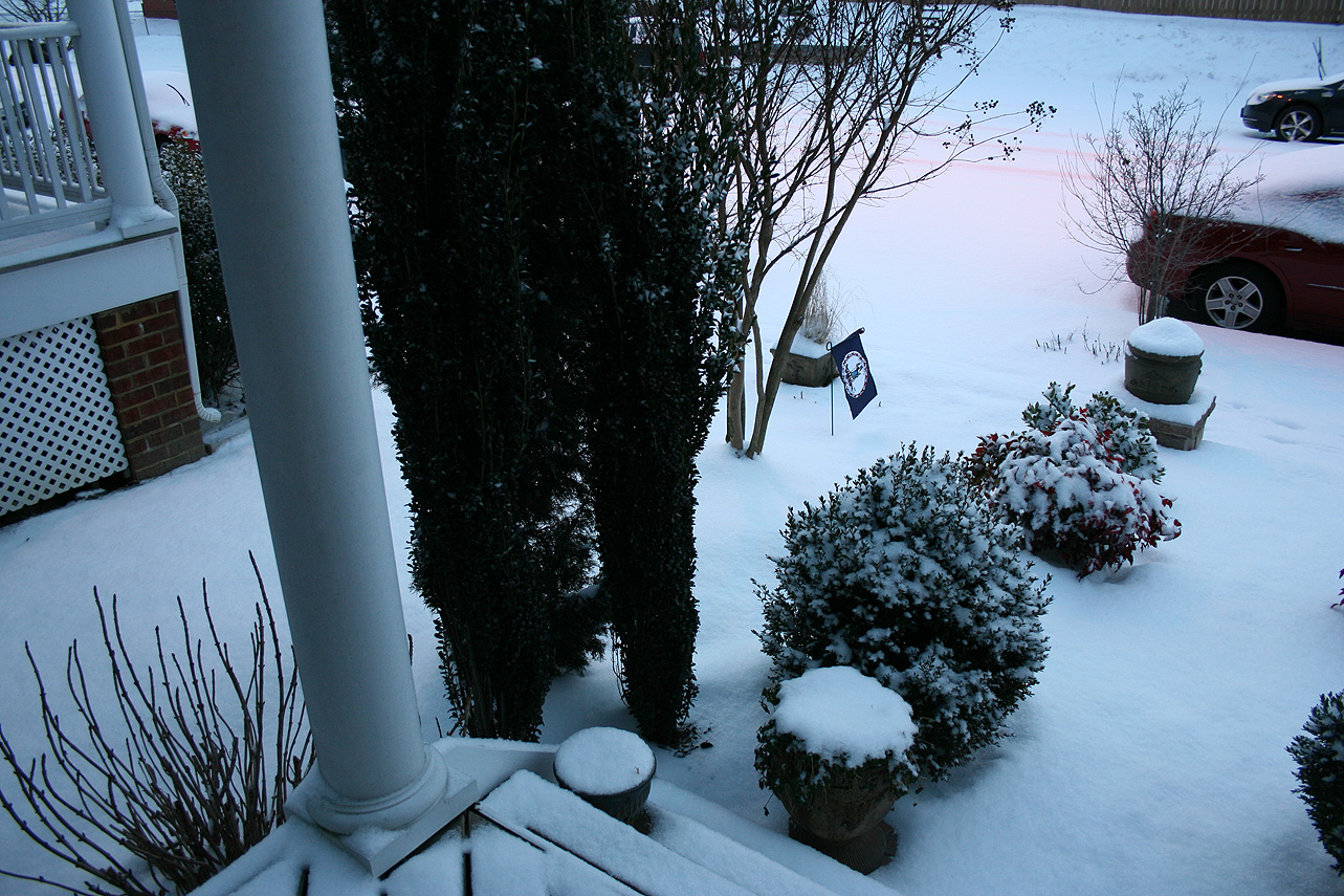
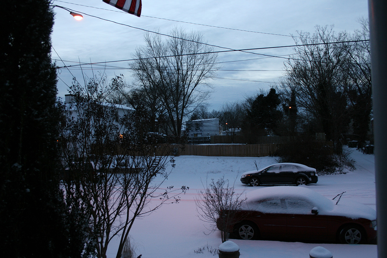
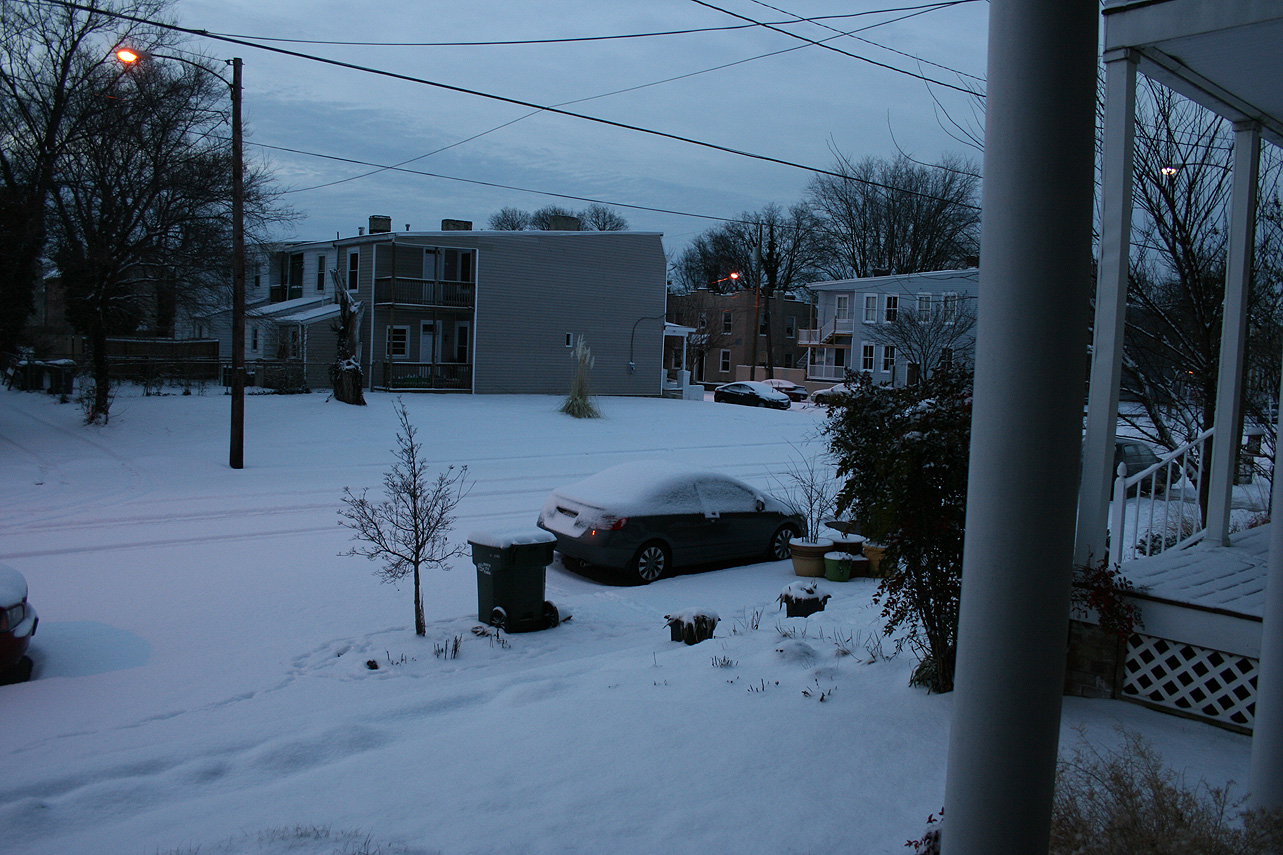
Church Hill Storm Observation Summary:
* Place – Time: Church Hill, (1/15/2015)
* Temperature: 30-32, During Event
* Winter Weather Watch/Warning/Advisory: None
* Closings: All local school districts had a delayed opening or were closed, Chesterfield County Government had a delayed opening for 10:00 AM.
* Predicted Totals: Dusting of snow.
* Road Conditions: All roads had varying amounts of snow, mostly in areas where previous ice from the 14th had not melted. Streets cleared by 10 AM.
* Precipitation Description: Snow.
* Total Precipitation: Trace of snow accumulation (light dusting). Snow on most surfaces. 0.00″ of liquid equivalent was reported at the Richmond airport.
* Comments: Low-level moisture from a surprise system overnight (12 AM – 3 AM) left a layer of light snow on most surfaces. The chance of snow was not discussed in the forecast.
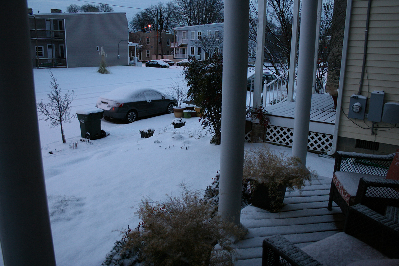
Tag Archives: church hill
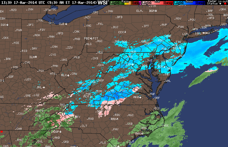
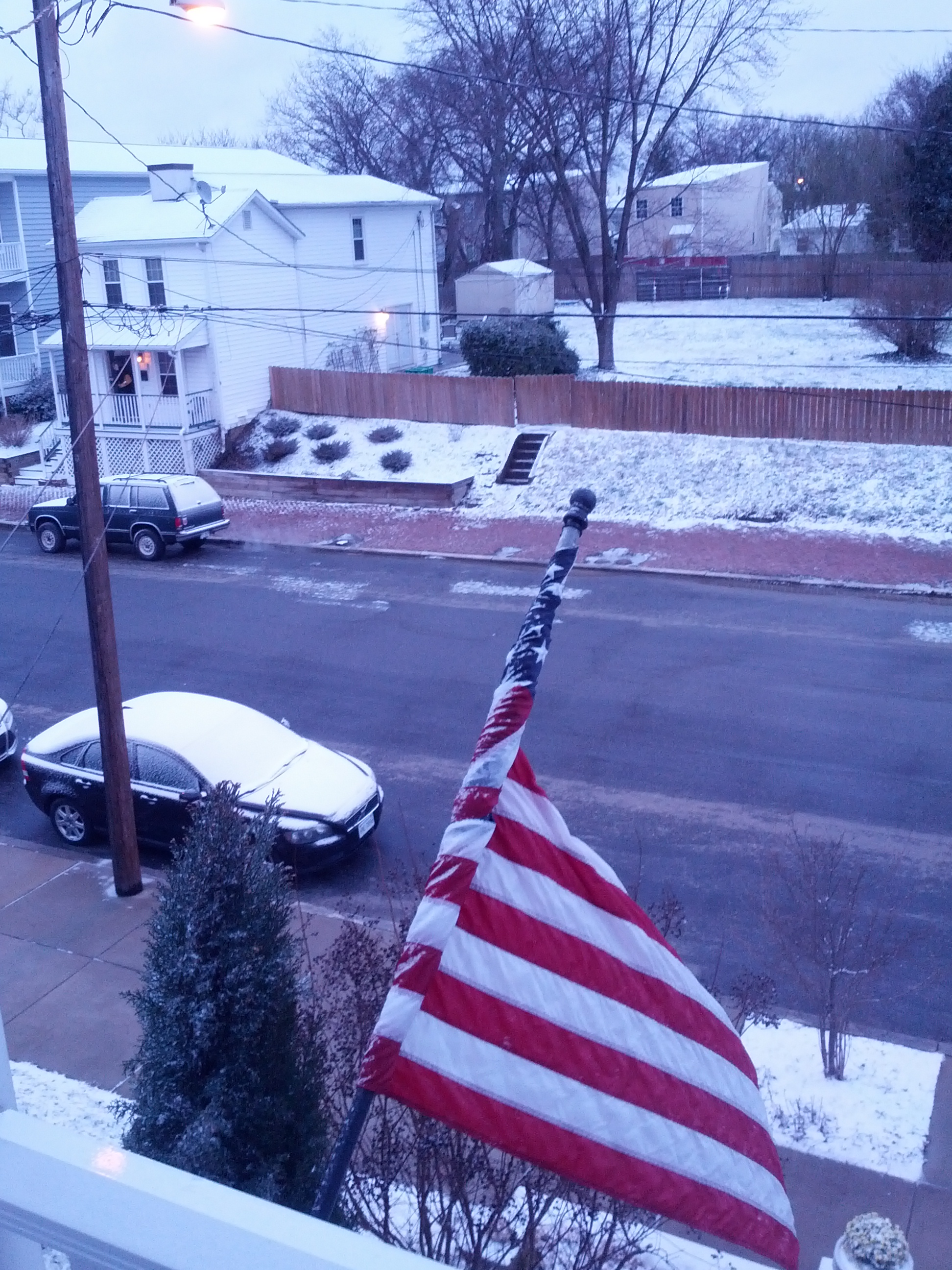
March, 17, 2014: Observations
Church Hill Storm Observation Summary:
* Place – Time: Church Hill, (3/17/2014)
* Temperature: 29-35, During Event
* Winter Weather Watch/Warning/Advisory: Watch & Advisory
* Closings: None
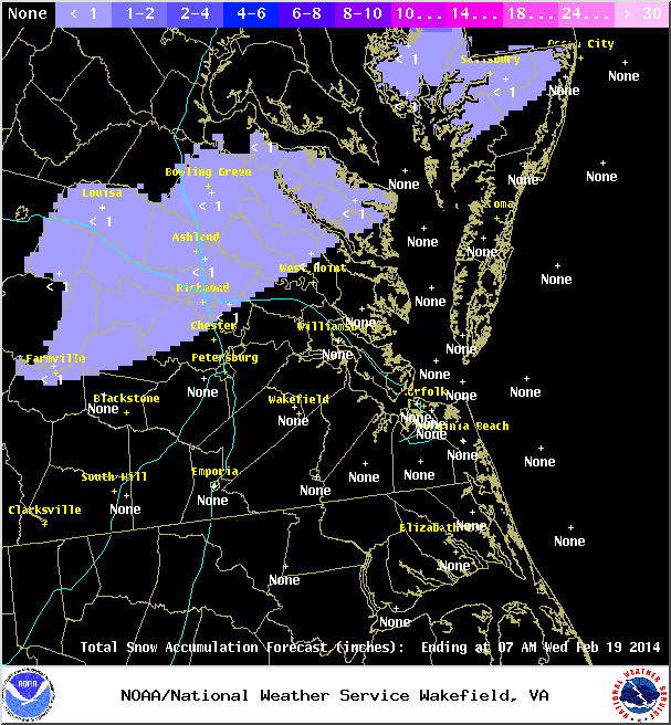
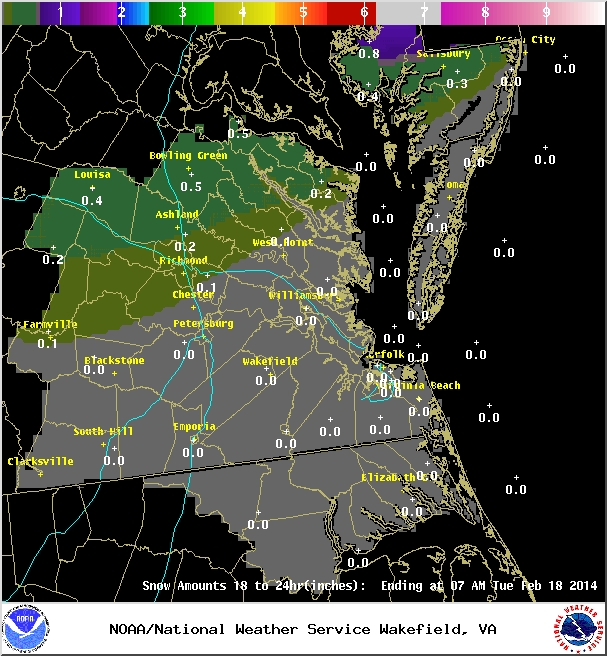
* Predicted Totals: Ranged from 2-4” initialed, downgraded to less than 1” on Sunday night.
* Road Conditions: All roads were primarily wet during the event.
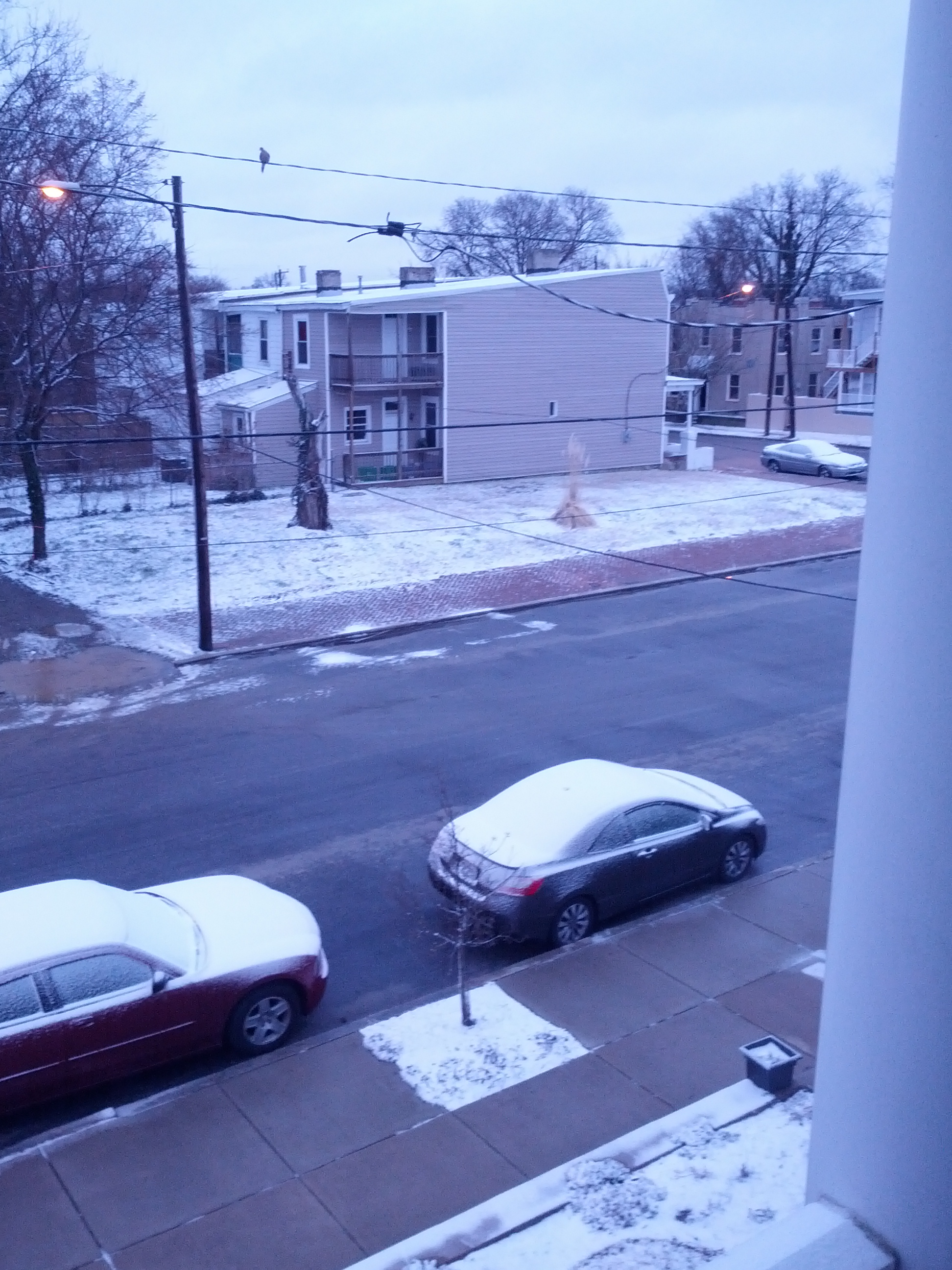
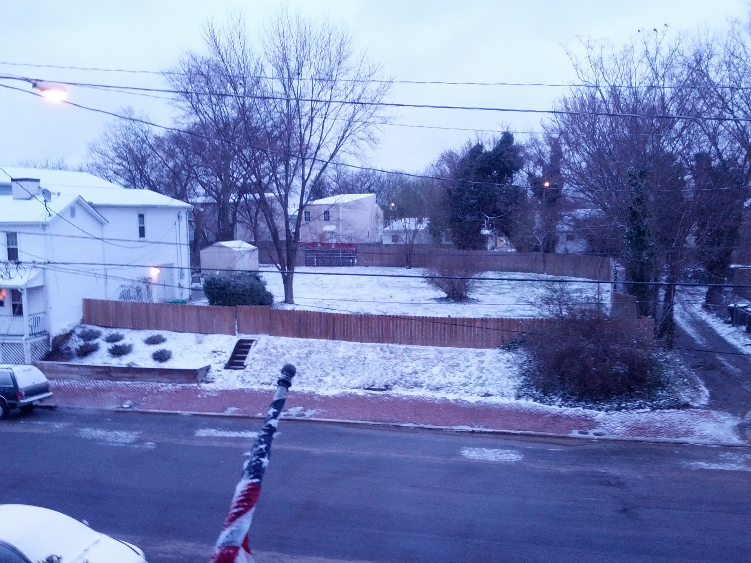
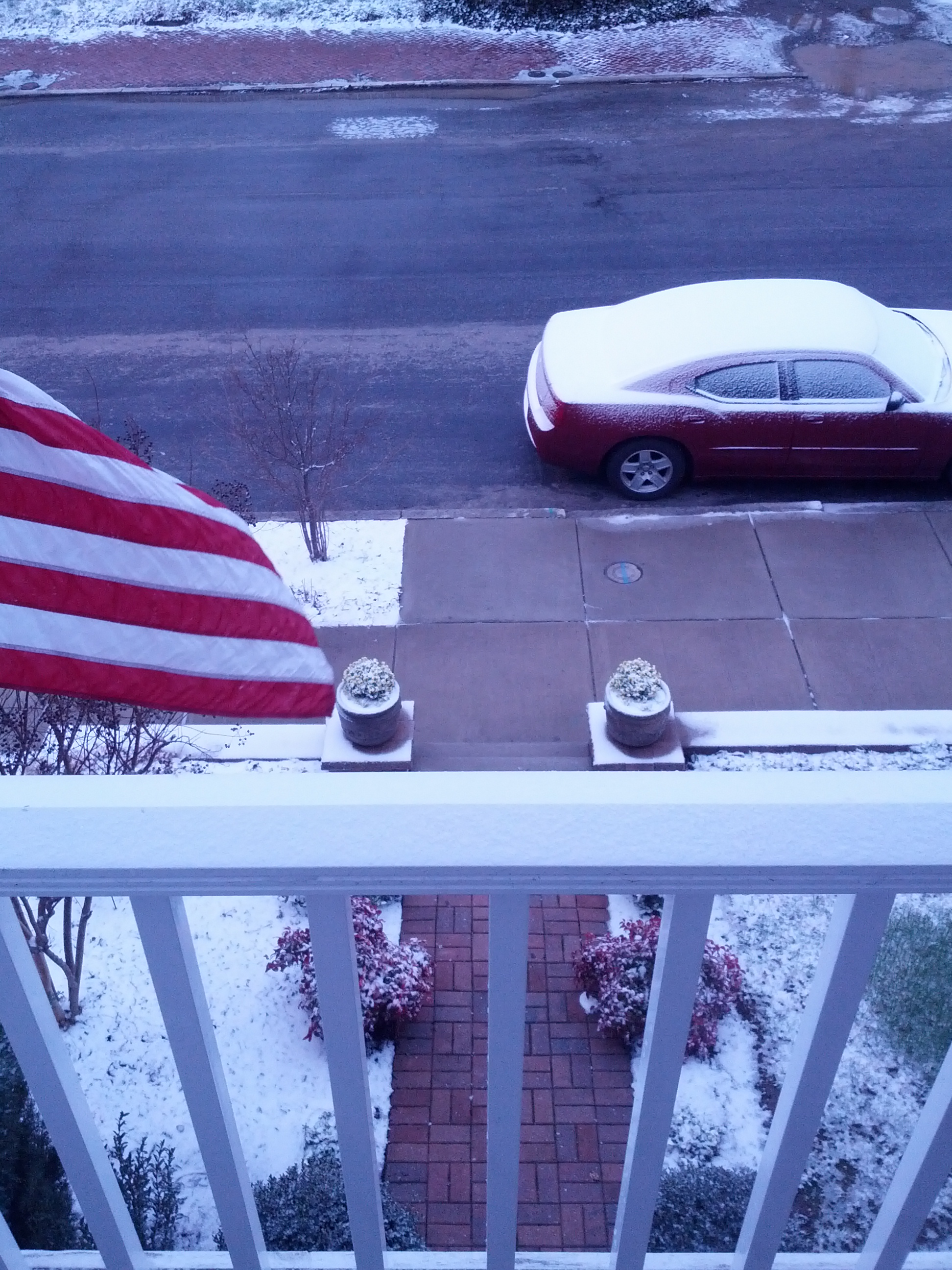
* Precipitation Description: A mix of rain to sleet, followed by freezing rain, sleet and snow during the overnight hours. Additional freezing rain and sleet fell during the morning hours of 3/17/2014.
* Total Precipitation: Approximately 0.5″ of snow, sleet and ice accumulation. Snow, sleet and freezing rain accumulated on elevated surfaces. 0.6″ was reported at Richmond airport.
* Comments: A low sliding through the Tennessee Valley towards the coast of Virginia delivered a late season winter storm event to the Richmond area. A cold air wedge developed on Sunday afternoon that slowly changed rain over to sleet during the late evening and overnight hours. Periods of sleet, snow, freezing rain and rain continued through the morning and early afternoon hours. Impacts from snow and ice to the Richmond area were minimal from this storm. However, areas to the north saw increased snow totals between 2-8” towards Fredericksburg & DC.
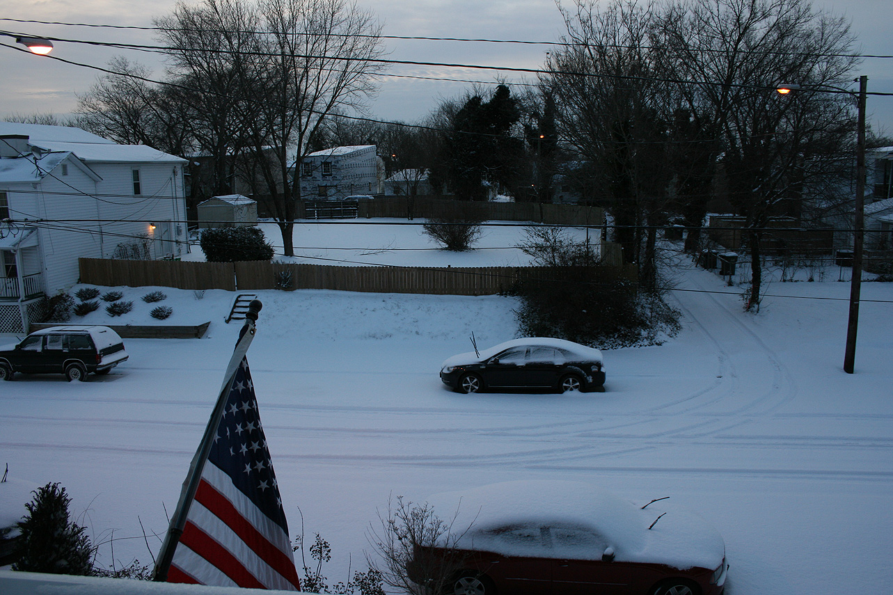
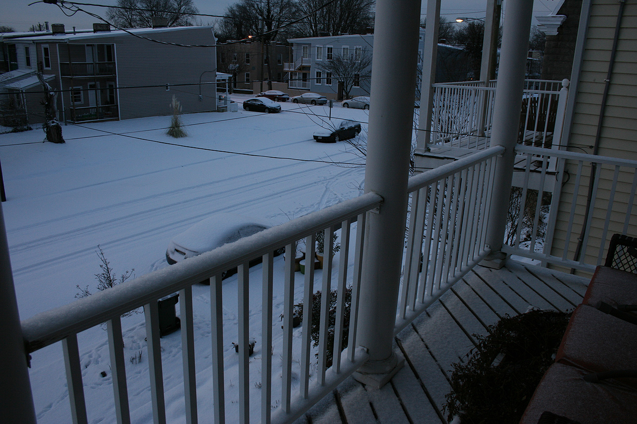
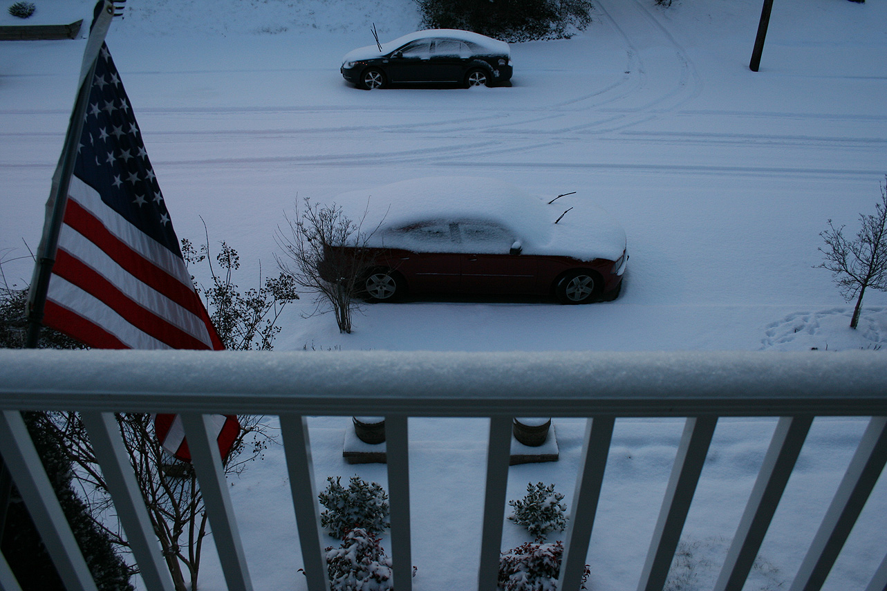
Snowfall Totals:
Photos:
NWS Forecast, Day of Event:
March 7, 2014: Observations
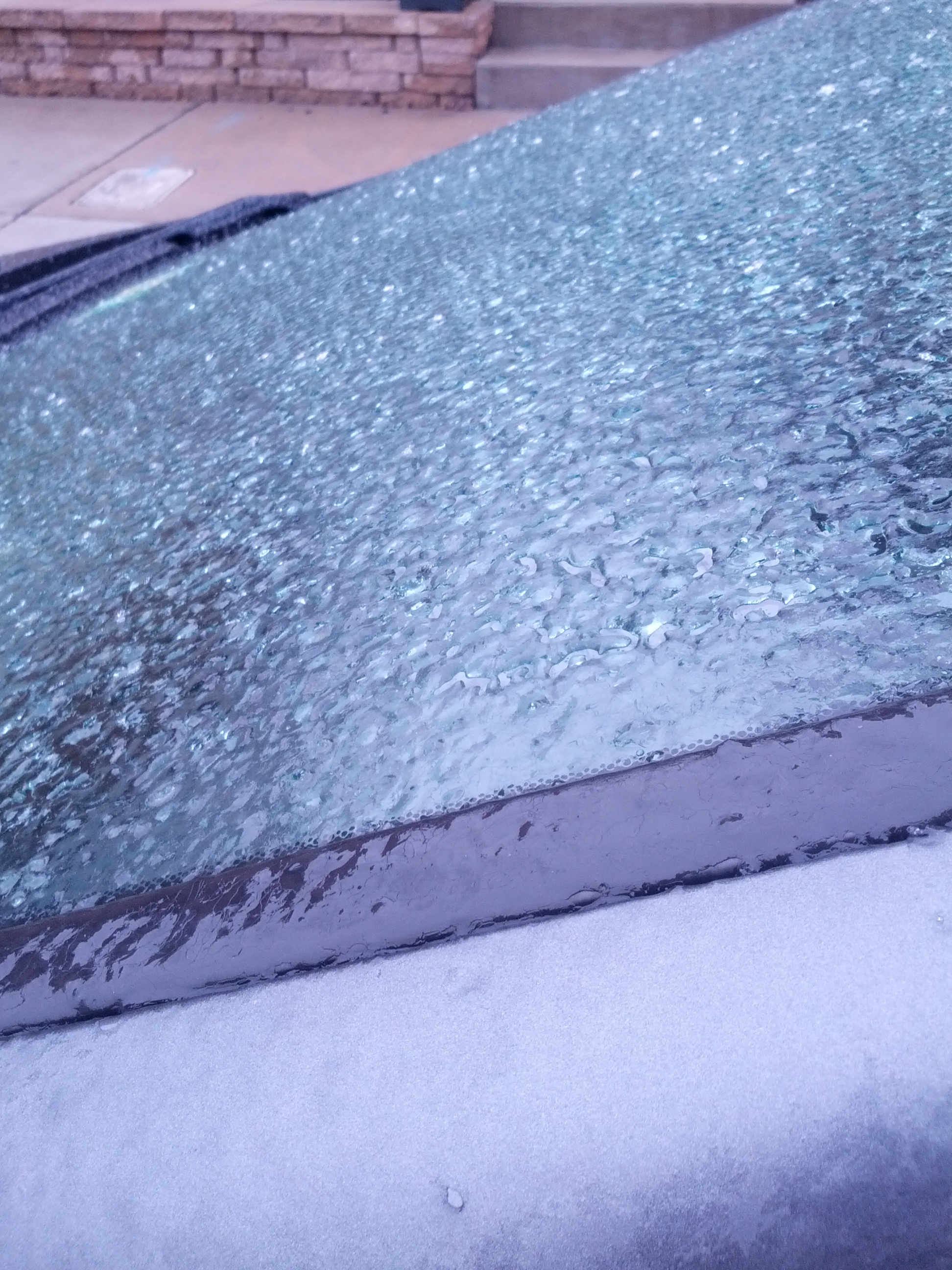
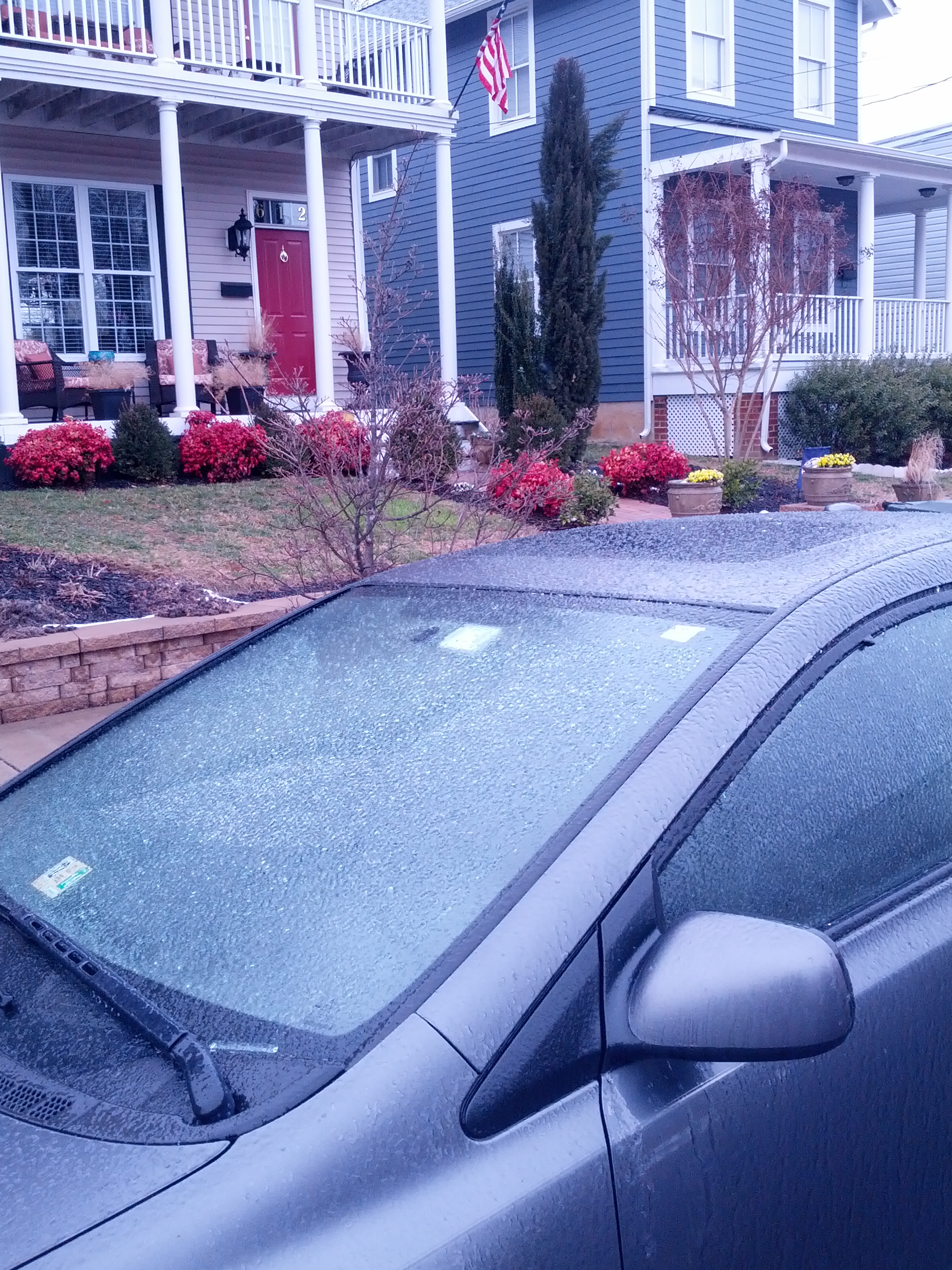
Church Hill Storm Observation Summary:
* Place – Time: Church Hill, (3/7/2014)
* Temperature: 32-33, During Event
* Winter Weather Watch/Warning/Advisory: Advisory
* Closings: None
* Road Conditions: All roads were wet during the event.
* Precipitation Description: Sleet, transitioned to freezing rain and then rain by 8 AM. Sleet began around 4:00 AM and quickly turned over to a mix of sleet and freezing rain by 7 AM.
* Total Precipitation: Less than 0.1″ of ice accumulation. Freezing rain accumulated on elevated surfaces.
* Comments: A low coming out of the Gulf of Mexico tracked up the east coast, delivering a severe snow and ice storm to western North Carolina and southwest Virginia. Impacts from ice to the Richmond area were minimal from this storm.

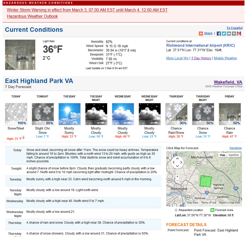
March 3, 2014: Observations
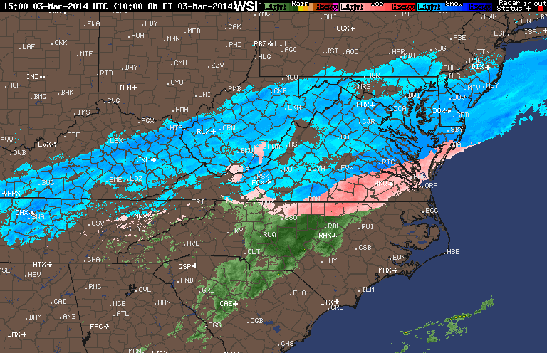
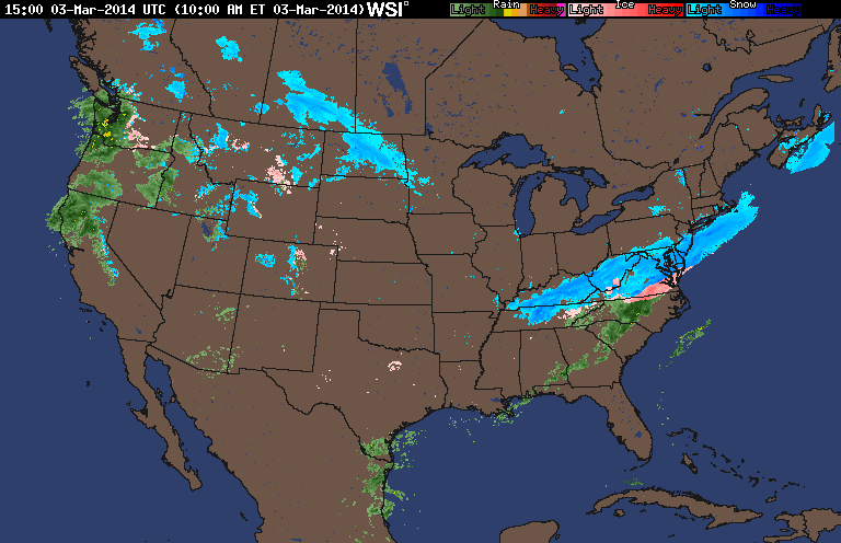
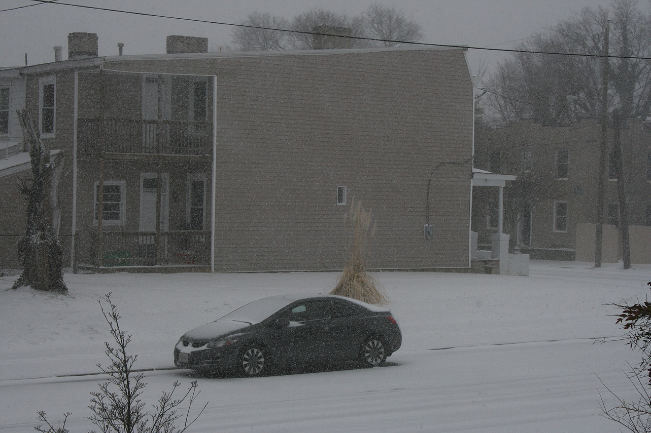
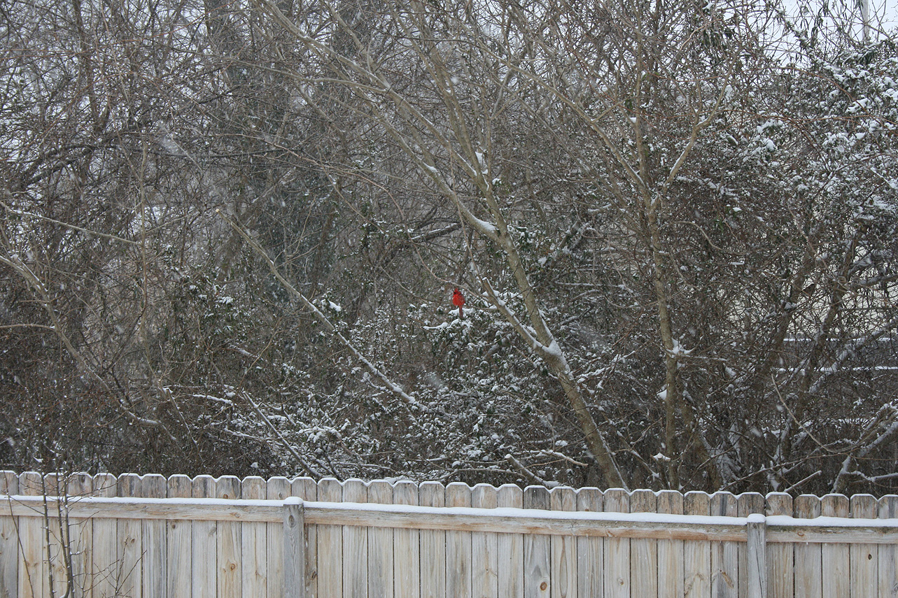
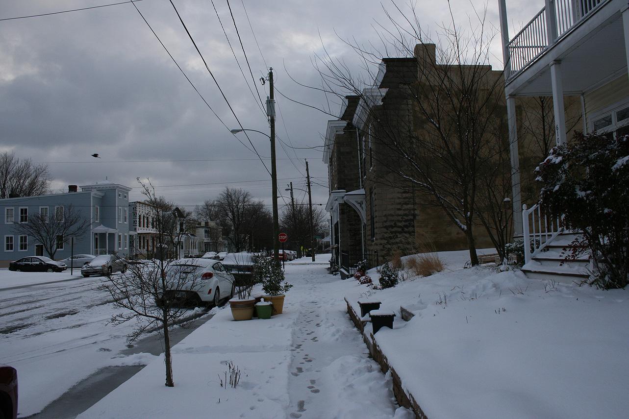
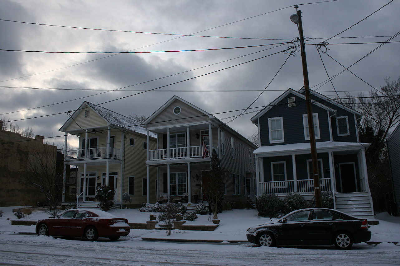
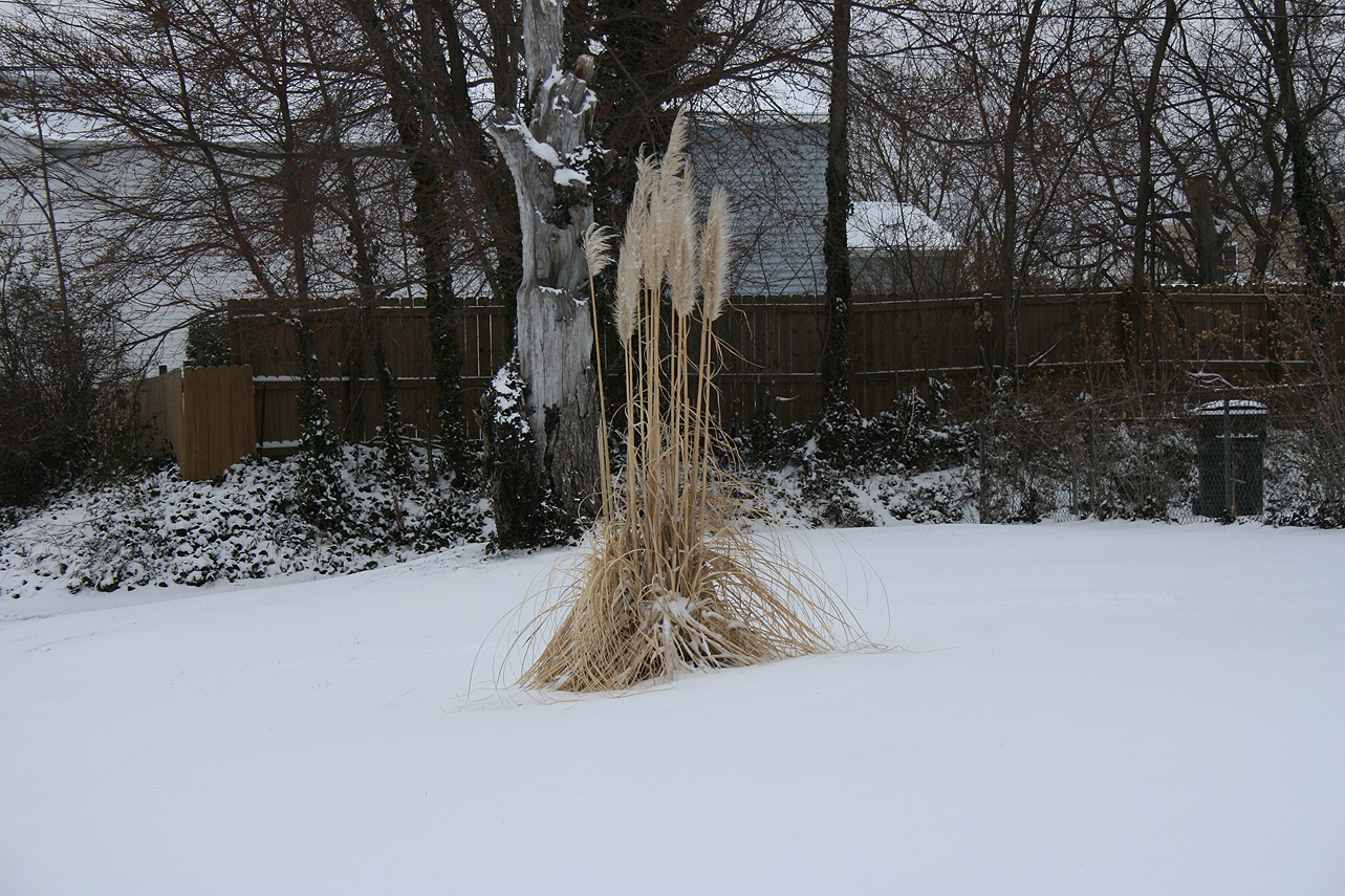
Church Hill Storm Observation Summary:
* Place – Time: Church Hill, (3/3/2014)
* Temperature: 24-36, During Event
* Winter Weather Watch/Warning/Advisory: Warning
* Closings: Chesterfield Government Closed on 3/3/14 at 10:30 AM, Delayed opening on 3/4/14 for 10:30 AM.
* Road Conditions: All roads covered during event.
* Precipitation Description: Snow, sleet, and rain. Rain and sleet began around 6:30 AM and quickly turned over to all sleet by 7 AM. Snow began to mix in with the sleet by 8 AM. All snow by 9 AM where heavy snow fell for almost 2 hours. Snow tapered off by noon as a large dry slot infiltrated the area. Flurries and light snow continued until 4 PM with no real additional accumulation.
* Total Precipitation: 3.1″. Approximately 0.1″ of sleet. 3.0″ inches of snow was reported at the airport on 3/3/14. Snowfall totals were fairly consistent across central Virginia with totals between 2-5″.
* Comments: Initial forecast for the storm shifted the axis of snow from the Midwest/upper mid-Atlantic to central Virginia on Saturday (3/1). Snow was expected to develop along a backdoor cold front that would create a cold air damning wedge. Afternoon high temperatures reached 72 on Sunday in Richmond, with the temperature plummeting to 11 on March 4th. Sleet, moderate to heavy at times, quickly transitioned to heavy snow. The dry slot quickly stopped the snow by midday, making the higher forecast totals of 7-8″ unattainable. Even higher forecasts of 8-12″ towards Fredericksburg busted due to this dry slot. The sun peaked out briefly before the sun set on 3/3/2014.
Snowfall Totals:
Photos:

Videos:
NWS Forecast, Day of Event:
February 17-18, 2014: Snow, Ice & Rain
A quick system brushed across Central Virginia around 11 PM on 2/17 into the early morning hours of 2/18 that dropped a brief batch of snow, graupel, and ice. Accumulations were minor (Less than 0.1″ of snow/graupel and ice) and occurred mostly on elevated surfaces.
February 8, 2014: Observation
Nothing to report with this event. No precipitation was observed.
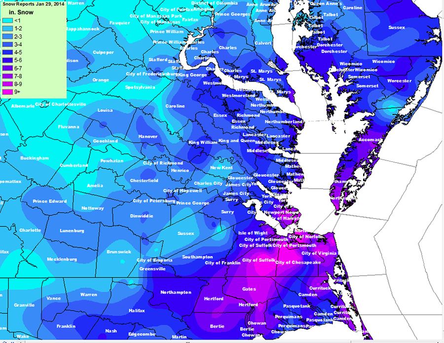
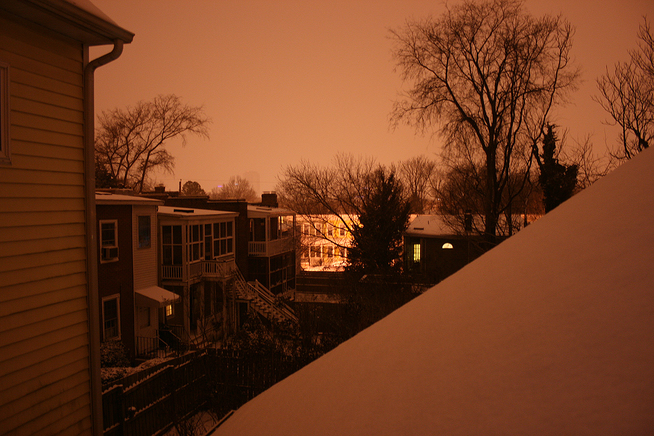
January 28-29, 2014: Observations
Event Updates:
As of 9:00 PM on 1/28, there is approximately 1″ of snow on all surfaces in Church Hill. Temperature continues to slowly fall and is hovering at 15.4 degrees Fahrenheit.
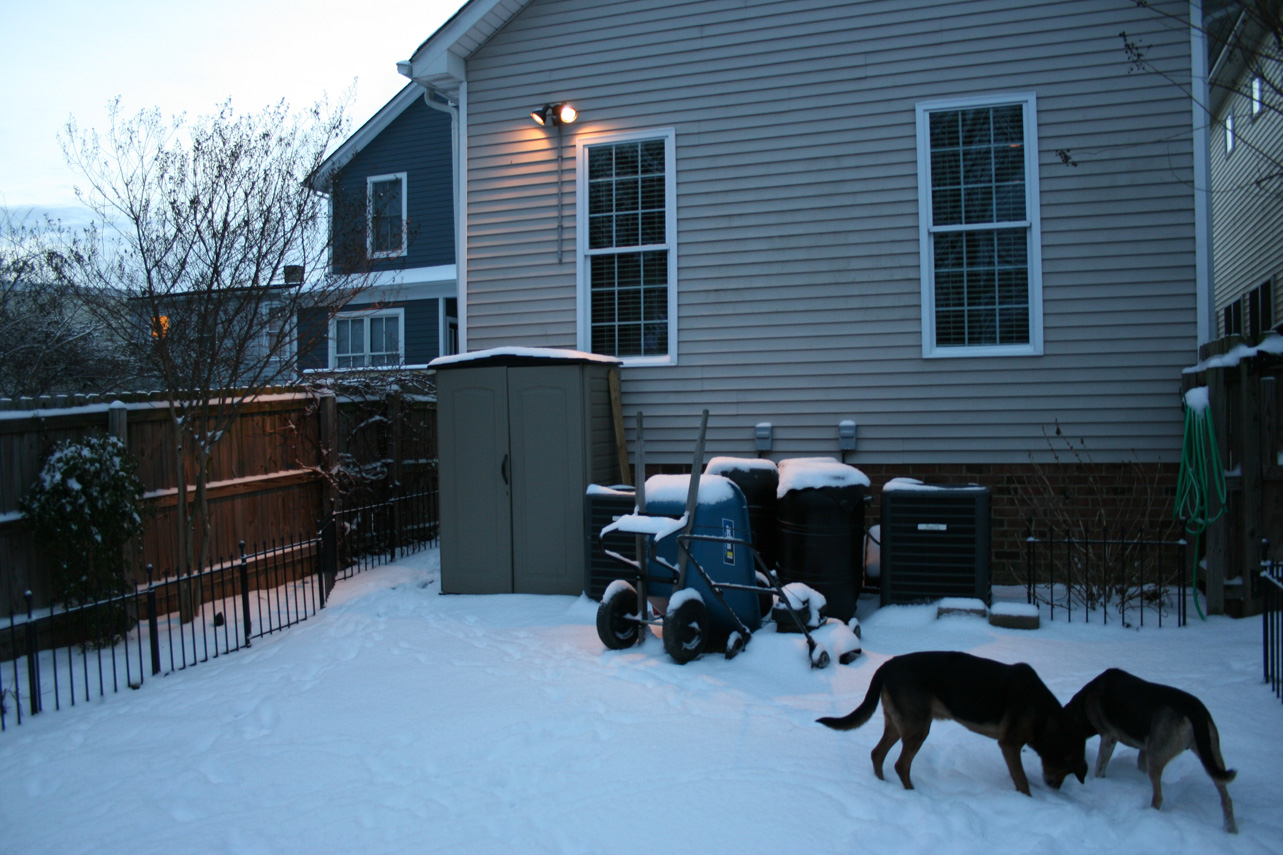
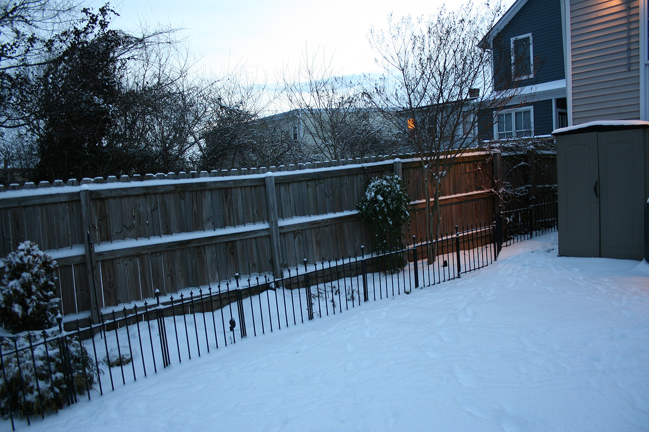
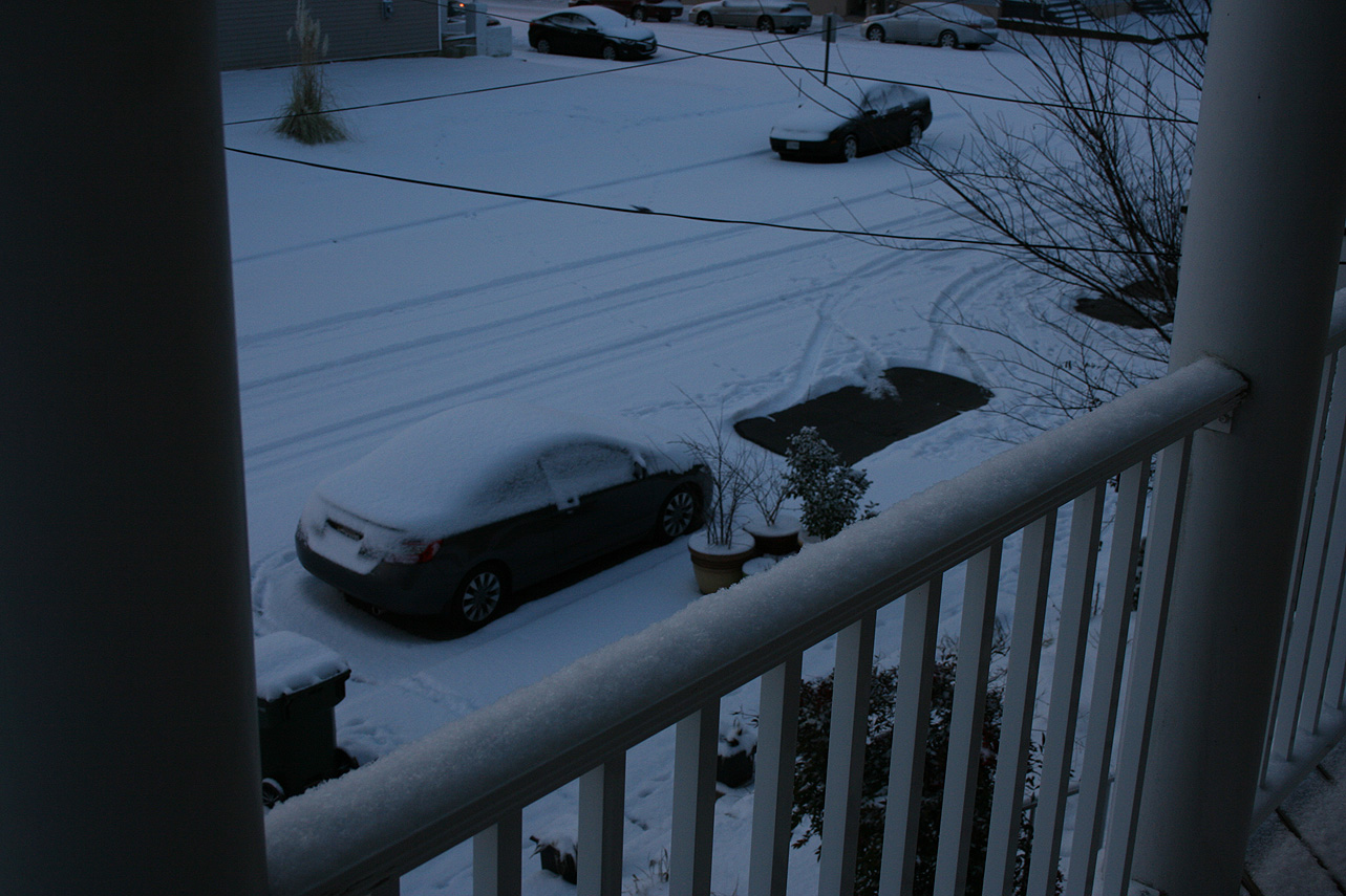
Church Hill Storm Observation Summary:
* Place – Time: Church Hill, (1/30/2014)
* Temperature: 12-20, During Event
* Dewpoint: 1-10, During Event
* Relative Humidity: N/A%
* Winter Weather Watch/Warning/Advisory: Advisory
* Road Conditions: All roads covered during event, primary roads cleared by the morning of 1/22. However, secondary roads were still partially snow covered for 2-3 days after event.
* Precipitation Description: Very small snowflakes. Event remained all snow. Snow was so light that it could be swept off of hard surfaces.
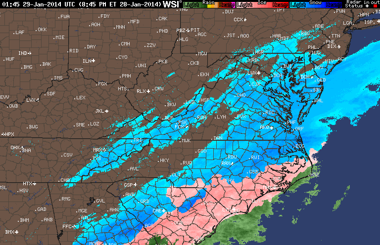
* Total Precipitation: 2 and 1/2” (2.5”) of snow. Liquid equivalent of 0.14” fell during the event, which equates to a snow ration of 1:17.9! 2″ to 3″ fell across metro area. 3.1 inches of snow was reported at the airport. Snowfall totals were heavier towards the Bay and Hampton Roads area (6-10” was common).
* Comments: The snow began around the metro area around 3:30-4 PM. Temperatures dropped during the day (due to the passage of an arctic front) and snowfall was light during the entire event. A low tracking off the NC coast spread precipitation into most of Virginia. Wind during the event, averaging 5 MPH or less, was light. Accumulations were present on most surfaces. Snow was measured in the backyard of the house. Snow continued until about 4 AM on January 29th where the temperature dropped to nearly 10 degrees. By far, one of the coldest snow events I’ve witnessed. There was a 1.5 hour delay for Chesterfield County Government Offices.
Snowfall Totals:
Videos:
Photos:

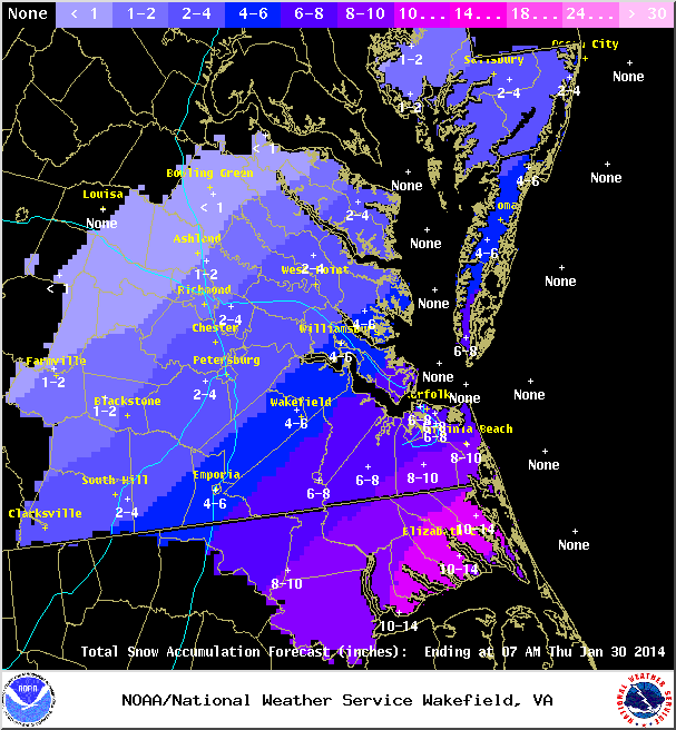
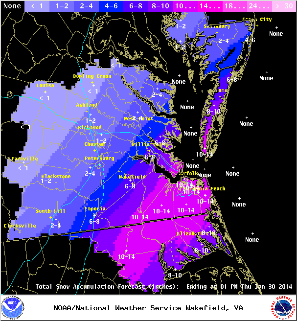
January 28-29, 2014: Snow Forecast
A complex system may impact Central Virginia where anything but model consensus can be found. A low pressure developing on the edge of an arctic front will cause widespread snow from southern Texas to the Middle Atlantic. Models have slowly increased precipitation around metro Richmond in the 24-hours leading up to the event. Still, most of the precipitation will likely be south and east of the metro area (VA beach could easily see 6-12″ of snow) which is located closer to the low off the Hatteras coast.
Below are some forecast images from the NWS. The forecast has evolved over the last 2 days from a chance at flurries to around 1-2″ of snow in Metro Richmond.
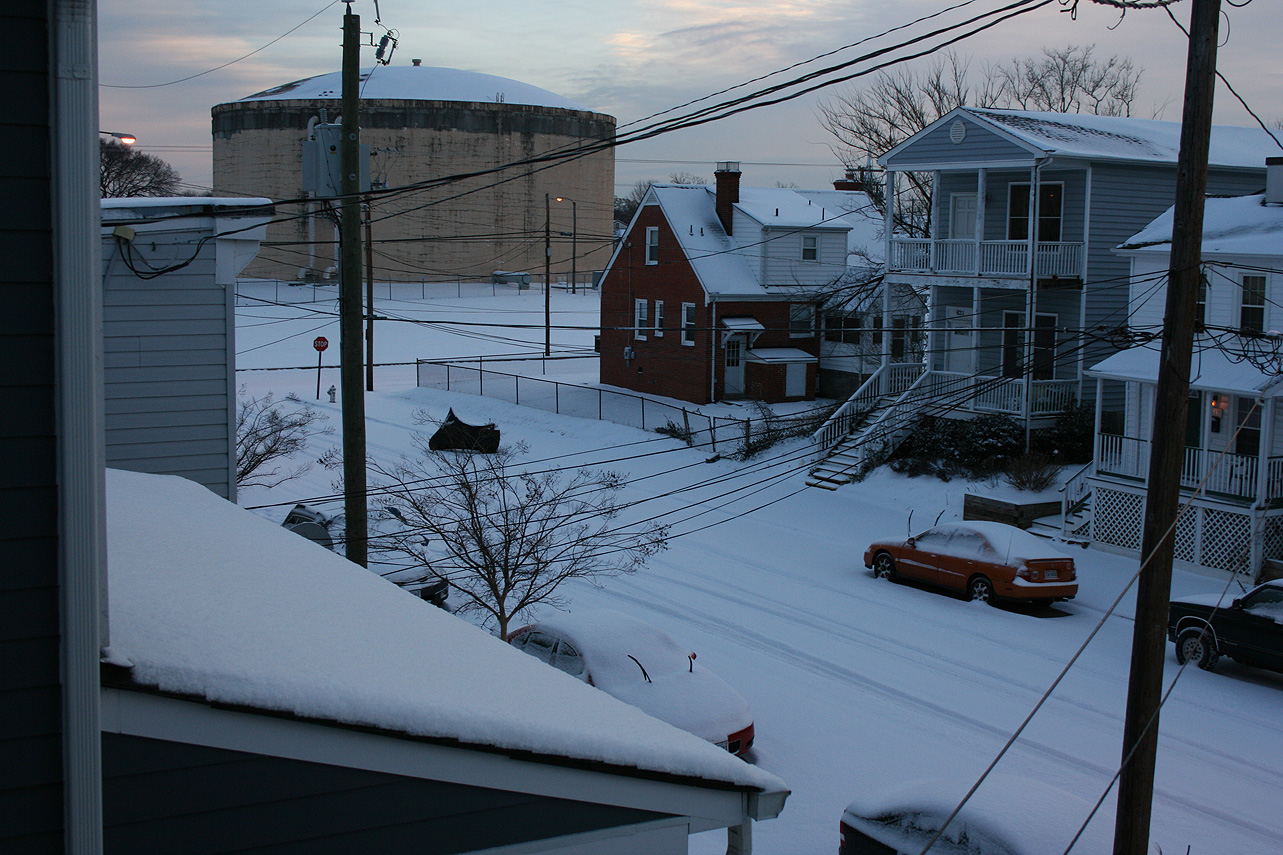
January 21, 2014: Observations
Church Hill Storm Observation Summary:
* Place – Time: Church Hill, 10:00 PM (1/21/2014)
* Temperature: 22-34, During Event
* Dewpoint: 29-33, During Event
* Relative Humidity: N/A%
* Winter Weather Watch/Warning/Advisory: Watch & Warning
* Road Conditions: All roads covered during event, primary roads cleared by the morning of 1/22. However, secondary roads were still partially snow covered.
* Precipitation Description: Light rain transitioned to snow showers during the overnight hours.
* Total Precipitation: 2 and 3/4” (2.75”) of snow. Liquid equivalent of 0.12” fell during the event, which equates to a snow ration of 1:22.9! 1″ to 3″ fell across metro area. Two (2) inches of snow was reported at the airport, which also set the daily record for snowfall on January 21st. Snowfall totals were heavier towards the Bay and Hampton Roads area.
* Comments: An initial band of snow showers and flurries rolled through the metro area around 11 AM with no accumulation. Dropping temperatures (due to the passage of an arctic front) and snowfall began around 3:30 PM at the Chesterfield Government Complex. Snow turned heavier by 5:30-6 PM. Winds gusts between 25-30 MPH were recorded at the airport during the snow event. By 7 AM on 1/16, snow was still falling at a light rate. Accumulations were present on most surfaces. Snow was measured in the field near the tennis courts at Ethel Bailey Furman Memorial Park. Snow continued until about 2 AM on January 22nd.
Images:
Videos:
Other Resources:
Church Hill Snow Observation Records Since March 1, 2009
Compiled with information I have since 2009:
| Church Hill Snow Observations (Above 1″)* | ||
| Rank | Date | Observed Snowfall (Inches) |
| 1 | 1/30/2010 | 12.25 |
| 2 | 3/1/2009 | 8.00 |
| 3 | 2/5/2010 | 7.75 |
| 4 | 12/18/2009 | 7.50 |
| 5 | 12/25/2010 | 4.25 |
| 6 | 2/19/2012 | 4.00 |
| 7 | 3/24/2013 | 3.75 |
| 8 | 2/10/2010 | 3.50 |
| 9 | 1/17/2013 | 2.00 |
| 10 | 1/7/2011 | 2.00 |
| 11 | 3/6/2013 | 1.50 |
| 12 | 12/13/2010 | 1.50 |
| 13 | 12/16/2010 | 1.30 |
| 14 | 1/25/2013 | 1.25 |
| 15 | 3/5/2012 | 1.00 |
| *Since March 1, 2009 | ||