Deprecated: Optional parameter $selected declared before required parameter $args is implicitly treated as a required parameter in /home/richmon/domains/richmondcitywatch.com/public_html/rvawx_test/wp-content/plugins/archives-calendar-widget/arw-settings.php on line 178
Deprecated: Optional parameter $view declared before required parameter $args is implicitly treated as a required parameter in /home/richmon/domains/richmondcitywatch.com/public_html/rvawx_test/wp-content/plugins/archives-calendar-widget/arw-widget.php on line 480
Deprecated: Optional parameter $archiveMonth declared before required parameter $args is implicitly treated as a required parameter in /home/richmon/domains/richmondcitywatch.com/public_html/rvawx_test/wp-content/plugins/archives-calendar-widget/arw-widget.php on line 480
Warning: Trying to access array offset on value of type bool in /home/richmon/domains/richmondcitywatch.com/public_html/rvawx_test/wp-content/plugins/archives-calendar-widget/archives-calendar.php on line 64 Statistics/Records | RVAWX.com
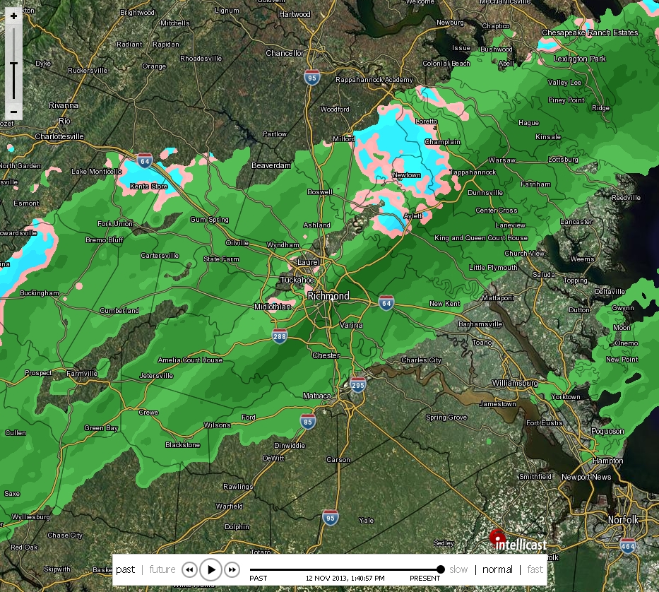
* Place – Time: Chesterfield Government Complex, 3:00 PM (11/12/2013)
* Temperature: 40-41, During Event
* Dewpoint: 29-30, During Event
* Relative Humidity: N/A%
* Pressure: N/A
* Trends: N/A
*Winter Weather Watch/Warning/Advisory: N/A
* Road Conditions: All roads remained passable, no accumulation.
* Precipitation Description: Light rain and snow showers persisted on and off during the afternoon hours.
* Total Precipitation: Trace of snow. Liquid equivalent of 0.0” fell during the event.
* Comments: A rain/snow mix started shortly after 1:15 PM. The snow persisted for about 20 minutes. Precipitation ended around 2 PM. No accumulation of snow was observed due to high air and ground temperatures. This was the first snow event of the 2013-2014 winter season.
I came across this handy document by the NWS yesterday that displays the top 10 snow events, by month, for Richmond, Virginia. The document is located here.
NWS Table for Top 10 Snow Events, By Month, For Richmond
I got an interesting email from Larry at the NWS Wakefield office about Richmond historical winter snow totals. See the email below:
“We have recorded at trace of snow thus far this season at Richmond (the only season that finished with just a trace is 1918-19). The 2nd lowest amount in a season was 0.5” in 1944-45. For “seasonal snowfall” the entire season is considered so we will need to have no measurable snow for Feb, Mar, Apr this year to tie the 1918-19 season. Recently in 2006-07, we had just 0.3″ by the end of March…appeared to be set to have the 2nd lowest snowfall season on record…until Easter Sunday in April recorded 1.0″ making the seasonal total 1.3″…9th lowest.”
One impressive statistic from the 2010 weather data that was recorded at my house was the highest amount of liquid rainfall accumulating in a 24-hour period. Signaling the end of summer and an extreme drought, my station recorded 3.36″ of rain in a single day. The radar loop from the day is impressive as well. The rain was spawned from the remnants of Nicole and a coastal low.