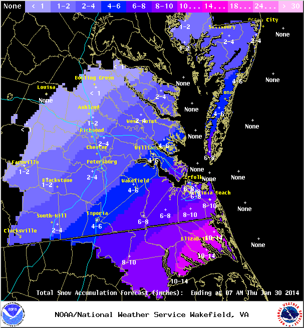
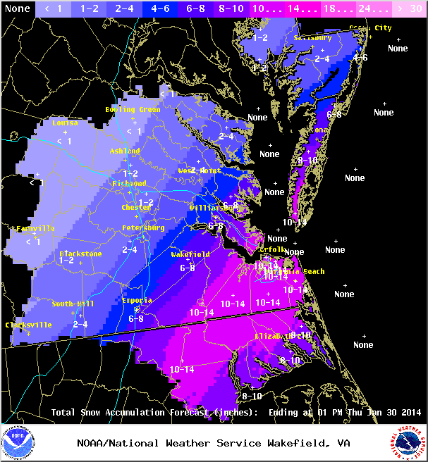
A complex system may impact Central Virginia where anything but model consensus can be found. A low pressure developing on the edge of an arctic front will cause widespread snow from southern Texas to the Middle Atlantic. Models have slowly increased precipitation around metro Richmond in the 24-hours leading up to the event. Still, most of the precipitation will likely be south and east of the metro area (VA beach could easily see 6-12″ of snow) which is located closer to the low off the Hatteras coast.
Below are some forecast images from the NWS. The forecast has evolved over the last 2 days from a chance at flurries to around 1-2″ of snow in Metro Richmond.