Tag Archives: thunder snow

December 9, 2018: Observations


Franconia Farm Storm Observation Summary:

* Place – Time: Franconia Road, (12/9/2018)
* Temperature: 30-32, During Event
* Winter Weather Watch/Warning/Advisory: Watch & Warning
* Closings: All local school districts were closed on 12/9, Chesterfield County Government was closed on 12/9.
* Predicted Totals: 1-4″ the day before the storm. Between 6-12″ the morning of the storm.
* Road Conditions: All roads had substantial snow accumulation on them by midday on 12/9.
* Precipitation Description: Snow. Snow began around 7:30 AM . Snow transitioned to gropel and snow flurries around 8 PM before ending.
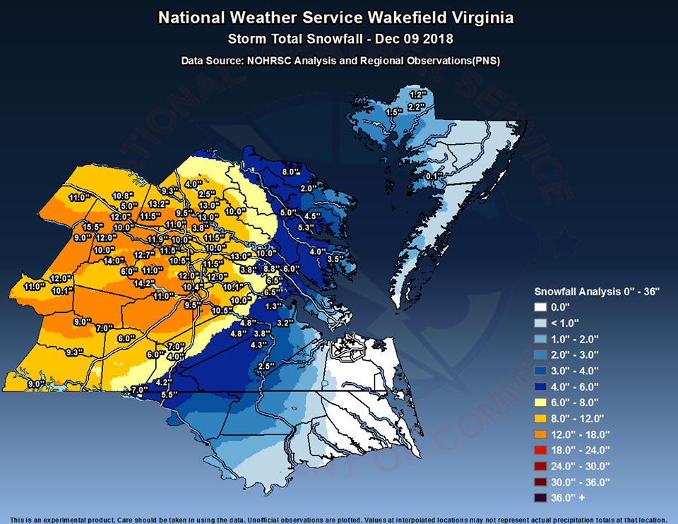
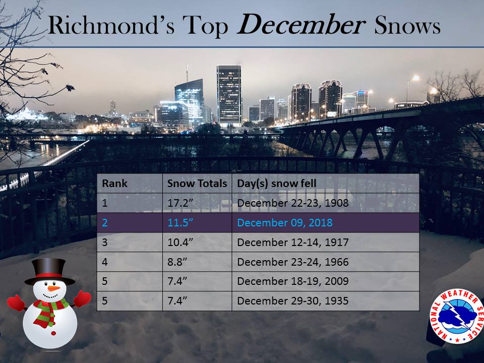
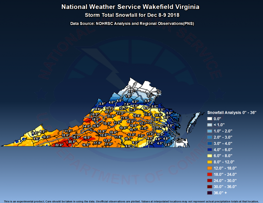
* Total Precipitation: 13.25″ of snow. 11.5″ of snow was reported at the Richmond airport. Locally heavier snow to the south and west of Richmond.
* Comments: A complex storm system tracked across the lower portion of the country, including a multi-phased low-pressure system that transitioned from the Gulf Coast to a low-pressure system off the South and North Carolina coasts. The low-pressure system then tracked ENE into the Atlantic Ocean, causing snow to overspread into Central Virginia. Snow was light to moderate for the until 2-3 PM. Two very heavy snow bands moved in during the afternoon and evening hours. Between 6:26 PM and 6:56 PM, we got 2.5″ of snow, which equates to over 3″ an hour! Reports of lightening and thunder snow were reported in Richmond my brother, David. Snow tapered off by 9 PM on Sunday night (12/9).

Snow impacted Oklahoma up to northern Virginia. This storm was known as “Diego” by TWC . Impacts in western Virginia and North Carolina were extreme, where totals ranged between 1 – 2 feet of snow.

Snowfall Totals & Records:
Photos & Videos

The last snow band moving through near 6:30 PM.

January 17, 2013: Observations

Video of Event:


NWS forecast for 1/17/2013:

NWS Forecast, 1/17/13

Current snowfall forecast:

NWS Snowfall Forecast, Morning of 1/17/13

Here is the latest warning for Richmond metro.

Winter Storm Warning

URGENT - WINTER WEATHER MESSAGE...UPDATED
NATIONAL WEATHER SERVICE WAKEFIELD VA
648 AM EST THU JAN 17 2013

MDZ021>023-VAZ060-065>083-085-172000-
/O.CON.KAKQ.WS.W.0001.130117T2300Z-130118T0600Z/
DORCHESTER-WICOMICO-SOMERSET-PRINCE EDWARD-MECKLENBURG-LUNENBURG-
NOTTOWAY-AMELIA-POWHATAN-CHESTERFIELD-HENRICO-KING WILLIAM-
KING AND QUEEN-ESSEX-WESTMORELAND-RICHMOND-NORTHUMBERLAND-
LANCASTER-BRUNSWICK-DINWIDDIE-PRINCE GEORGE-CHARLES CITY-NEW KENT-
MIDDLESEX-
INCLUDING THE CITIES OF...CAMBRIDGE...SALISBURY...CRISFIELD...
PRINCESS ANNE...FARMVILLE...SOUTH HILL...CREWE...
COLONIAL HEIGHTS...RICHMOND...TAPPAHANNOCK...LAWRENCEVILLE...
PETERSBURG...HOPEWELL
648 AM EST THU JAN 17 2013

...WINTER STORM WARNING REMAINS IN EFFECT FROM 6 PM THIS EVENING
TO 1 AM EST FRIDAY...

A WINTER STORM WARNING REMAINS IN EFFECT FROM 6 PM THIS EVENING
TO 1 AM EST FRIDAY.

* AREAS AFFECTED: THE VIRGINIA NORTHERN NECK AND MARYLAND
  EASTERN SHORE.

* HAZARDS: SNOW.

* ACCUMULATIONS: 3 TO 4 INCHES.

* TIMING: RAIN WILL QUICKLY CHANGE TO SNOW EARLY THIS EVENING AND
  BEGIN TO ACCUMULATE SHORTLY AFTER SUNSET. A BRIEF PERIOD OF
  HEAVY SNOWFALL THIS EVENING WILL CAUSE RAPID ACCUMULATIONS TO
  OCCUR. SNOW WILL END LATE TONIGHT.

* IMPACTS: SNOW...HEAVY AT TIMES...WILL ACCUMULATE ON ROADS AFTER
  SUNSET AND CREATE HAZARDOUS DRIVING CONDITIONS.

PRECAUTIONARY/PREPAREDNESS ACTIONS...

A WINTER STORM WARNING MEANS SIGNIFICANT AMOUNTS OF SNOW ARE
EXPECTED. STRONG WINDS ARE ALSO POSSIBLE. THIS WILL MAKE TRAVEL
VERY HAZARDOUS OR IMPOSSIBLE."

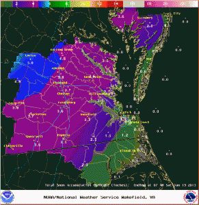
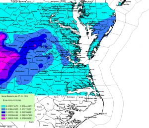
NWS Final Snow Totals


NWS Snow Total Map
NWS Snow Total Map

My Report (Church Hill):

* Place – Time: Church Hill, 11:00 AM (1/18/2013) *After the Event Update*
* Temperature: 33-37, During Storm Event
* Dewpoint: 33-37, During Storm Event
* Relative Humidity: 100%
* Pressure: N/A
* Trends: N/A
*Winter Weather Watch/Warning/Advisory: Watch & Warning
* Road Conditions: All roads had snow cover during the event. The morning after the event, secondary roads remained slushy. Most major roads passable.
* Precipitation Description: Light, moderate and sometimes brief periods of heavy snow fell throughout the event. I observed thunder snow at the onset of the snow in western Chesterfield County (near St. Francis Hospital).
* Total Precip: 2.0″ of snow. Liquid Equivalent of 0.64″ fell during the event at the airport.
* Comments: A rain/snow mix started shortly after sunset on the 17th. The precipitation fell as light to occasionally moderate snow throughout the evening hours. Snow began to accumulate within one hour of transitioning to snow. The precipitation quickly changed to moderate and heavy snow by 6 PM where local roads began to get covered. One hour of moderate snow was reported in and around RIC airport around 9 PM. The snow began to taper off by 11:00 PM as it transitioned between rain and snow. Snow was very wet, with ratios close to 3.3:1. Precipitation was spurred by an upper level low that tracked up from northern Alabama to off the Virginia coast. This storm came at the end of a long week of rain that occurred each day, starting on 1/14/13. The airport reported 1.6” of snow.

Photo Gallery Link: Forthcoming

Links: http://www.erh.noaa.gov/akq/wx_events/Snow/jan17_2013/