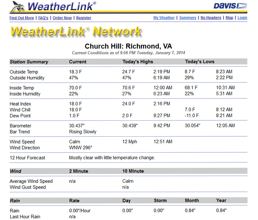
Church Hill Storm Observation Summary:
* Place – Time: Church Hill, 10:00 PM (1/21/2014)
* Temperature: 22-34, During Event
* Dewpoint: 29-33, During Event
* Relative Humidity: N/A%
* Winter Weather Watch/Warning/Advisory: Watch & Warning
* Road Conditions: All roads covered during event, primary roads cleared by the morning of 1/22. However, secondary roads were still partially snow covered.
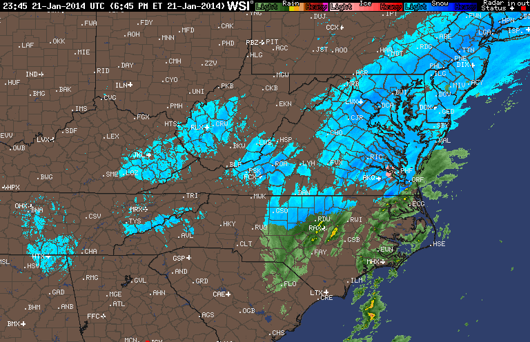
* Precipitation Description: Light rain transitioned to snow showers during the overnight hours.
* Total Precipitation: 2 and 3/4” (2.75”) of snow. Liquid equivalent of 0.12” fell during the event, which equates to a snow ration of 1:22.9! 1″ to 3″ fell across metro area. Two (2) inches of snow was reported at the airport, which also set the daily record for snowfall on January 21st. Snowfall totals were heavier towards the Bay and Hampton Roads area.
* Comments: An initial band of snow showers and flurries rolled through the metro area around 11 AM with no accumulation. Dropping temperatures (due to the passage of an arctic front) and snowfall began around 3:30 PM at the Chesterfield Government Complex. Snow turned heavier by 5:30-6 PM. Winds gusts between 25-30 MPH were recorded at the airport during the snow event. By 7 AM on 1/16, snow was still falling at a light rate. Accumulations were present on most surfaces. Snow was measured in the field near the tennis courts at Ethel Bailey Furman Memorial Park. Snow continued until about 2 AM on January 22nd.
Images:
Videos:
Other Resources: