Deprecated: Optional parameter $selected declared before required parameter $args is implicitly treated as a required parameter in /home/richmon/domains/richmondcitywatch.com/public_html/rvawx_test/wp-content/plugins/archives-calendar-widget/arw-settings.php on line 178
Deprecated: Optional parameter $view declared before required parameter $args is implicitly treated as a required parameter in /home/richmon/domains/richmondcitywatch.com/public_html/rvawx_test/wp-content/plugins/archives-calendar-widget/arw-widget.php on line 480
Deprecated: Optional parameter $archiveMonth declared before required parameter $args is implicitly treated as a required parameter in /home/richmon/domains/richmondcitywatch.com/public_html/rvawx_test/wp-content/plugins/archives-calendar-widget/arw-widget.php on line 480
Warning: Trying to access array offset on value of type bool in /home/richmon/domains/richmondcitywatch.com/public_html/rvawx_test/wp-content/plugins/archives-calendar-widget/archives-calendar.php on line 64 observations | RVAWX.com
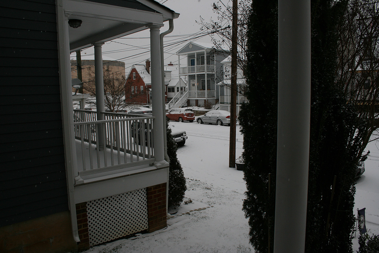
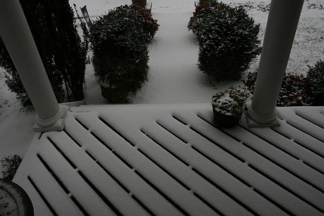
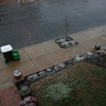
Church Hill Storm Observation Summary:
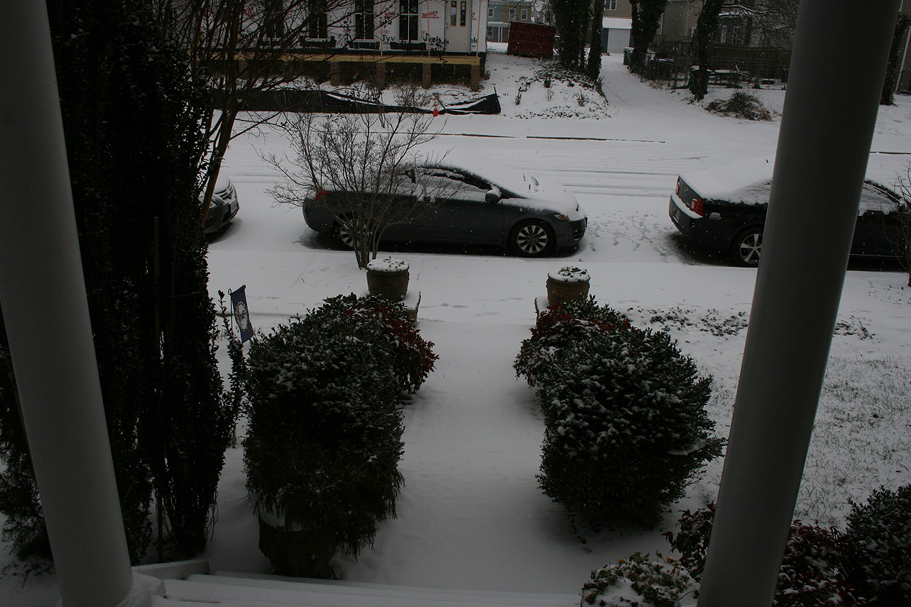
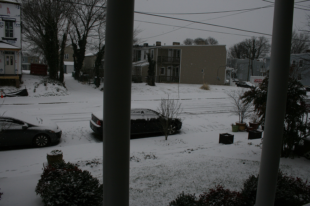
* Place – Time: Church Hill, (2/15/2016)
* Temperature: 23-, During Event
* Winter Weather Watch/Warning/Advisory: Watch & Advisory
* Closings: All local school districts were closed on 2/15, Chesterfield County Government was also closed on 2/15.
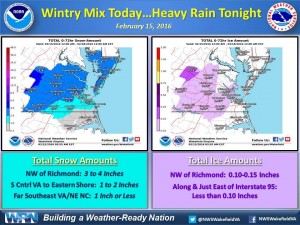
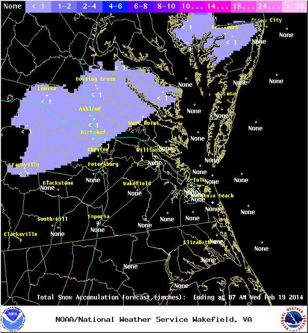
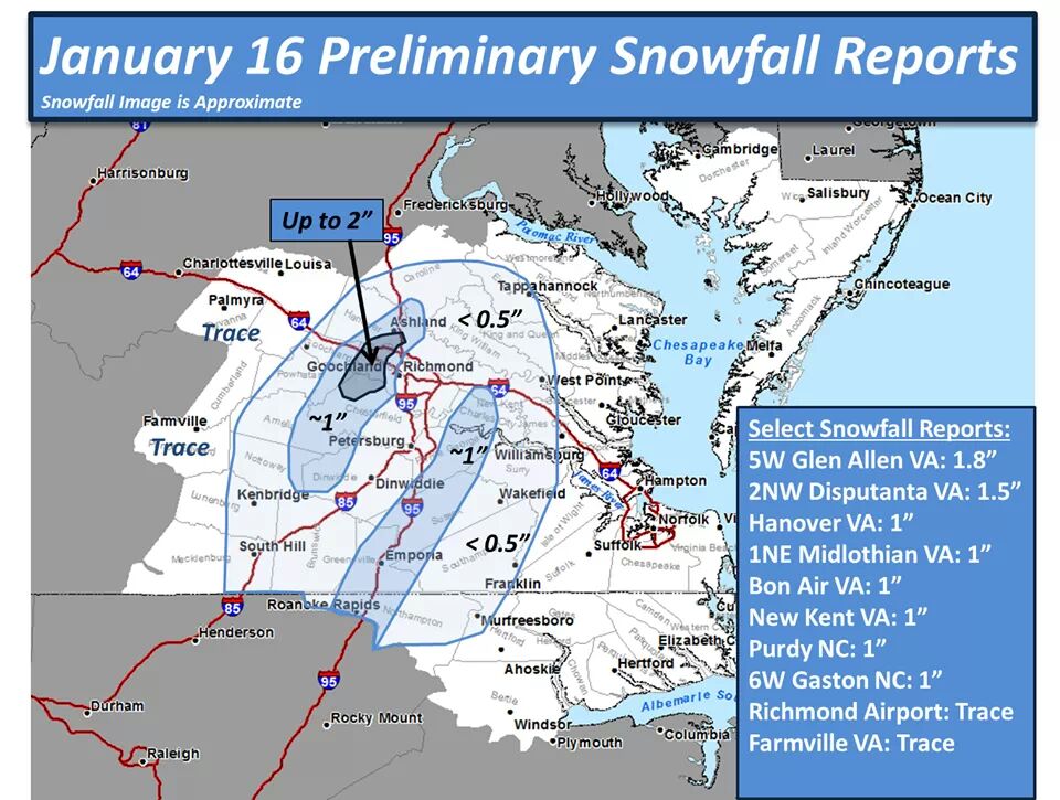
* Predicted Totals: Between 2-3″ before the storm. NWS updated to 2-4″ the morning of the event.
* Road Conditions: All roads had substantial snow and ice accumulation on them.
* Precipitation Description: Snow, sleet and freezing rain. Snow began around 4:00 AM. Snow transitioned to sleet and light freezing drizzle around 10:30 AM.
* Total Precipitation: 1.25″ of snow with minor icing occurring from about 10:30 AM until 5 PM in the afternoon. 1.4″ of snow was reported at the Richmond airport.
* Comments: Snow began in the early morning hours with about a 0.5″ accumulating on all surfaces by 8 AM. Snow changed to sleet and freezing drizzle at around 10:30 AM. The system eventually transitioned to rain by 5 PM.
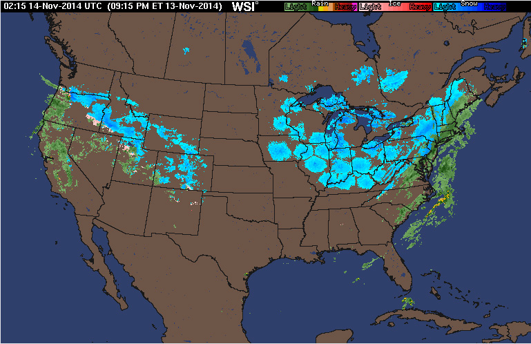
A quick batch of rain, mixed with sleet and some snow, came in behind an arctic front during the evening hours. No accumulation was observed. This serves as the first wintry precipitation observed for the 2014-2015 winter season.
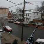
Church Hill Storm Observation Summary:
* Place – Time: Church Hill, (3/7/2014)
* Temperature: 32-33, During Event
* Winter Weather Watch/Warning/Advisory: Advisory
* Closings: None
* Road Conditions: All roads were wet during the event.
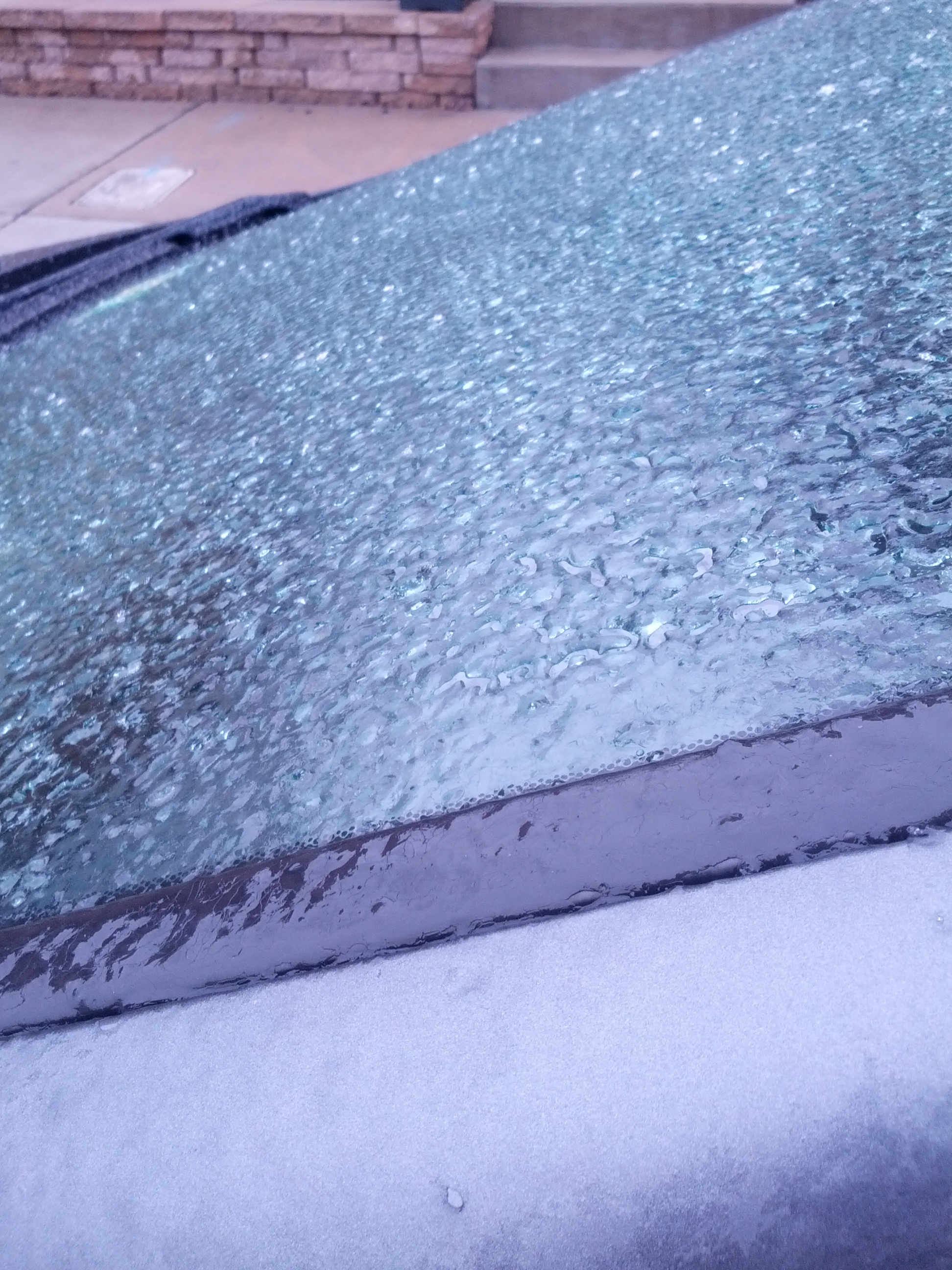
* Precipitation Description: Sleet, transitioned to freezing rain and then rain by 8 AM. Sleet began around 4:00 AM and quickly turned over to a mix of sleet and freezing rain by 7 AM.
* Total Precipitation: Less than 0.1″ of ice accumulation. Freezing rain accumulated on elevated surfaces.
* Comments: A low coming out of the Gulf of Mexico tracked up the east coast, delivering a severe snow and ice storm to western North Carolina and southwest Virginia. Impacts from ice to the Richmond area were minimal from this storm.
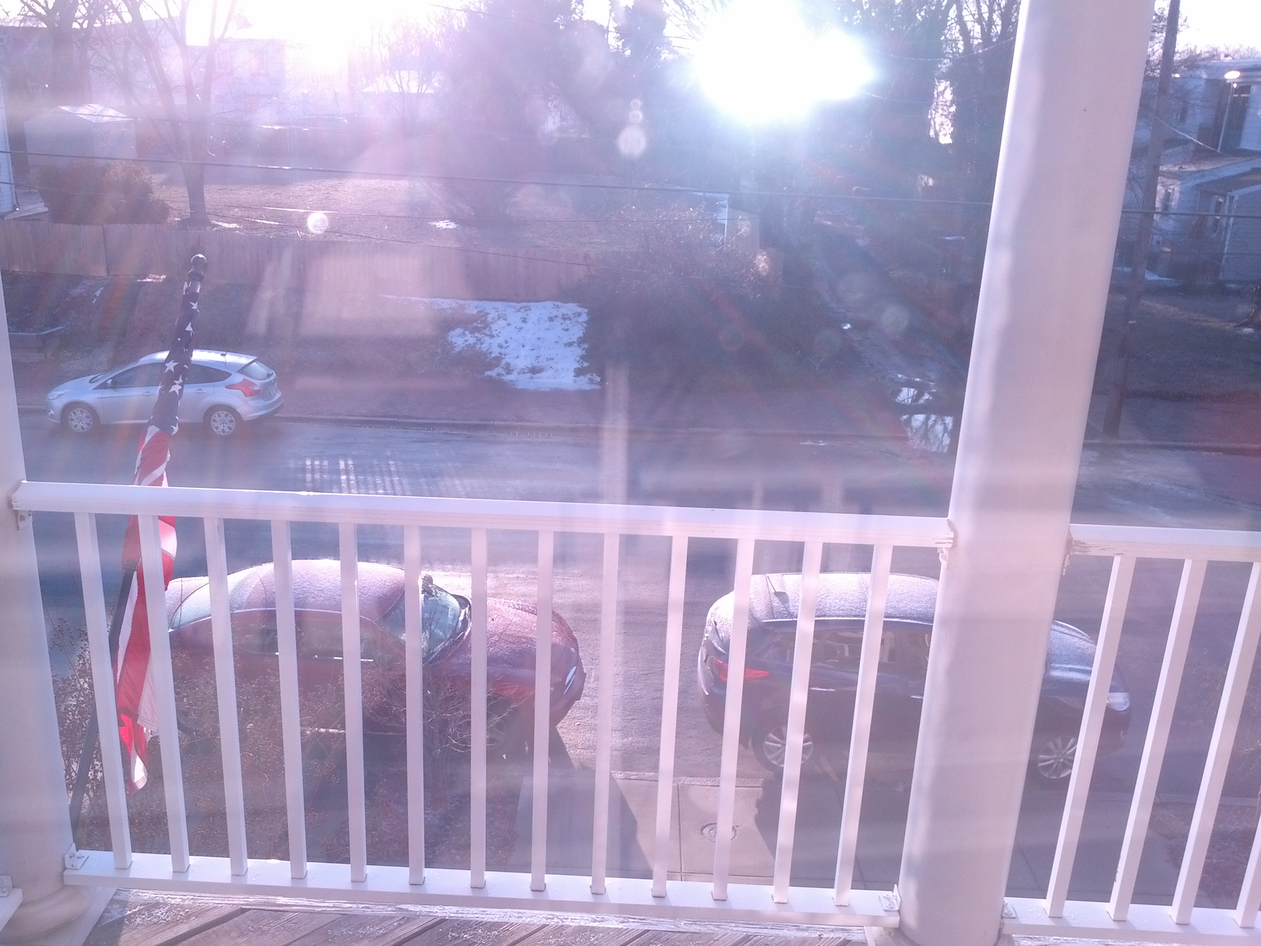
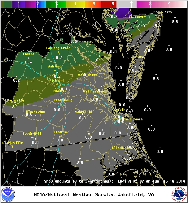
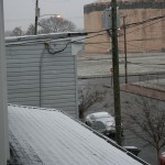
A quick system brushed across Central Virginia around 11 PM on 2/17 into the early morning hours of 2/18 that dropped a brief batch of snow, graupel, and ice. Accumulations were minor (Less than 0.1″ of snow/graupel and ice) and occurred mostly on elevated surfaces.
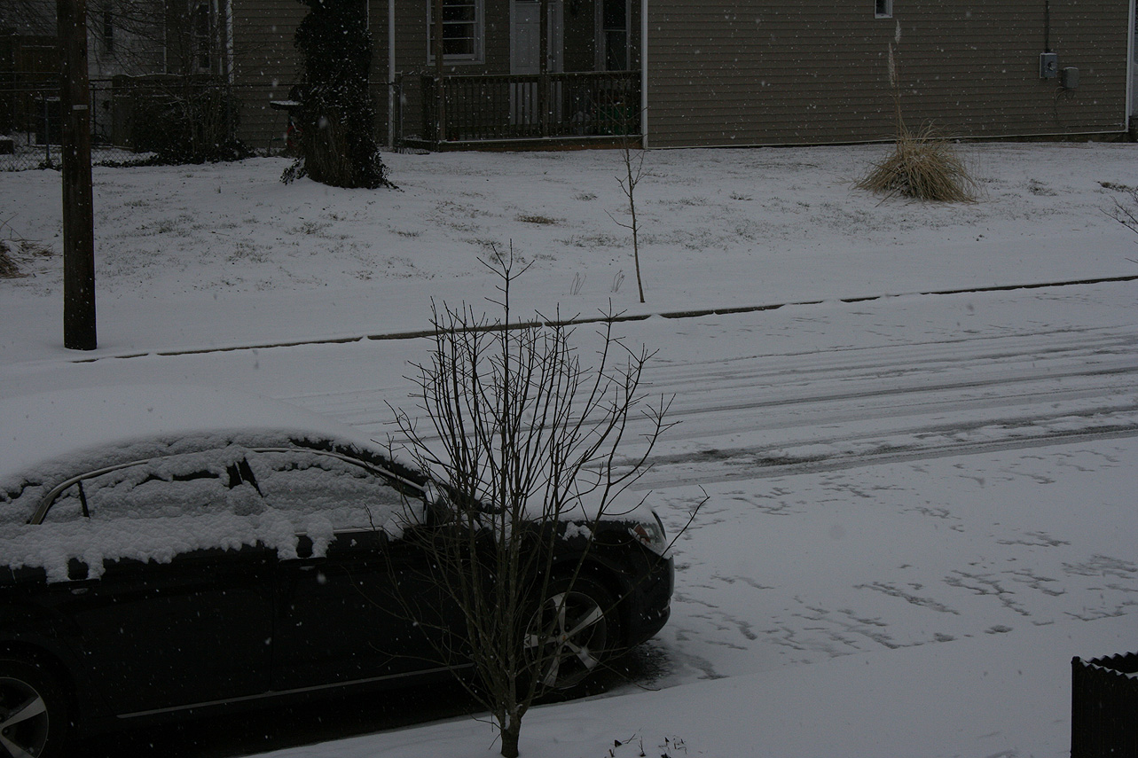
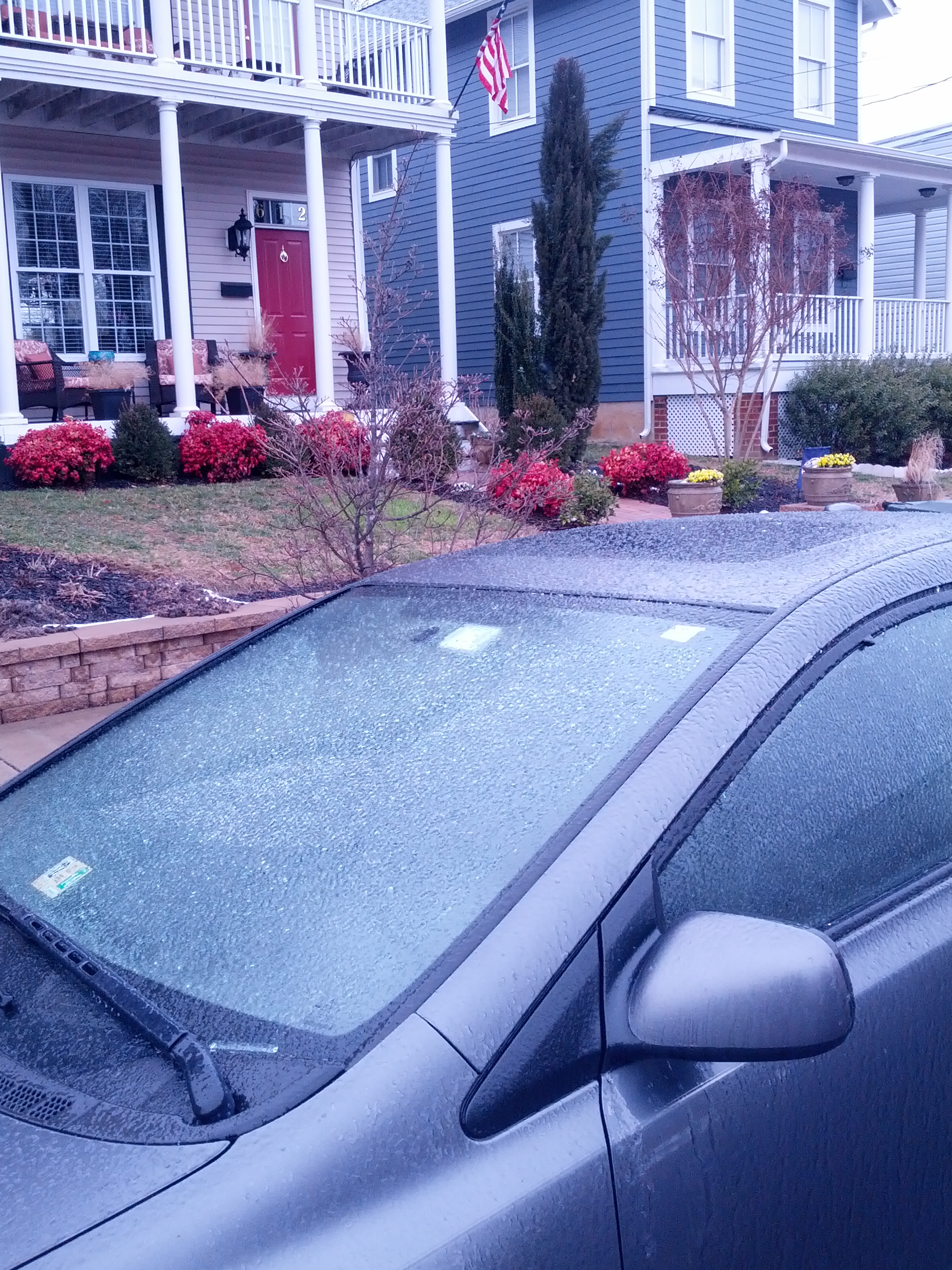
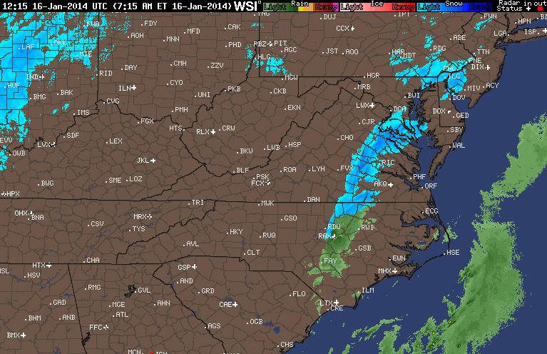
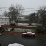
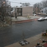
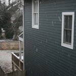
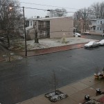
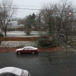
* Place – Time: Church Hill, 8:00 AM (1/16/2014)
* Temperature: 32-33, During Event
* Dewpoint: 29-33, During Event
* Relative Humidity: N/A%
* Pressure: N/A
* Trends: N/A
*Winter Weather Watch/Warning/Advisory: None
* Road Conditions: All roads remained passable, no accumulation of snow on roadways.
* Precipitation Description: Light rain transitioned to snow showers during the overnight hours.
* Total Precipitation: 3/8” (0.375”) of snow, mostly on elevated surfaces. Liquid equivalent of 0.15” fell during the event. 0.5″ to 2″ fell across metro area.
* Comments: Rain showers from late in the evening on 1/15 transitioned to snow showers around midnight. By 7 AM on 1/16, snow was still falling at a light rate. Accumulations were mostly confined to elevated and grassy surfaces. Snow was measured on top of my car, where accumulations were heaviest. Snow continued until 9 AM.