Deprecated: Optional parameter $selected declared before required parameter $args is implicitly treated as a required parameter in /home/richmon/domains/richmondcitywatch.com/public_html/rvawx_test/wp-content/plugins/archives-calendar-widget/arw-settings.php on line 178
Deprecated: Optional parameter $view declared before required parameter $args is implicitly treated as a required parameter in /home/richmon/domains/richmondcitywatch.com/public_html/rvawx_test/wp-content/plugins/archives-calendar-widget/arw-widget.php on line 480
Deprecated: Optional parameter $archiveMonth declared before required parameter $args is implicitly treated as a required parameter in /home/richmon/domains/richmondcitywatch.com/public_html/rvawx_test/wp-content/plugins/archives-calendar-widget/arw-widget.php on line 480
Warning: Trying to access array offset on value of type bool in /home/richmon/domains/richmondcitywatch.com/public_html/rvawx_test/wp-content/plugins/archives-calendar-widget/archives-calendar.php on line 64 changeover | RVAWX.com
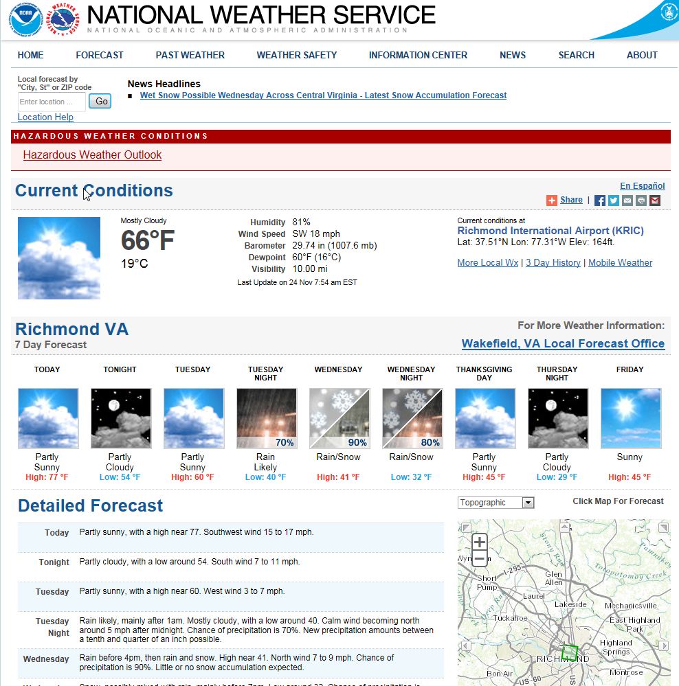
A low-pressure system is expected to develop off the Florida coast Tuesday that will run up the eastern seaboard on Wednesday, causing a wide variety of precipitation types in Virginia. The precipitation could end as a period of rain/snow or even snow. At this point, there is no expected accumulation.
NWS Forecast from 11/24/2104
NWS Forecast for Snow: 11/24/2014
Observation Update: A changeover to some snow and rain occurred for about an hour on 11/26/14 from 3-4 PM. No measurable precipitation fell.
An impressive low-pressure system will develop off the Georgia coast tomorrow morning and race northeastward towards New England. The track of this storm will situate the brunt of its precipitation offshore. However, a period of light snow tomorrow morning and tomorrow evening may give Central Virginia a light dusting of snow.
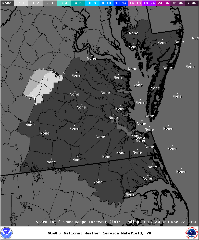
Forecasted snowfall.
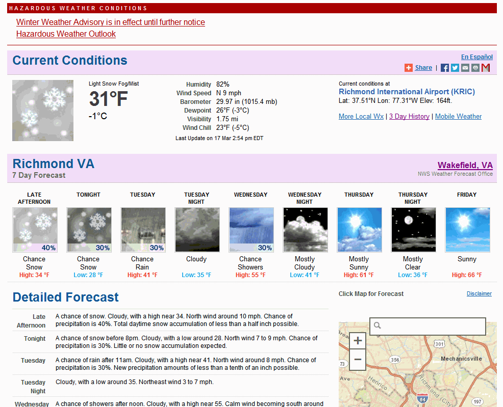
Hazardous Weather Outlook
HAZARDOUS WEATHER OUTLOOK
NATIONAL WEATHER SERVICE WAKEFIELD VA
628 AM EDT MON MAR 24 2014
VAZ060-064>086-251030-
PRINCE EDWARD-CAROLINE-MECKLENBURG-LUNENBURG-NOTTOWAY-AMELIA-
POWHATAN-CHESTERFIELD-HENRICO-KING WILLIAM-KING AND QUEEN-ESSEX-
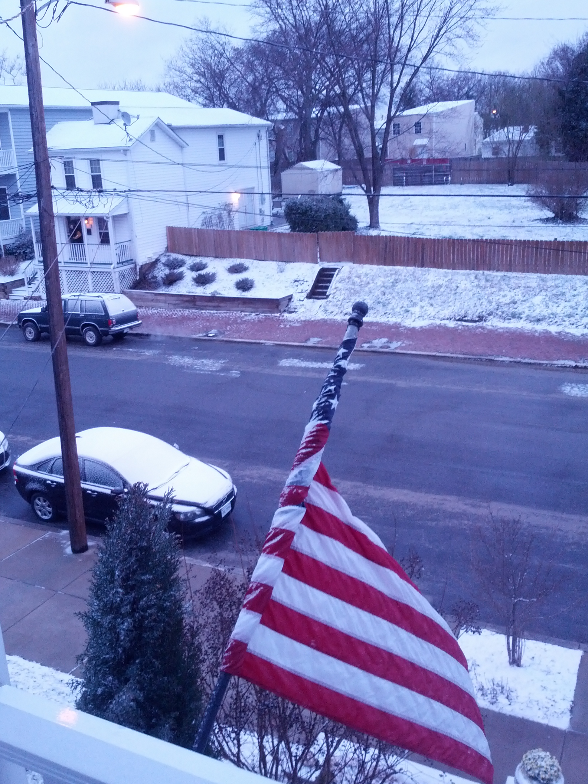
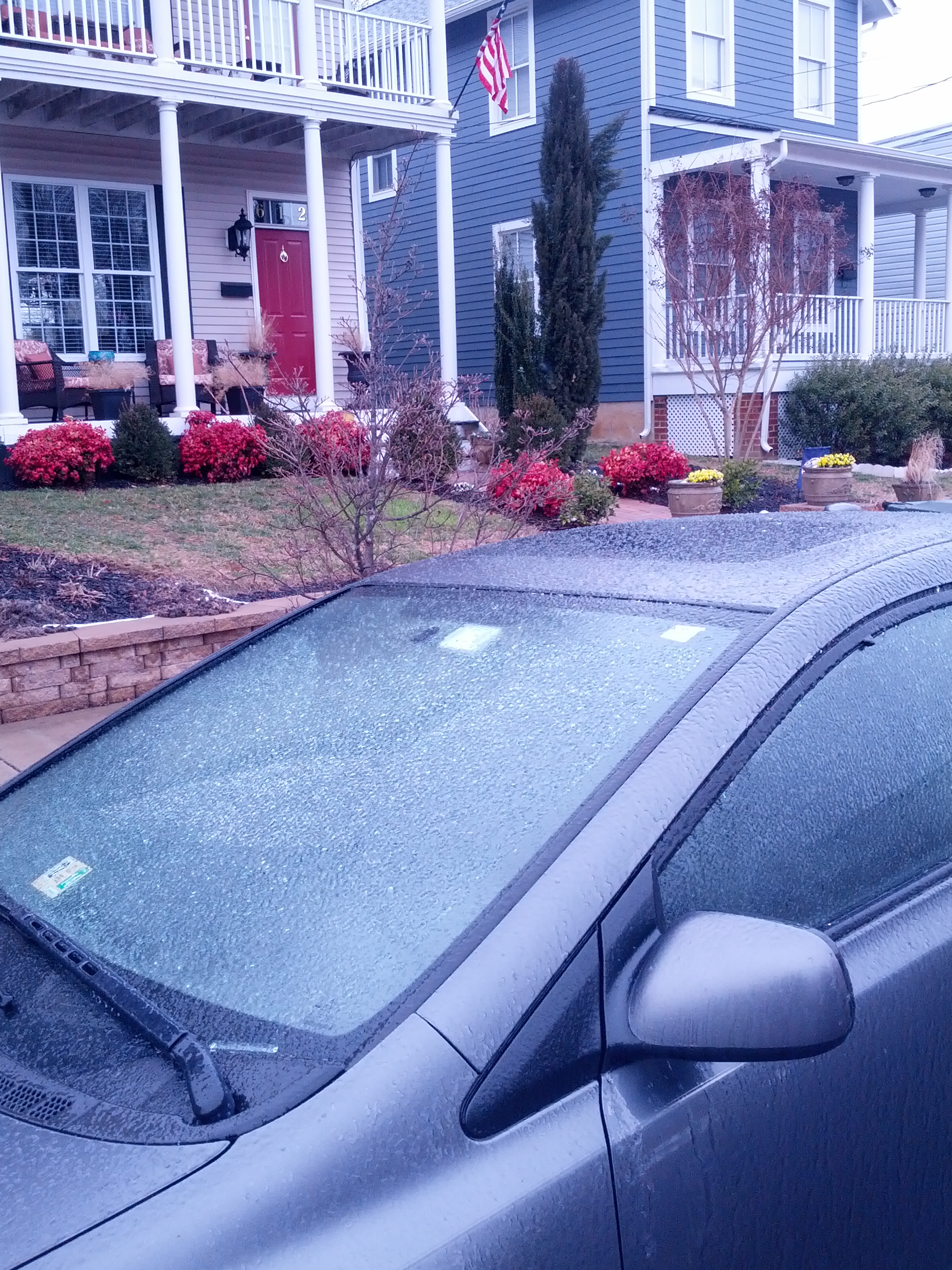
Church Hill Storm Observation Summary:
* Place – Time: Church Hill, (3/17/2014)
* Temperature: 29-35, During Event
* Winter Weather Watch/Warning/Advisory: Watch & Advisory
* Closings: None
* Predicted Totals: Ranged from 2-4” initialed, downgraded to less than 1” on Sunday night.
* Road Conditions: All roads were primarily wet during the event.
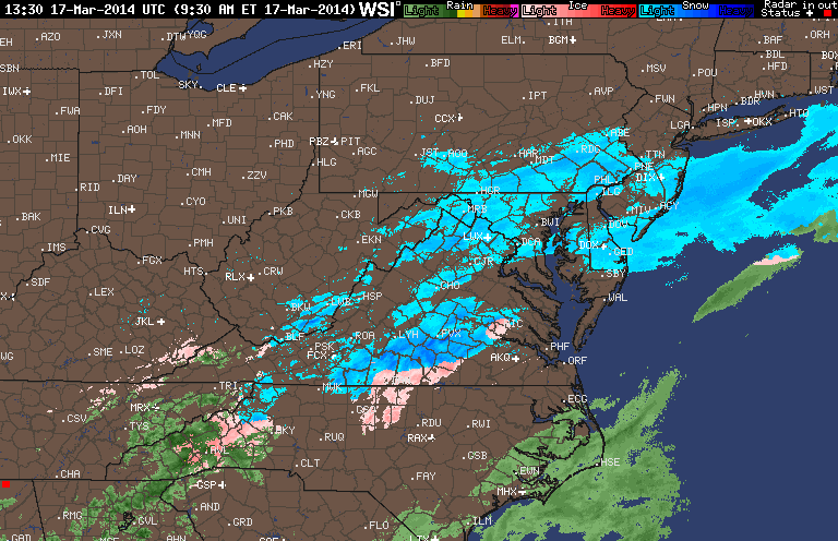
* Precipitation Description: A mix of rain to sleet, followed by freezing rain, sleet and snow during the overnight hours. Additional freezing rain and sleet fell during the morning hours of 3/17/2014.
* Total Precipitation: Approximately 0.5″ of snow, sleet and ice accumulation. Snow, sleet and freezing rain accumulated on elevated surfaces. 0.6″ was reported at Richmond airport.
* Comments: A low sliding through the Tennessee Valley towards the coast of Virginia delivered a late season winter storm event to the Richmond area. A cold air wedge developed on Sunday afternoon that slowly changed rain over to sleet during the late evening and overnight hours. Periods of sleet, snow, freezing rain and rain continued through the morning and early afternoon hours. Impacts from snow and ice to the Richmond area were minimal from this storm. However, areas to the north saw increased snow totals between 2-8” towards Fredericksburg & DC.
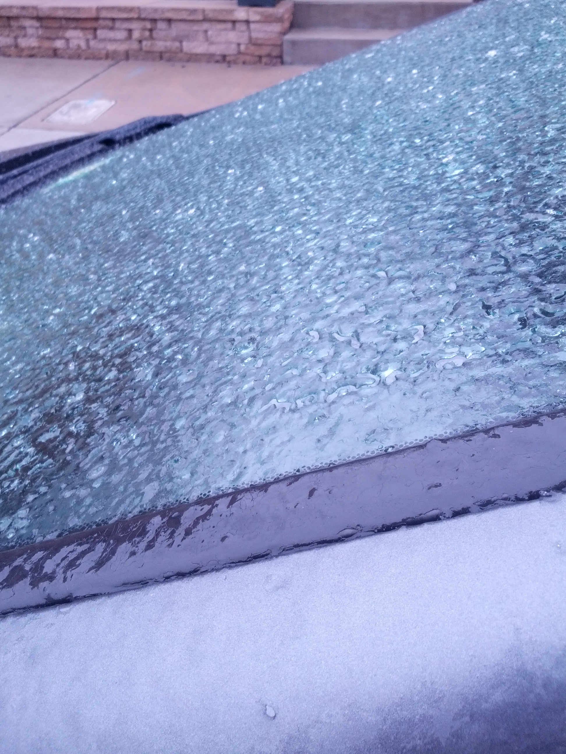
Church Hill Storm Observation Summary:
* Place – Time: Church Hill, (3/7/2014)
* Temperature: 32-33, During Event
* Winter Weather Watch/Warning/Advisory: Advisory
* Closings: None
* Road Conditions: All roads were wet during the event.
* Precipitation Description: Sleet, transitioned to freezing rain and then rain by 8 AM. Sleet began around 4:00 AM and quickly turned over to a mix of sleet and freezing rain by 7 AM.
* Total Precipitation: Less than 0.1″ of ice accumulation. Freezing rain accumulated on elevated surfaces.
* Comments: A low coming out of the Gulf of Mexico tracked up the east coast, delivering a severe snow and ice storm to western North Carolina and southwest Virginia. Impacts from ice to the Richmond area were minimal from this storm.
A major winter storm is shaping up for the Ohio Valley and Northeast that will come through Central Virginia on Sunday into Monday. Trends now indicate that Richmond could even see some significant snowfall, per the NWS forecast this morning:
NWS Forecast, 3/1/2014
HAZARDOUS WEATHER OUTLOOK
NATIONAL WEATHER SERVICE WAKEFIELD VA
434 AM EST SAT MAR 1 2014

MDZ021>025-VAZ048-049-060>064-066>078-080>086-090-091-099-100-020945-
DORCHESTER-WICOMICO-SOMERSET-INLAND WORCESTER-MARYLAND BEACHES-
FLUVANNA-LOUISA-PRINCE EDWARD-CUMBERLAND-GOOCHLAND-HANOVER-CAROLINE-
LUNENBURG-NOTTOWAY-AMELIA-POWHATAN-CHESTERFIELD-HENRICO-KING WILLIAM-
KING AND QUEEN-ESSEX-WESTMORELAND-RICHMOND-NORTHUMBERLAND-LANCASTER-
DINWIDDIE-PRINCE GEORGE-CHARLES CITY-NEW KENT-GLOUCESTER-MIDDLESEX-
MATHEWS-JAMES CITY-YORK-ACCOMACK-NORTHAMPTON VA-
434 AM EST SAT MAR 1 2014

THIS HAZARDOUS WEATHER OUTLOOK IS FOR THE LOWER EASTERN SHORE OF
MARYLAND...CENTRAL VIRGINIA...EAST CENTRAL VIRGINIA...SOUTH CENTRAL
VIRGINIA...THE EASTERN SHORE OF VIRGINIA...THE MIDDLE PENINSULA OF
VIRGINIA...THE NORTHERN NECK OF VIRGINIA...THE PENINSULA OF
SOUTHEAST VIRGINIA AND THE PIEDMONT OF CENTRAL VIRGINIA.

.DAY ONE...TODAY AND TONIGHT.

HAZARDOUS WEATHER IS NOT EXPECTED AT THIS TIME.

.DAYS TWO THROUGH SEVEN...SUNDAY THROUGH FRIDAY.

A POTENT WINTER STORM SYSTEM WILL AFFECT THE REGION ON MONDAY.
SIGNIFICANT ACCUMULATIONS OF SNOW AND SLEET WILL BE POSSIBLE
DURING THE DAY MONDAY...BEFORE THE PRECIPITATION COMES TO AN END
MONDAY EVENING.

.SPOTTER INFORMATION STATEMENT...

SPOTTER ACTIVATION IS NOT EXPECTED AT THIS TIME.
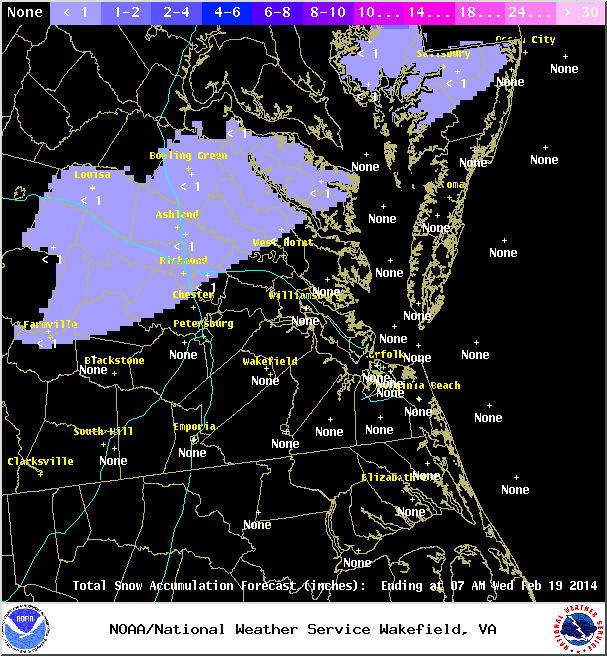
A quick system brushed across Central Virginia around 11 PM on 2/17 into the early morning hours of 2/18 that dropped a brief batch of snow, graupel, and ice. Accumulations were minor (Less than 0.1″ of snow/graupel and ice) and occurred mostly on elevated surfaces.
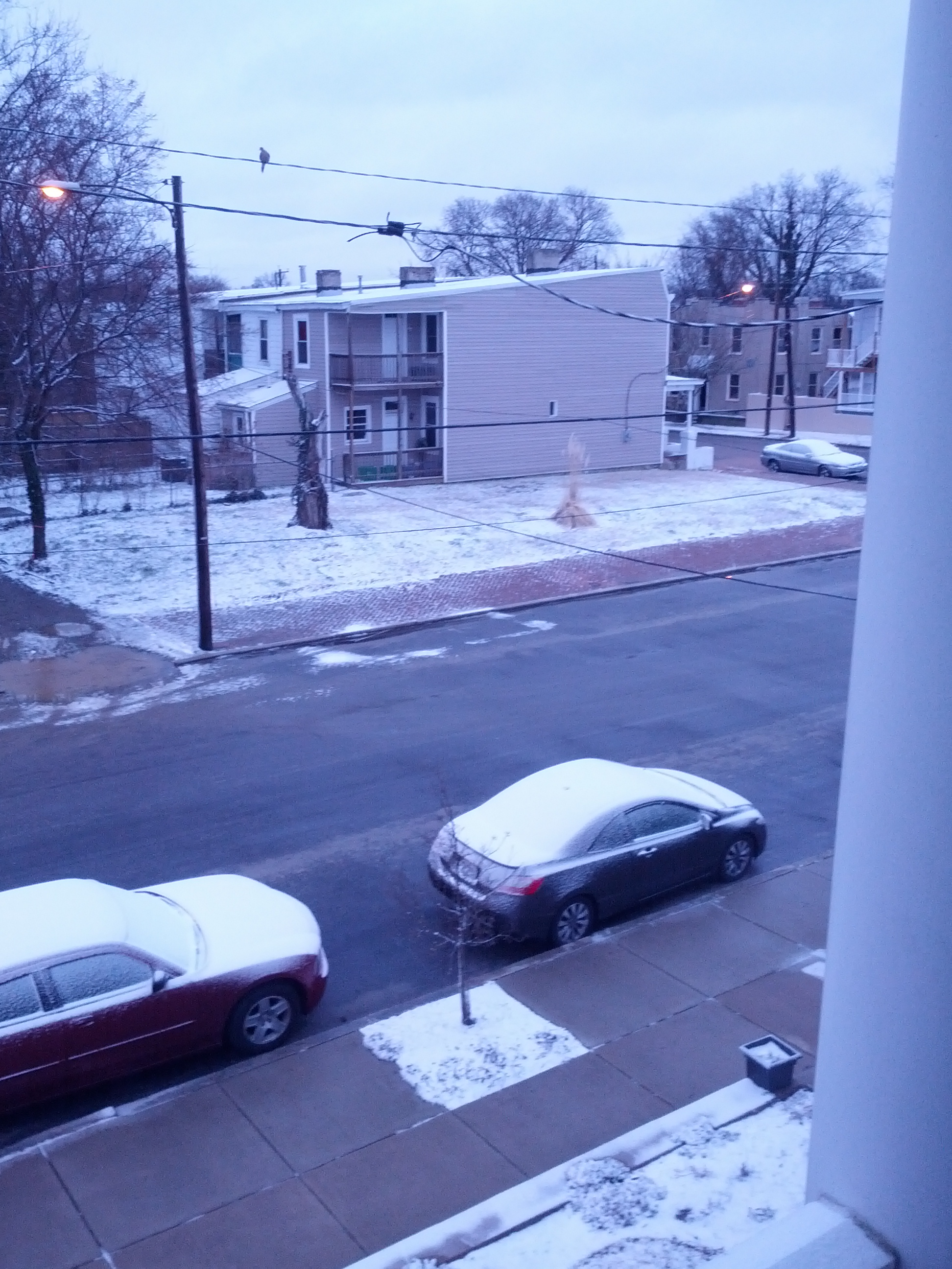
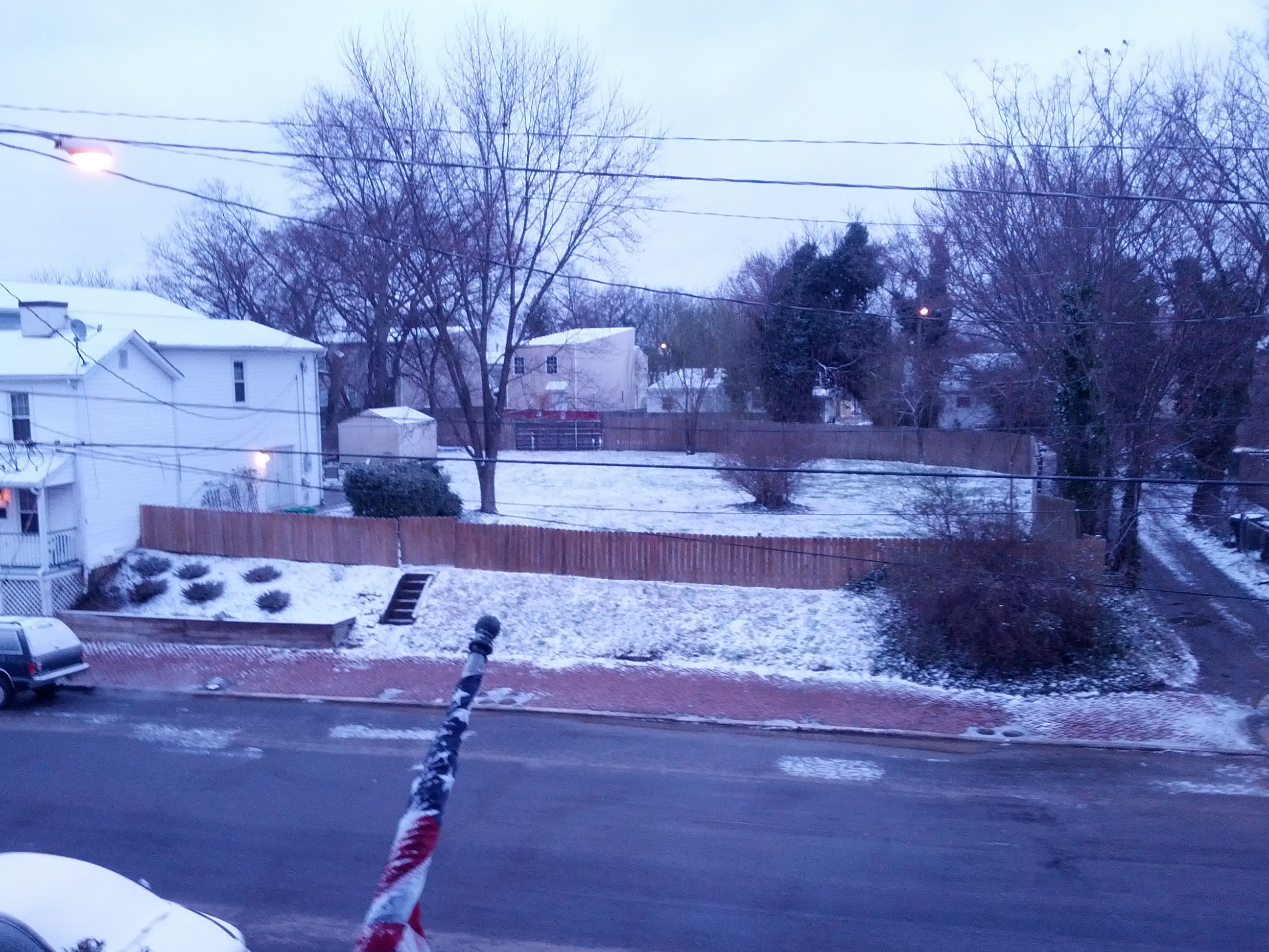
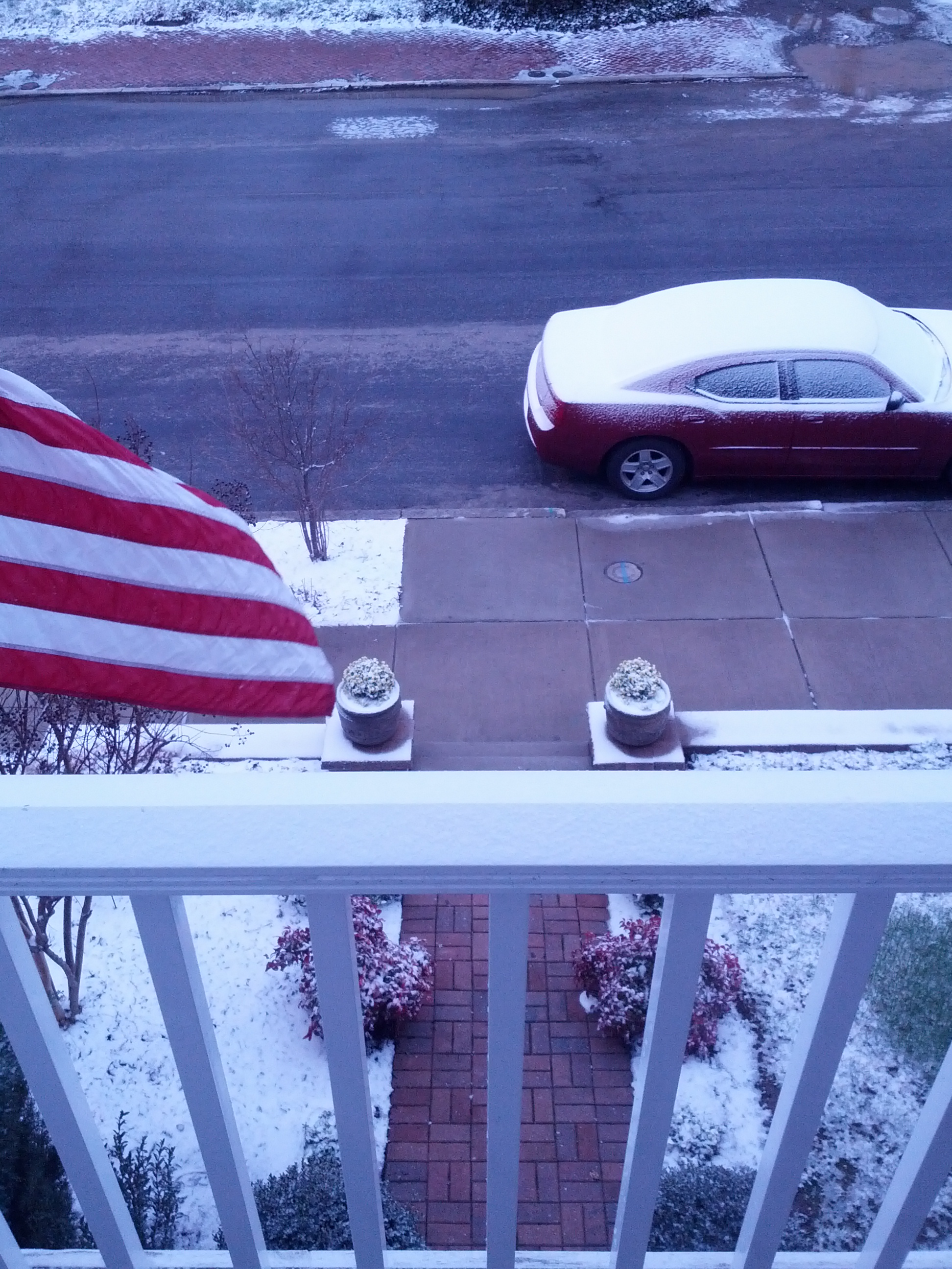
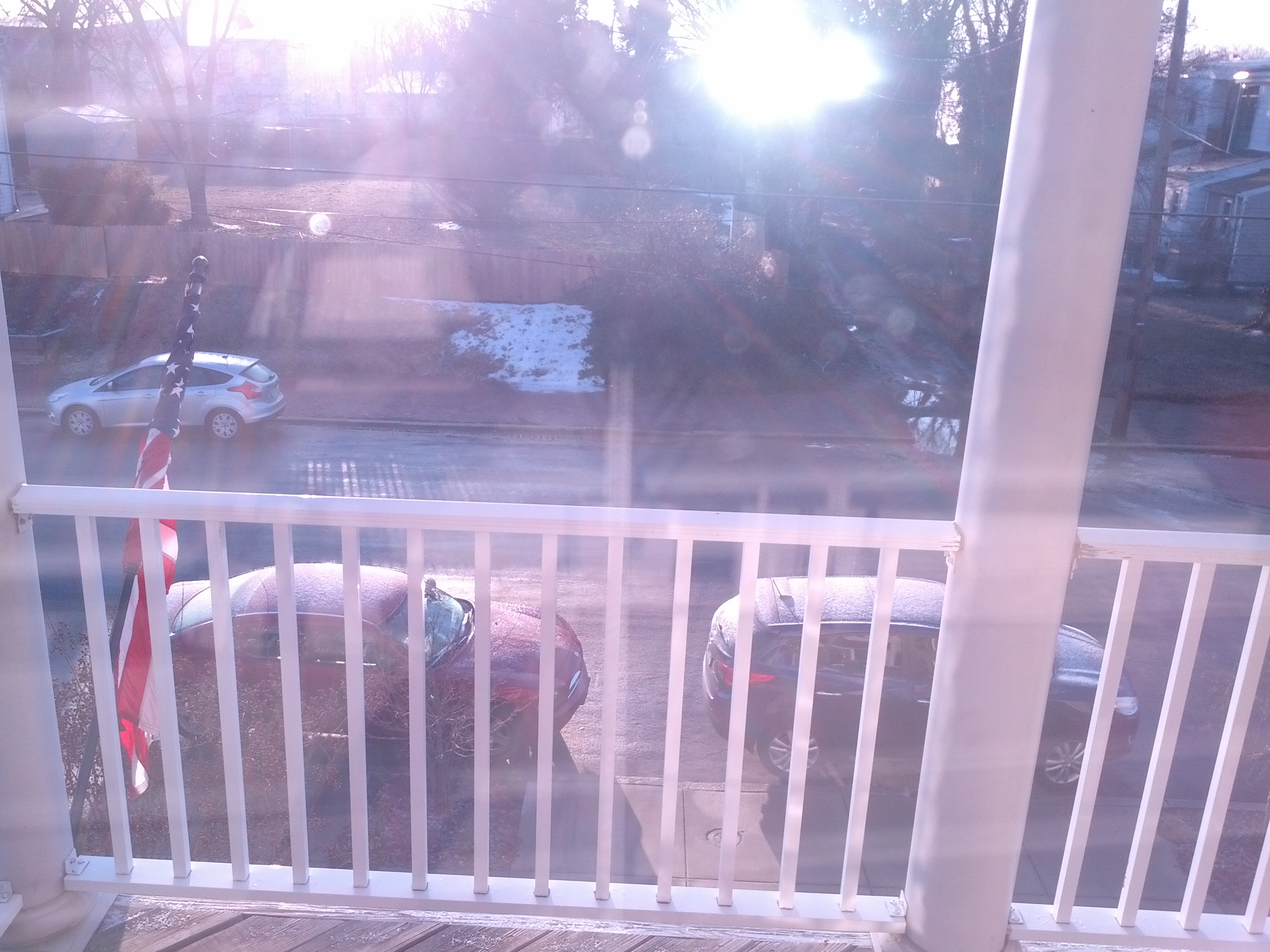
As of 3:30 PM on 2/13, there is approximately 1.5″ of snow/sleet on the majority of surfaces in Church Hill. Temperature continues to slowly fall and is hovering at 34 degrees Fahrenheit. Rain has changed to sleet and now snow.
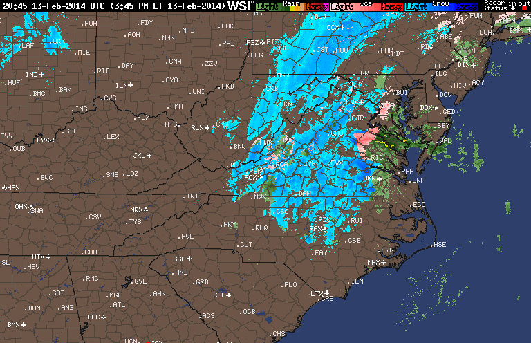
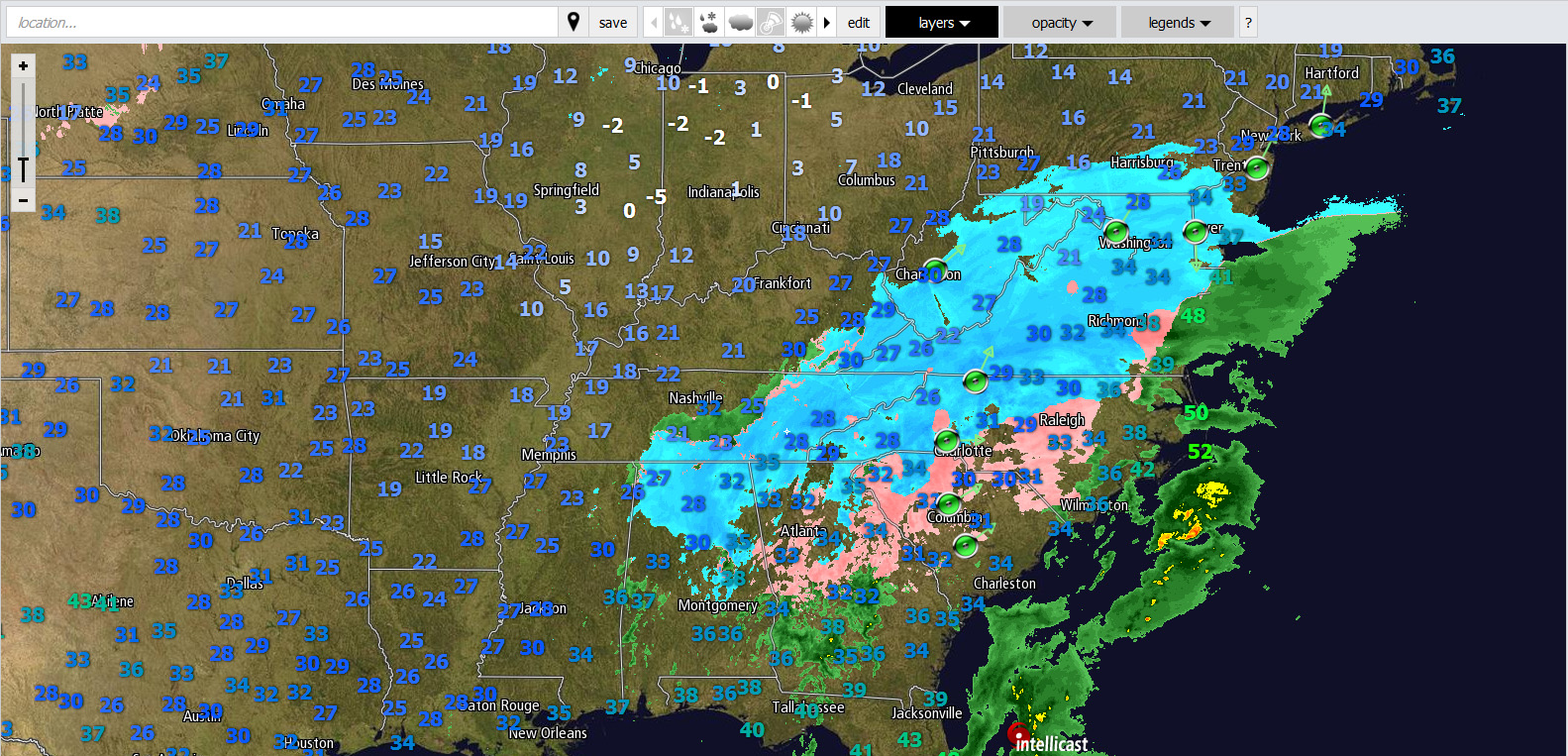
Radar from evening of 2/12/2014
Church Hill Storm Observation Summary:
* Place – Time: Church Hill, (2/13/2014)
* Temperature: 25-37, During Event
* Winter Weather Watch/Warning/Advisory: Warning
* Closings: Chesterfield Government Closed on 2/13/14
* Road Conditions: All roads covered during event, primary roads cleared by the morning of 2/13. However, secondary roads were still partially snow covered.
* Precipitation Description: Snow, sleet, freezing rain and rain. Initial snow was very fine and powdery snowflakes. Event transitioned from snow to sleet near 11 PM on 2/12. Sleet changed to freezing rain by 1:00 AM on 2/13/14. Rain and Drizzle followed during the early morning hours until 2 PM on 2/13/14. Sleet and the sleet to snow transitioned back into Richmond by 3:30 PM.
* Total Precipitation: 5.75″ (4.25” of snow on 2/12, 1.5″ of snow on 2/13). Approximately 0.25″ of sleet. Minor accumulations of freezing rain. 3.7″ inches of snow was reported at the airport on 2/12, 2.1″ inches of snow was reported at the airport on 2/12 for a total of 5.8″. Snowfall totals were heavier towards the peidmont and mountains in western Virginia (6-21” was common).
* Comments: Snow began near 4 PM at the Chesterfield Courthouse on 2/12/14. Nearly .75″ had accumulated by 5:30 PM when I left work. My commute home took nearly an hour, which is about twice as long as it normally takes. Heavy snow occurred for about an hour between 9-10 PM when about an inch of snow fell. The precipitation quickly transitioned to sleet. Freezing rain then set in late in the evening after I went to bed. As the storm wrapped up on 2/13, drizzle changed to a brief round of heavy sleet and rain with two loud rumbles of thunder. An hour later, the second round of precipatation hit with moderate to heavy snowfall. The snow tapered off by 7 PM dropping another 1.5″ of snow.
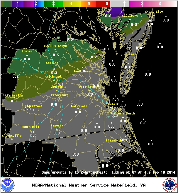
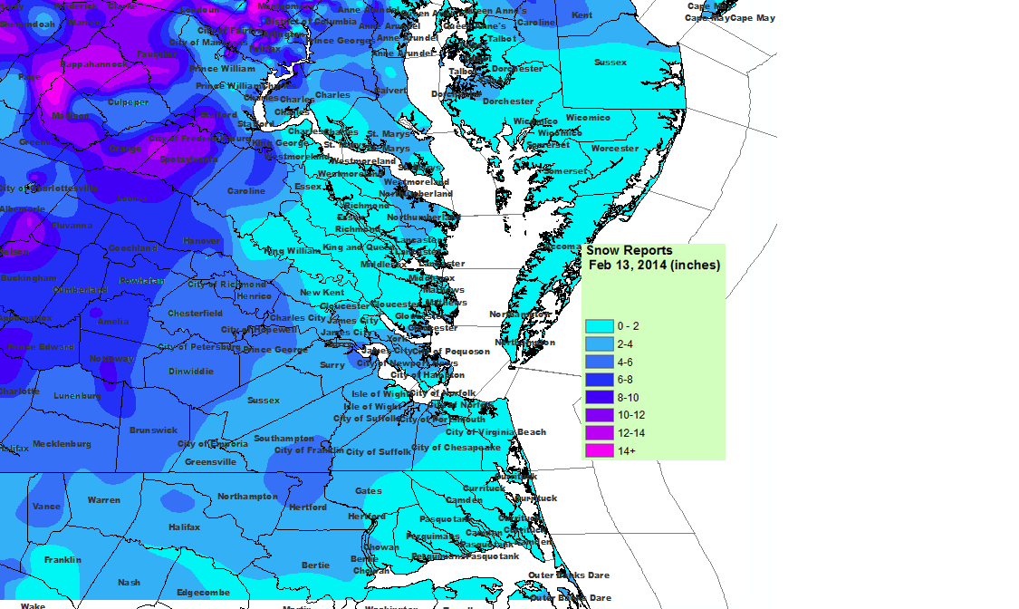
Snowfall Totals:
NWS Updated Snowfall Map for 2/12-2/13
Videos:
NWS Special Weather Statement:
Special Weather Statement
SPECIAL WEATHER STATEMENT
NATIONAL WEATHER SERVICE WAKEFIELD VA
358 PM EST THU FEB 13 2014

VAZ063-070>072-080>083-132230-
HANOVER-CHESTERFIELD-HENRICO-KING WILLIAM-DINWIDDIE-PRINCE GEORGE-
CHARLES CITY-NEW KENT-
INCLUDING THE CITIES OF...ASHLAND...COLONIAL HEIGHTS...RICHMOND...
PETERSBURG...HOPEWELL
358 PM EST THU FEB 13 2014

...A BAND OF MODERATE TO HEAVY SNOW TO MOVE ACROSS THE INTERSTATE 95
CORRIDOR THROUGH 530 PM...

A BAND OF MODERATE TO HEAVY SNOW WILL MOVE ACROSS THE INTERSTATE
95 CORRIDOR FROM THE TRI-CITIES TO RICHMOND THRU 530 PM. THE SNOW
WILL COME DOWN HARD ENOUGH TO REDUCE THE VISIBILITY TO AROUND ONE
QUARTER MILE AND QUICKLY COVER ROAD SURFACES. A COATING TO UP TO ONE
INCH OF SNOW IS POSSIBLE WITH THIS BAND OF SNOW. MOTORISTS SHOULD
USE CAUTION AND SLOW DOWN IF TRAVELING LATE THIS AFTERNOON. BE
PREPARED FOR POOR VISIBILITIES AND SLIPPERY ROAD CONDITIONS.

$$

JM
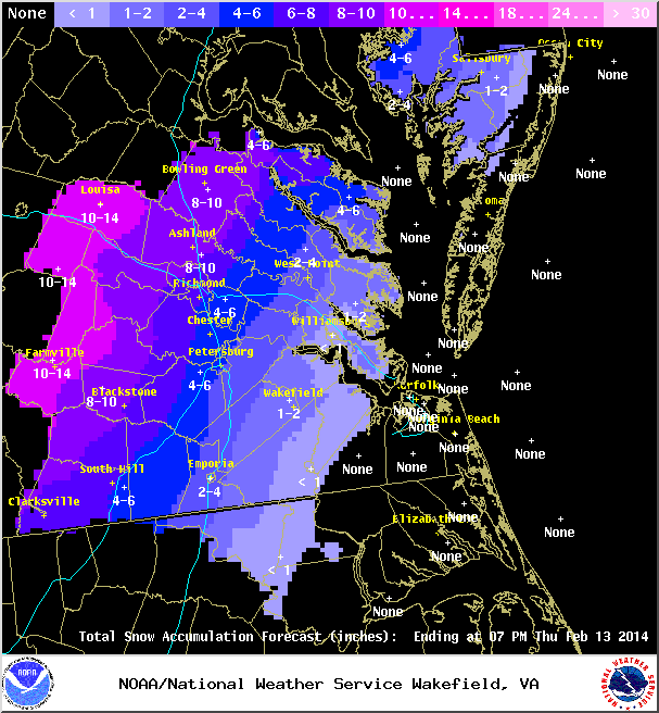
Late evening update on the latest snowfall forecast from the NWS and their text on the Winter Storm Warning:
NWS Snowfall Forecast, Evening of 2/11/14.
Winter Storm Warning Text:
URGENT - WINTER WEATHER MESSAGE
NATIONAL WEATHER SERVICE WAKEFIELD VA
551 PM EST TUE FEB 11 2014

VAZ065-066-070-071-079-080-121200-
/O.CON.KAKQ.WS.W.0003.140212T1800Z-140214T0000Z/
MECKLENBURG-LUNENBURG-CHESTERFIELD-HENRICO-BRUNSWICK-DINWIDDIE-
INCLUDING THE CITIES OF...SOUTH HILL...COLONIAL HEIGHTS...
RICHMOND...LAWRENCEVILLE
551 PM EST TUE FEB 11 2014

...WINTER STORM WARNING REMAINS IN EFFECT FROM 1 PM WEDNESDAY TO
7 PM EST THURSDAY...

A WINTER STORM WARNING REMAINS IN EFFECT FROM 1 PM WEDNESDAY TO
7 PM EST THURSDAY.

* LOCATIONS...PORTIONS OF CENTRAL VIRGINIA.

* TIMING...WEDNESDAY AFTERNOON THROUGH THURSDAY EVENING.

* HAZARDS...SNOW AND SLEET...POSSIBLY MIXED WITH FREEZING RAIN
  OVER SOUTHERN SECTIONS. A CHANGEOVER TO PLAIN RAIN IS POSSIBLE
  FOR A BRIEF PERIOD ALONG THE INTERSTATE 95 CORRIDOR EARLY
  THURSDAY.

* ACCUMULATIONS...SNOW ACCUMULATIONS OF 4 TO 8 INCHES...WITH THE
  HEAVIEST ACCUMULATIONS EXPECTED WEST OF INTERSTATE 95. A TRACE
  TO A TENTH OF AN INCH OF ICE ACCUMULATION IS ALSO POSSIBLE.

* IMPACTS...SNOW AND ICE CAN LEAD TO SLICK AND HAZARDOUS TRAVEL
  CONDITIONS AS IT ACCUMULATES ON ROADWAYS. THE SNOW IS EXPECTED
  TO BE HEAVY AND WET...AND MAY WEIGH DOWN ON TREE LIMBS AND
  POWER LINES. SPORADIC POWER OUTAGES ARE POSSIBLE.

PRECAUTIONARY/PREPAREDNESS ACTIONS...

A WINTER STORM WARNING MEANS SIGNIFICANT AMOUNTS OF SNOW...
SLEET...AND ICE ARE EXPECTED OR OCCURRING. STRONG WINDS ARE ALSO
POSSIBLE.  THIS WILL MAKE TRAVEL VERY HAZARDOUS OR IMPOSSIBLE.

&&

$$
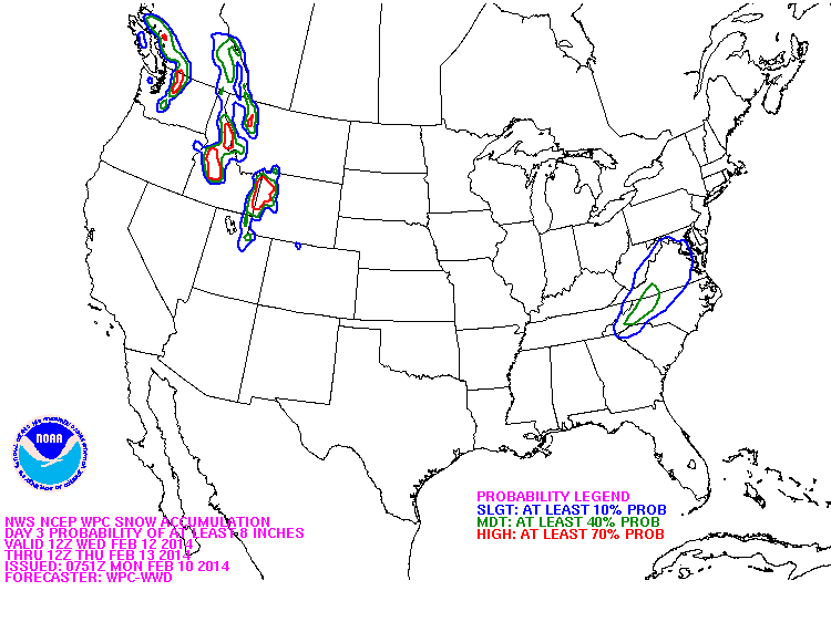
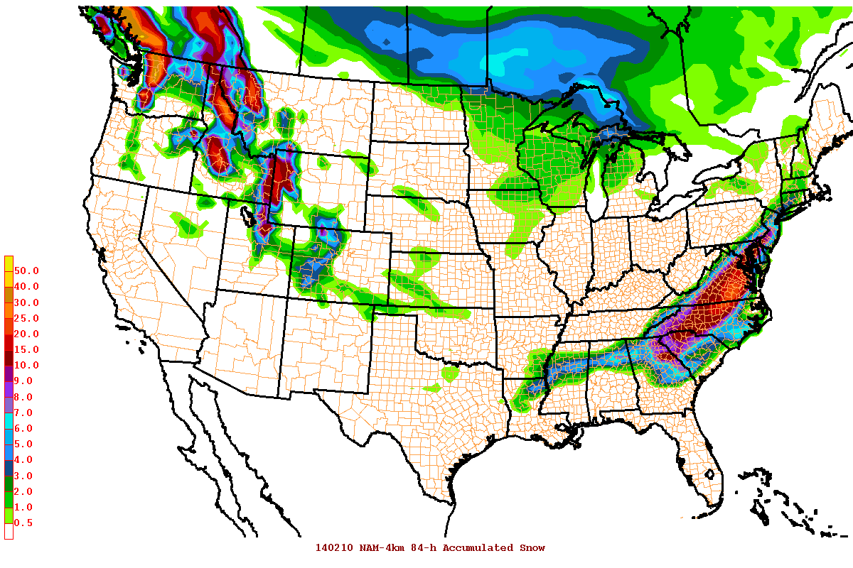
The Eurpoean Weather model has been showing hints of a winter storm since last Thursday (2/6) for the middle of this week. As we are within 48 hours of the storm, several more weather models are on board with a significant storm scenario for Central Virginia. While it is still early to issue snowfall forecasts, certain models have pegged Richmond for as much as 6″ to 25″ of snow. A wide range that can vary based on the track and intensity of the storm.
NAM 12Z 84-Hour Snowfall Accumulation
The NAM model above is likely overdone in snow totals since it is projecting totals for the later hours of its run (shown for the novelity factor only).
URGENT - WINTER WEATHER MESSAGE
NATIONAL WEATHER SERVICE WAKEFIELD VA
410 PM EST MON FEB 10 2014

NCZ012-VAZ065-066-070-071-079>081-087>089-092-093-111200-
/O.NEW.KAKQ.WS.A.0003.140212T1700Z-140213T2300Z/
NORTHAMPTON NC-MECKLENBURG-LUNENBURG-CHESTERFIELD-HENRICO-
BRUNSWICK-DINWIDDIE-PRINCE GEORGE-GREENSVILLE-SUSSEX-SURRY-
SOUTHAMPTON-ISLE OF WIGHT-
INCLUDING THE CITIES OF...MARGARETTSVILLE...SOUTH HILL...
COLONIAL HEIGHTS...RICHMOND...LAWRENCEVILLE...PETERSBURG...
HOPEWELL...EMPORIA...WAKEFIELD...FRANKLIN
410 PM EST MON FEB 10 2014

...WINTER STORM WATCH IN EFFECT FROM WEDNESDAY AFTERNOON THROUGH
THURSDAY AFTERNOON...

THE NATIONAL WEATHER SERVICE IN WAKEFIELD HAS ISSUED A WINTER
STORM WATCH...WHICH IS IN EFFECT FROM WEDNESDAY AFTERNOON THROUGH
THURSDAY AFTERNOON.

* LOCATIONS...PORTIONS OF CENTRAL AND EASTERN VIRGINIA.

* TIMING...WEDNESDAY AFTERNOON THROUGH THURSDAY AFTERNOON.

* HAZARDS...SNOW AND SLEET...POSSIBLY MIXED WITH FREEZING RAIN.
  MUCH OF THIS AREA WILL CHANGE TO MAINLY RAIN ON THURSDAY.

* ACCUMULATIONS...THE POTENTIAL FOR 4 OR MORE INCHES OF
  SNOW...ALONG WITH A LIGHT ACCUMULATION OF ICE.

* IMPACTS...SNOW AND SLEET CAN LEAD TO SLICK AND HAZARDOUS TRAVEL
  CONDITIONS AS IT ACCUMULATES ON ROADWAYS. THE SNOW IS EXPECTED TO
  BE HEAVY AND WET...AND MAY WEIGH DOWN ON TREE LIMBS AND POWER
  LINES. SPORADIC POWER OUTAGES ARE POSSIBLE.

PRECAUTIONARY/PREPAREDNESS ACTIONS...

A WINTER STORM WATCH MEANS THERE IS A POTENTIAL FOR SIGNIFICANT
SNOW...SLEET...OR ICE ACCUMULATIONS THAT MAY IMPACT TRAVEL.
CONTINUE TO MONITOR THE LATEST FORECASTS.
Current & Historical Weather Events in Richmond, Virginia