Click below for a link to my snow observations from home or work since 2009. I’ll work on something a little easier to keep updated shortly.
Category Archives: Forecast Discussion
What do the models say? What are the local mets saying? Discuss it here.
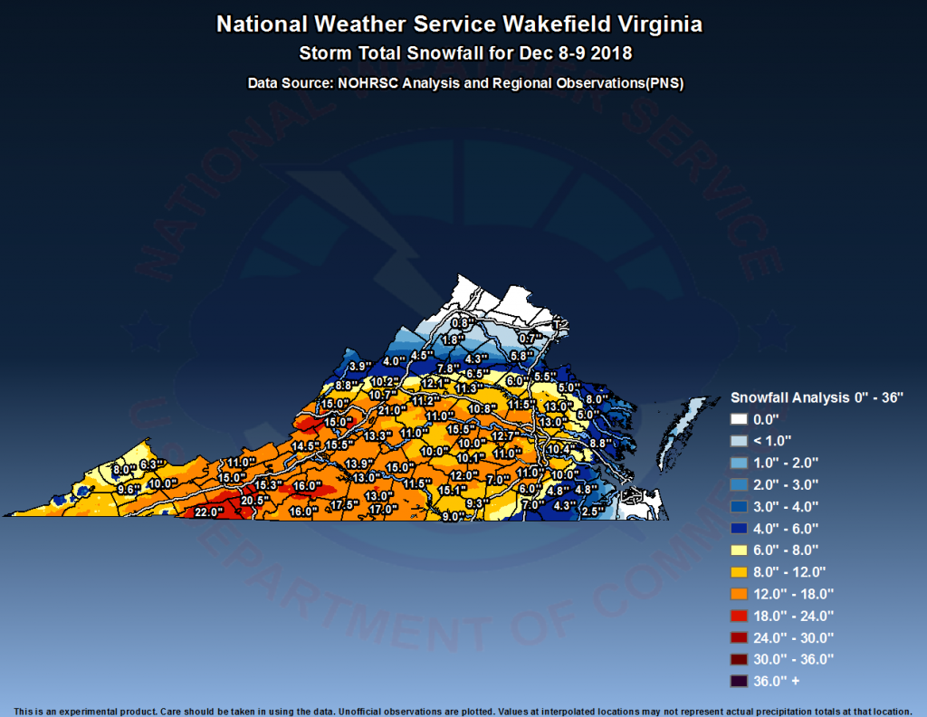
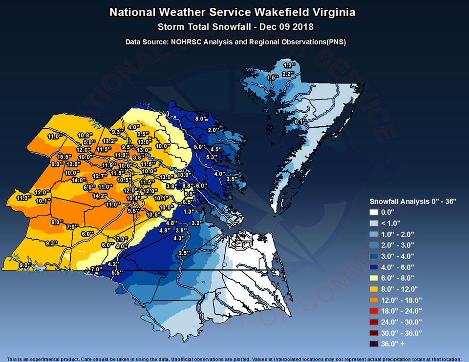
December 9, 2018: Observations
Franconia Farm Storm Observation Summary:
* Place – Time: Franconia Road, (12/9/2018)
* Temperature: 30-32, During Event
* Winter Weather Watch/Warning/Advisory: Watch & Warning
* Closings: All local school districts were closed on 12/9, Chesterfield County Government was closed on 12/9.
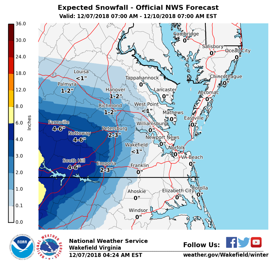
* Predicted Totals: 1-4″ the day before the storm. Between 6-12″ the morning of the storm.
* Road Conditions: All roads had substantial snow accumulation on them by midday on 12/9.
* Precipitation Description: Snow. Snow began around 7:30 AM . Snow transitioned to gropel and snow flurries around 8 PM before ending.
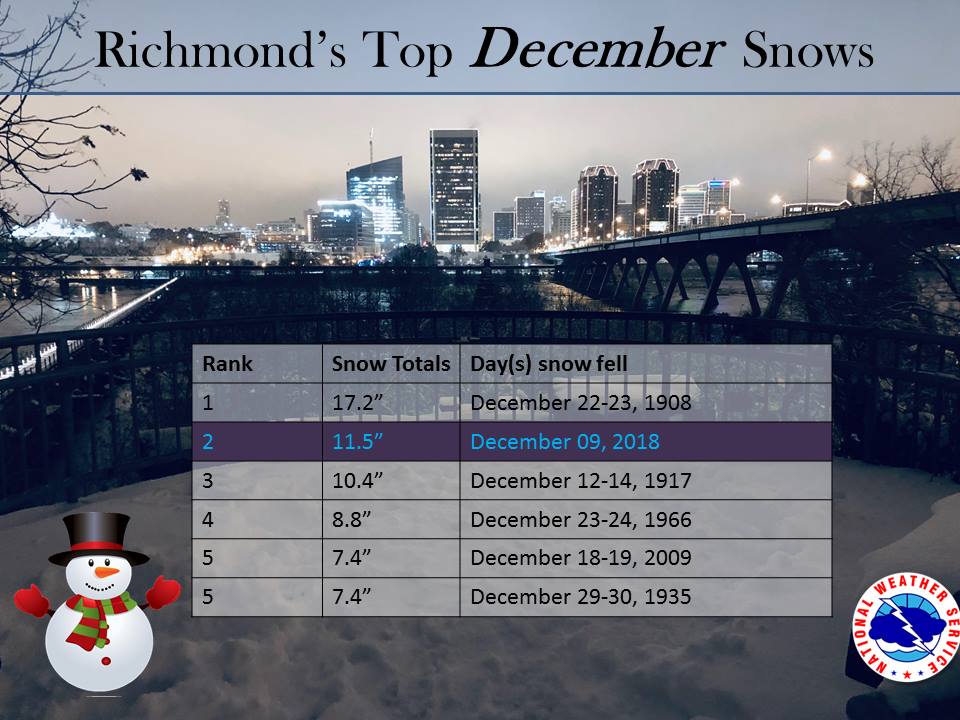
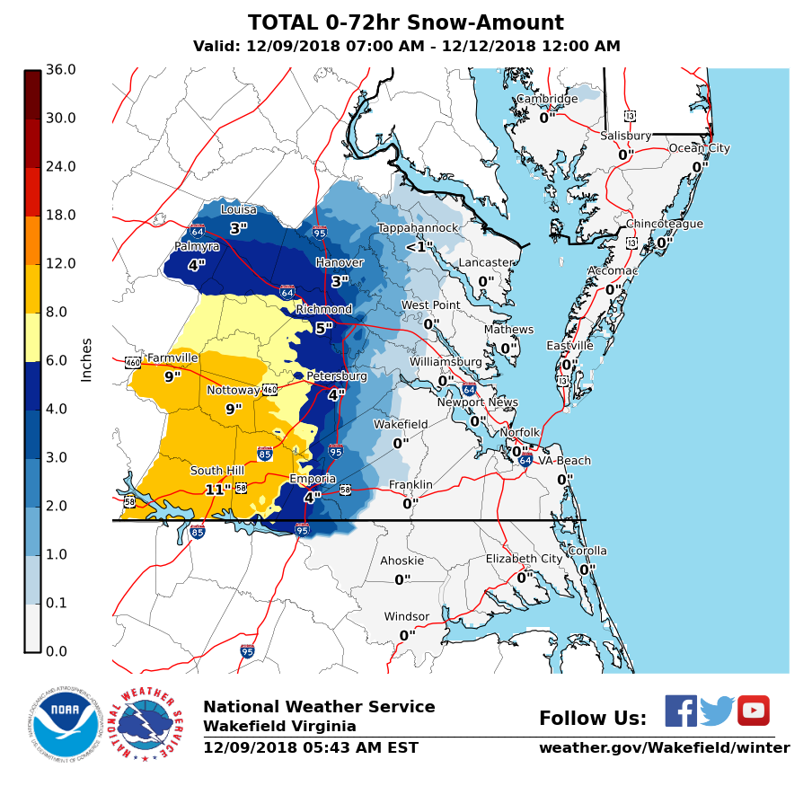
* Total Precipitation: 13.25″ of snow. 11.5″ of snow was reported at the Richmond airport. Locally heavier snow to the south and west of Richmond.
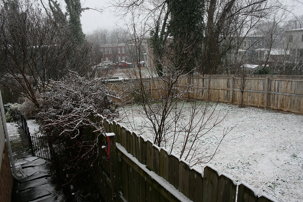
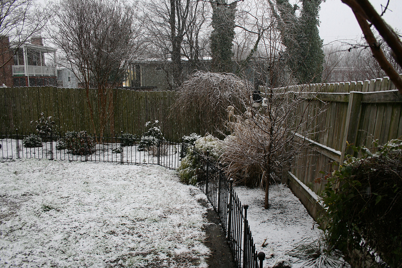
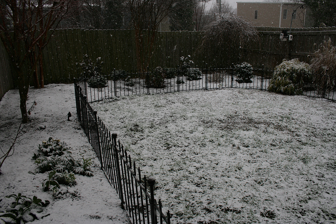
* Comments: A complex storm system tracked across the lower portion of the country, including a multi-phased low-pressure system that transitioned from the Gulf Coast to a low-pressure system off the South and North Carolina coasts. The low-pressure system then tracked ENE into the Atlantic Ocean, causing snow to overspread into Central Virginia. Snow was light to moderate for the until 2-3 PM. Two very heavy snow bands moved in during the afternoon and evening hours. Between 6:26 PM and 6:56 PM, we got 2.5″ of snow, which equates to over 3″ an hour! Reports of lightening and thunder snow were reported in Richmond my brother, David. Snow tapered off by 9 PM on Sunday night (12/9).
Snow impacted Oklahoma up to northern Virginia. This storm was known as “Diego” by TWC . Impacts in western Virginia and North Carolina were extreme, where totals ranged between 1 – 2 feet of snow.
Snowfall Totals & Records:
Photos & Videos
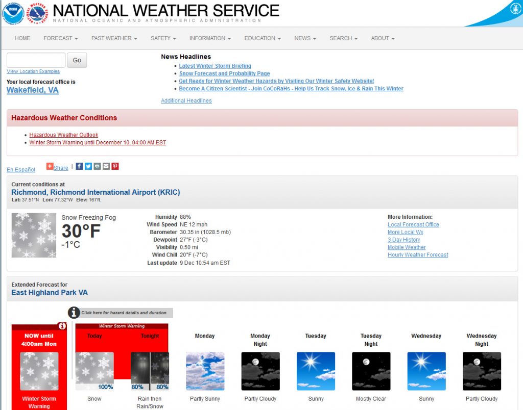
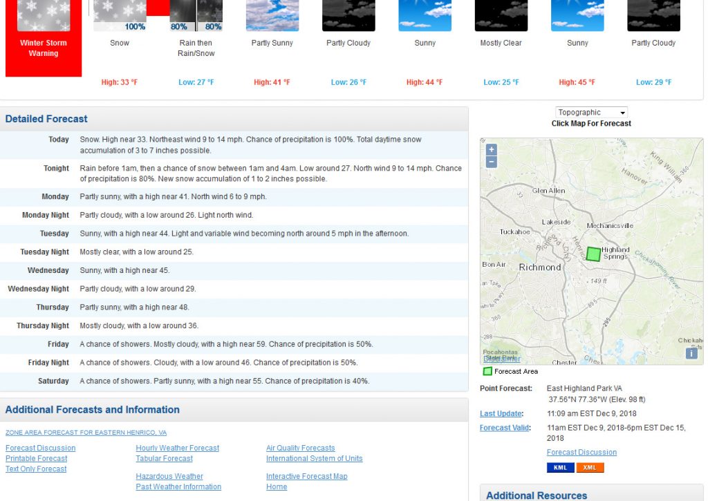
December 9, 2018: Forecast
Diego was a major winter storm that developed off the coast of California the week of December 3rd. The storm traveled across the southern tier of the country and redeveloped along the Gulf Coast on December 8th. By Sunday, it regenerated off the Carolina coast, pushing copious amounts of moisture and wintry precipitation into North Carolina and Virginia. It’s track closely followed a “Miller A” type setup for a winter storm.
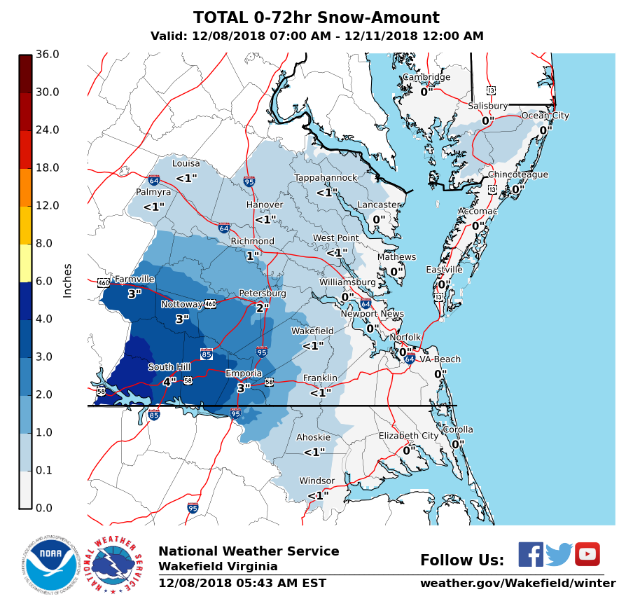
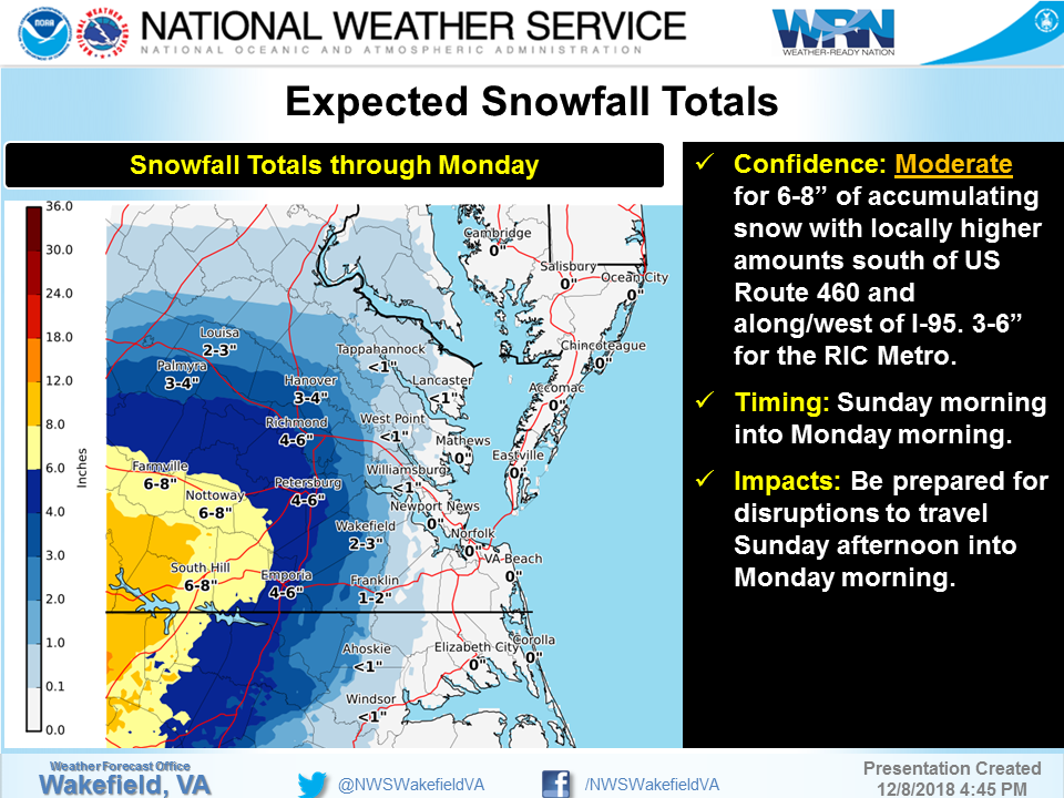
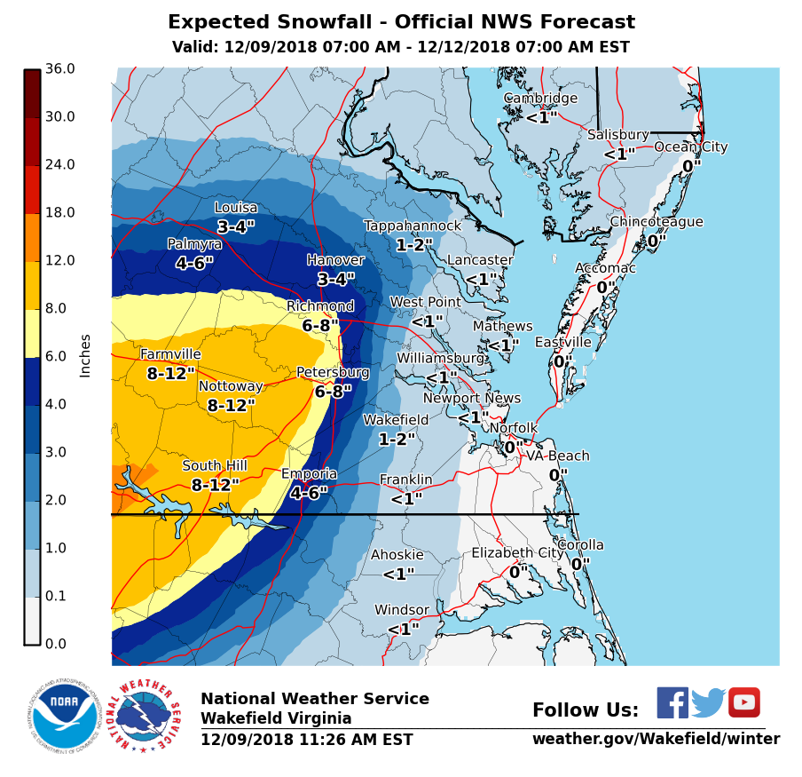
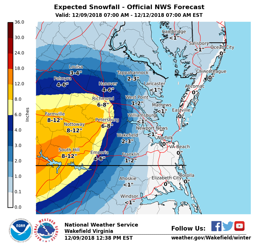
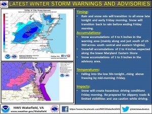
In retrospect, the majority of folks forecasting this event underestimated the amount of snow Central Virginia would receive. Days before the event, snow totals were quite low. The NWS out of Wakefield only significantly increased snow totals on the morning of the 9th. A progression of the snowfall forecast is shown below:
Watches and warnings posted on Saturday, December 8th:
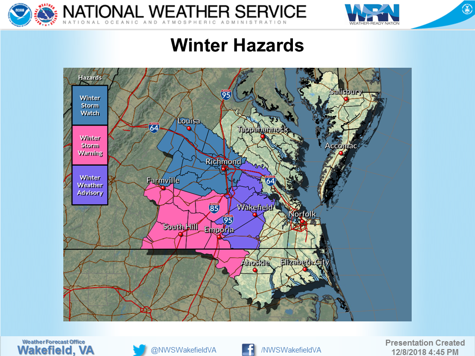
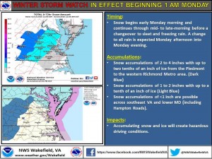
By the morning of the 9th, Winter Storm Warnings were issued for the watch areas. The NWS forecast for Richmond the morning of the event.
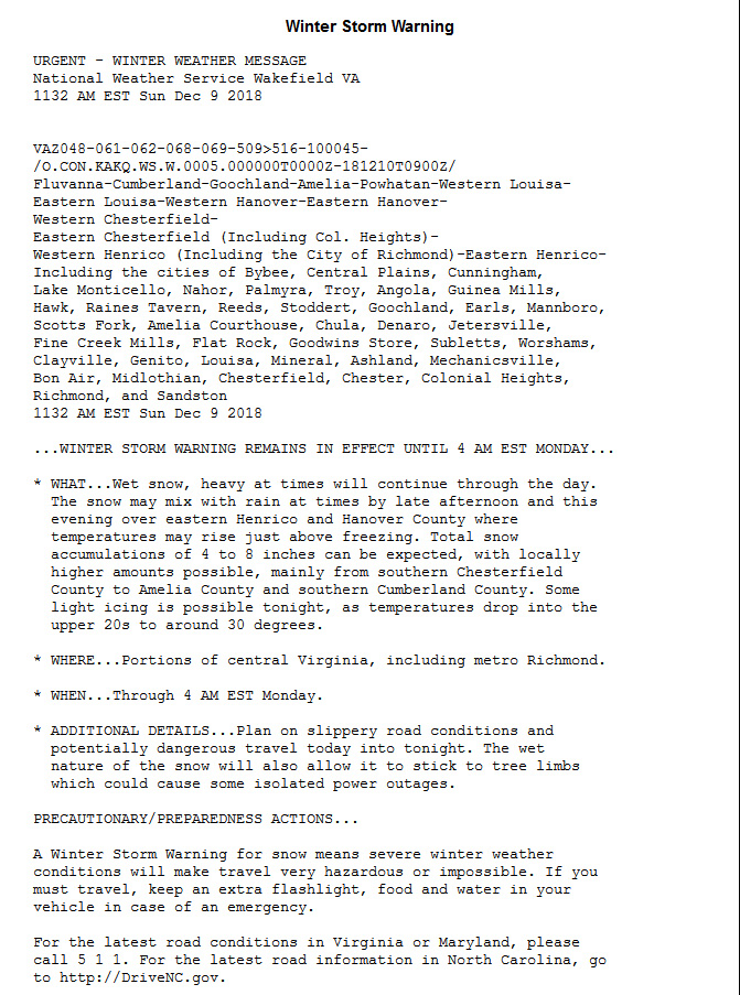
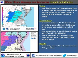
The winter storm warning language:
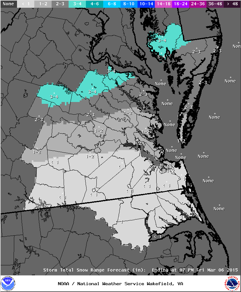
March 3-4, 2016: Rain/Snow to Snow, then Rain?
An quick brush with a coastal low developing off the North Carolina coast will bring the possibility for rain changing to snow to Central Virginia overnight on 3/3 into 3/4. Rain, mixing with and changing to snow, could bring accumulating snow to Metro Richmond. A winter storm watch and warning have been issued for most of Richmond. Snow amounts from 3-6″ are projected from Richmond south to the Tri-Cities. Snowfall will need to be heavy to provide forecasted accumulations. Snow will likely change back to rain by 10 AM (should moisture still be present).
February 15, 2016: Forecast for Snow, Ice to Rain
A multi-part storm will impact central Virginia on February 15th. A winter storm watch was issued on February 13th. It was converted to a winter weather advisory on February 14th. Consensus is building on the models to have snow fall overnight on the 14-15th, transition to sleet and freezing rain by noon and to rain by the afternoon.
URGENT – WINTER WEATHER MESSAGE
NATIONAL WEATHER SERVICE WAKEFIELD VA
354 AM EST SUN FEB 14 2016VAZ064>068-511-513-515-141700-
/O.UPG.KAKQ.WS.A.0002.160215T0600Z-160216T0500Z/
/O.NEW.KAKQ.WW.Y.0005.160215T0500Z-160216T0000Z/
CAROLINE-MECKLENBURG-LUNENBURG-NOTTOWAY-AMELIA-WESTERN HANOVER-
WESTERN CHESTERFIELD-WESTERN HENRICO-
INCLUDING THE CITIES OF…SOUTH HILL…CREWE…ASHLAND…
MIDLOTHIAN…BON AIR…RICHMOND
354 AM EST SUN FEB 14 2016…WINTER WEATHER ADVISORY IN EFFECT FROM MIDNIGHT TONIGHT TO
7 PM EST MONDAY…THE NATIONAL WEATHER SERVICE IN WAKEFIELD HAS ISSUED A WINTER
WEATHER ADVISORY FOR CENTRAL AND SOUTH CENTRAL VIRGINIA WHICH IS
IN EFFECT FROM MIDNIGHT TONIGHT TO 7 PM EST MONDAY. THE WINTER
STORM WATCH IS NO LONGER IN EFFECT.* AREAS AFFECTED: CENTRAL AND SOUTH CENTRAL VIRGINIA.
* HAZARDS: SNOW…SLEET AND FREEZING RAIN.
* ACCUMULATIONS: TWO TO THREE INCHES OF SNOW…AND UP TO ONE TENTH OF
AN INCH OF ICE.* TEMPERATURES: LOWS SUNDAY NIGHT AROUND 20. HIGHS LATE MONDAY IN
THE MID 30S.* TIMING: SNOW OVERSPREADING THE AREA LATE SUNDAY NIGHT INTO
EARLY MONDAY MORNING…THEN CONTINUING THROUGH THE MORNING
HOURS MONDAY. THE SNOW IS EXPECTED TO CHANGE TO SLEET AND
FREEZING RAIN LATE MONDAY MORNING OR EARLY AFTERNOON…THEN
EVENTUALLY RAIN THROUGH MONDAY AFTERNOON AND MONDAY EVENING.* IMPACTS: HAZARDOUS TRAVEL DUE TO SNOW AND ICE COVERED ROADS.
PRECAUTIONARY/PREPAREDNESS ACTIONS…
A WINTER WEATHER ADVISORY MEANS THAT PERIODS OF SNOW…SLEET…OR
FREEZING RAIN WILL CAUSE TRAVEL DIFFICULTIES. BE PREPARED FOR
SLIPPERY ROADS AND LIMITED VISIBILITIES…AND USE CAUTION WHILE
DRIVING.
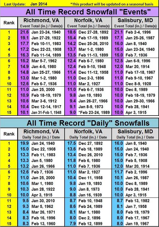
Richmond All-Time Snowfall Records
January 22-23, 2016: Snow to Sleet to Snow?
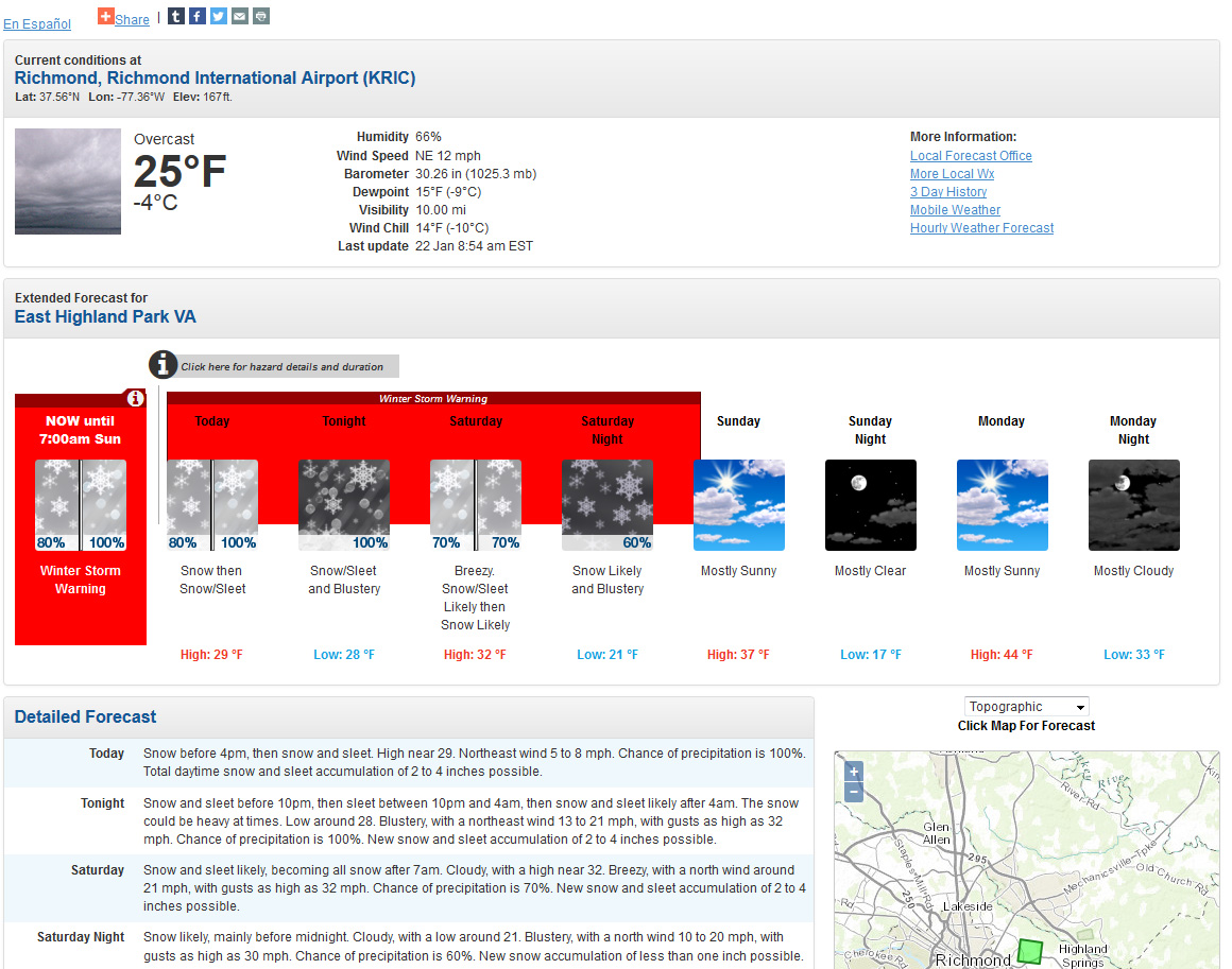
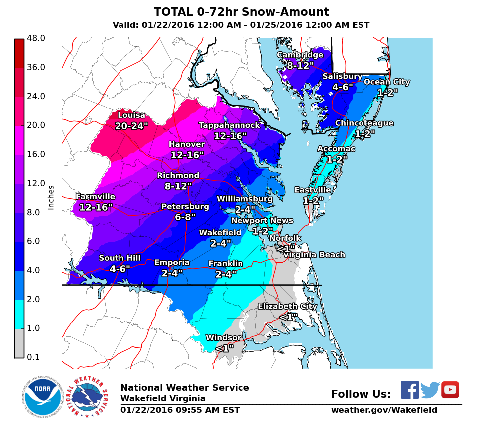
A major storm in now on it’s way with the expected development of a coastal low off the Carolina coast later today, impacting the area from Friday morning into Saturday night. The system is expected to bring period of heavy snow, sleet and possibly freezing rain to Richmond. Models latched on to a storm threat since last weekend (January 16th-17th) and have continually shown a winter storm that will impact most of Virginia and a good portion of the Mid-Atlantic, Ohio Valley and North East. Snow totals to the north and west of Richmond are expected to exceed 2′ in spots. The storm is taking on characteristics (intensity and snowfall) of the Snowmaggedon (2/2010) and 96′ Blizzard. Snow totals in Richmond will be highly dependent on the amount of sleet that falls Saturday night. Models have varied snow from 5-6″ upwards of 20-24″.
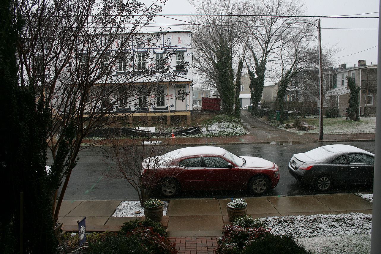
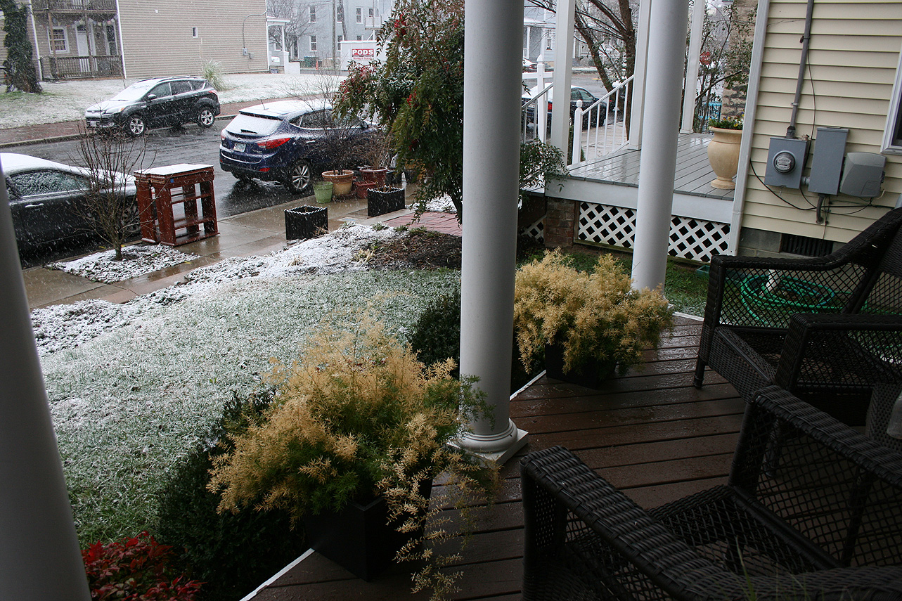
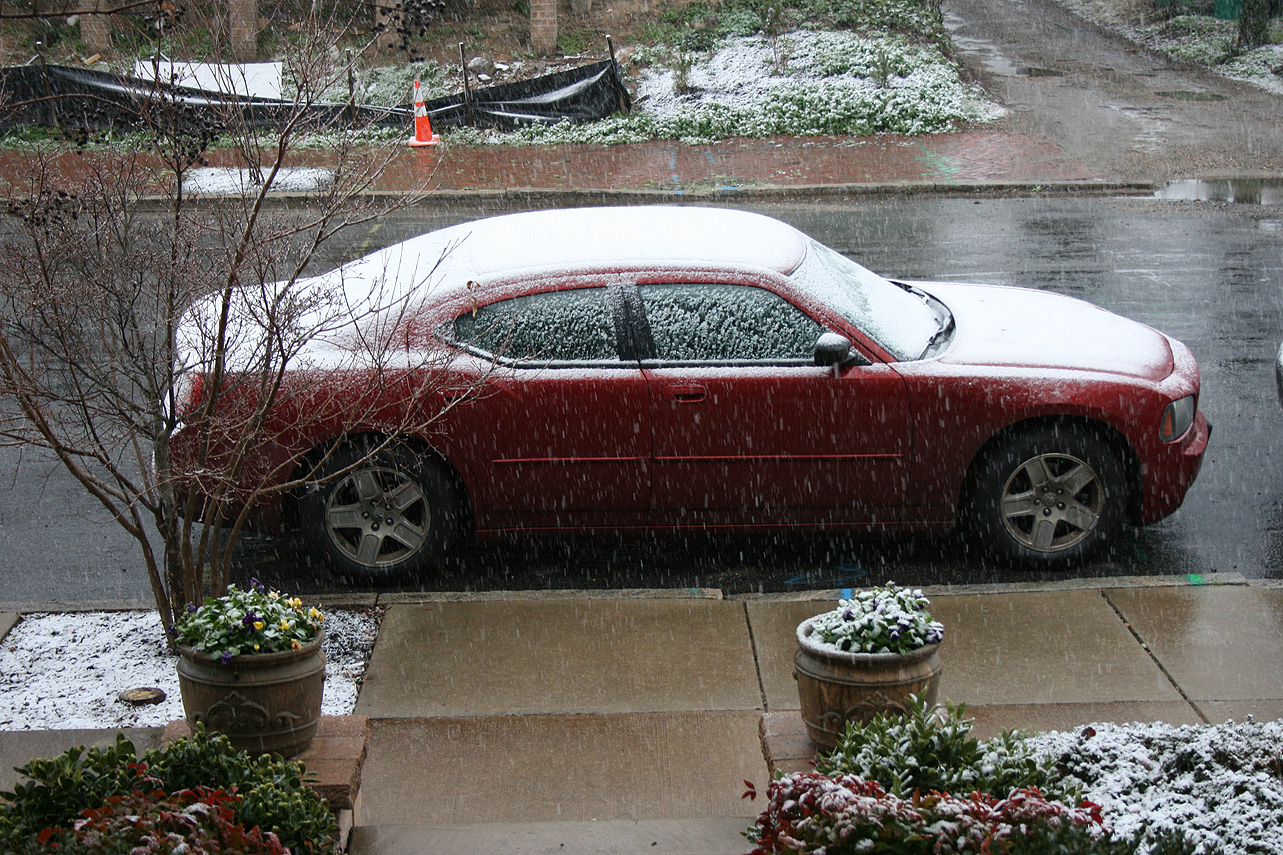
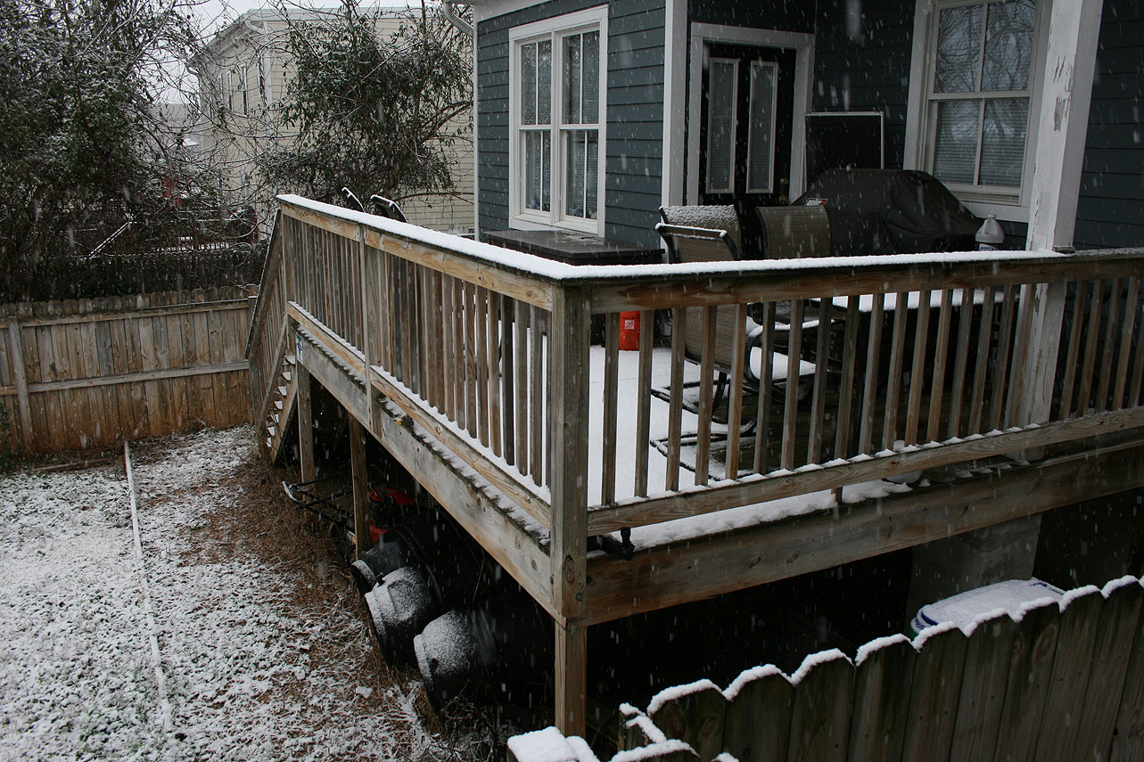
January 17, 2016: Observation
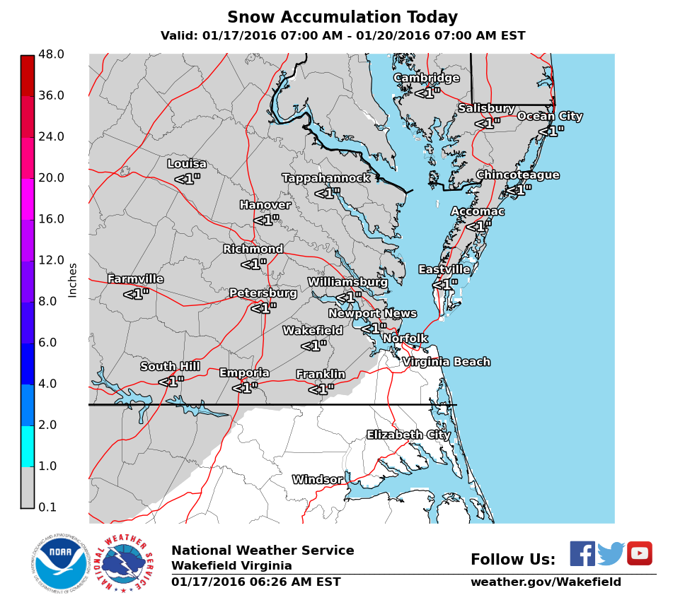

Church Hill Storm Observation Summary:
* Place – Time: Church Hill, (1/17/2016)
* Temperature: 33-35, During Event
* Winter Weather Watch/Warning/Advisory: None
* Closings: N/A (Sunday Event)
* Predicted Totals: Dusting to 1″.
* Road Conditions: Minor snow accumulations on pavement, mostly clear roads.
* Precipitation Description: Snow, which began at 8:00 AM and ended around 1:30 PM.
* Total Precipitation: 1.125″ of snow. 0.7″ of snow was reported at the Richmond airport. Totals higher to the east and north of Richmond.
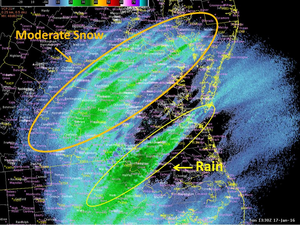
* Comments: A low pressure system developed along the gulf coast and subsequently redeveloped off the Carolina coast. Snowfall came down at light to moderate rates during the morning hours.
Snowfall Totals:
Not available.
Photo Gallery:
First Snow of 2015-2016 Winter Season
While away in Florida, the first appearance of snow flurries happened in Richmond. There was no accumulation.
March 5, 2015: Rain to Sleet/Snow?