Deprecated: Optional parameter $selected declared before required parameter $args is implicitly treated as a required parameter in /home/richmon/domains/richmondcitywatch.com/public_html/rvawx_test/wp-content/plugins/archives-calendar-widget/arw-settings.php on line 178
Deprecated: Optional parameter $view declared before required parameter $args is implicitly treated as a required parameter in /home/richmon/domains/richmondcitywatch.com/public_html/rvawx_test/wp-content/plugins/archives-calendar-widget/arw-widget.php on line 480
Deprecated: Optional parameter $archiveMonth declared before required parameter $args is implicitly treated as a required parameter in /home/richmon/domains/richmondcitywatch.com/public_html/rvawx_test/wp-content/plugins/archives-calendar-widget/arw-widget.php on line 480
Warning: Trying to access array offset on value of type bool in /home/richmon/domains/richmondcitywatch.com/public_html/rvawx_test/wp-content/plugins/archives-calendar-widget/archives-calendar.php on line 64 sleet | RVAWX.com
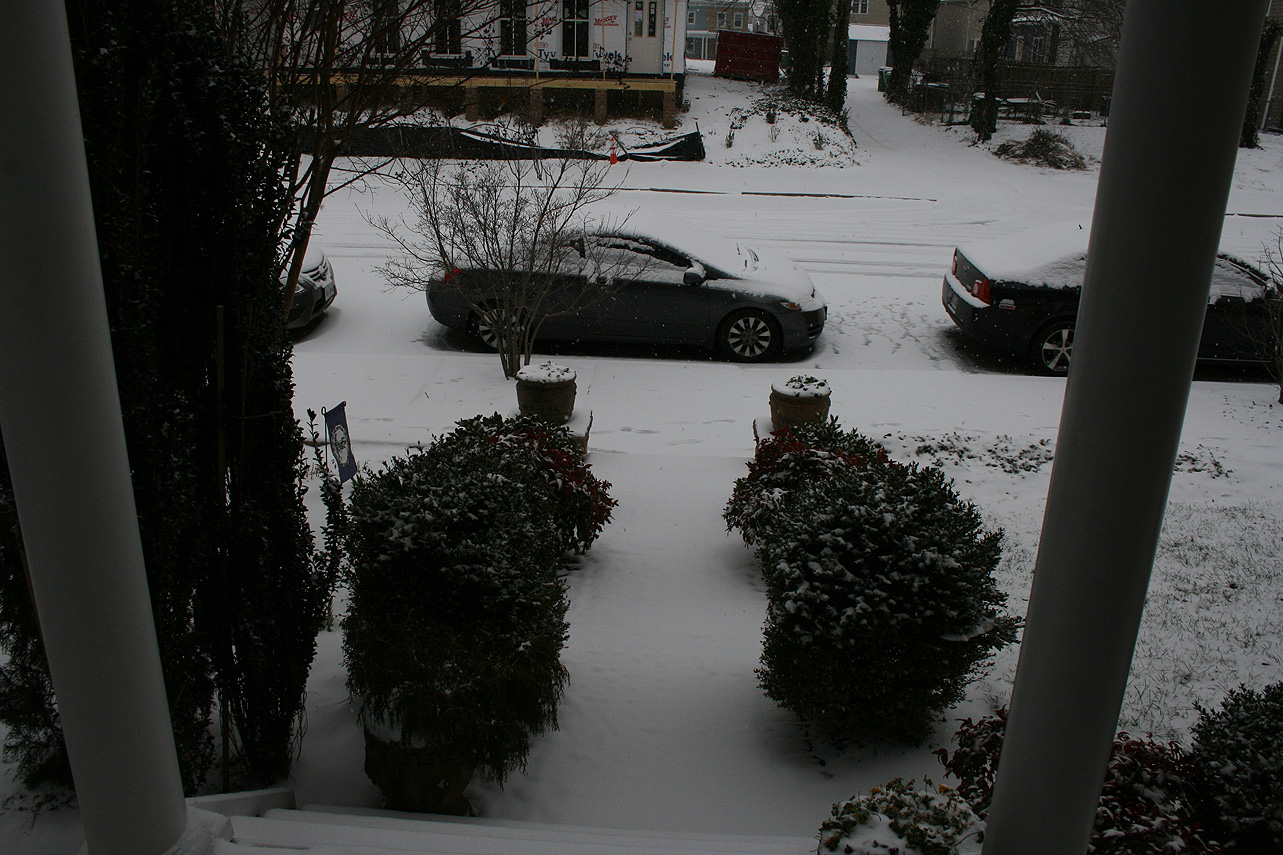
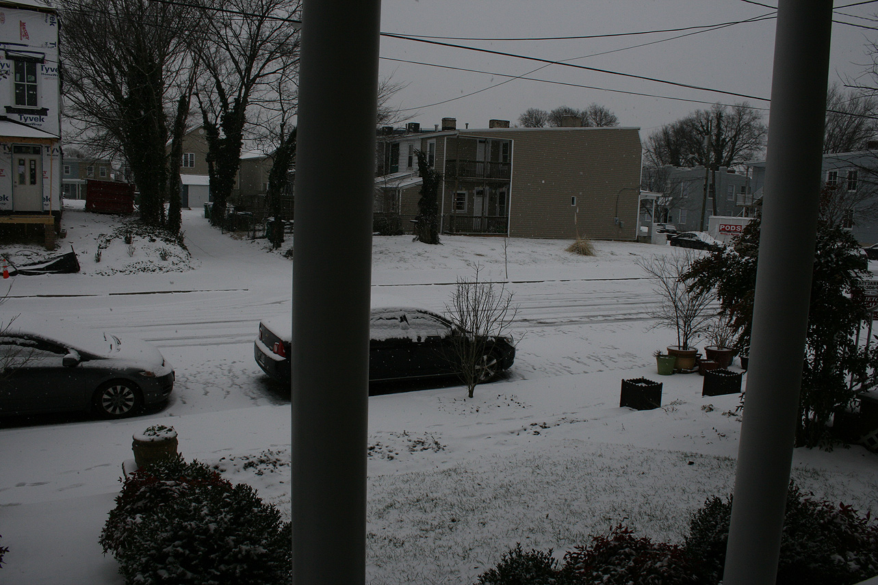
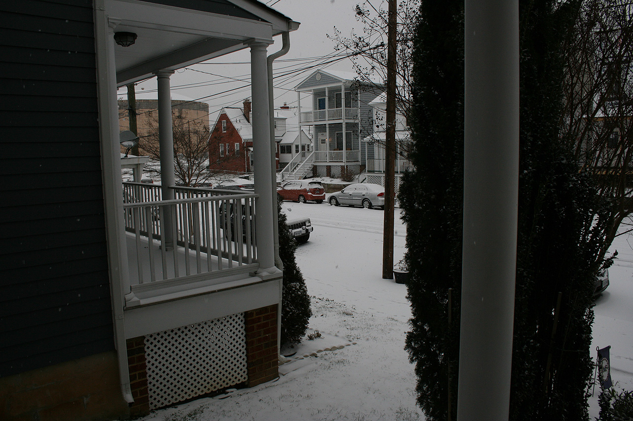
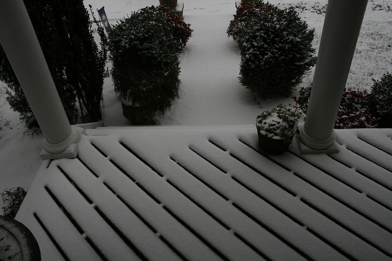
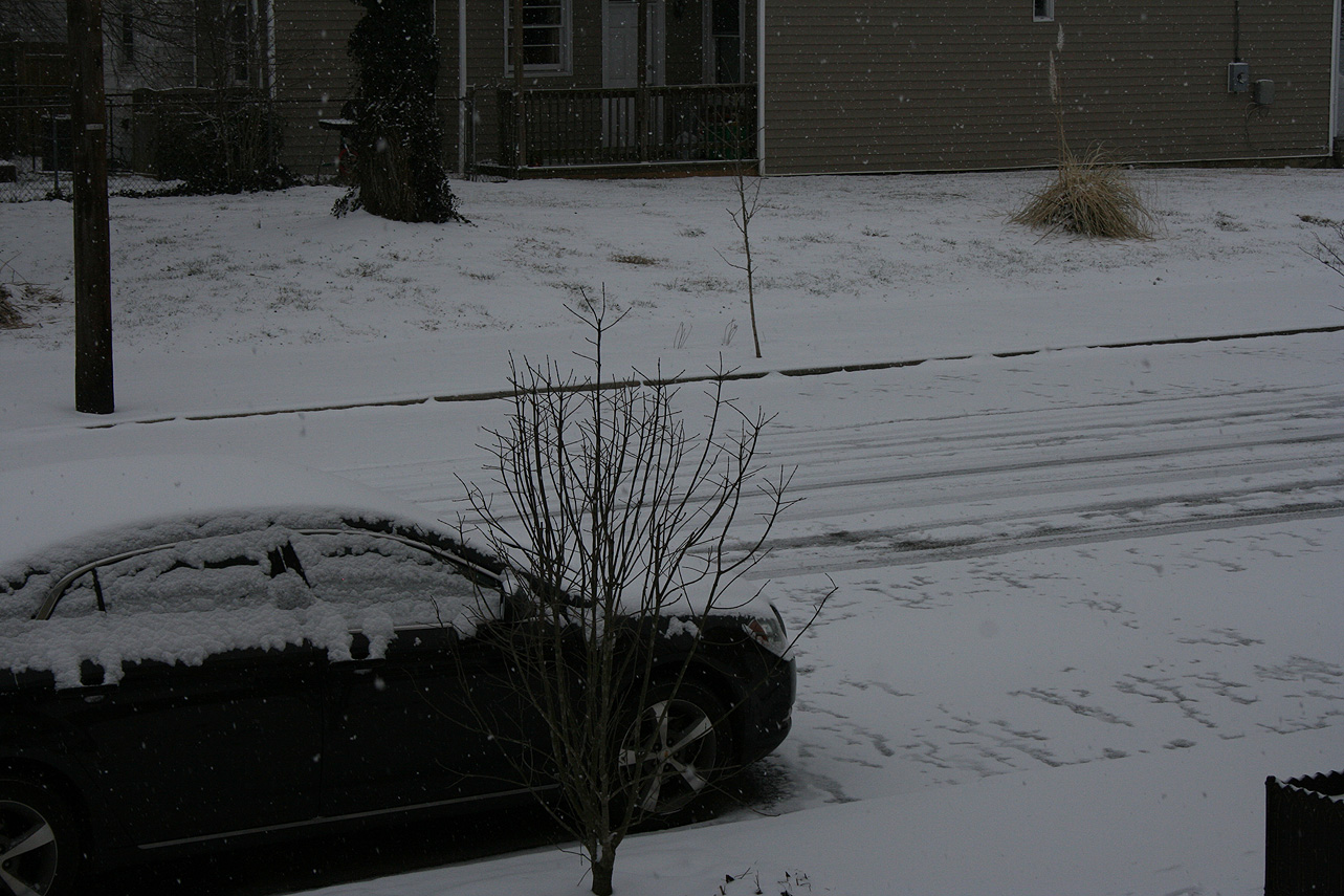
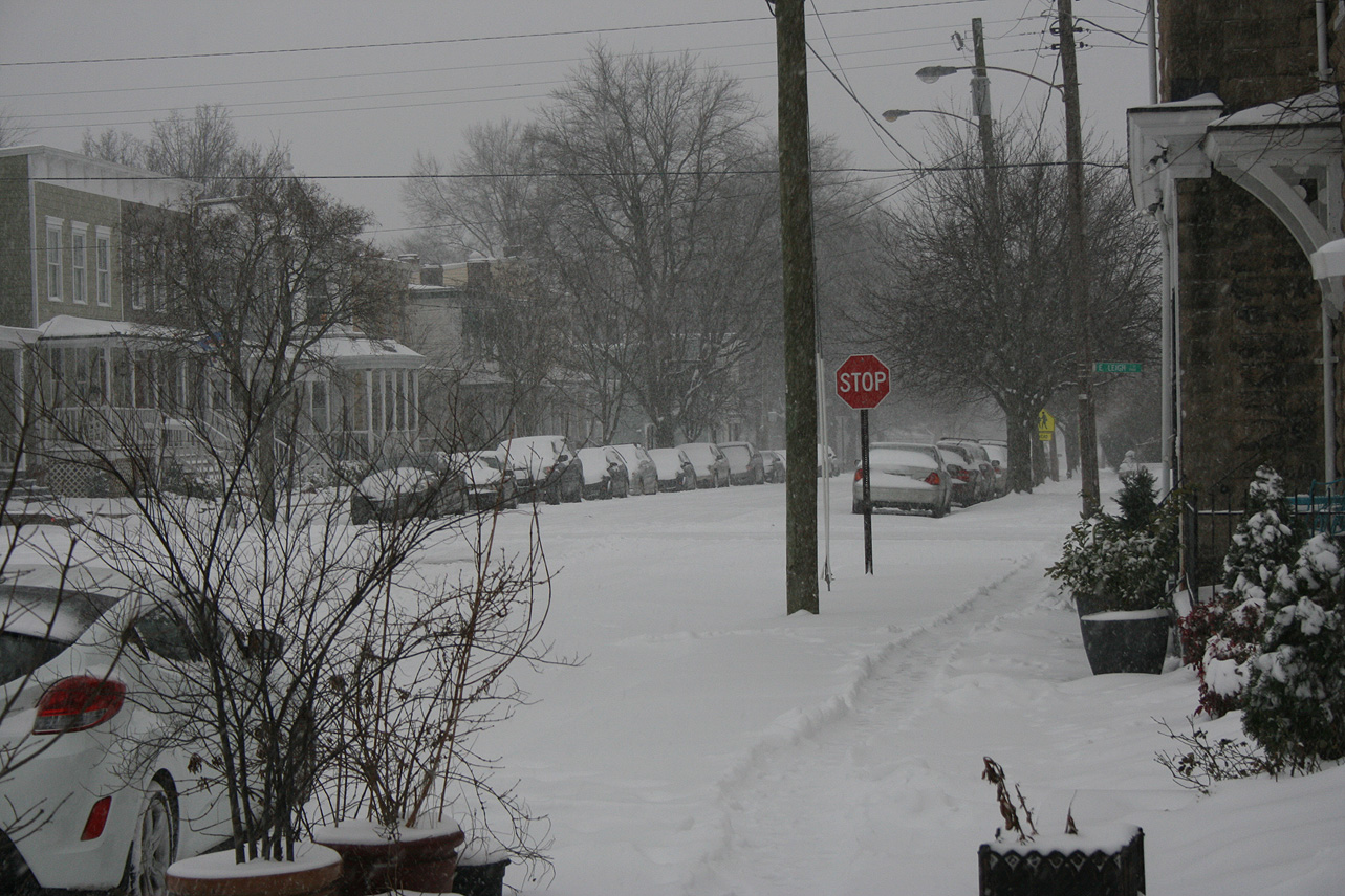
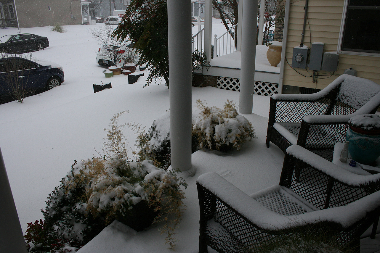
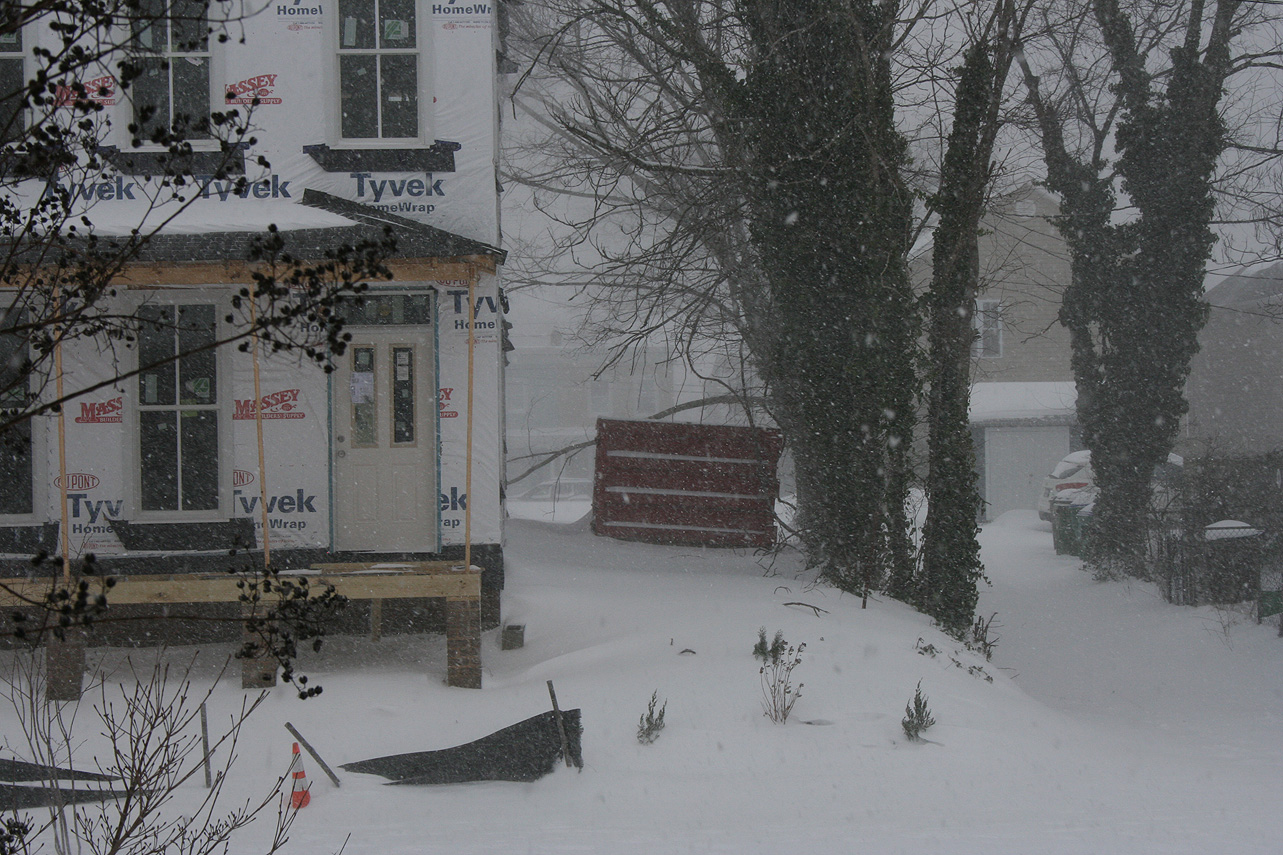
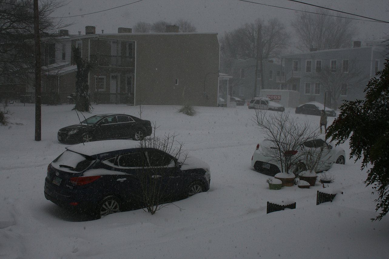
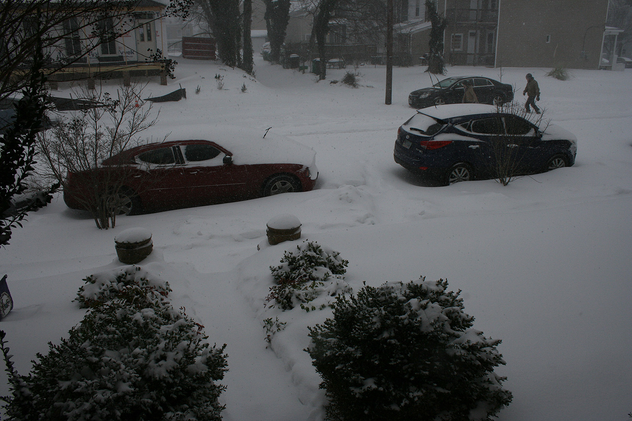
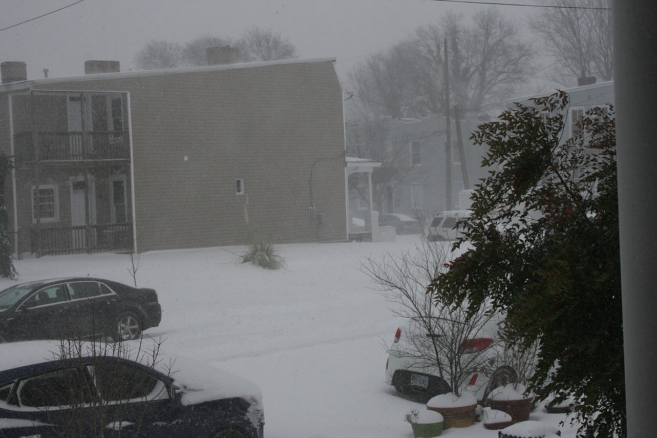
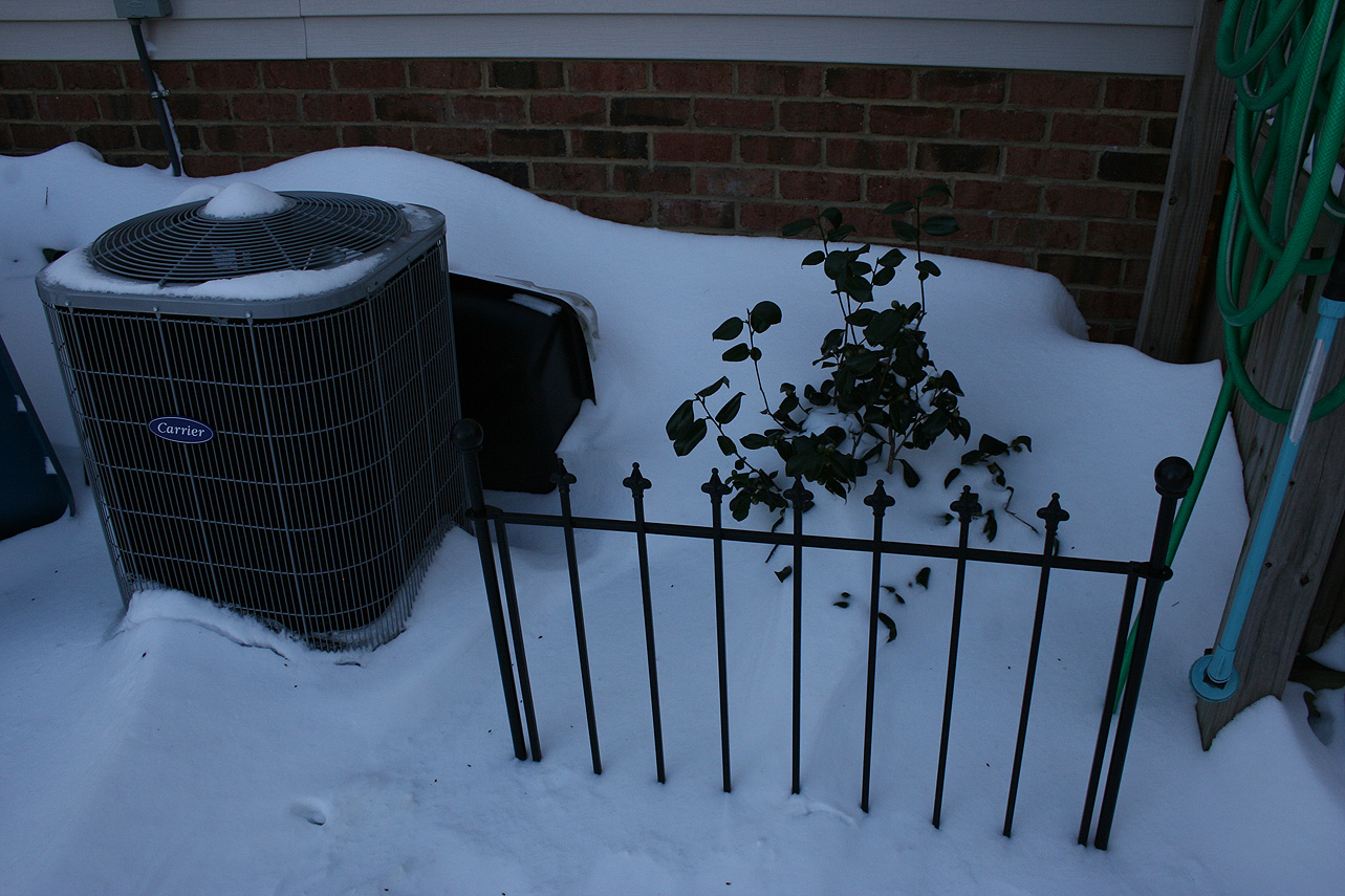
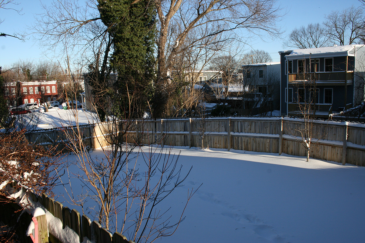
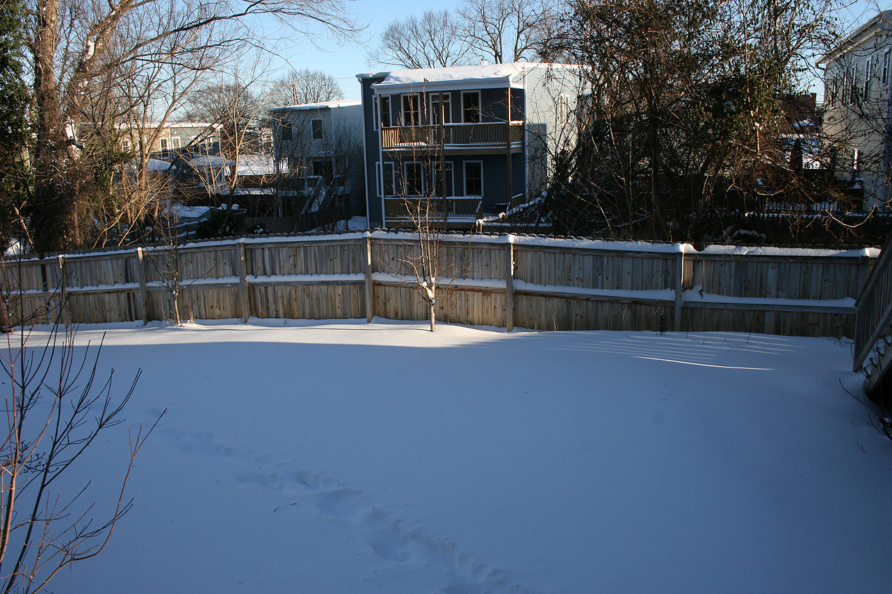
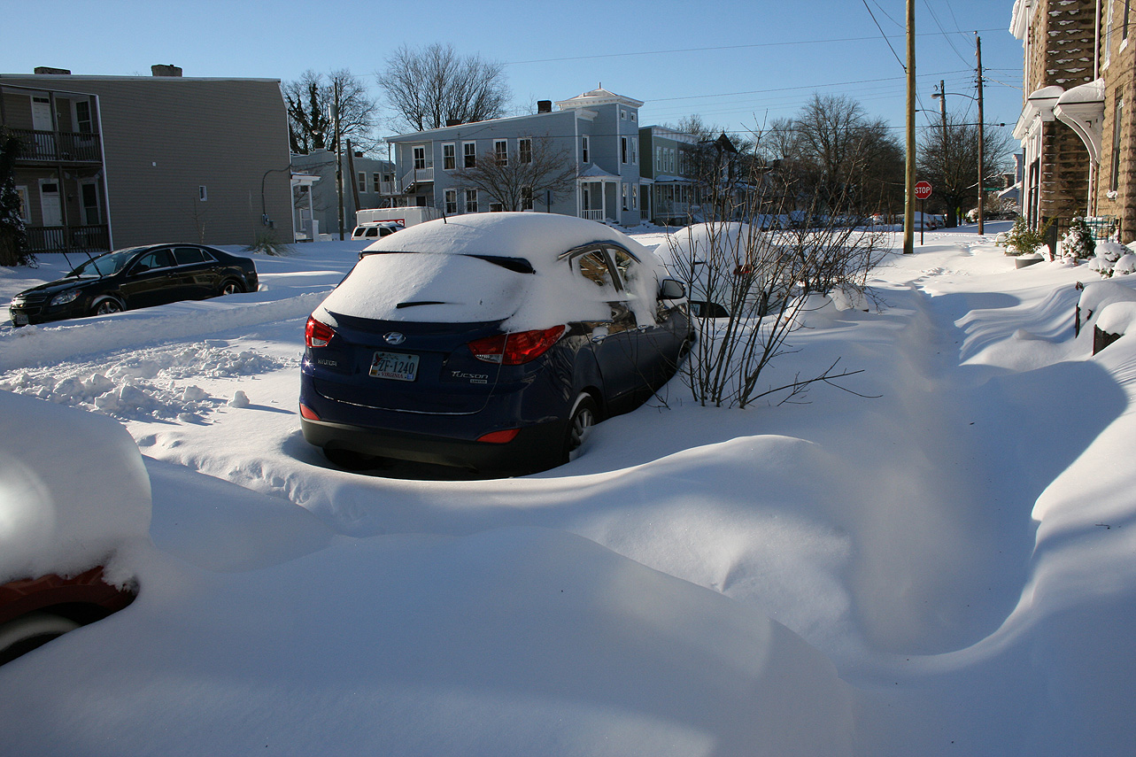
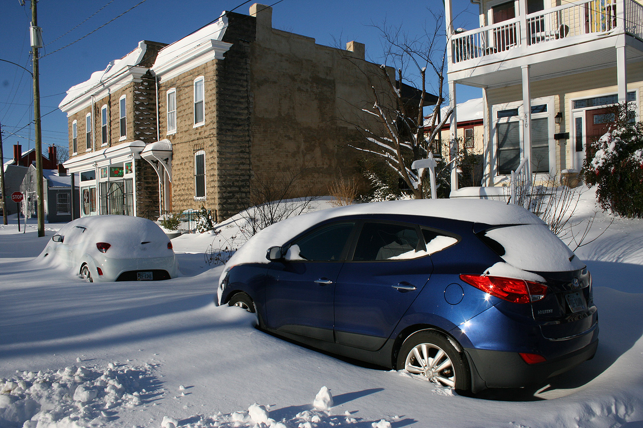
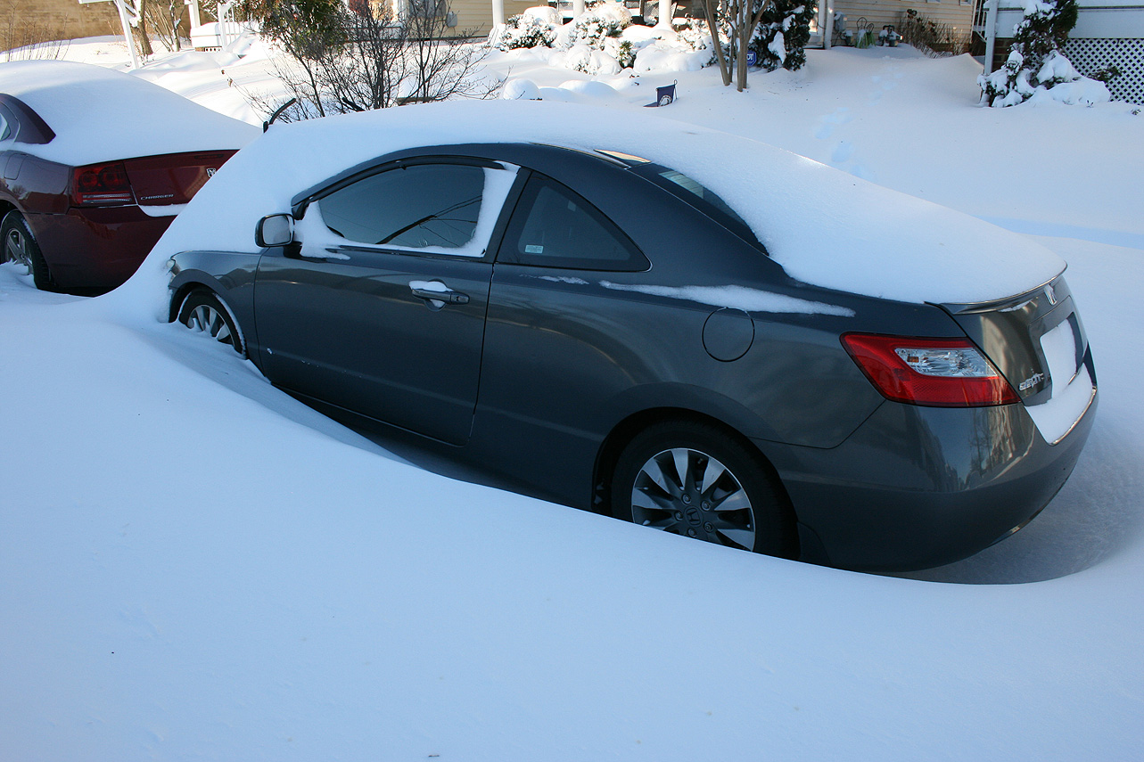
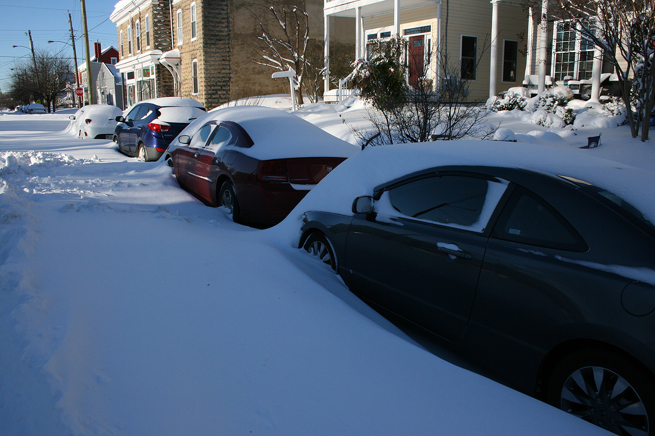
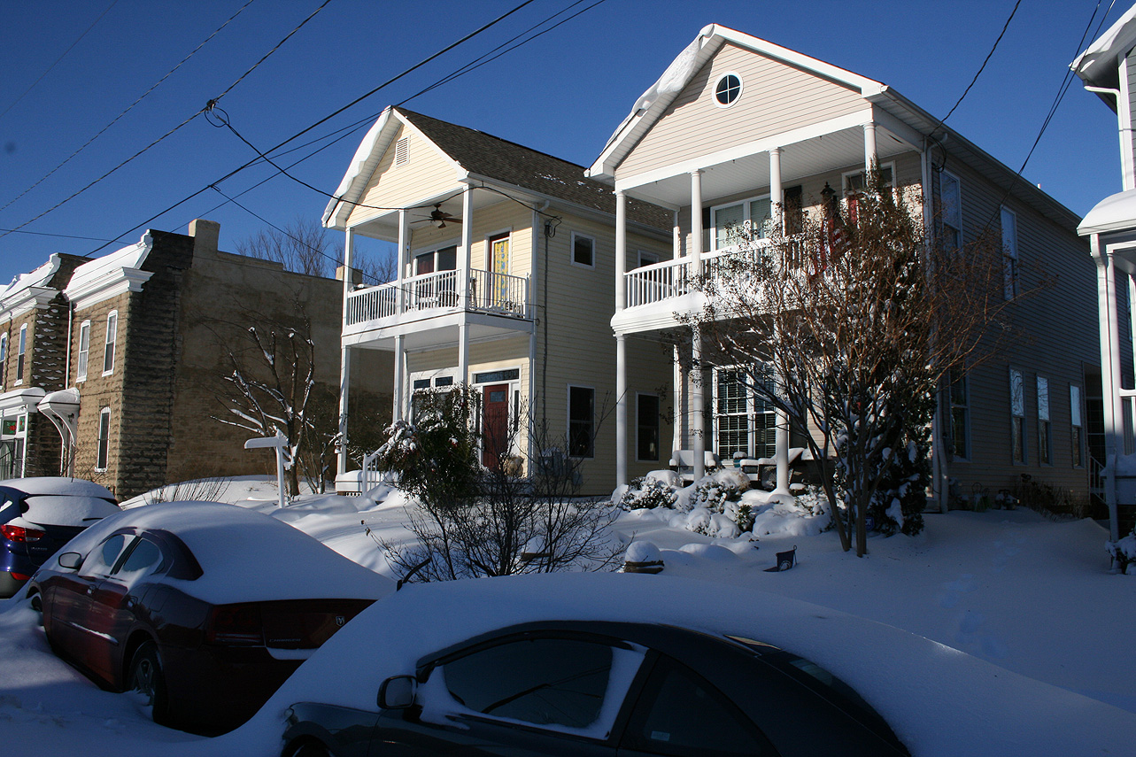
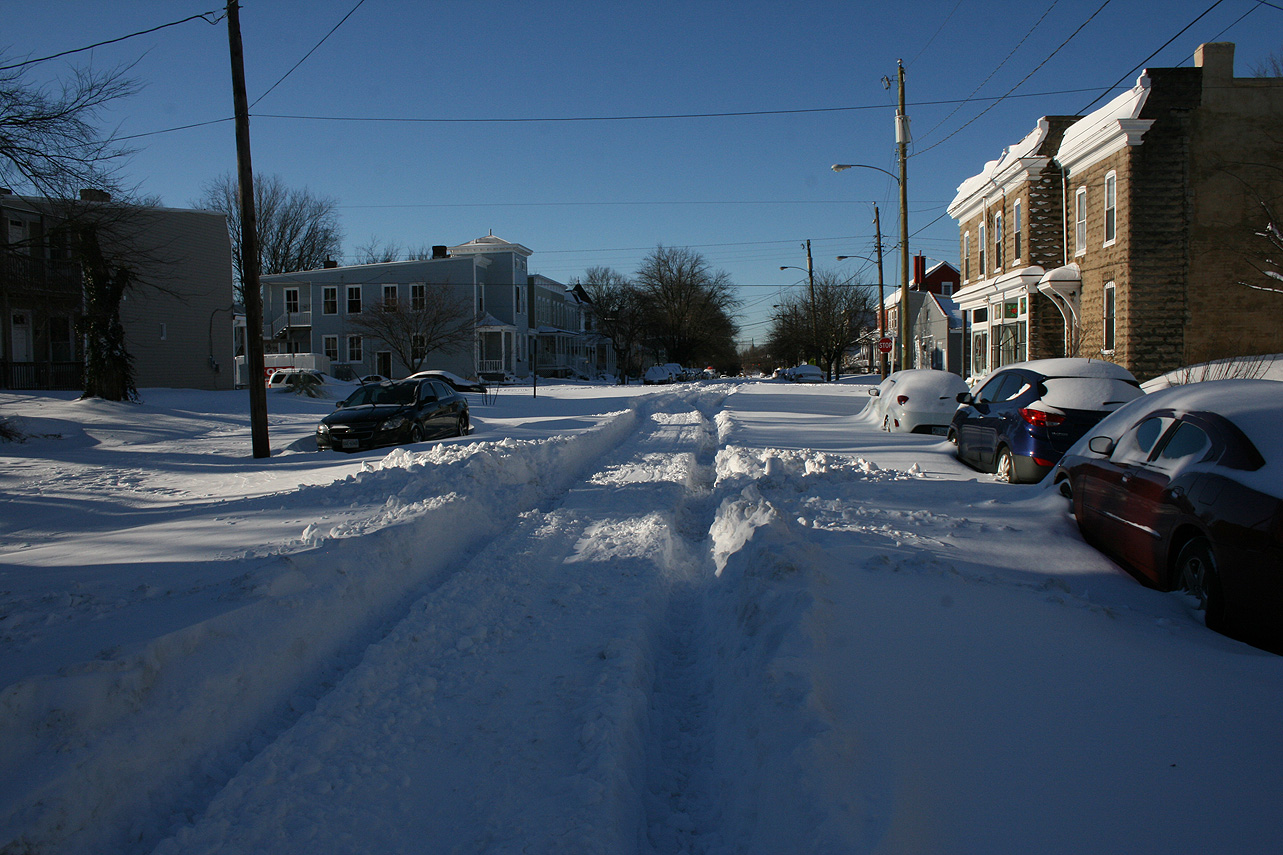
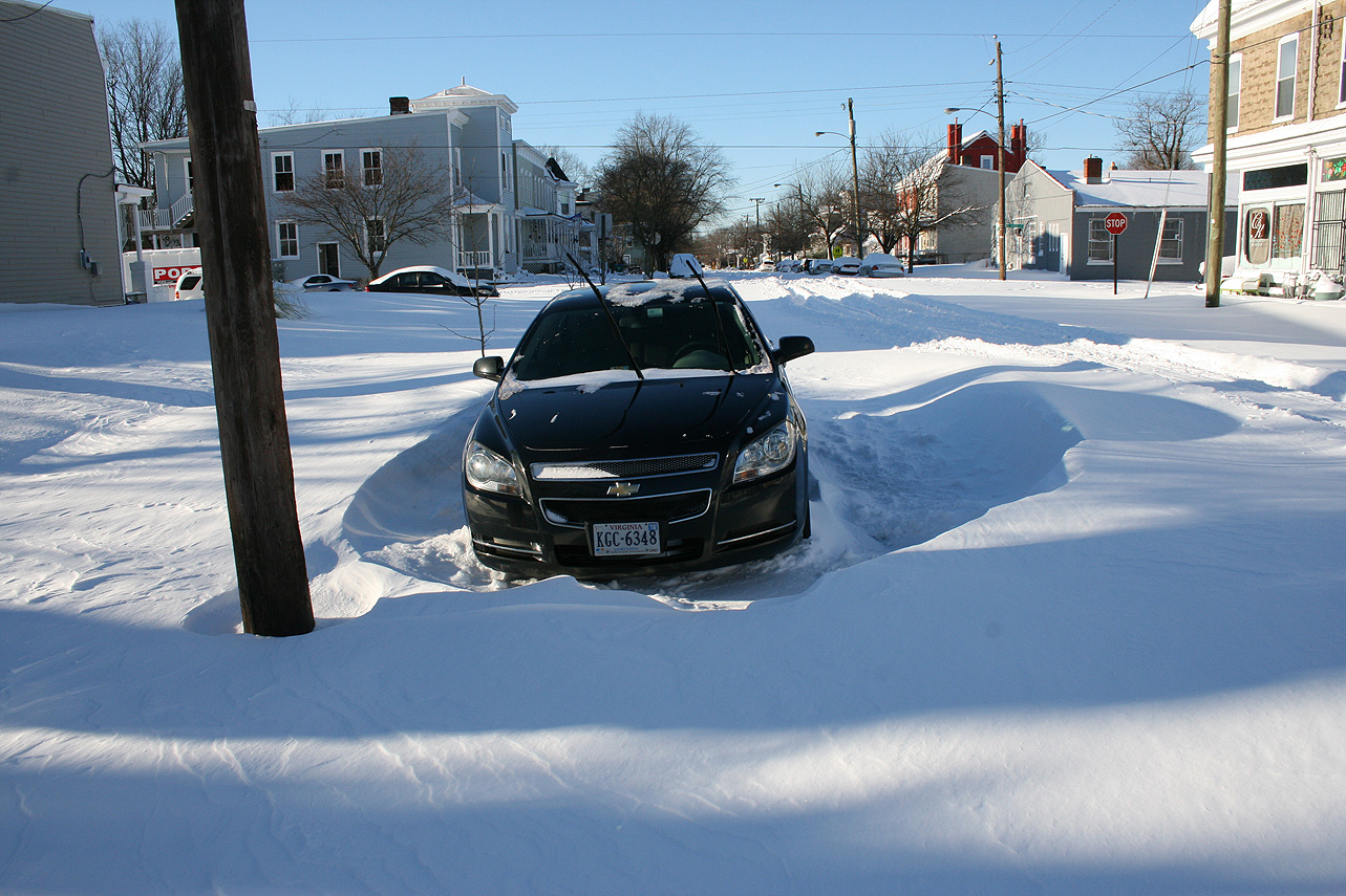
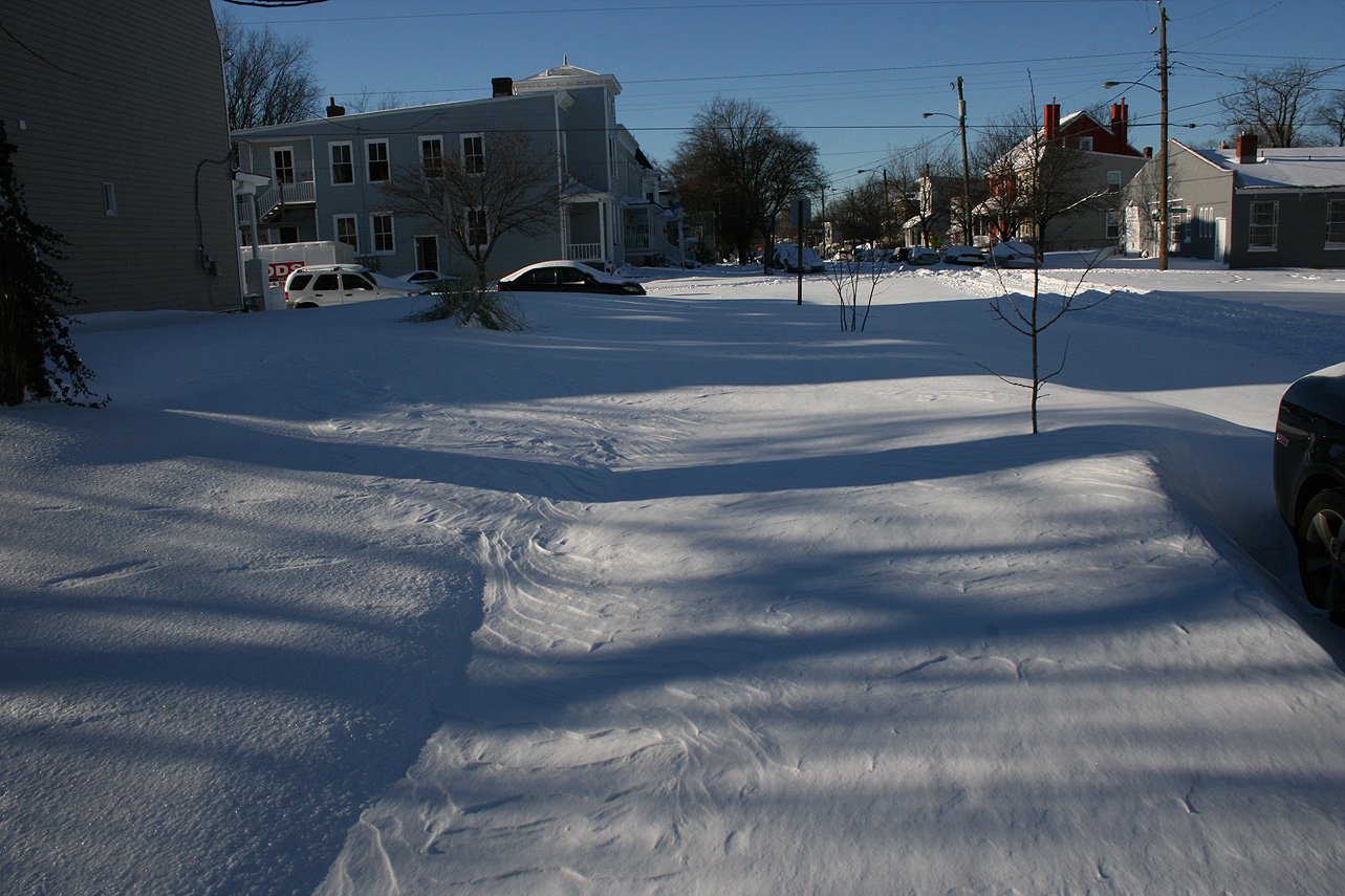
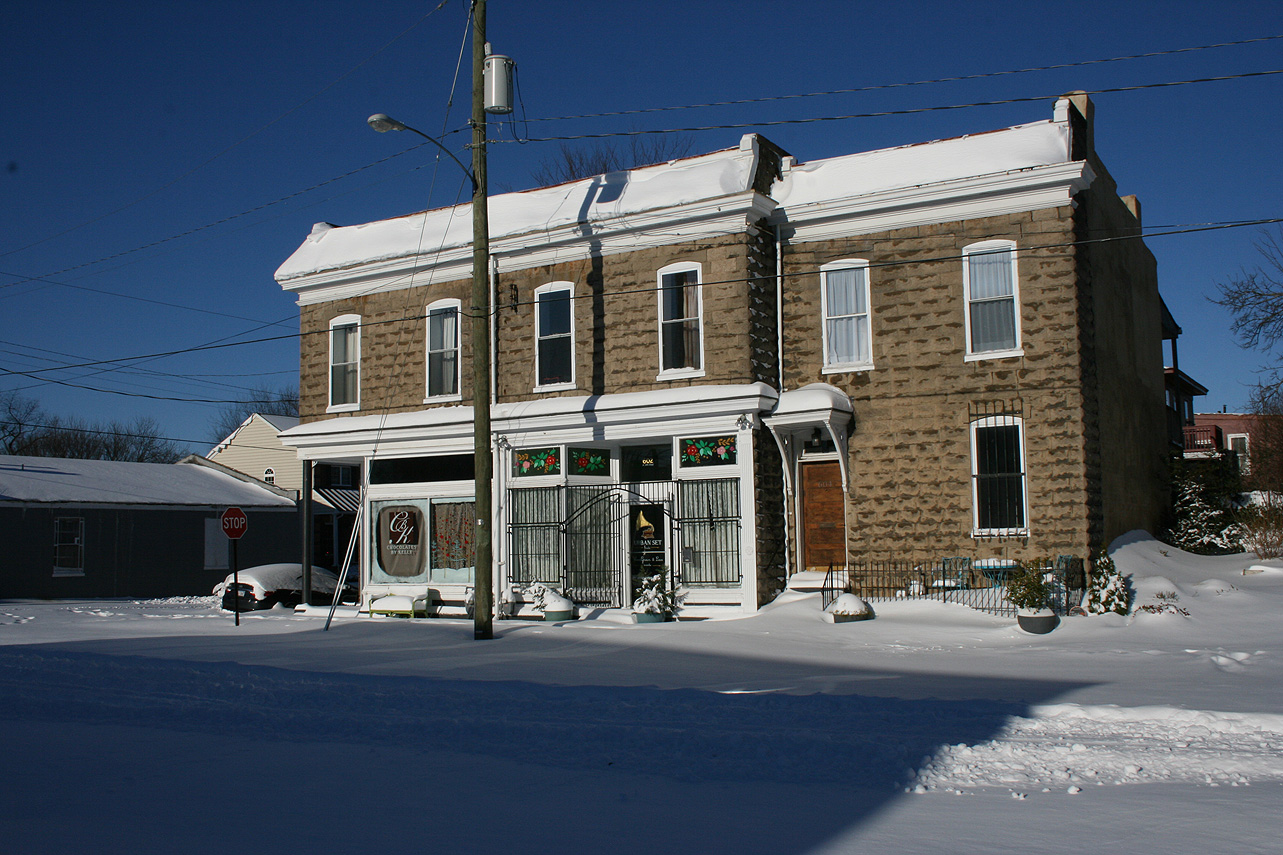
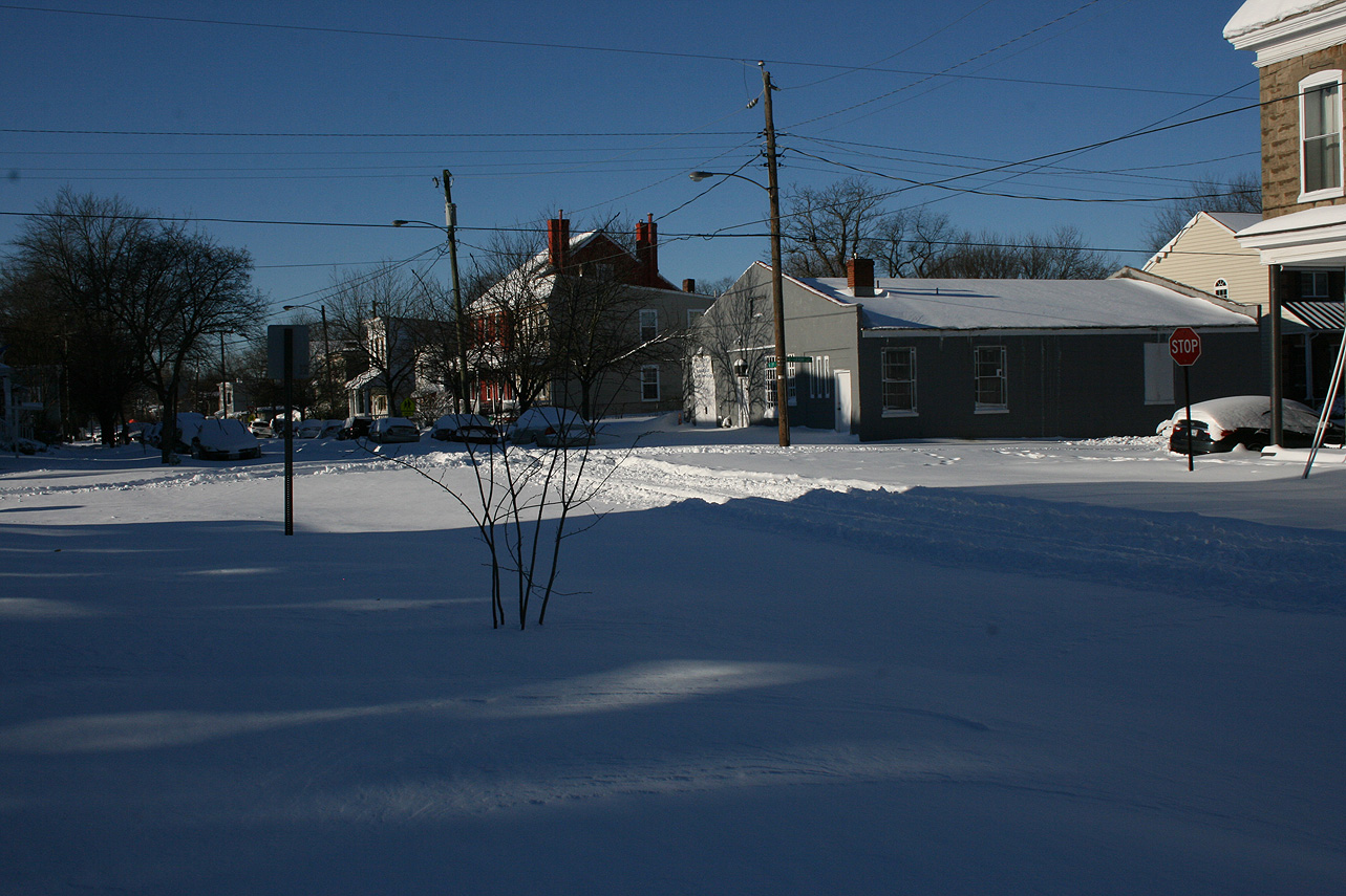
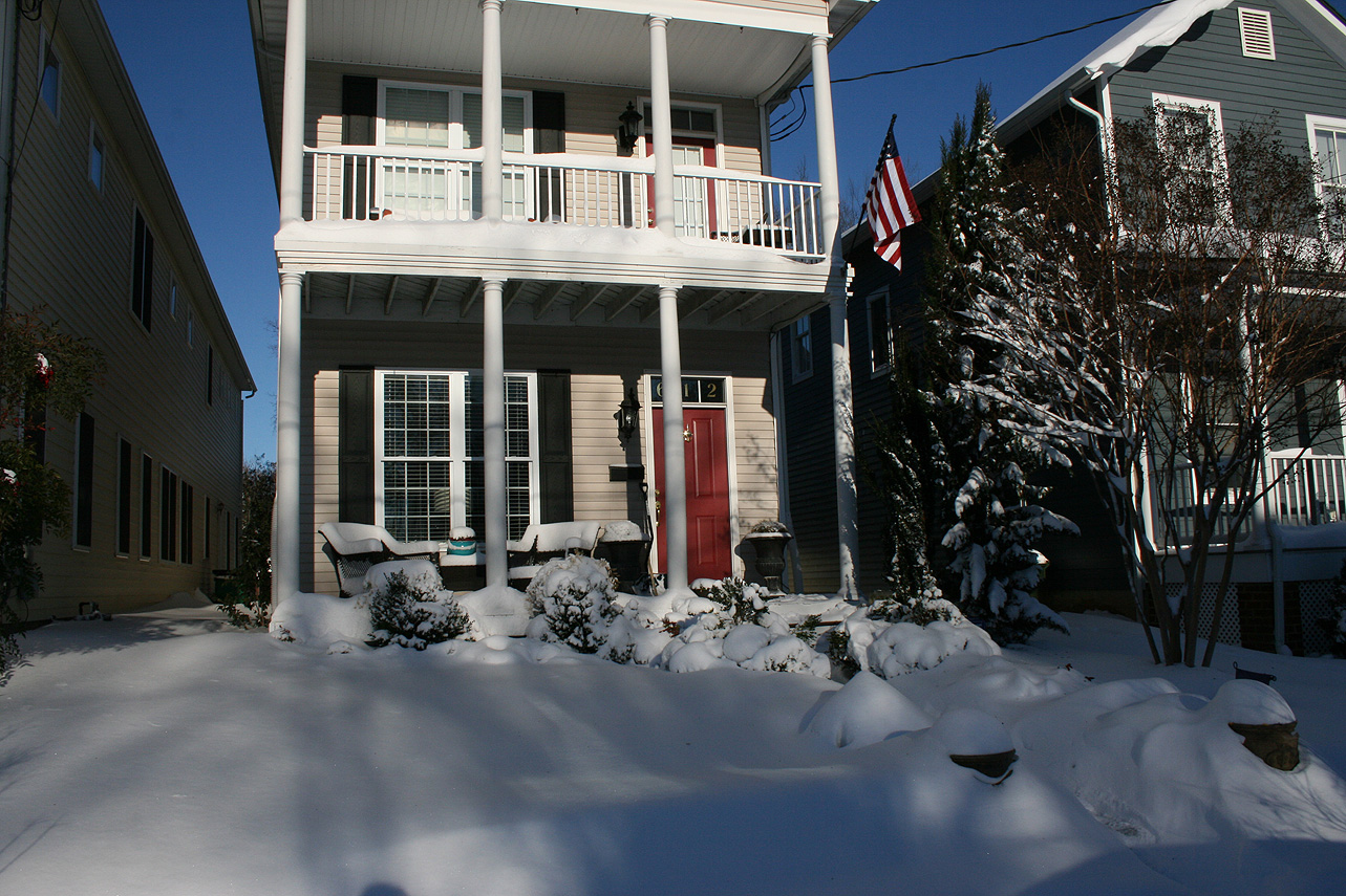
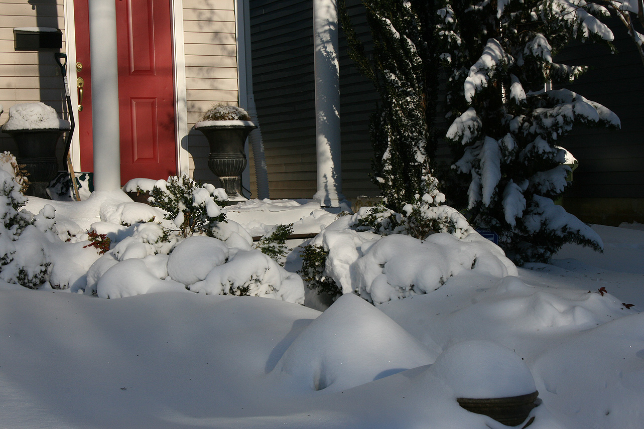
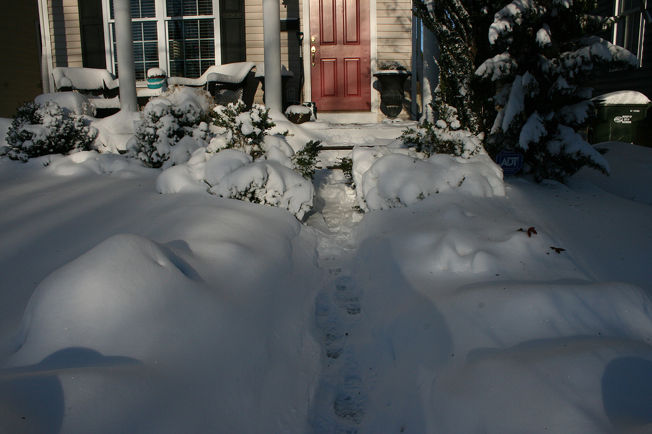
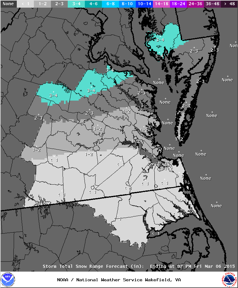
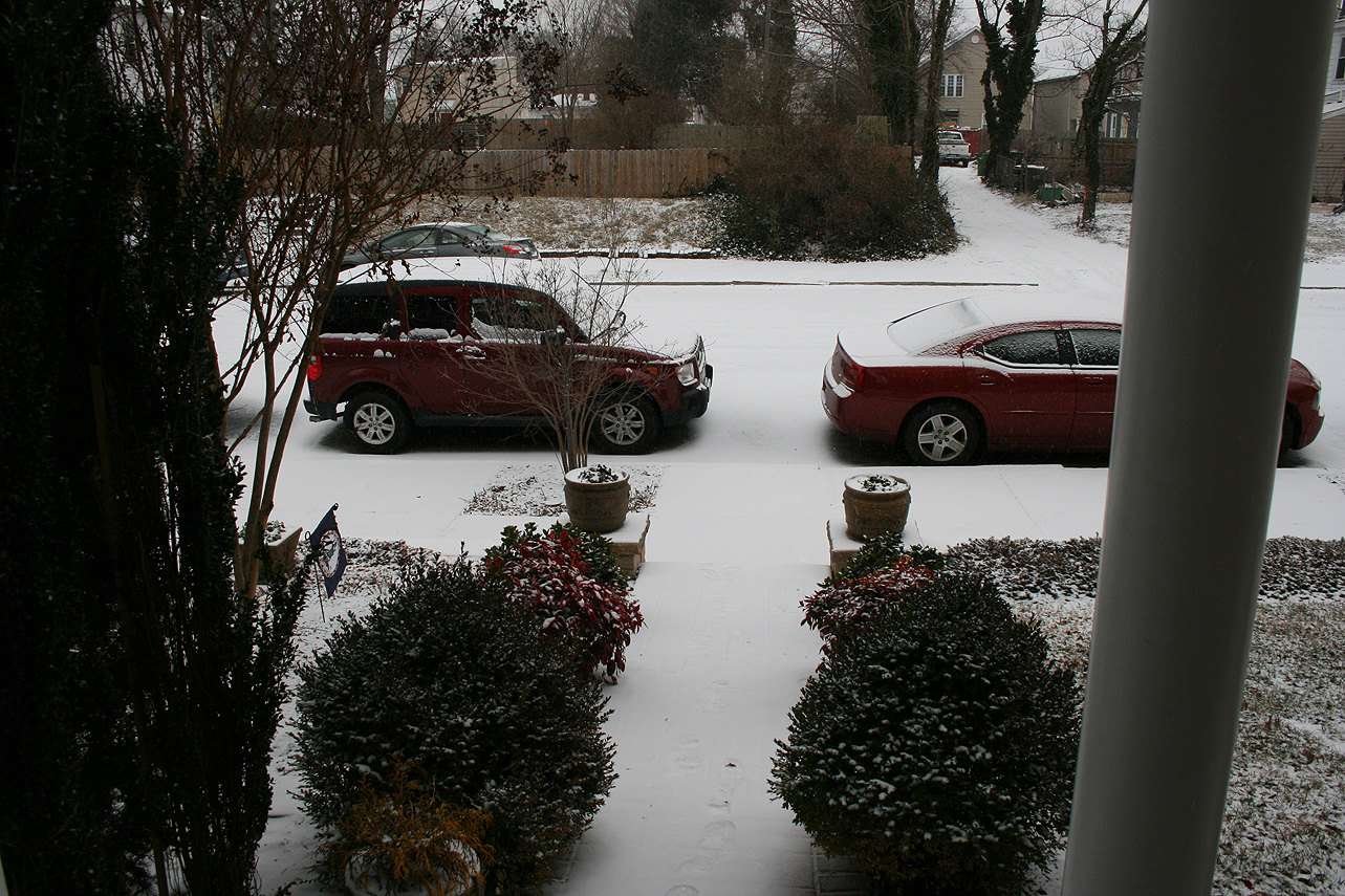
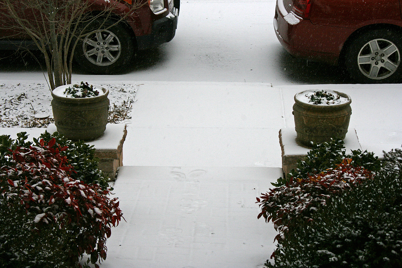
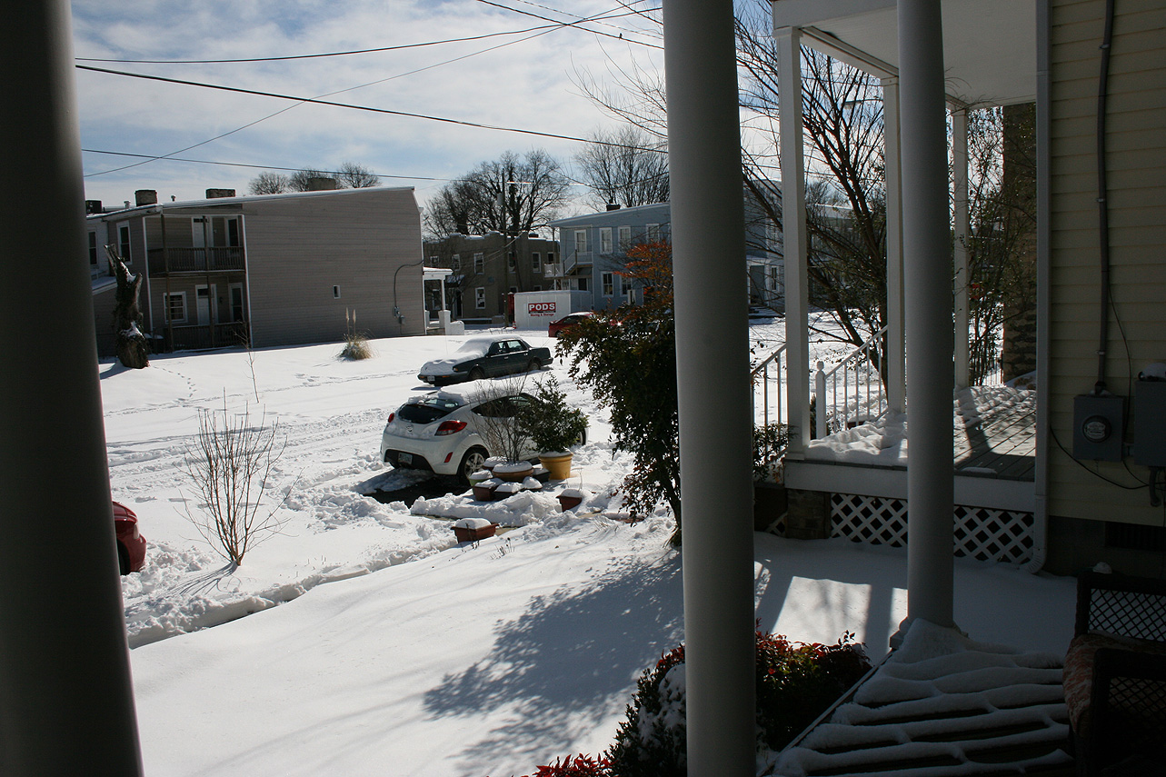
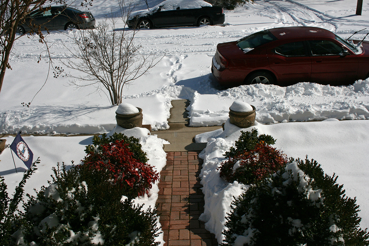
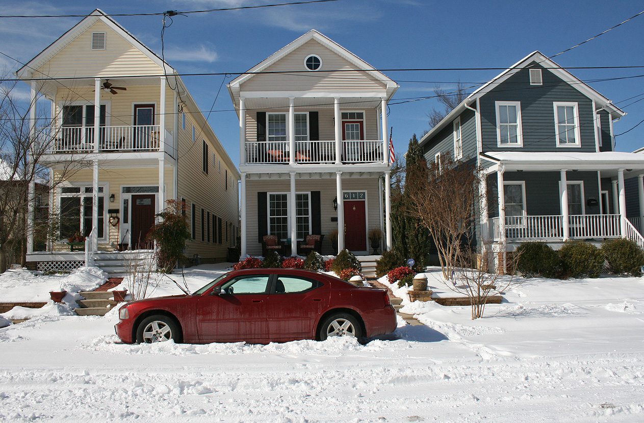
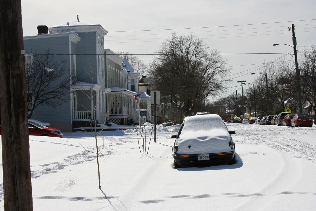
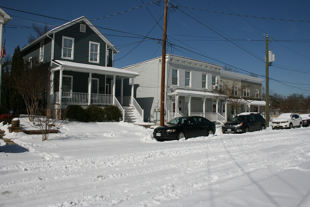
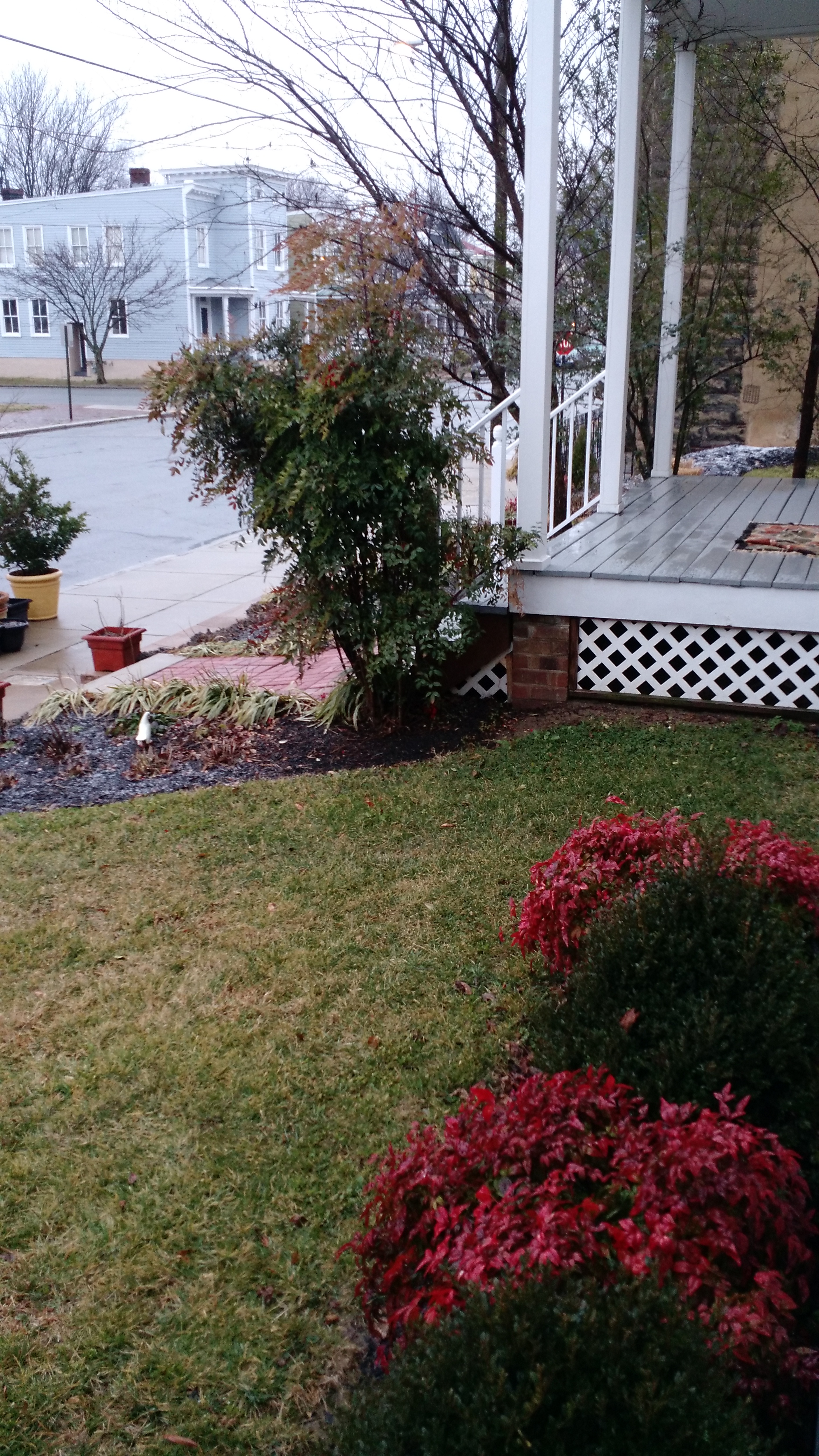
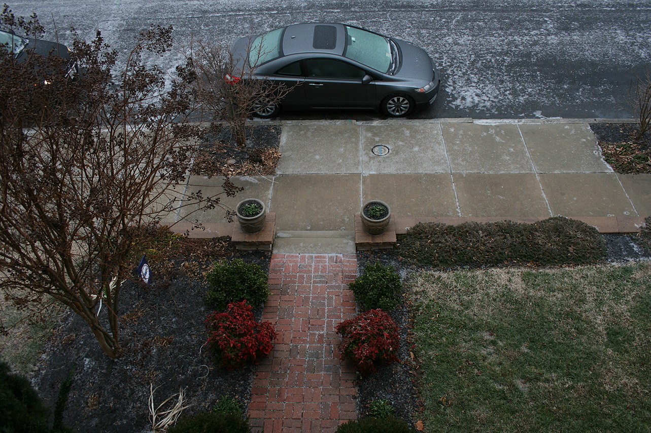
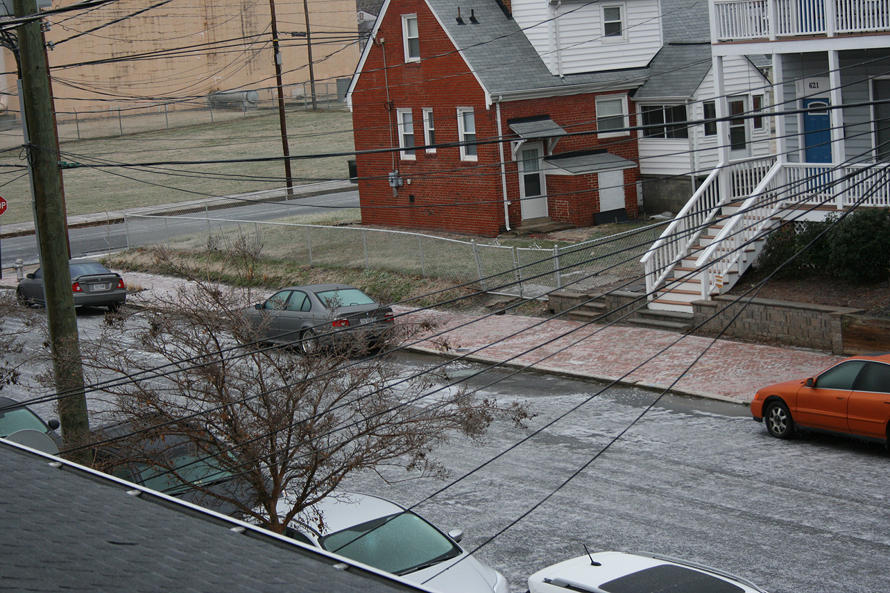
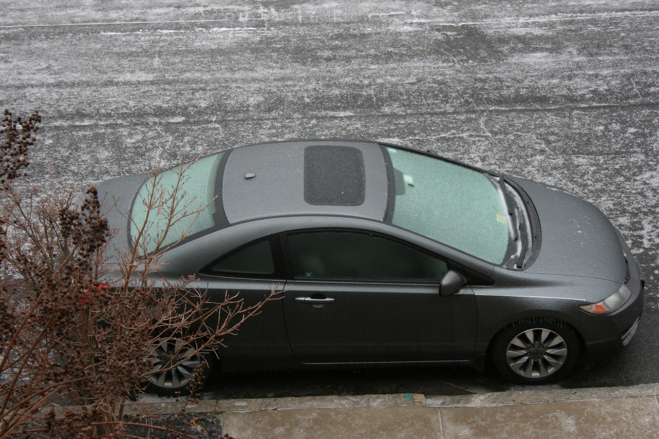
Church Hill Storm Observation Summary:
* Place – Time: Church Hill, (2/15/2016)
* Temperature: 23-, During Event
* Winter Weather Watch/Warning/Advisory: Watch & Advisory
* Closings: All local school districts were closed on 2/15, Chesterfield County Government was also closed on 2/15.
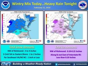
* Predicted Totals: Between 2-3″ before the storm. NWS updated to 2-4″ the morning of the event.
* Road Conditions: All roads had substantial snow and ice accumulation on them.
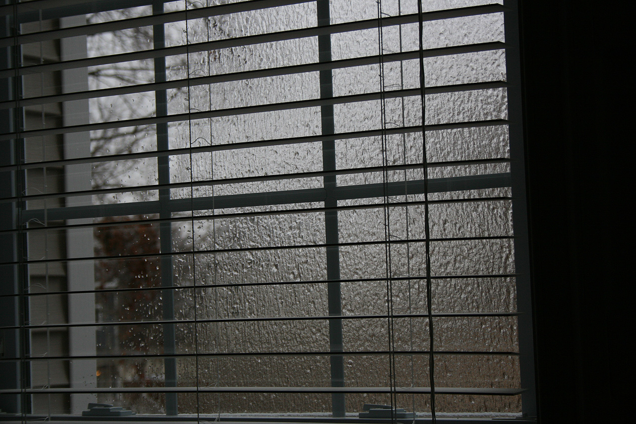
* Precipitation Description: Snow, sleet and freezing rain. Snow began around 4:00 AM. Snow transitioned to sleet and light freezing drizzle around 10:30 AM.
* Total Precipitation: 1.25″ of snow with minor icing occurring from about 10:30 AM until 5 PM in the afternoon. 1.4″ of snow was reported at the Richmond airport.
* Comments: Snow began in the early morning hours with about a 0.5″ accumulating on all surfaces by 8 AM. Snow changed to sleet and freezing drizzle at around 10:30 AM. The system eventually transitioned to rain by 5 PM.
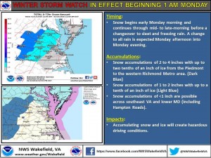
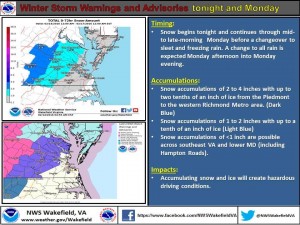
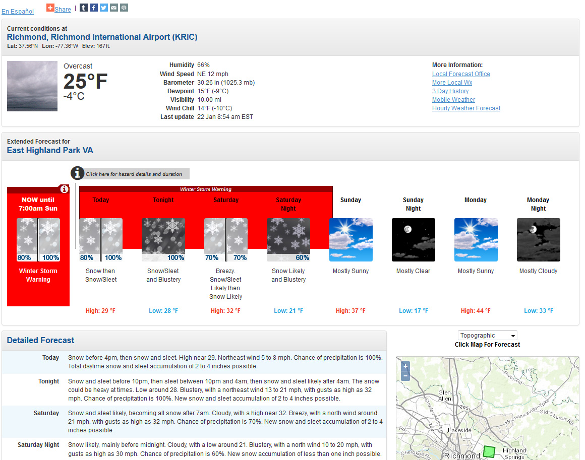
A multi-part storm will impact central Virginia on February 15th. A winter storm watch was issued on February 13th. It was converted to a winter weather advisory on February 14th. Consensus is building on the models to have snow fall overnight on the 14-15th, transition to sleet and freezing rain by noon and to rain by the afternoon.
NWS Forecast Graphic on 2/13/16NWS Forecast Graphic on 2/14/16
URGENT – WINTER WEATHER MESSAGE
NATIONAL WEATHER SERVICE WAKEFIELD VA
354 AM EST SUN FEB 14 2016
VAZ064>068-511-513-515-141700-
/O.UPG.KAKQ.WS.A.0002.160215T0600Z-160216T0500Z/
/O.NEW.KAKQ.WW.Y.0005.160215T0500Z-160216T0000Z/
CAROLINE-MECKLENBURG-LUNENBURG-NOTTOWAY-AMELIA-WESTERN HANOVER-
WESTERN CHESTERFIELD-WESTERN HENRICO-
INCLUDING THE CITIES OF…SOUTH HILL…CREWE…ASHLAND…
MIDLOTHIAN…BON AIR…RICHMOND
354 AM EST SUN FEB 14 2016
…WINTER WEATHER ADVISORY IN EFFECT FROM MIDNIGHT TONIGHT TO
7 PM EST MONDAY…
THE NATIONAL WEATHER SERVICE IN WAKEFIELD HAS ISSUED A WINTER
WEATHER ADVISORY FOR CENTRAL AND SOUTH CENTRAL VIRGINIA WHICH IS
IN EFFECT FROM MIDNIGHT TONIGHT TO 7 PM EST MONDAY. THE WINTER
STORM WATCH IS NO LONGER IN EFFECT.
* AREAS AFFECTED: CENTRAL AND SOUTH CENTRAL VIRGINIA.
* HAZARDS: SNOW…SLEET AND FREEZING RAIN.
* ACCUMULATIONS: TWO TO THREE INCHES OF SNOW…AND UP TO ONE TENTH OF
AN INCH OF ICE.
* TEMPERATURES: LOWS SUNDAY NIGHT AROUND 20. HIGHS LATE MONDAY IN
THE MID 30S.
* TIMING: SNOW OVERSPREADING THE AREA LATE SUNDAY NIGHT INTO
EARLY MONDAY MORNING…THEN CONTINUING THROUGH THE MORNING
HOURS MONDAY. THE SNOW IS EXPECTED TO CHANGE TO SLEET AND
FREEZING RAIN LATE MONDAY MORNING OR EARLY AFTERNOON…THEN
EVENTUALLY RAIN THROUGH MONDAY AFTERNOON AND MONDAY EVENING.
* IMPACTS: HAZARDOUS TRAVEL DUE TO SNOW AND ICE COVERED ROADS.
PRECAUTIONARY/PREPAREDNESS ACTIONS…
A WINTER WEATHER ADVISORY MEANS THAT PERIODS OF SNOW…SLEET…OR
FREEZING RAIN WILL CAUSE TRAVEL DIFFICULTIES. BE PREPARED FOR
SLIPPERY ROADS AND LIMITED VISIBILITIES…AND USE CAUTION WHILE
DRIVING.
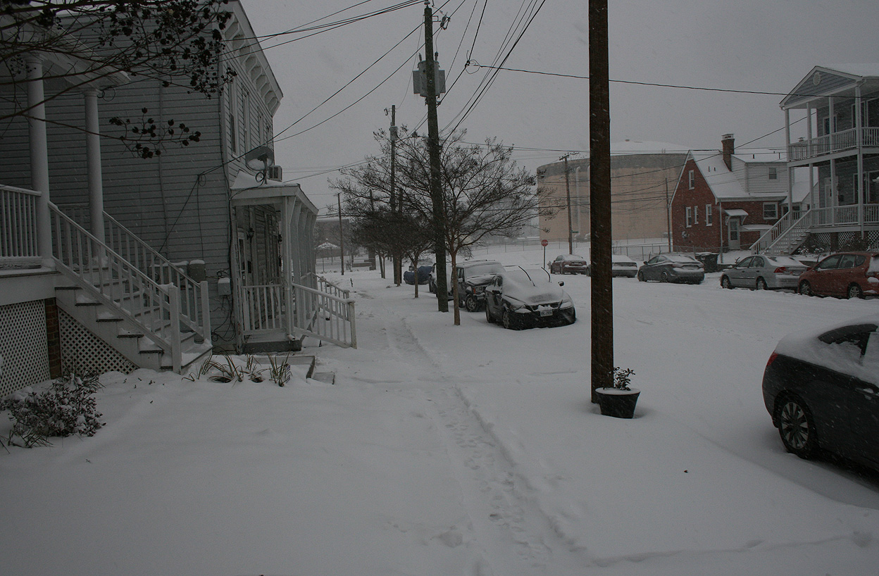
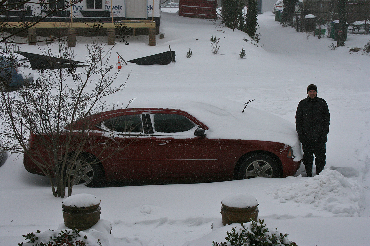
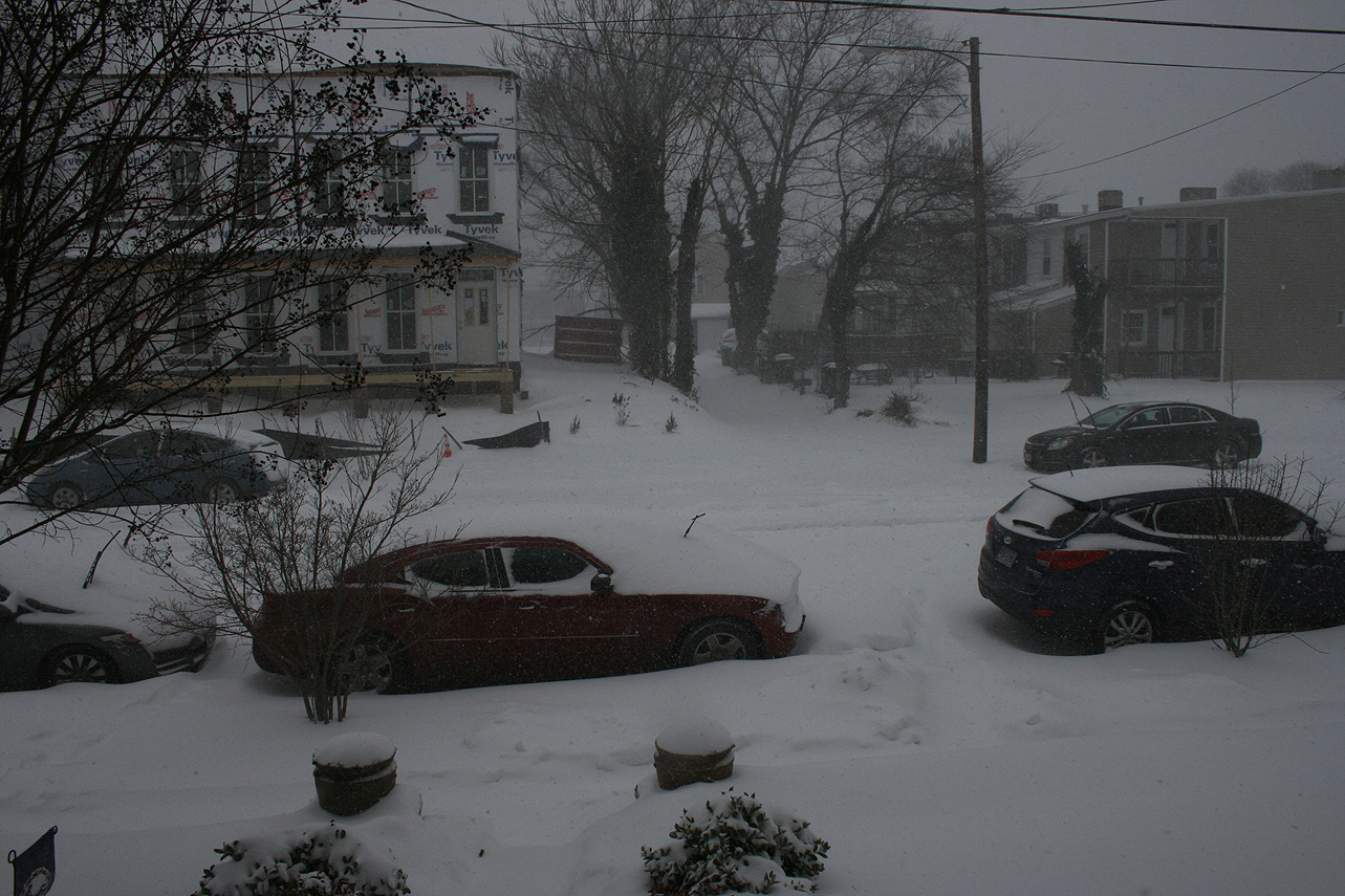
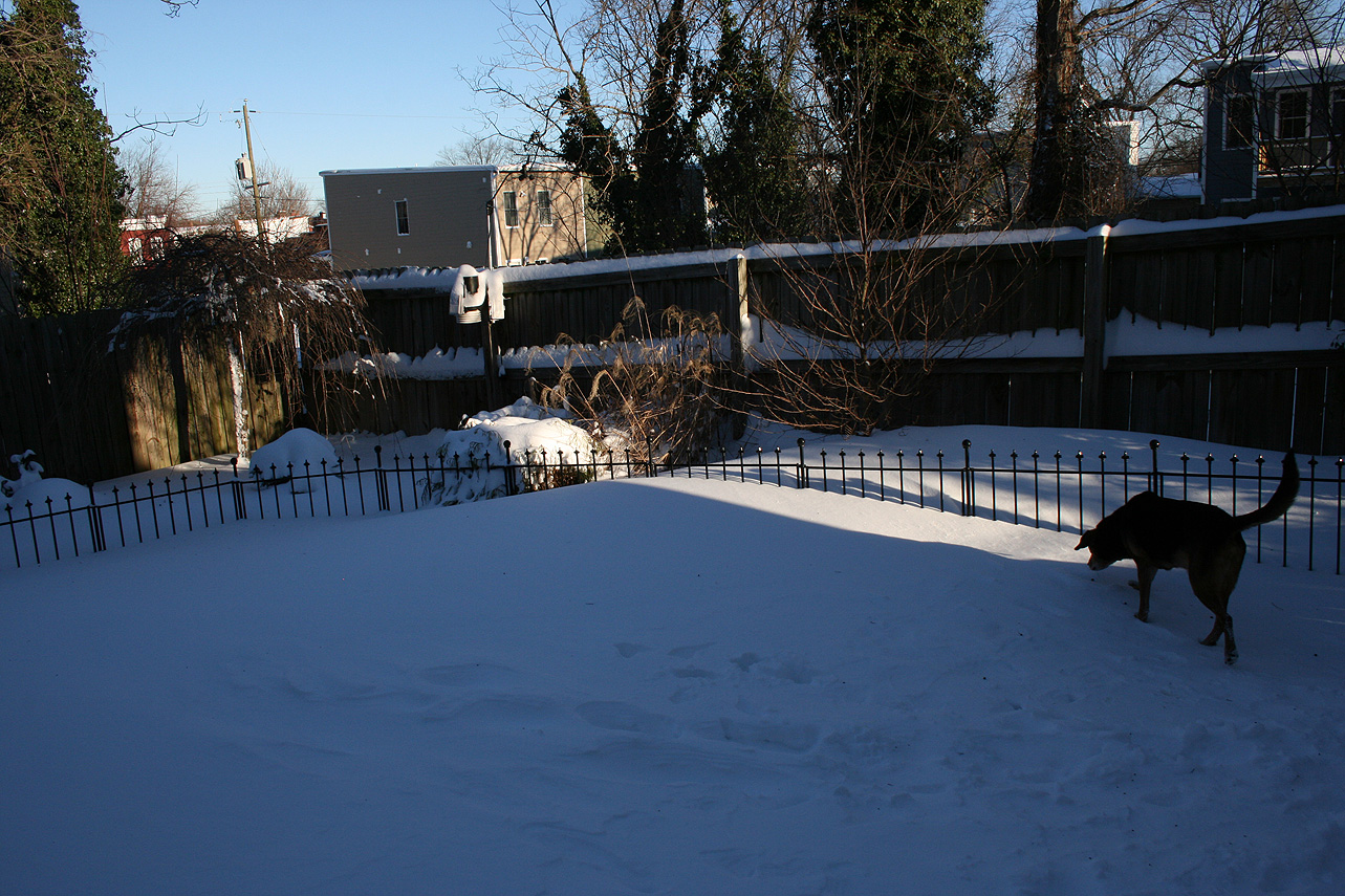
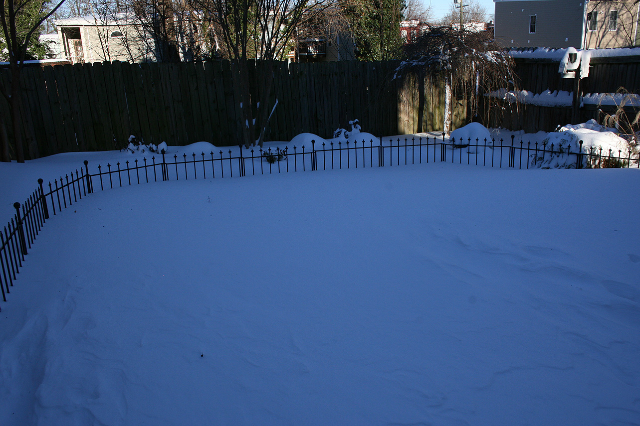
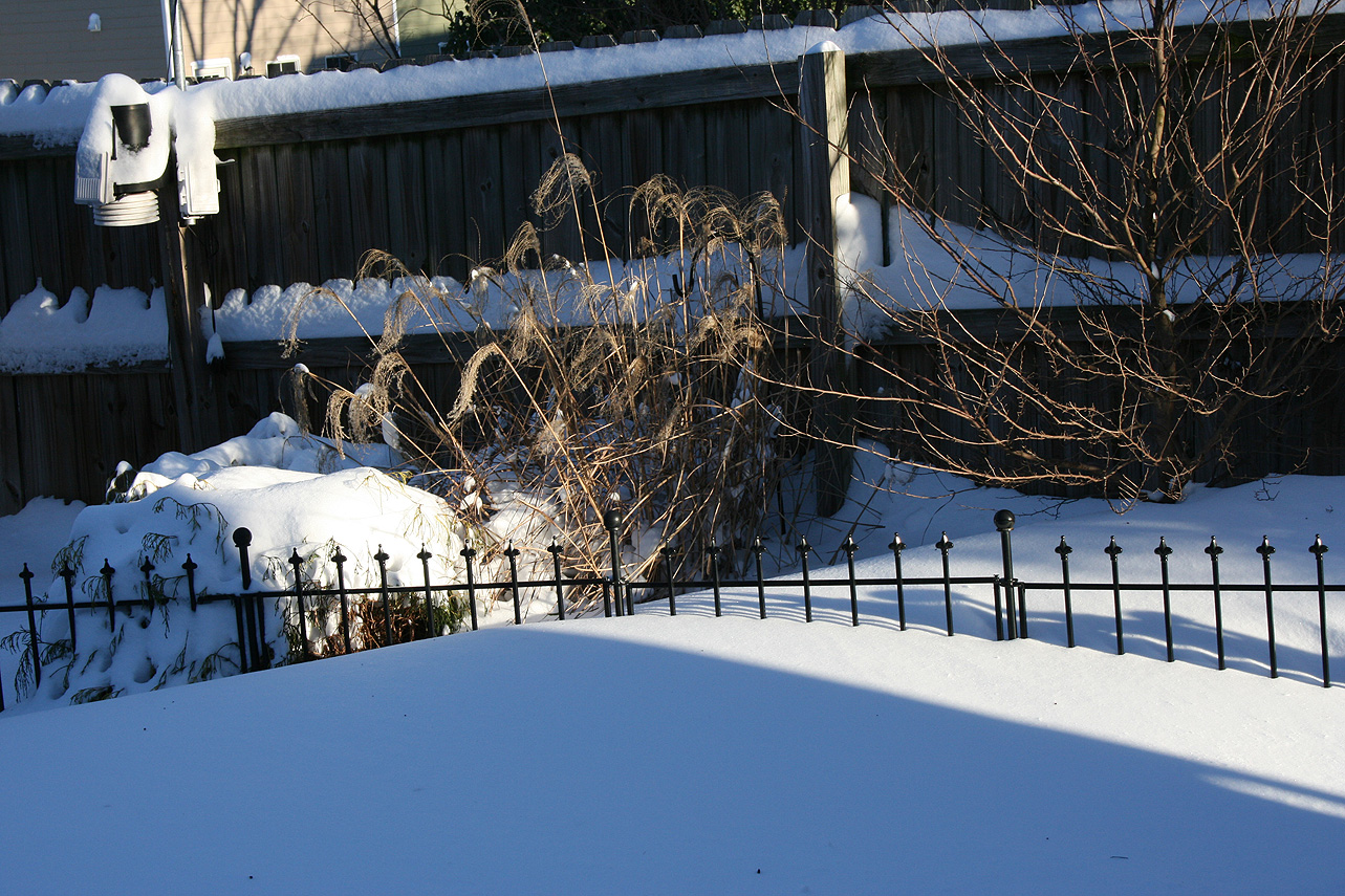
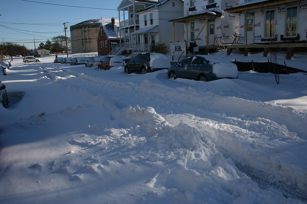
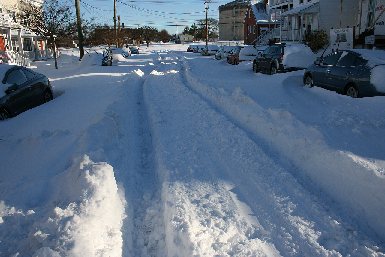
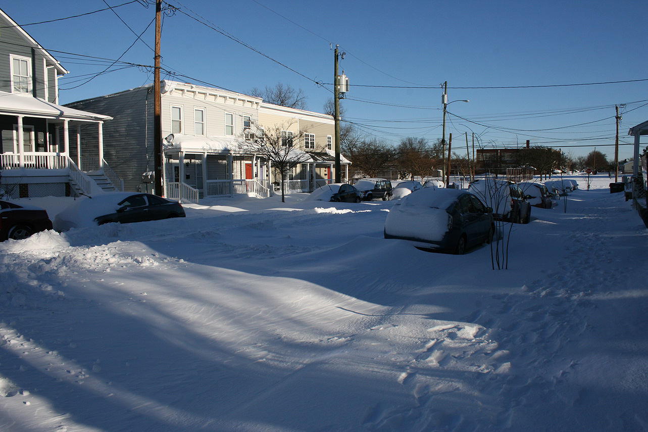
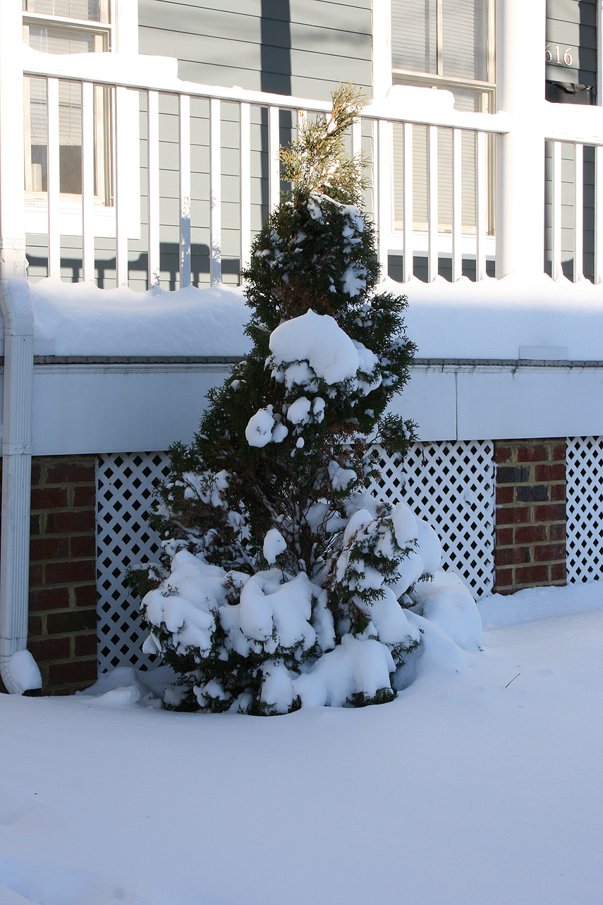
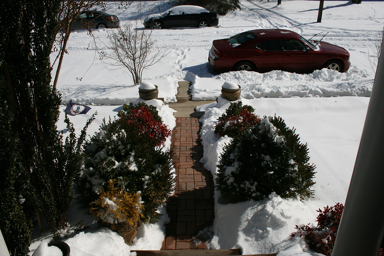
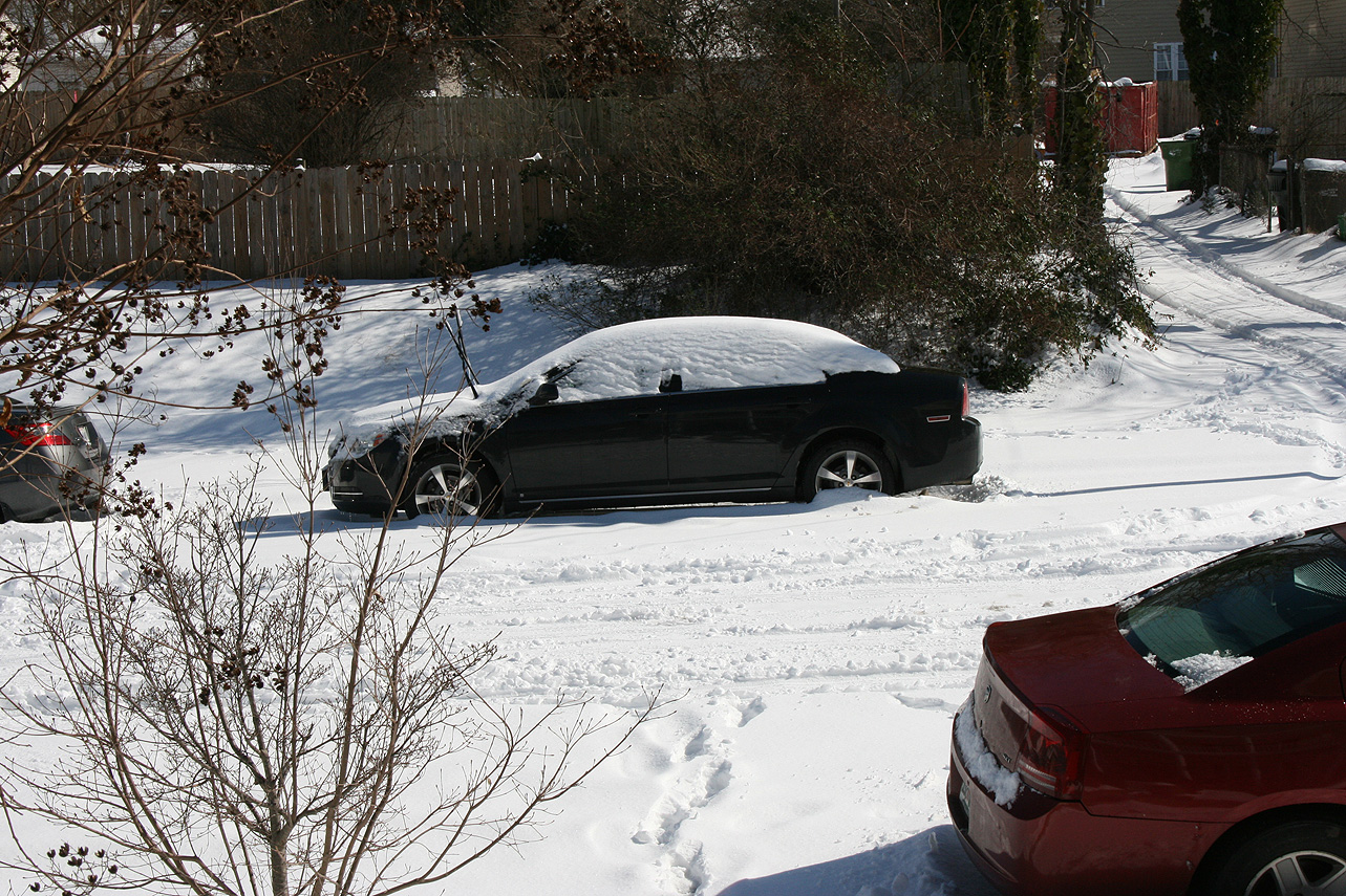
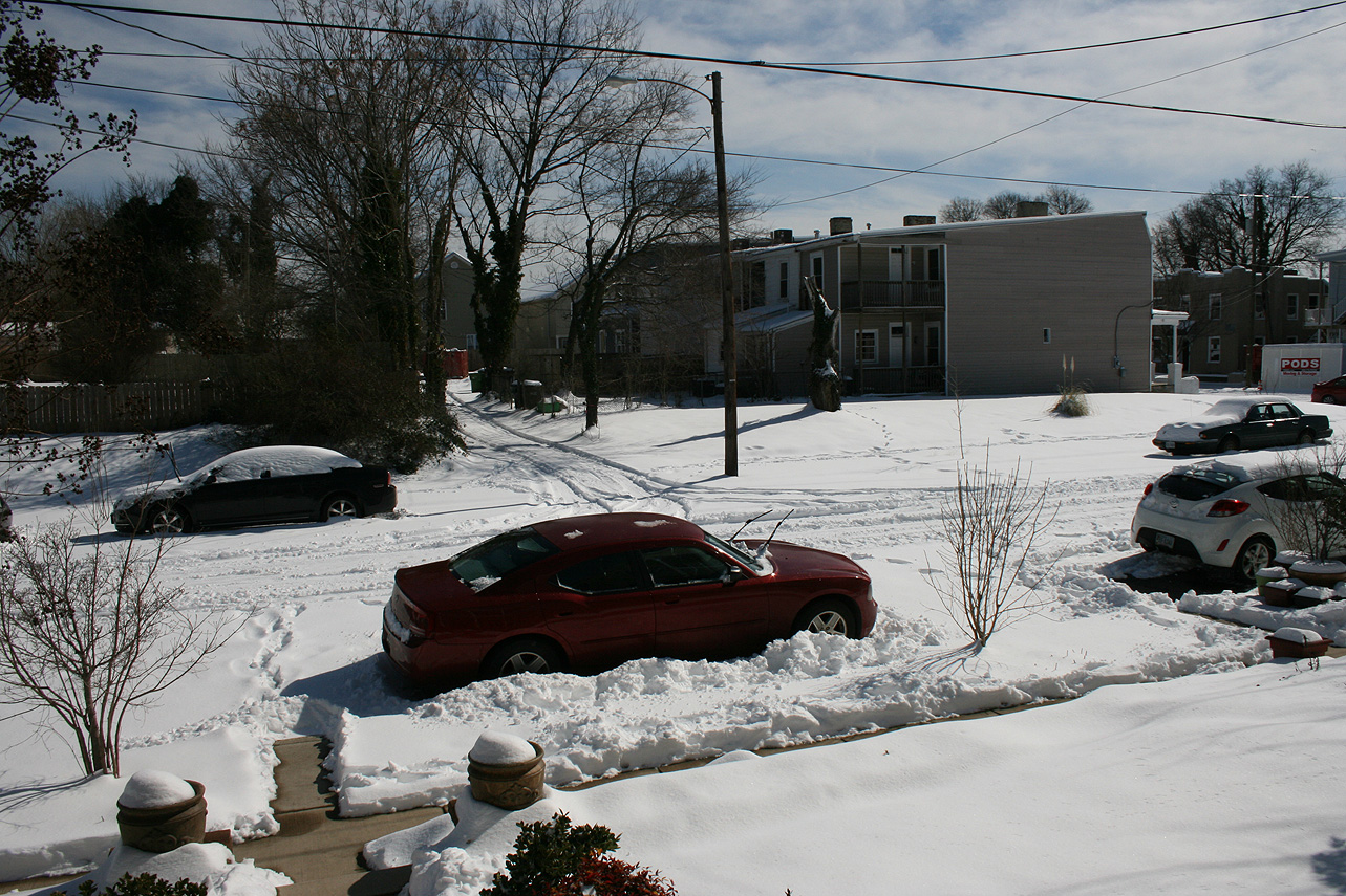
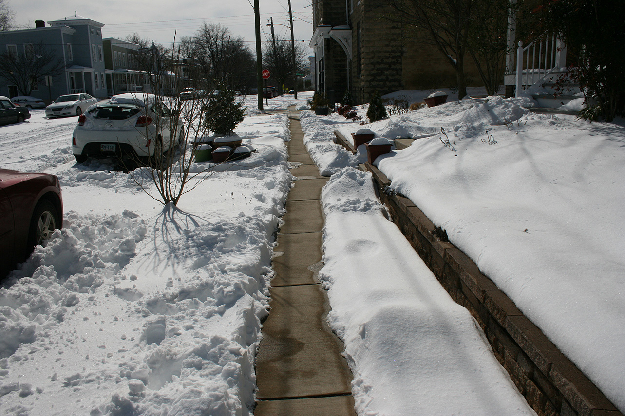
Church Hill Storm Observation Summary:
* Place – Time: Church Hill, (1/22 – 1/23/2016)
* Temperature: 26-28, During Event
* Winter Weather Watch/Warning/Advisory: Watch & Warning
* Closings: All local school districts were closed on 1/22, 1-25 thru 1/27, Chesterfield County Government was closed on 1/22 & 1/25-26.
* Predicted Totals: Between 7-14″ before and the morning of the storm.
* Road Conditions: All roads had substantial snow and ice accumulation on them.
* Precipitation Description: Snow and sleet. Snow began around 9:30 AM to 10:00 AM on 1/22. Snow transitioned to sleet around 5:30-6 PM on 1/22. Snow began once again around 7 AM on 1/23.
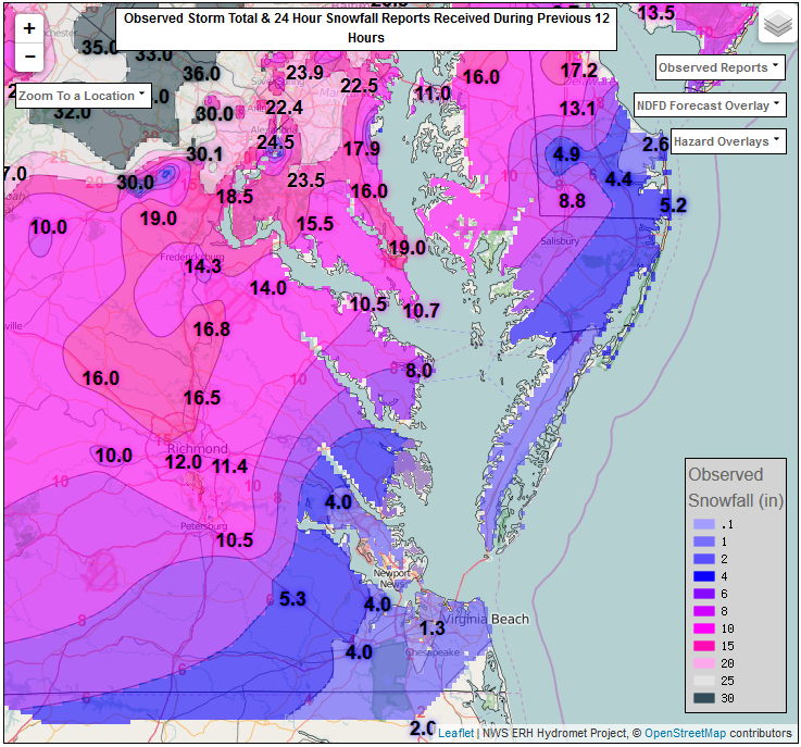
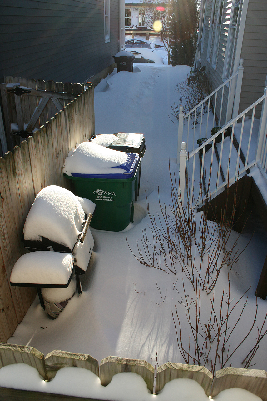
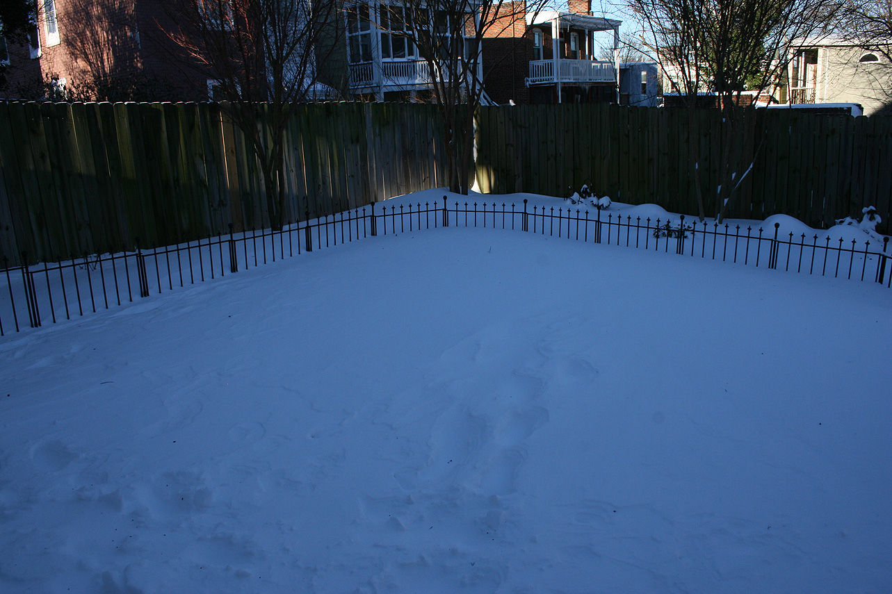
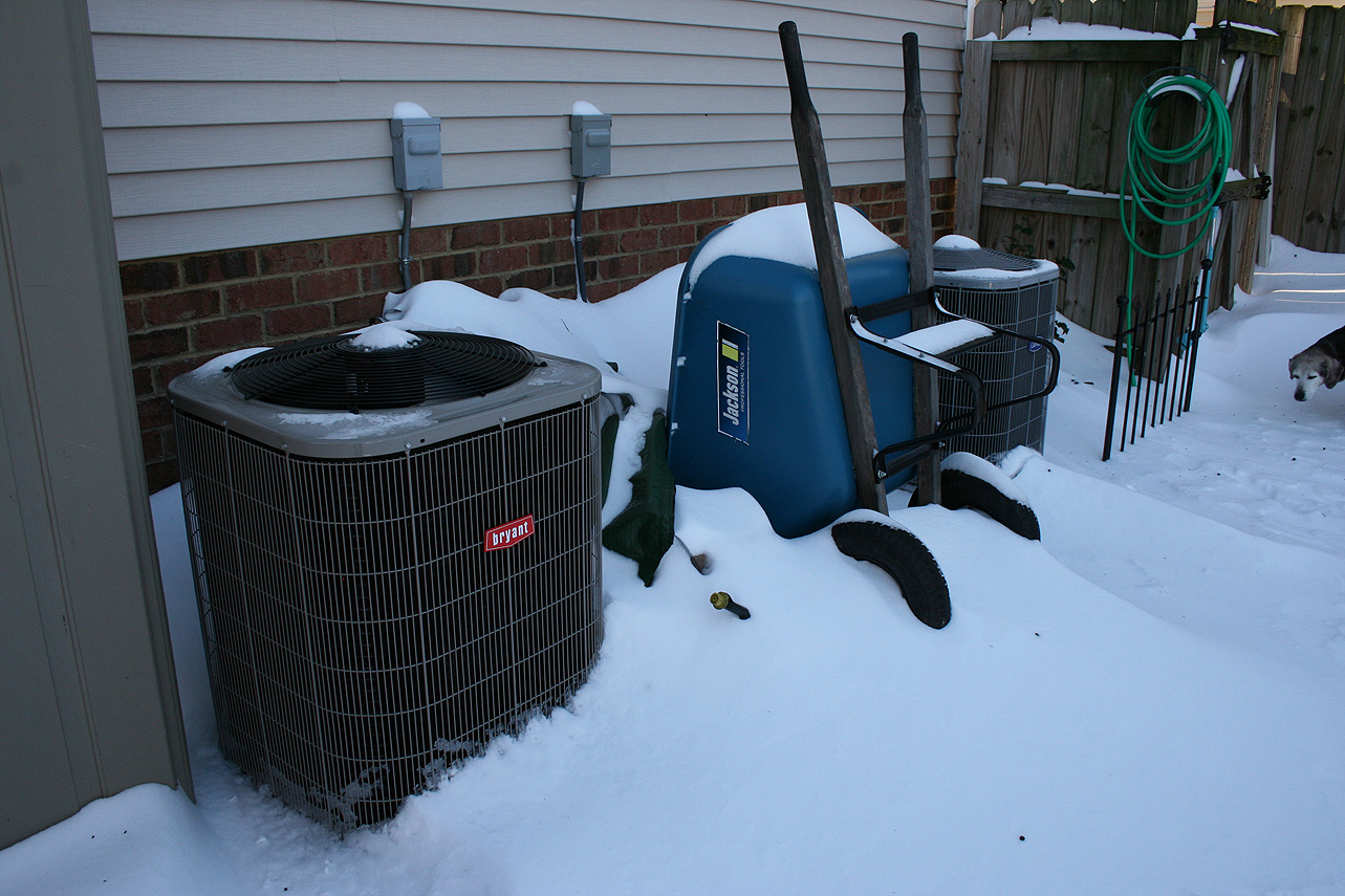
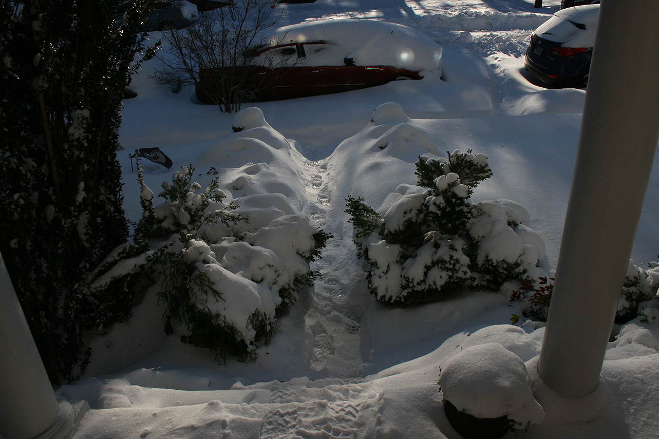
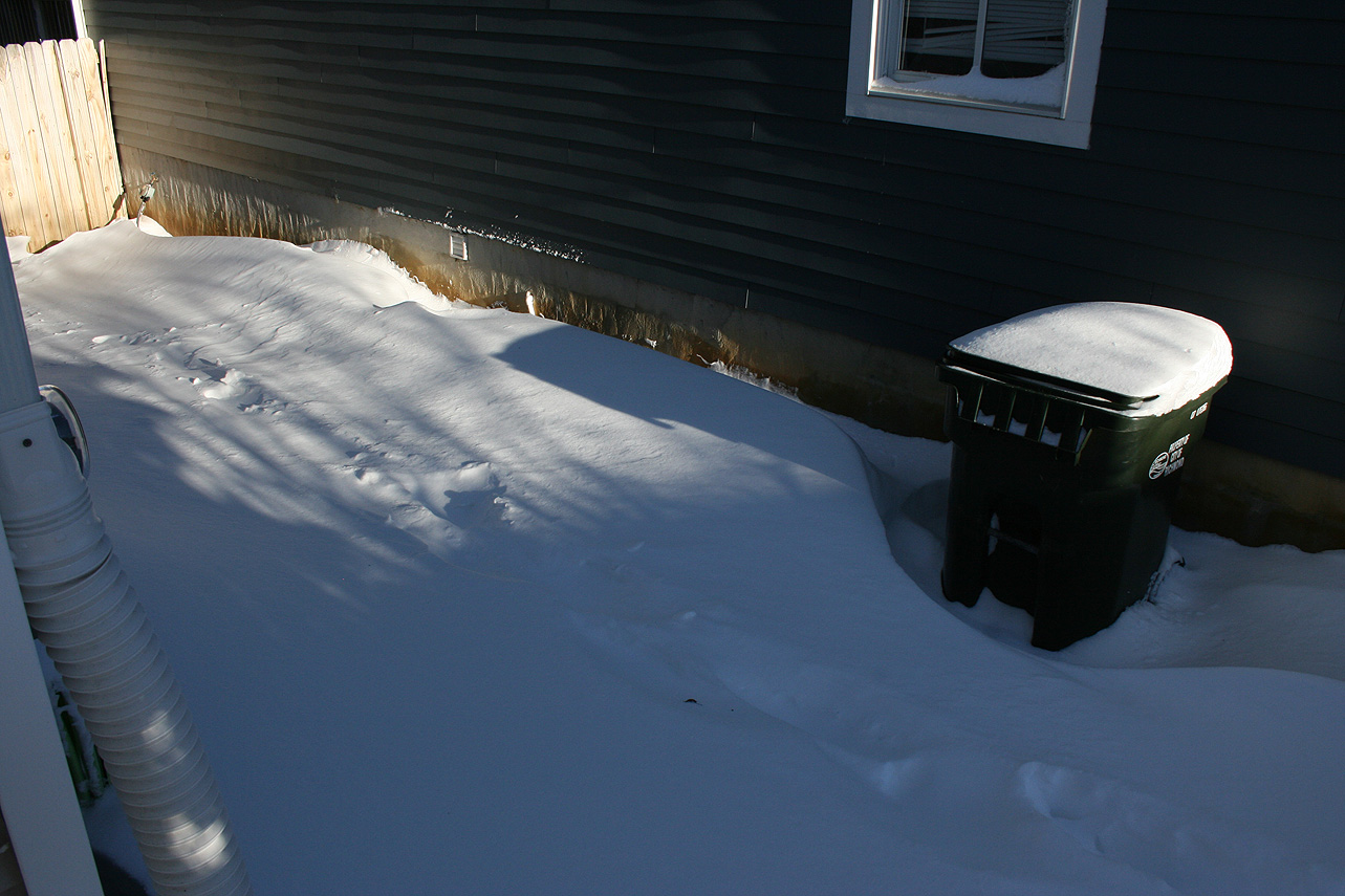
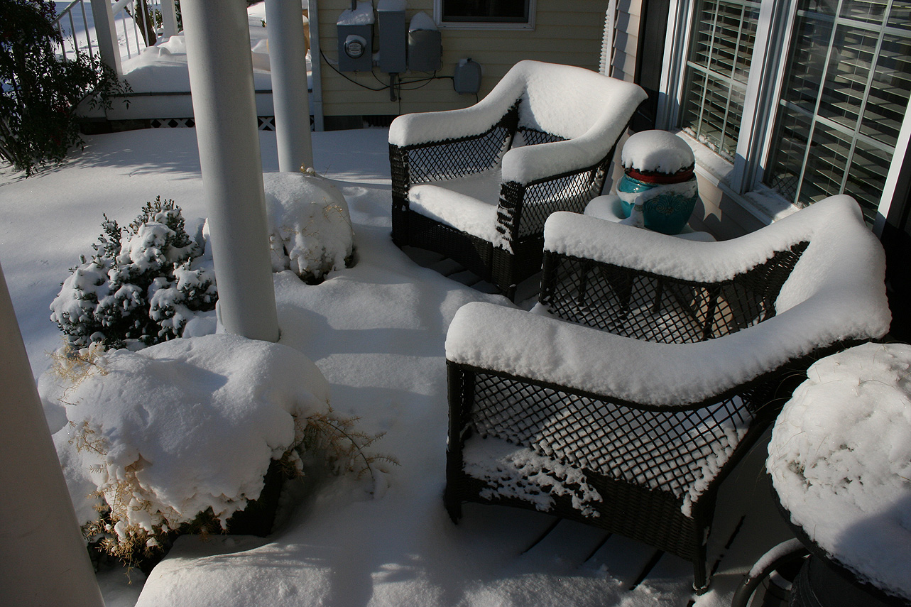
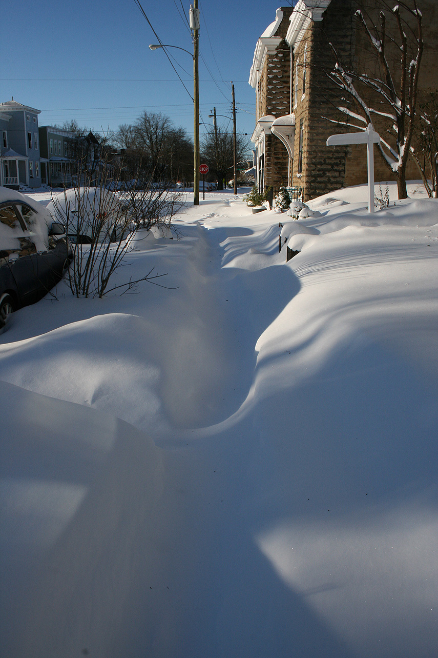
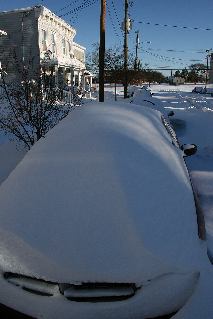
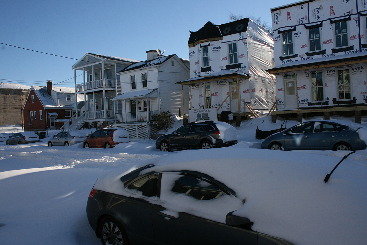
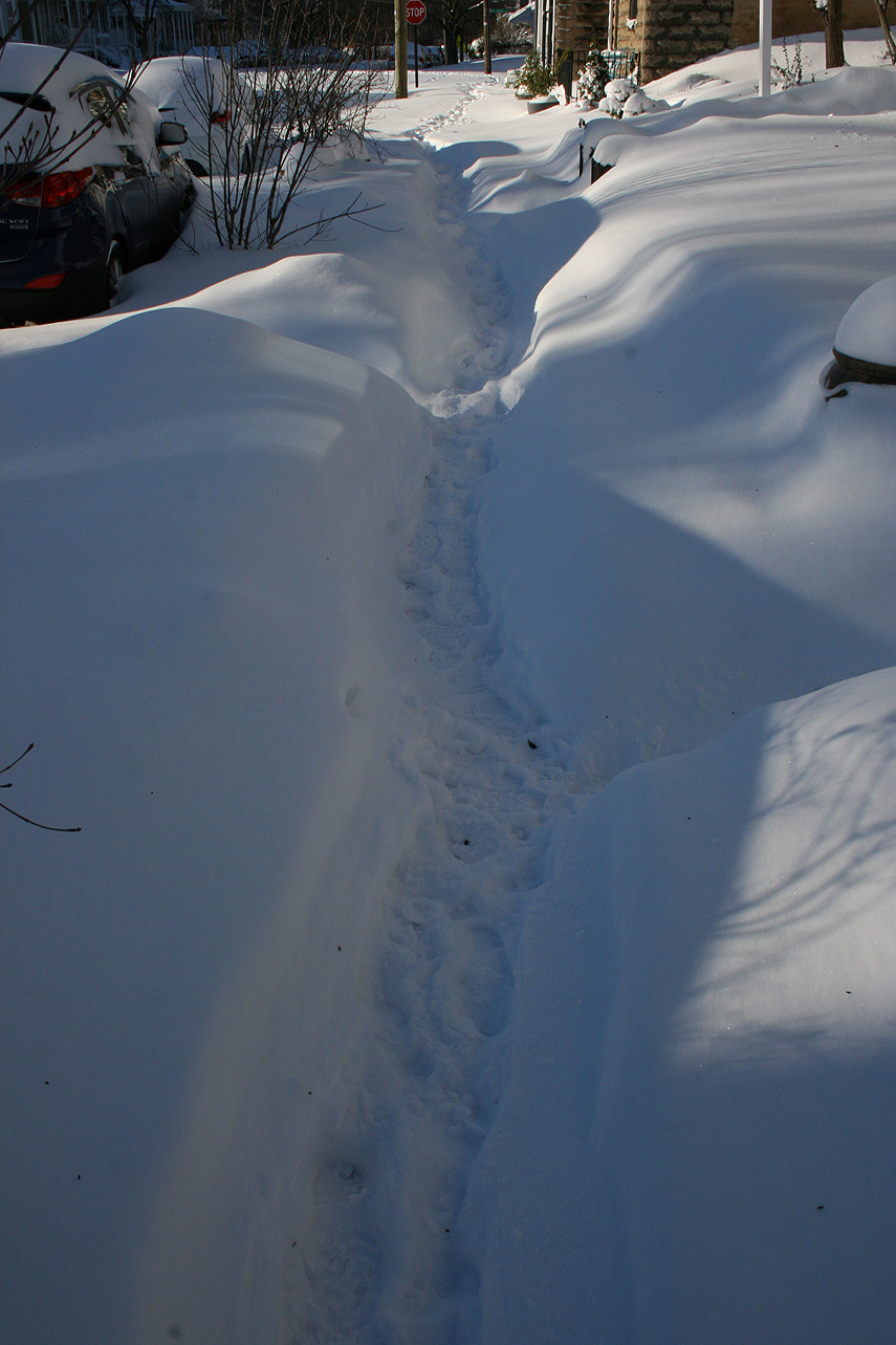
* Total Precipitation: 12.5″ of snow and sleet (5″ snow to 1.5″ of sleet to 6″ of snow). Measurements ranged from 10-18″ around the block. High winds caused drifting, with snow banks between 2-3′ tall. Sleet provided compaction to the snow depth. 11.4″ of snow was reported at the Richmond airport. This was the 11th highest storm total at the Richmond airport.Locally heavier snow to the north of Richmond.
* Comments: A complex storm system tracked across the country, including a multi-phased low-pressure system that transitioned to a low-pressure system off the North Carolina coast. The low-pressure system then tracked north to the Chesapeake Bay, causing snow in Central Virginia (and as far west as Lynchburg & Charlottesville) to transition to sleet. Heavy sleet and a dry slot occurred the night of 1/22 into 1/23. The morning of 1/23, precipitation redeveloped along a deformation band stretching along I-95 from NC to Washington DC. The snow fell moderate to heavy from 11 AM to 6 PM. Wind gusts from 30-45 MPH (43 MPH at the airport) caused near blizzard conditions during the afternoon. Snow tapered off by 10 PM on 1/23.
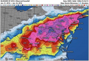
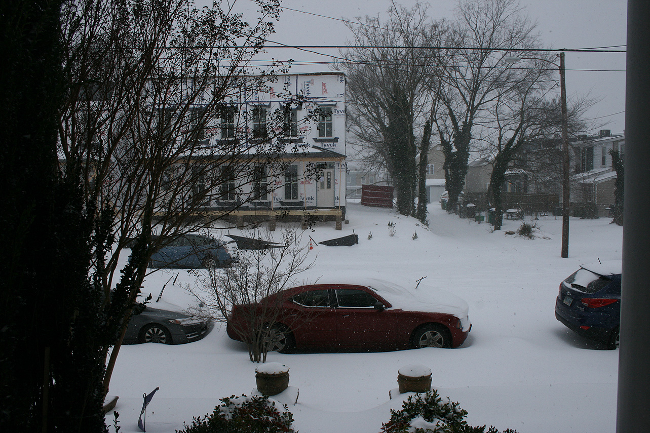
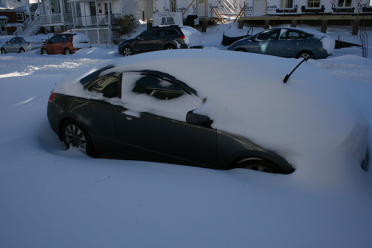
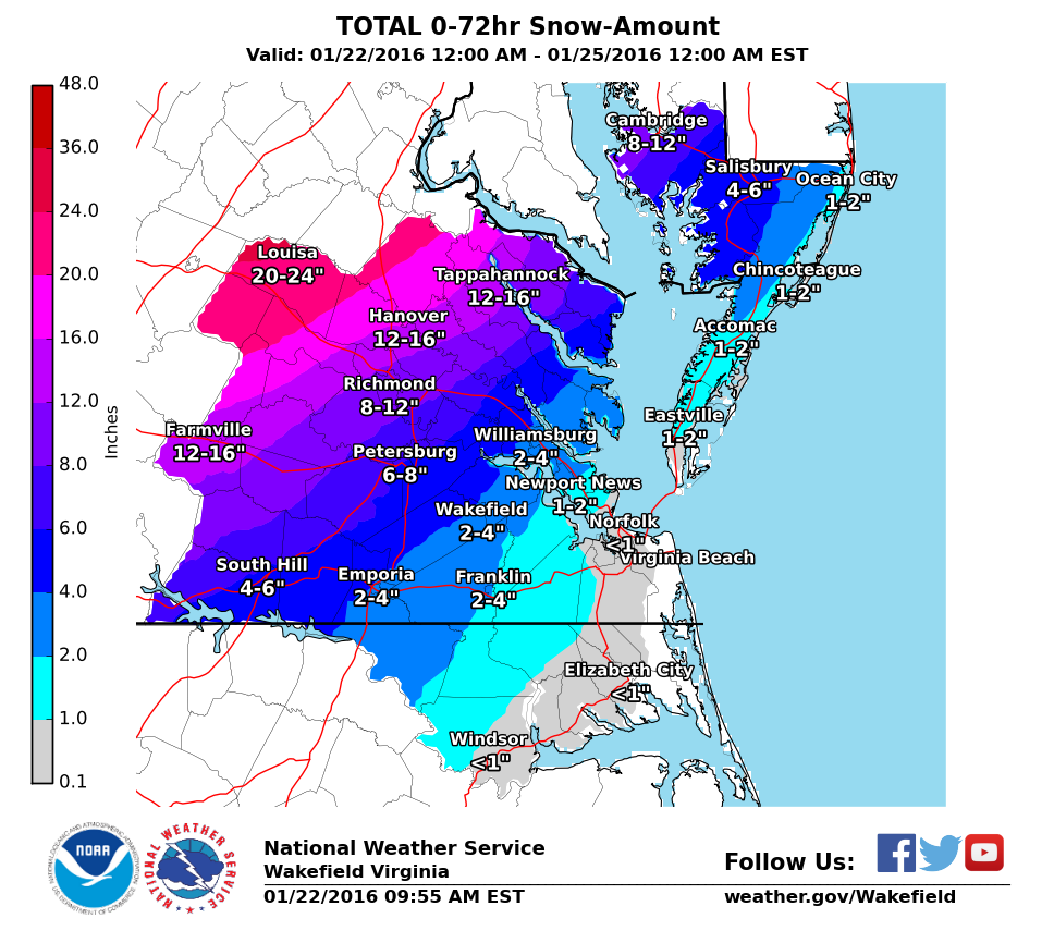
Snow impacted Arkansas up to southern New England. This storm was known as “Jonas” by TWC and the Blizzard of 2016 in other news outlets. Impacts in DC to NYC were extreme, where totals exceeded 2′ of snow.
A major storm in now on it’s way with the expected development of a coastal low off the Carolina coast later today, impacting the area from Friday morning into Saturday night. The system is expected to bring period of heavy snow, sleet and possibly freezing rain to Richmond. Models latched on to a storm threat since last weekend (January 16th-17th) and have continually shown a winter storm that will impact most of Virginia and a good portion of the Mid-Atlantic, Ohio Valley and North East. Snow totals to the north and west of Richmond are expected to exceed 2′ in spots. The storm is taking on characteristics (intensity and snowfall) of the Snowmaggedon (2/2010) and 96′ Blizzard. Snow totals in Richmond will be highly dependent on the amount of sleet that falls Saturday night. Models have varied snow from 5-6″ upwards of 20-24″.
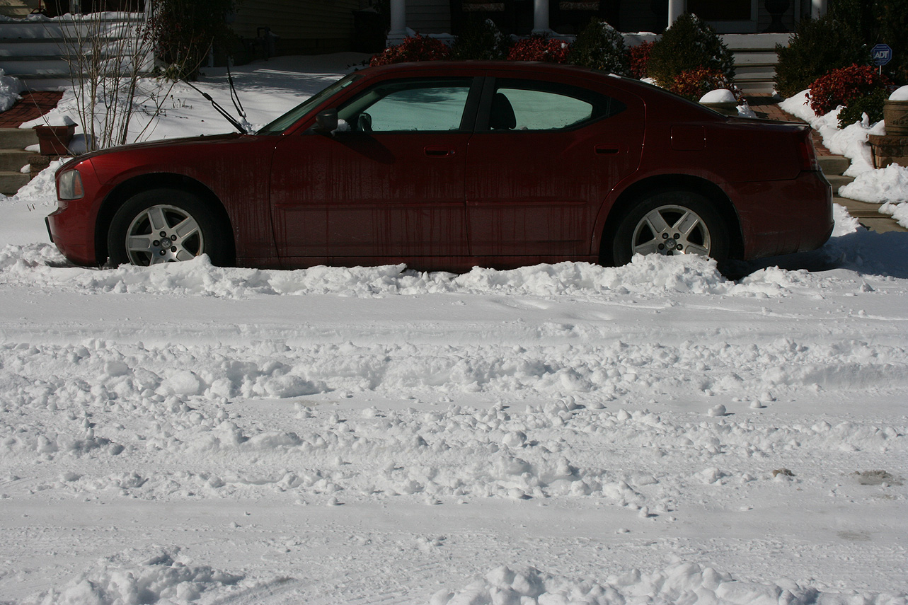
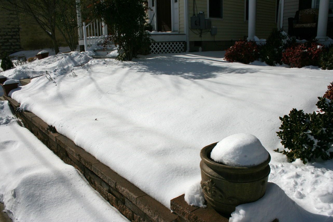
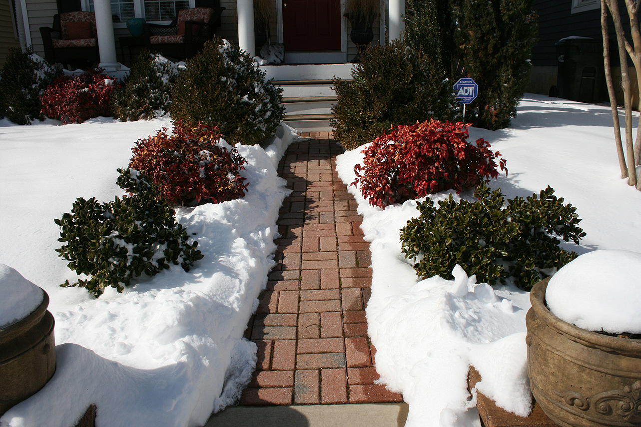
Church Hill Storm Observation Summary:
* Place – Time: Church Hill, (3/1/2015)
* Temperature: 27-32, During Event
* Winter Weather Watch/Warning/Advisory: Advisory
* Closings: None.
* Predicted Totals: Less than ¼”.
* Road Conditions: Minor accumulation on roads. Roads were mainly wet during the event.
* Precipitation Description: Sleet and Freezing Rain/Drizzle, which began around 10:00 AM on 3/1 and ended around 5 PM that afternoon. Sleet quickly changed to all freezing rain/rain by 11 AM.
* Total Precipitation: 0.03″ of primarily freezing rain. 0.16″ of precipitation was reported at the Richmond airport. A system overriding a recent cold surge into the Virginia Piedmont created a minor ice event for the Richmond metro area. Elevated surfaces and trees accumulated the most ice. A winter storm advisory was issued the evening before the event to notify residents of minor ice accumulations. No major power outages were associated with this storm.
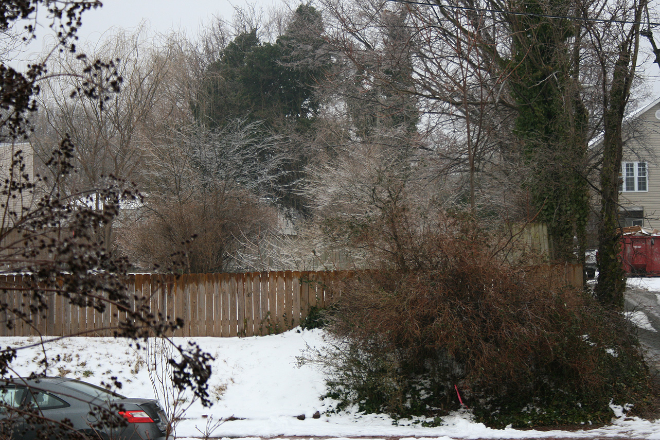
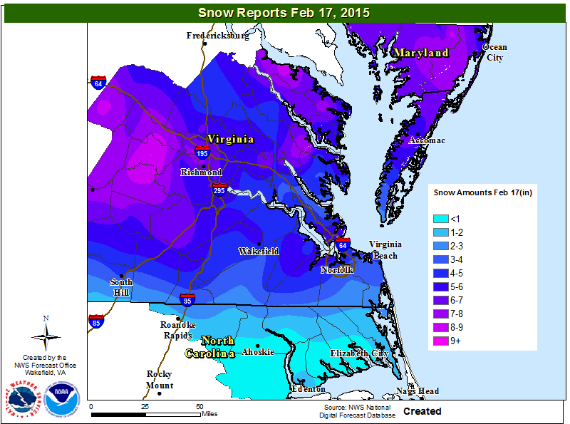
Church Hill Storm Observation Summary:
* Place – Time: Church Hill, (2/17/2015)
* Temperature: 17-20, During Event
* Winter Weather Watch/Warning/Advisory: Watch & Warning
* Closings: All local school districts closed on 2/17, Chesterfield County Government closed early on 2/16, and closed on 2/17. Delayed opening on 2/18.
* Predicted Totals: Between 6-10″ and 9-14″ the day before and day of the event.
* Road Conditions: All roads had snow accumulation on them. Local streets were covered at the onset of the snow.
* Precipitation Description: Snow, which began at 1 PM on 2/16 and ended around 7 AM on 2/17. Sleet mixed in overnight after 12 AM on 2/17.
* Total Precipitation: 6.0″ of snow. 6.9″ of snow was reported at the Richmond airport. Locally heavier snow to the west of Richmond. Sleet likely compacted measurement total in Richmond.
* Comments: A southern slider system that originated in Missouri/Arkansas, dubbed “Octavia”, developed and slide east through the Tennessee Valley, south of Virginia. Snow broke out during the day on 2/16 and was light until 6 and 7 PM. The heaviest snow and accumulation occurred between 7 PM and 12 AM. Sleet mixed with snow overnight, which limited snow totals. Impacts from snow and ice to the Richmond area were significant from this storm.
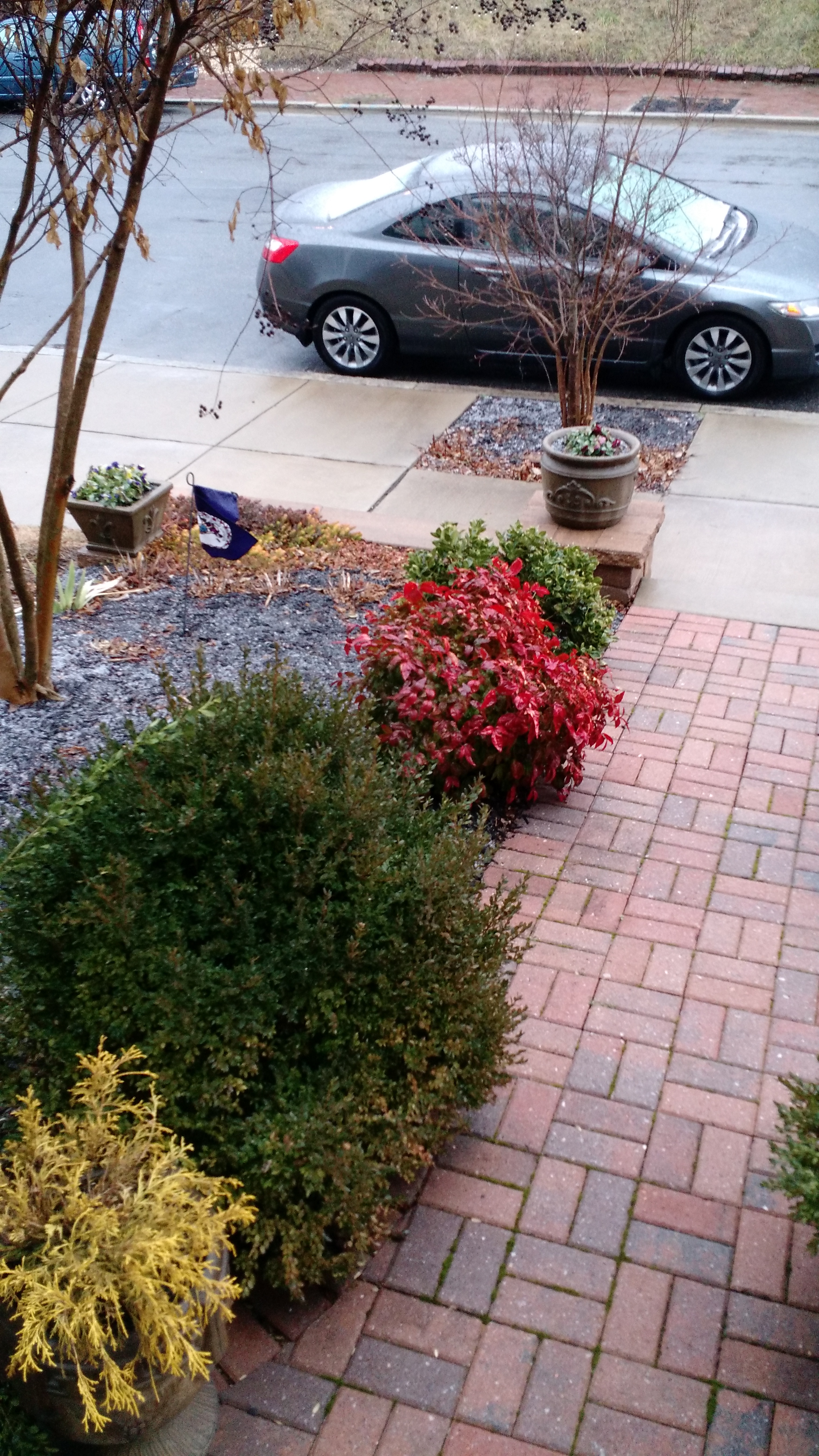
Church Hill Storm Observation Summary:
* Place – Time: Church Hill, (2/10/2015)
* Temperature: 33-34, During Event
* Winter Weather Watch/Warning/Advisory: None.
* Closings: None.
* Predicted Totals: No accumulations were predicted for the event.
* Road Conditions: No impacts to local roads.
* Precipitation Description: Sleet and sleet/rain mix, which began during the early morning hours on Tuesday (3 AM) and ended by mid-morning Tuesday (9 AM).
* Total Precipitation: Approximately 0.1″ of sleet. A trace of snow/sleet or ice was reported at the Richmond airport. More accumulation was present in Chesterfield along my commute route into work.
* Comments: This was a low impact system with accumulations mainly on elevated (car tops), grassy and mulch surfaces.
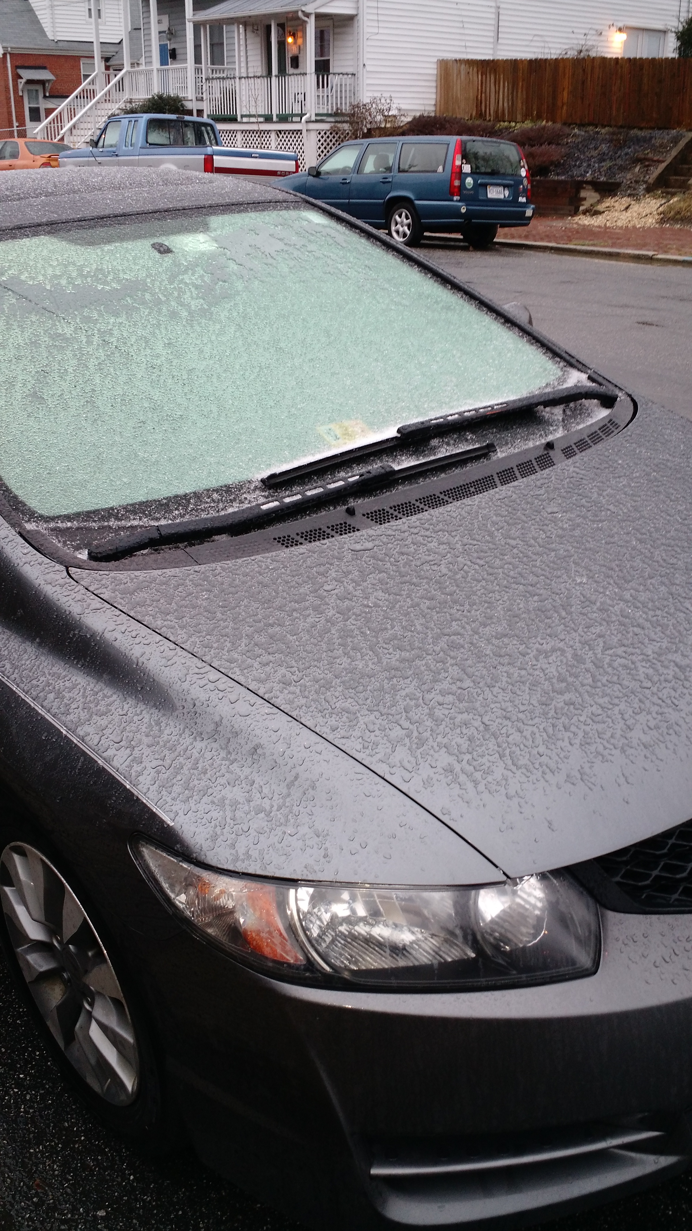
Church Hill Storm Observation Summary:
* Place – Time: Church Hill, (1/14/2015)
* Temperature: 27-28, During Event
* Winter Weather Watch/Warning/Advisory: Advisory, which was issued towards end of the event
* Closings: All local school districts closed, Chesterfield County Government had a delayed opening for 10:30 AM. Government closed for the day at 10:00 AM.
* Predicted Totals: Very light accumulation of freezing rain and sleet.
* Road Conditions: All roads had varying amounts of ice and sleet that accumulated on them. Local streets were very poor most of the day.
* Precipitation Description: A mix of freezing drizzle, freezing rain and brief periods of sleet from 12 AM to 6 AM.
* Total Precipitation: Approximately 0.14″ of sleet and ice accumulation. Sleet and freezing rain accumulated on all surfaces. 0.21″ of liquid equivalent was reported at the Richmond airport. It took an extensive amount of time to melt the ice from my car.
* Comments: A low developed off the Florida coast and quickly bypassed the area off the Carolina coast. A fresh wave of cold air provided more than adequate temperatures to support sleet and freezing rain at the surface. Periods of sleet and freezing rain occurred during the early morning hours, before tapering off by sunrise. Impacts from snow and ice to the Richmond area were moderate from this storm.
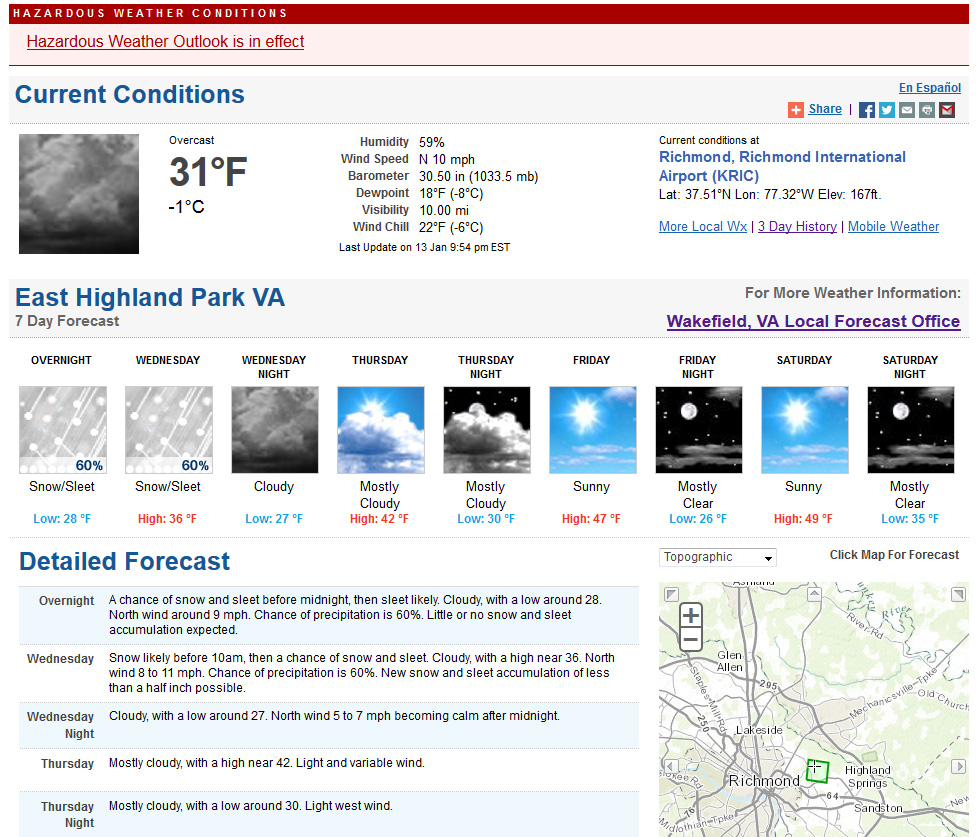
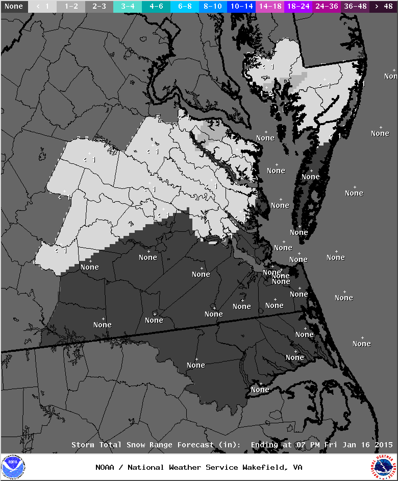
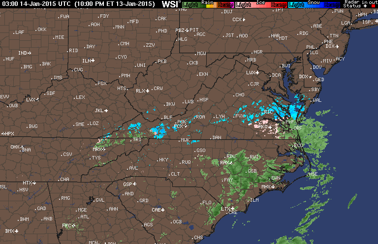
A quick moving storm system may provide some overnight snow, sleet and freezing rain in Metro Richmond. This appears to be a very low-impact storm in terms of accumulation. I’ll update any accumulations tomorrow afternoon. As of the time of this posting, a trace amount (0.01″) of freezing rain has accumulated.
NWS Forecast from 1/13/2015NWS Snow ForecastRadar the evening of 1/13/2015
NWS Forecast discussion:
000
FXUS61 KAKQ 140257
AFDAKQ
AREA FORECAST DISCUSSION
NATIONAL WEATHER SERVICE WAKEFIELD VA
957 PM EST TUE JAN 13 2015
.SYNOPSIS…
HIGH PRESSURE SITS OVER NEW ENGLAND OVERNIGHT INTO WEDNESDAY…AS
LOW PRESSURE DEVELOPING OFF THE FLORIDA COAST THIS EVENING…TRACKS
NORTHEAST JUST OFF THE CAROLINA COAST ON WEDNESDAY. HIGH PRESSURE
RETURNS FOR THE REST OF THE WEEK…BRINGING A RETURN TO MORE DRY
AND SEASONAL CONDITIONS.
&&
.NEAR TERM /THROUGH WEDNESDAY NIGHT/…
LATE THIS EVENG…INITIAL WEAK SHRTWV/LIFT IN SW FLO ALOFT WAS
PRODUCING MAINLY -RA…WITH PATCHY -IP AND -ZR ACRS SE VA AND NE
NC. BUT…NEXT STRONGER SHRTWV/ENHANCED VERTICAL MOTION/PCPN AREA
STARTING TO DEVELOP OVR CNTRL/ERN NC…WILL LIFT NE INTO AND ACRS
THE REGION OVRNGT INTO MIDDAY WED. BASED ON LATEST OBS AND 00Z WAL
SOUNDING…HAVE ADDED SLEET TO THE VA ERN SHR COUNTIES FOR OVRNGT
INTO WED MORNG. ONLY MINOR CHANGES TO TEMPS.
PREVIOUS DISCUSSION:
FOCUS TURNS TO A LOW PRESSURE SYSTEM DEVELOPING OFF THE FL COAST
TONIGHT THAT TRACKS NE OFF THE CAROLINA COAST ON WED. THE
INTERACTION BTWN COLD/DRY AIR FROM THE HIGH AND AN INFLUX OF MORE
MOIST/WARM AIR FROM THE SE WILL SET THE STAGE FOR WINTRY
PRECIPITATION OVER THE AREA LATE TONIGHT THROUGH WED.
AFTER EVALUATING CURRENT WX FEATURES/OBS VS 12Z MODEL DATA…HAVE
DETERMINED THAT THE GFS IS THE MODEL OF CHOICE. THIS IS ALSO THE
PREFERRED MODEL OF CHOICE BY WPC AND IS REFLECTED IN THEIR QPF
ANALYSIS. 12Z GFS/ECMWF MODEL SOLUTIONS KEEP A JET STREAK ACROSS THE
DEEP SOUTH TONIGHT…SHIFTING SLIGHTLY NWD ACROSS THE CAROLINAS ON
WED. WITH THE JET STAYING FARTHER SOUTH…THE REMNANT ARCTIC COLD
FRONT (CURRENTLY AROUND 150-250 MILES OFF THE CAROLINA COAST) IS
EXPECTED TO SLOWLY PUSH ESE TONIGHT THROUGH WED. THIS WILL KEEP
INCOMING PRECIPITATION CLOSER TO THE COASTAL AREAS (60-100 PERCENT
POPS) WITH LESSER CHANCES FARTHER INLAND (15-50 PERCENT POPS) AS THE
CENTRAL LOW PRESSURE CENTER STAYS WELL SOUTHEAST OF THE MID ATLANTIC
COAST. SOUNDING AND CROSS SECTION ANALYSES KEEPS AREAS WITHIN
CURRENT WINTER WX ADVISORY INTACT. FOR AREAS WITHIN THE CURRENT
WINTER WX ADVISORY…PRECIP WILL START AS ALL RAIN AND THEN
TRANSITION TO FREEZING RAIN OR A MIX OF FREEZING RAIN/SLEET AFTER
MIDNIGHT TONIGHT. THIS WINTRY MIX WILL PERSIST THROUGH WED MORNING
BEFORE TRANSITIONING BACK TO LIGHT SLEET (POSSIBLY MIXING WITH RAIN)
LATE WED MORNING INTO AFTN. THE MAIN IMPACT TIMING OF FREEZING RAIN
WILL BE FROM ROUGHLY 4-10 AM EARLY WED MORNING. LIGHT ICE
ACCUMULATIONS OF ONE TENTH OF AN INCH OR LESS ARE EXPECTED.
DANGEROUS TRAVEL CONDITIONS SHOULD BE ANTICIPATED LATE TONIGHT
THROUGH EARLY WED MORNING…ESPECIALLY ON UNTREATED ROADS AND
OVERPASSES. SEE WBCWSWAKQ FOR ADDITIONAL DETAILS AND UPDATES.
NORTHWEST OF THE WINTER WX ADVISORY AREA…A WINTRY MIX OF SNOW
AND SLEET IS EXPECTED AS LIQUID PRECIP OVERRUNS THE COLDER/DRIER
AIRMASS IN PLACE AT THE SFC. IT IS ANTICIPATED THAT MORE SLEET
THAN SNOW SHOULD FALL SINCE THERE IS NOT MUCH LIFT OR AMPLE
MOISTURE WITHIN THE DENDRITIC GROWTH ZONE TO SUPPORT ALL SNOW.
SNOW/SLEET ACCUMULATIONS WILL BE LIGHT…LESS THAN ONE HALF INCH
IN ANY 6 HOUR PERIOD AND LESS THAN ONE INCH OVERALL. A DEFORMATION
ZONE SETS UP OVER THE MD/VA EASTERN SHORE CENTERED ON 12Z…WHICH
MEANS THAT THERE COULD BE A QUICK BURST OF SNOW/SLEET BTWN 4-7 AM
ACROSS THE NRN NECK AND THE MD LOWER EASTERN SHORE. ANY
ACCUMULATIONS DURING THIS POSSIBLE BURST SHOULD STILL AMOUNT TO
ONE HALF INCH OR LESS.
AT THE COAST…PRECIPITATION WILL REMAIN AS ALL RAIN SINCE
TEMPERATURES AND DEWPOINTS WILL BE TOO WARM TO SUPPORT FROZEN
PRECIPITATION AT THE SFC. HOWEVER…WILL NEED TO KEEP A CLOSE EYE ON
DEWPOINTS FARTHER INLAND ACROSS THE SRN TIDEWATER AND NE NC AREAS
(AWAY FROM THE OCEAN AND ALBEMARLE SOUND). IF THEY DROP INTO THE MID
20S…THIS WILL CAUSE WET BULB TEMPERATURES TO FALL BELOW FREEZING
AND THEN FREEZING RAIN COULD BE POSSIBLE. CONFIDENCE IS NOT HIGH
ENOUGH AT THE TIME TO SUPPORT AN EXPANSION OF THE CURRENT WINTER WX
ADVISORY BUT IT IS WORTH NOTING WITHIN THIS FORECAST DISCUSSION.
FOR ALL AREAS…PRECIPITATION EXITS THE COAST LATE WED AFTN/EARLY
EVENING. WITH THE EXCEPTION OF COASTAL AREAS FROM THE VA EASTERN
SHORE TO THE TIDEWATER AREA TO COASTAL NE NC…PRECIP TYPE SHOULD
TRANSITION TO A MIX OF LIGHT SNOW/SLEET. THE AFOREMENTIONED COASTAL
AREAS WILL REMAIN AS ALL RAIN. A FEW LINGERING SHOWERS WILL BE
POSSIBLE OVER FAR SE COASTAL AREAS INTO THE EVENING AS THE SFC LOW
OFF THE CAROLINA COAST TRACKS FARTHER NE OUT TO SEA.
TEMPERATURES WILL BE A BIT TRICKY TONIGHT THROUGH WED NIGHT. TEMPS
SHOULD FALL NICELY ACROSS THE NORTH WHERE CLOUDS CLEARED DURING THE
DAY…BUT HOW FAR THEY DROP WILL BE DETERMINED BY THE INCOMING
CLOUDS FROM THE SW. LOWS WILL BE EVEN MORE TRICKY ACROSS THE SRN
HALF OF THE AREA WHERE PERSISTENT CLOUD COVER HAS HELD TEMPERATURES
STEADY WITH SLOW FALLS EARLY THIS EVENING. WINTER PRECIP POTENTIAL
WILL BE HIGHLY DEPENDENT ON SFC TEMPS AS WELL AS THE AFOREMENTIONED
DEWPOINTS. FOR NOW…LOWS ARE FORECAST IN THE LOW-MID 20S NORTH TO
UPPER 20S-LOWER 30S SOUTH (35-40 SE COAST). HIGHS WED WILL ALSO BE
TRICKY AS TEMPS SHOULD RISE SEVERAL DEGREES AFTER PRECIP COMES TO AN
END FROM WEST TO EAST WED AFTN. HIGHS WED GENERALLY IN THE MID-UPPER
30S (40-45 SE COAST). CLOUDS NOT EXPECTED TO CLEAR WED NIGHT AS HIGH
PRESSURE BUILDS ACROSS THE OHIO VALLEY…HOWEVER LIGHT NORTH WINDS
AND LINGERING EVAPORATIVE COOLING FROM RECENT PRECIP SHOULD RESULT
IN OVERNIGHT LOWS IN THE MID-UPPER 20S NW TO LOW-MID 30S SE.
Current & Historical Weather Events in Richmond, Virginia