Deprecated: Optional parameter $selected declared before required parameter $args is implicitly treated as a required parameter in /home/richmon/domains/richmondcitywatch.com/public_html/rvawx_test/wp-content/plugins/archives-calendar-widget/arw-settings.php on line 178
Deprecated: Optional parameter $view declared before required parameter $args is implicitly treated as a required parameter in /home/richmon/domains/richmondcitywatch.com/public_html/rvawx_test/wp-content/plugins/archives-calendar-widget/arw-widget.php on line 480
Deprecated: Optional parameter $archiveMonth declared before required parameter $args is implicitly treated as a required parameter in /home/richmon/domains/richmondcitywatch.com/public_html/rvawx_test/wp-content/plugins/archives-calendar-widget/arw-widget.php on line 480
Warning: Trying to access array offset on value of type bool in /home/richmon/domains/richmondcitywatch.com/public_html/rvawx_test/wp-content/plugins/archives-calendar-widget/archives-calendar.php on line 64 RVAWX.com | Current & Historical Weather Events in Richmond, Virginia | Page 15
The latest computer guidance and models seem to be coming into agreement for a sizable storm for central and southeastern Virginia this weekend. The NWS forecast for the weekend storm is (Richmond Metro):
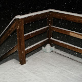
Friday Night: A chance of snow. Mostly cloudy, with a low around 28. Chance of precipitation is 30%.
Christmas Day: A chance of snow. Cloudy, with a high near 36. Chance of precipitation is 40%.
Saturday Night: A chance of snow. Cloudy, with a low around 27. Chance of precipitation is 50%.
Sunday: A chance of snow. Mostly cloudy, with a high near 35. Chance of precipitation is 30%.
The latest 12z GFS is sowing the formation of a costal storm during the day on Saturday:
Stay tuned for further updates.
Update: 12/24/2010
The models have come into general agreement that this storm will take a more easterly path and not create a massive snow storm for central Virginia. Instead, a smaller upper level disturbance from the Midwest will likely swing through tomorrow afternoon (12/25) and tomorrow night to produce some snow showers. Local meteorologists are estimating anywhere from a dusting to an inch. The track of this storm is still uncertain, so it will still bear some watching today and tomorrow. Observation posts will be posted tomorrow if snow looks likely.
URGENT - WINTER WEATHER MESSAGE
NATIONAL WEATHER SERVICE WAKEFIELD VA
311 PM EST WED DEC 15 2010
...SNOW...POSSIBLY MIXED WITH SLEET AND LIGHT FREEZING RAIN LATE
TONIGHT AND THURSDAY...
THE NATIONAL WEATHER SERVICE IN WAKEFIELD HAS ISSUED A WINTER
STORM WARNING FOR HEAVY SNOW...WHICH IS IN EFFECT FROM 4 AM TO 7 PM
EST THURSDAY. THE WINTER STORM WATCH IS NO LONGER IN EFFECT.
* ACCUMULATION...2 TO 5 INCHES OF SNOW.
* ICE AMOUNTS...A TRACE TO ONE TENTH OF AN INCH OF ICE IS
POSSIBLE...MAINLY TOWARD THE NORTH CAROLINA BORDER THURSDAY
AFTERNOON AND EVENING.
* TIMING: LATE TONIGHT THROUGH THURSDAY EVENING.
* IMPACTS: HAZARDOUS TRAVEL CONDITIONS.
12/15 9:00PM: Not much has changed in the past few hours in terms of the forecast. Some areas to the west had the snow totals increased to 3-7″
The main precip shield is still just west of the Apps, and, amazingly, it stretches NW up to Bismark!
URGENT - WINTER WEATHER MESSAGE
NATIONAL WEATHER SERVICE WAKEFIELD VA
311 PM EST WED DEC 15 2010

...SNOW...POSSIBLY MIXED WITH SLEET AND LIGHT FREEZING RAIN LATE
TONIGHT AND THURSDAY...

.A LOW PRESSURE SYSTEM WILL MOVE ACROSS THE MID-MISSISSIPPI
TONIGHT AND THEN INTO THE MID-ATLANTIC REGION ON THURSDAY. THIS
SYSTEM WILL SPREAD WINTER WEATHER ACROSS MOST OF THE REGION
BEGINNING LATE TONIGHT...AND ESPECIALLY ON THURSDAY. AT THIS
TIME...THE HEAVIEST SNOW AMOUNTS APPEAR TO BE FOCUSED OVER
CENTRAL AND SOUTH-CENTRAL VIRGINIA...INCLUDING THE INTERSTATE
95 CORRIDOR. THERE IS THE POTENTIAL FOR SNOW TO MIX WITH OR
CHANGE OVER TO SLEET AND LIGHT FREEZING RAIN THURSDAY AFTERNOON...
MAINLY NEAR THE NORTH CAROLINA BORDER.

VAZ048-060>062-065>071-079>082-087>089-161030-
/O.UPG.KAKQ.WS.A.0006.101216T0900Z-101217T0000Z/
/O.NEW.KAKQ.WS.W.0005.101216T0900Z-101217T0000Z/
FLUVANNA-PRINCE EDWARD-CUMBERLAND-GOOCHLAND-MECKLENBURG-LUNENBURG-
NOTTOWAY-AMELIA-POWHATAN-CHESTERFIELD-HENRICO-BRUNSWICK-DINWIDDIE-
PRINCE GEORGE-CHARLES CITY-GREENSVILLE-SUSSEX-SURRY-
INCLUDING THE CITIES OF...FARMVILLE...GOOCHLAND...SOUTH HILL...
CREWE...COLONIAL HEIGHTS...RICHMOND...LAWRENCEVILLE...
PETERSBURG...HOPEWELL...EMPORIA...WAKEFIELD
311 PM EST WED DEC 15 2010

...WINTER STORM WARNING IN EFFECT FROM 4 AM TO 7 PM EST
THURSDAY...

THE NATIONAL WEATHER SERVICE IN WAKEFIELD HAS ISSUED A WINTER
STORM WARNING FOR HEAVY SNOW...WHICH IS IN EFFECT FROM 4 AM TO 7 PM
EST THURSDAY. THE WINTER STORM WATCH IS NO LONGER IN EFFECT.

* ACCUMULATION...2 TO 5 INCHES OF SNOW.

* ICE AMOUNTS...A TRACE TO ONE TENTH OF AN INCH OF ICE IS
  POSSIBLE...MAINLY TOWARD THE NORTH CAROLINA BORDER THURSDAY
  AFTERNOON AND EVENING.

* TIMING: LATE TONIGHT THROUGH THURSDAY EVENING.

* IMPACTS: HAZARDOUS TRAVEL CONDITIONS.

PRECAUTIONARY/PREPAREDNESS ACTIONS...

A WINTER STORM WARNING MEANS SIGNIFICANT AMOUNTS OF SNOW...
SLEET...AND ICE ARE EXPECTED OR OCCURRING. THIS WILL MAKE TRAVEL
VERY HAZARDOUS OR IMPOSSIBLE.
It appears that before the potentially large winter storm this weekend, Richmond is slated for a glancing blow by a system coming out of the Rockies early Thursday into Thursday night. The temperature profiles for the system seem to indicate a snow event for Richmond, but some of the local meteorologists and NWS are calling for some mixing (a changeover to sleet and freezing rain). The NWS is currently expecting 2″-4″ of snow, and we could get as much as 3″-6″ before all is said and done. Mixing issue Thursday evening could limit accumulations. Snow is expected to begin around 9AM tomorrow morning.
Snow Amount Map - TWC
Below is the 00z GFS from 12/15/2010. It shows us in .25-.50 liquid precip, which is roughly 2.5″-5″ of snow.
Saw on the local news that next week (19th-22nd) looks very interesting. Could we have the coveted coastal storm setup brewing? We’ll be keeping an eye on the models and posting updates. Feel free to join in on the discussion.
The 00GFS waffled again…now the storm slides OTS…
The image below is the 18z gfs and it shows us getting 9-10″ of snow total!
This graph of the 18z GFS data shows 9″ as well
12/21/2010 Update:
No measurable precipitation affected the Richmond metro area for this projected storm. Instead, the bulk of the moisture was confined to the southeast portion of the state. The sotrm system was wisked out to sea (OTS) without so much a flurry in downtown Richmond. Below is an image of the storm prior to it exiting the southeast coast:
The NWS has now changed Thursday’s forecast to “Snow Likely” with a 60% chance. Snow should start around 9-10AM and continue through early evening. It may mix with some sleet and/or freezing rain as it tapers off.
The NAM is showing 3-4″ for us, as of the last run. We’ll monitor this as Thursday nears.
Check out the excel spreadsheet at the link. I plan on working on a huge database covering every monthly report since 1982 for Richmond. Look for more info and ways to help soon.
12/11 NEWS:
– Added “News, Links and Favorites”, “RADAR Images”, “Real Time Weather Data”, and “RVAWX Archives” pages. Check out videos on the “Archives” pages (youtube viewable and downloadable HD versions for your preferences)
– Started “Event” posts for forecasts
– Started “OBS” posts for real time observation posting
– Much more to come as we expand and grow
– Keep an eye on the front page, we may be asking for volunteers to help with maps, forecasting and observation data
Current & Historical Weather Events in Richmond, Virginia