Update: 1/17/2011
**While cold air has filtered into place over Central Virginia, it appears that this will primarily be a rain event for tonight into Wednesday morning. There may be a little sleet at the onset of the precipitation, but no accumulation is expected. All eyes are now on the next potential winter storm which may arrive in Virginia by 1/21. **
The possibility of winter weather looks unlikely over the next week to ten days. The next substantial storm on the horizon is slated to cross the area on Monday and Tuesday of next week (January 18-19). Most models currently show a rain solution for this storm as it tracks well west of Central Virginia. One model, the GGEM, shows the possibility for some initial snow/ice at the onset, followed by rain for the duration of the event.
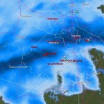
GGEM, 1/13/2011

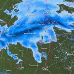
GFS, 1/13/2011

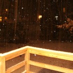
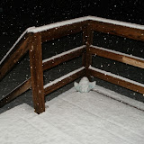
Video from Event: