Category Archives: Forecast Discussion

What do the models say? What are the local mets saying? Discuss it here.

December 16-17, 2010: WSW ISSUED

WINTER STORM WARNING ISSUED

Winter Storm Warning

URGENT - WINTER WEATHER MESSAGE
NATIONAL WEATHER SERVICE WAKEFIELD VA
311 PM EST WED DEC 15 2010

...SNOW...POSSIBLY MIXED WITH SLEET AND LIGHT FREEZING RAIN LATE
TONIGHT AND THURSDAY...

.A LOW PRESSURE SYSTEM WILL MOVE ACROSS THE MID-MISSISSIPPI
TONIGHT AND THEN INTO THE MID-ATLANTIC REGION ON THURSDAY. THIS
SYSTEM WILL SPREAD WINTER WEATHER ACROSS MOST OF THE REGION
BEGINNING LATE TONIGHT...AND ESPECIALLY ON THURSDAY. AT THIS
TIME...THE HEAVIEST SNOW AMOUNTS APPEAR TO BE FOCUSED OVER
CENTRAL AND SOUTH-CENTRAL VIRGINIA...INCLUDING THE INTERSTATE
95 CORRIDOR. THERE IS THE POTENTIAL FOR SNOW TO MIX WITH OR
CHANGE OVER TO SLEET AND LIGHT FREEZING RAIN THURSDAY AFTERNOON...
MAINLY NEAR THE NORTH CAROLINA BORDER.

VAZ048-060>062-065>071-079>082-087>089-161030-
/O.UPG.KAKQ.WS.A.0006.101216T0900Z-101217T0000Z/
/O.NEW.KAKQ.WS.W.0005.101216T0900Z-101217T0000Z/
FLUVANNA-PRINCE EDWARD-CUMBERLAND-GOOCHLAND-MECKLENBURG-LUNENBURG-
NOTTOWAY-AMELIA-POWHATAN-CHESTERFIELD-HENRICO-BRUNSWICK-DINWIDDIE-
PRINCE GEORGE-CHARLES CITY-GREENSVILLE-SUSSEX-SURRY-
INCLUDING THE CITIES OF...FARMVILLE...GOOCHLAND...SOUTH HILL...
CREWE...COLONIAL HEIGHTS...RICHMOND...LAWRENCEVILLE...
PETERSBURG...HOPEWELL...EMPORIA...WAKEFIELD
311 PM EST WED DEC 15 2010

...WINTER STORM WARNING IN EFFECT FROM 4 AM TO 7 PM EST
THURSDAY...

THE NATIONAL WEATHER SERVICE IN WAKEFIELD HAS ISSUED A WINTER
STORM WARNING FOR HEAVY SNOW...WHICH IS IN EFFECT FROM 4 AM TO 7 PM
EST THURSDAY. THE WINTER STORM WATCH IS NO LONGER IN EFFECT.

* ACCUMULATION...2 TO 5 INCHES OF SNOW.

* ICE AMOUNTS...A TRACE TO ONE TENTH OF AN INCH OF ICE IS
  POSSIBLE...MAINLY TOWARD THE NORTH CAROLINA BORDER THURSDAY
  AFTERNOON AND EVENING.

* TIMING: LATE TONIGHT THROUGH THURSDAY EVENING.

* IMPACTS: HAZARDOUS TRAVEL CONDITIONS.

PRECAUTIONARY/PREPAREDNESS ACTIONS...

A WINTER STORM WARNING MEANS SIGNIFICANT AMOUNTS OF SNOW...
SLEET...AND ICE ARE EXPECTED OR OCCURRING. THIS WILL MAKE TRAVEL
VERY HAZARDOUS OR IMPOSSIBLE.


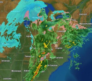
It appears that before the potentially large winter storm this weekend, Richmond is slated for a glancing blow by a system coming out of the Rockies early Thursday into Thursday night. The temperature profiles for the system seem to indicate a snow event for Richmond, but some of the local meteorologists and NWS are calling for some mixing (a changeover to sleet and freezing rain). The NWS is currently expecting 2″-4″ of snow, and we could get as much as 3″-6″ before all is said and done. Mixing issue Thursday evening could limit accumulations. Snow is expected to begin around 9AM tomorrow morning.
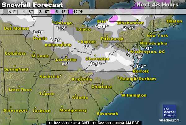
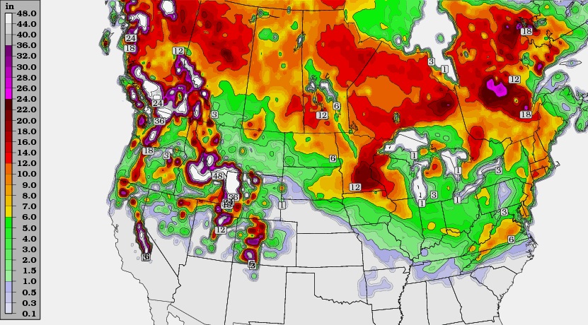
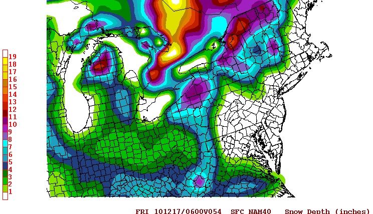
Snow Amount Map - TWC

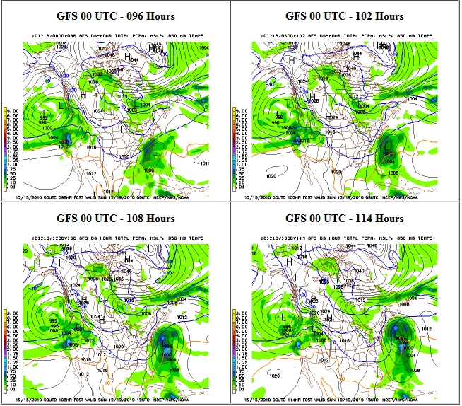
Below is the 00z GFS from 12/15/2010. It shows us in .25-.50 liquid precip, which is roughly 2.5″-5″ of snow.
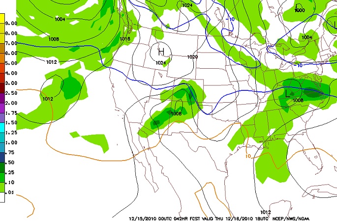
00Z GFS
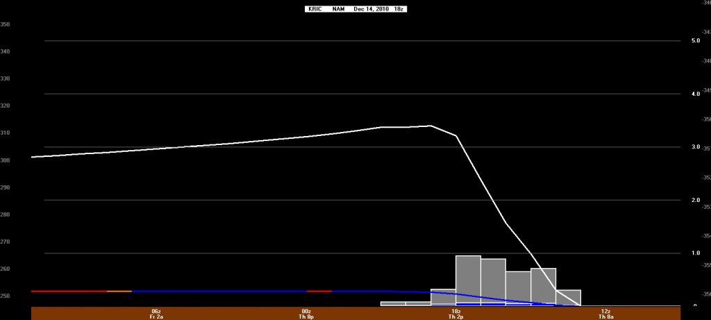
18Z NAM

18Z NAM:

December 19-22, 2010: Winter Wx *CLOSED*

Saw on the local news that next week (19th-22nd) looks very interesting. Could we have the coveted coastal storm setup brewing? We’ll be keeping an eye on the models and posting updates. Feel free to join in on the discussion.

The 00GFS waffled again…now the storm slides OTS…

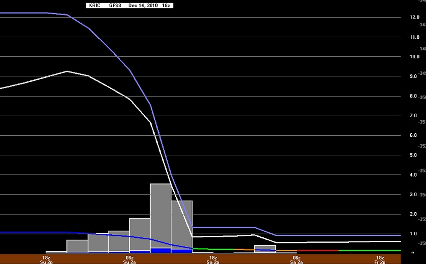
The image below is the 18z gfs and it shows us getting 9-10″ of snow total!

This graph of the 18z GFS data shows 9″ as well

12/21/2010 Update:

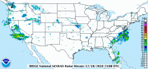
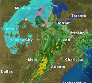
No measurable precipitation affected the Richmond metro area for this projected storm. Instead, the bulk of the moisture was confined to the southeast portion of the state. The sotrm system was wisked out to sea (OTS) without so much a flurry in downtown Richmond. Below is an image of the storm prior to it exiting the southeast coast:

More on Sunday’s Weather Event

Well, this weekend’s system looks more and more like an all rain event for us here in the Richmond Metro area. Temperatures will remain in the low to mid 40’s and may warm up a bit more before some precipitation moves in some time after 1pm Saturday. This light rain will come up from the south, and is not from the main rain event.

updated 10:50PM 12/12

This rain will bring showers to the area and become a steady light rain from 8pm until around 4 or 5am Sunday morning. The rain will become more steady and continue through the day Sunday until about 7 or 8pm.

A rapid drop in temperature will occur, dropping from about 47* at about 6pm Sunday, to around 26* by 6am Monday morning. Black ice will be an issue for early travelers.

There is still a slight chance of wraparound moisture from the system bringing a few flakes to the area. At most, a light dusting could occur for us here, while places east of I-95 may see slightly more.

Total rain amounts should vary between 0.5″ to 0.75″ in most places, with a few places see locally around 1.00″.

Read for real time updates during the event and for any changes in the forecast.

Next up: Next week’s big arctic blast and another storm? Could the timing be right for these to come together to bring Richmond Metro some snow and ice? Read later for more on this.

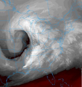
Cool WV Sat image of the storm. Classic coma shaped, with the front right behind that bright white band from LA to MI

Part 2
Well, the main storm hasn’t even arrived yet, but managed about 0.22″ of rain so far. The main wave will move in around late morning, and the rain will last through the early evening hours. Temperatures will remain well above freezing, getting into the low 40’s. As the system moves out, temperatures will drop as the cold front sweeps by. There may be enough moisture late evening to squeeze out a few flakes or a snow shower. These will mainly be hit-or-miss for Metro Richmond.

Storm Total Rain: 0.65″
Snow: Trace-0.25″
High Sunday: 46* dropping into the upper 20’s by early Monday AM

updated 3:00AM 12/12