A quick batch of rain, mixed with sleet and some snow, came in behind an arctic front during the evening hours. No accumulation was observed. This serves as the first wintry precipitation observed for the 2014-2015 winter season.
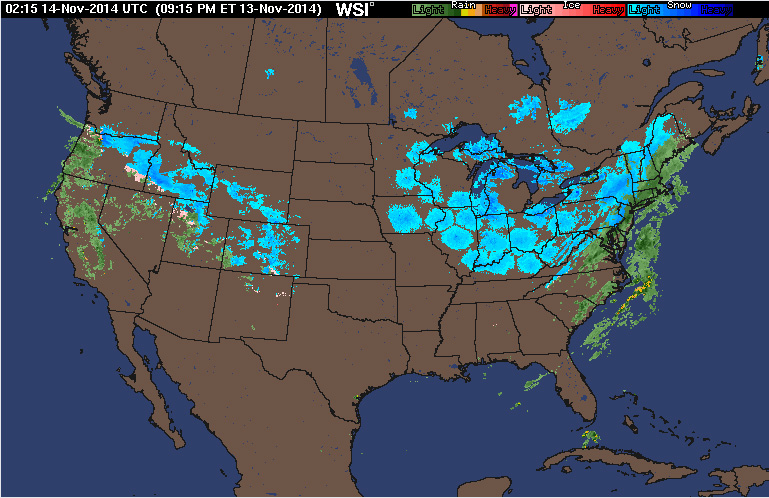
A quick batch of rain, mixed with sleet and some snow, came in behind an arctic front during the evening hours. No accumulation was observed. This serves as the first wintry precipitation observed for the 2014-2015 winter season.
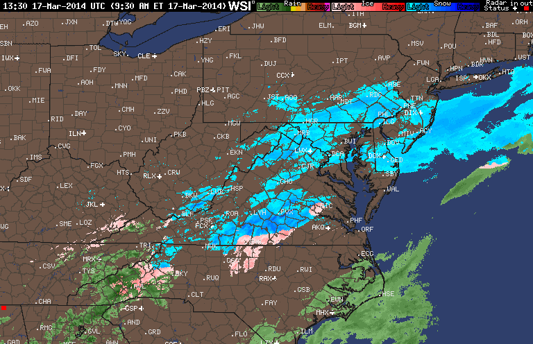
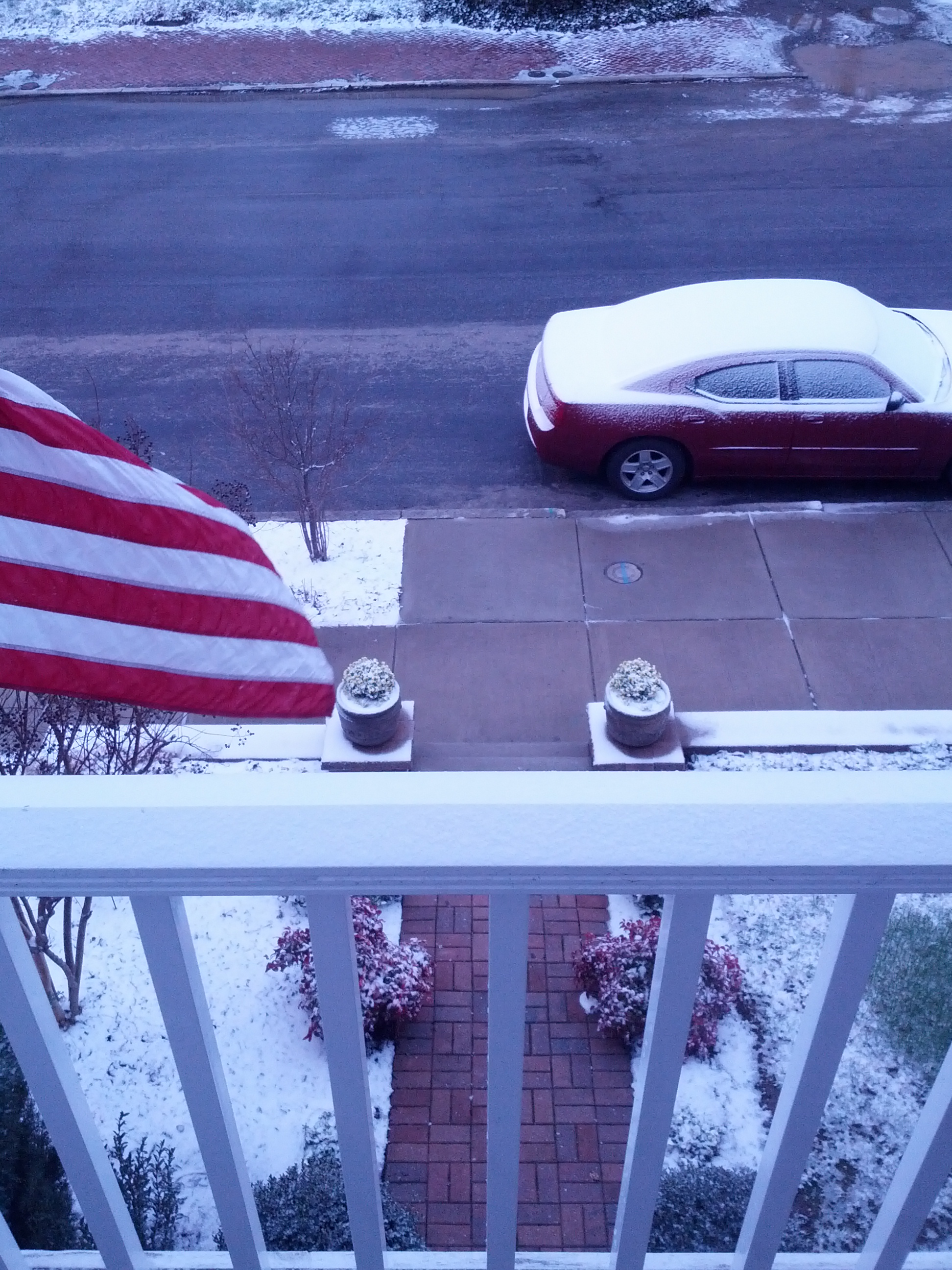
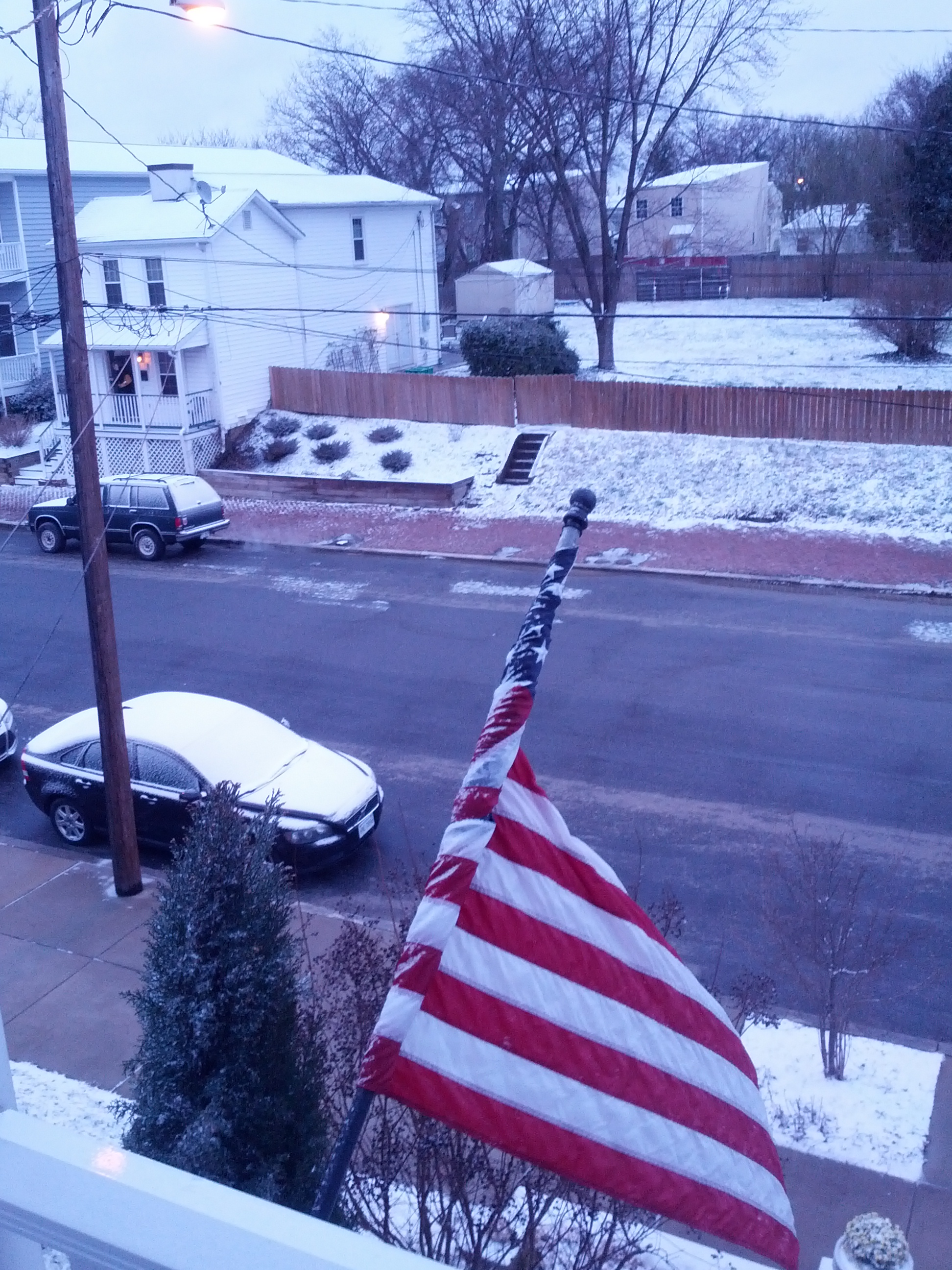
Church Hill Storm Observation Summary:
* Place – Time: Church Hill, (3/17/2014)
* Temperature: 29-35, During Event
* Winter Weather Watch/Warning/Advisory: Watch & Advisory
* Closings: None
* Predicted Totals: Ranged from 2-4” initialed, downgraded to less than 1” on Sunday night.
* Road Conditions: All roads were primarily wet during the event.
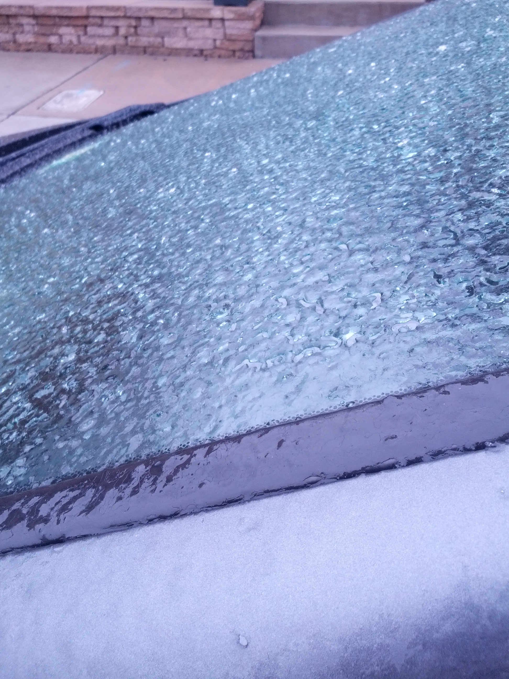
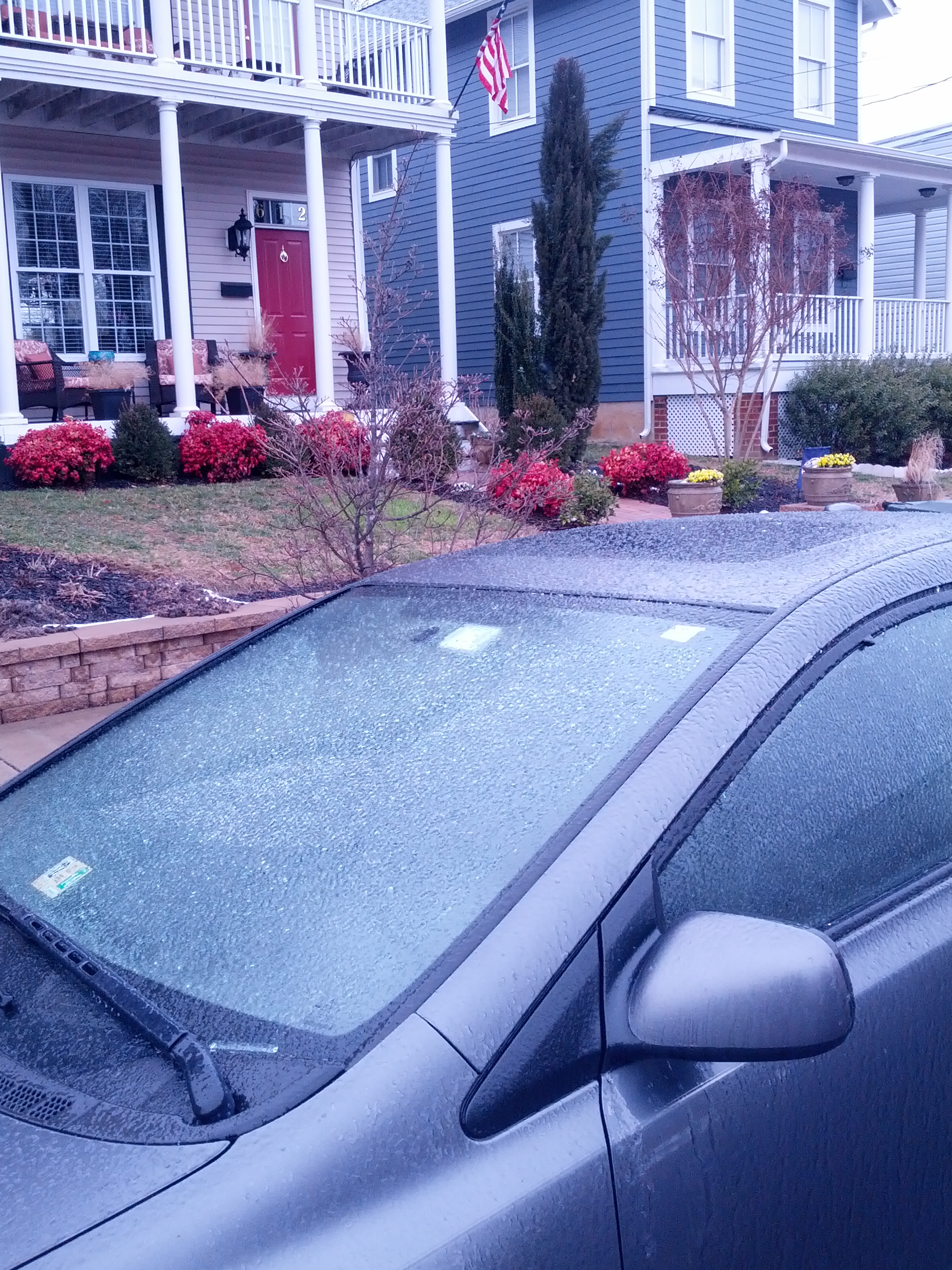
* Precipitation Description: A mix of rain to sleet, followed by freezing rain, sleet and snow during the overnight hours. Additional freezing rain and sleet fell during the morning hours of 3/17/2014.
* Total Precipitation: Approximately 0.5″ of snow, sleet and ice accumulation. Snow, sleet and freezing rain accumulated on elevated surfaces. 0.6″ was reported at Richmond airport.
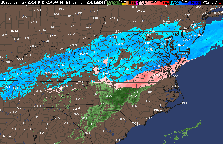
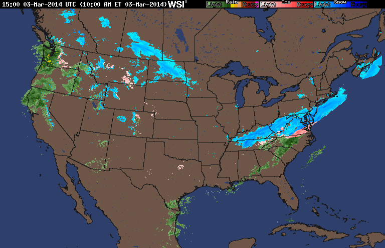
* Comments: A low sliding through the Tennessee Valley towards the coast of Virginia delivered a late season winter storm event to the Richmond area. A cold air wedge developed on Sunday afternoon that slowly changed rain over to sleet during the late evening and overnight hours. Periods of sleet, snow, freezing rain and rain continued through the morning and early afternoon hours. Impacts from snow and ice to the Richmond area were minimal from this storm. However, areas to the north saw increased snow totals between 2-8” towards Fredericksburg & DC.
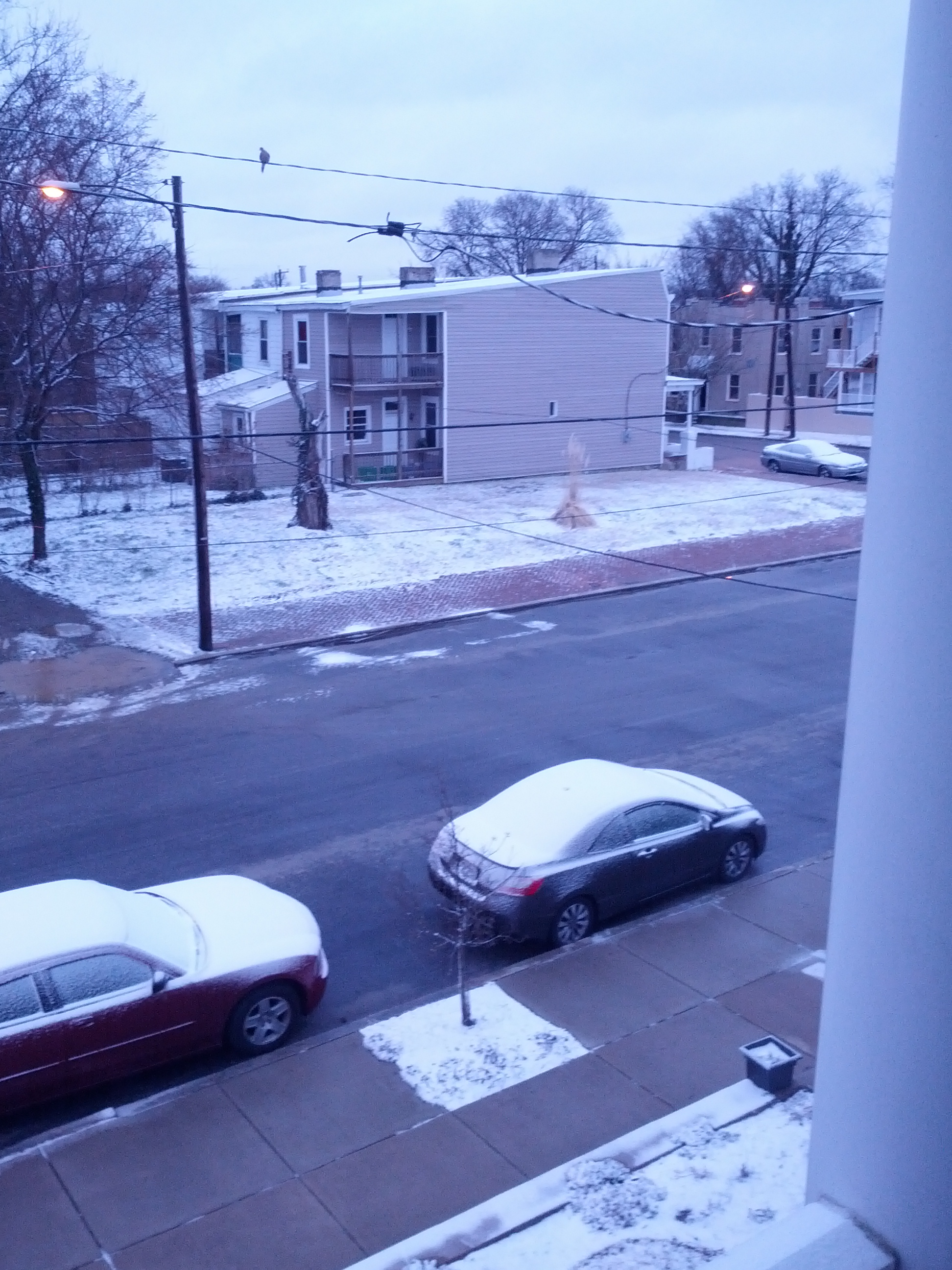
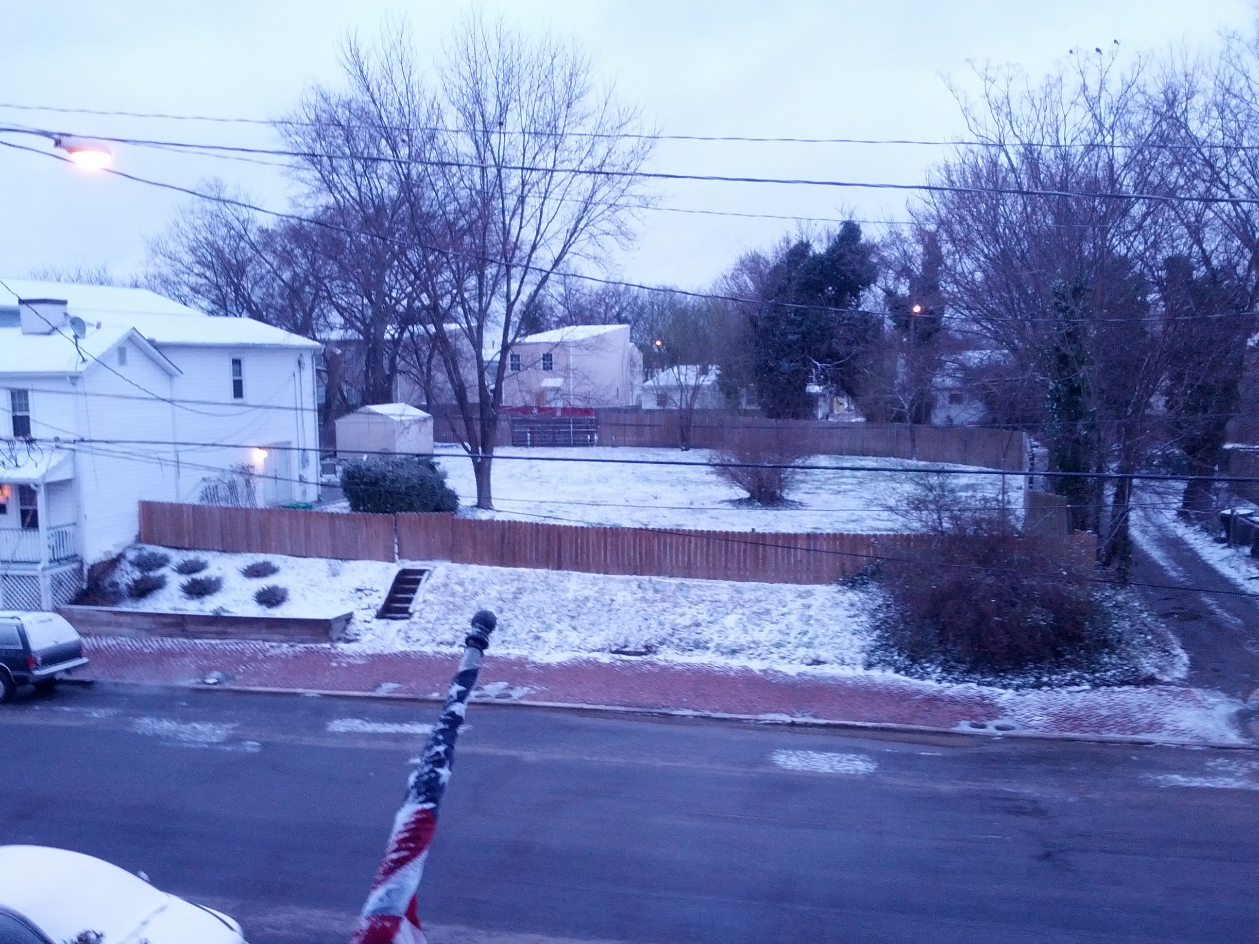
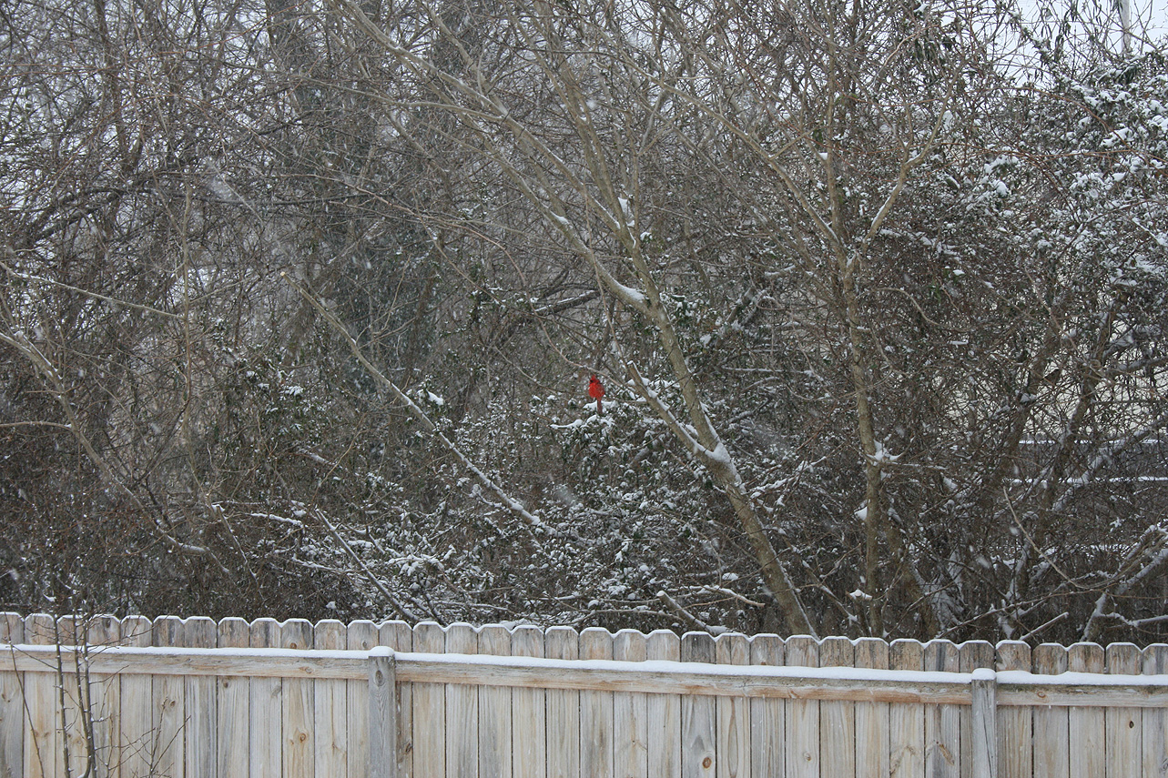
Snowfall Totals:
Photos:
NWS Forecast, Day of Event:
More information to follow.
Church Hill Storm Observation Summary:
* Place – Time: Church Hill, (3/7/2014)
* Temperature: 32-33, During Event
* Winter Weather Watch/Warning/Advisory: Advisory
* Closings: None
* Road Conditions: All roads were wet during the event.
* Precipitation Description: Sleet, transitioned to freezing rain and then rain by 8 AM. Sleet began around 4:00 AM and quickly turned over to a mix of sleet and freezing rain by 7 AM.
* Total Precipitation: Less than 0.1″ of ice accumulation. Freezing rain accumulated on elevated surfaces.
* Comments: A low coming out of the Gulf of Mexico tracked up the east coast, delivering a severe snow and ice storm to western North Carolina and southwest Virginia. Impacts from ice to the Richmond area were minimal from this storm.

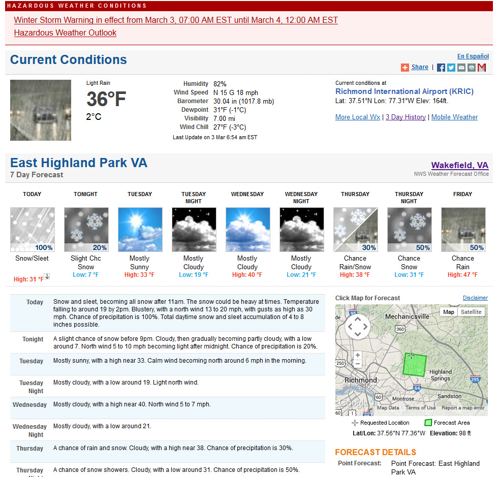
Church Hill Storm Observation Summary:
* Place – Time: Church Hill, (3/3/2014)
* Temperature: 24-36, During Event
* Winter Weather Watch/Warning/Advisory: Warning
* Closings: Chesterfield Government Closed on 3/3/14 at 10:30 AM, Delayed opening on 3/4/14 for 10:30 AM.
* Road Conditions: All roads covered during event.
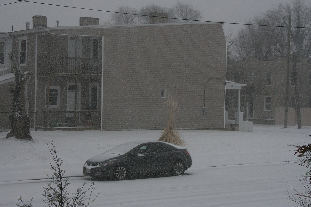
* Precipitation Description: Snow, sleet, and rain. Rain and sleet began around 6:30 AM and quickly turned over to all sleet by 7 AM. Snow began to mix in with the sleet by 8 AM. All snow by 9 AM where heavy snow fell for almost 2 hours. Snow tapered off by noon as a large dry slot infiltrated the area. Flurries and light snow continued until 4 PM with no real additional accumulation.
* Total Precipitation: 3.1″. Approximately 0.1″ of sleet. 3.0″ inches of snow was reported at the airport on 3/3/14. Snowfall totals were fairly consistent across central Virginia with totals between 2-5″.
* Comments: Initial forecast for the storm shifted the axis of snow from the Midwest/upper mid-Atlantic to central Virginia on Saturday (3/1). Snow was expected to develop along a backdoor cold front that would create a cold air damning wedge. Afternoon high temperatures reached 72 on Sunday in Richmond, with the temperature plummeting to 11 on March 4th. Sleet, moderate to heavy at times, quickly transitioned to heavy snow. The dry slot quickly stopped the snow by midday, making the higher forecast totals of 7-8″ unattainable. Even higher forecasts of 8-12″ towards Fredericksburg busted due to this dry slot. The sun peaked out briefly before the sun set on 3/3/2014.
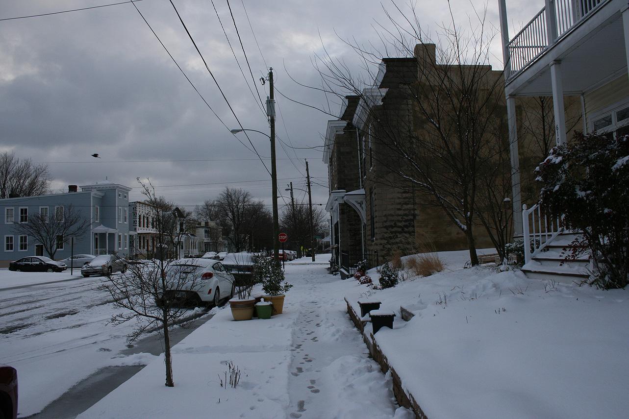
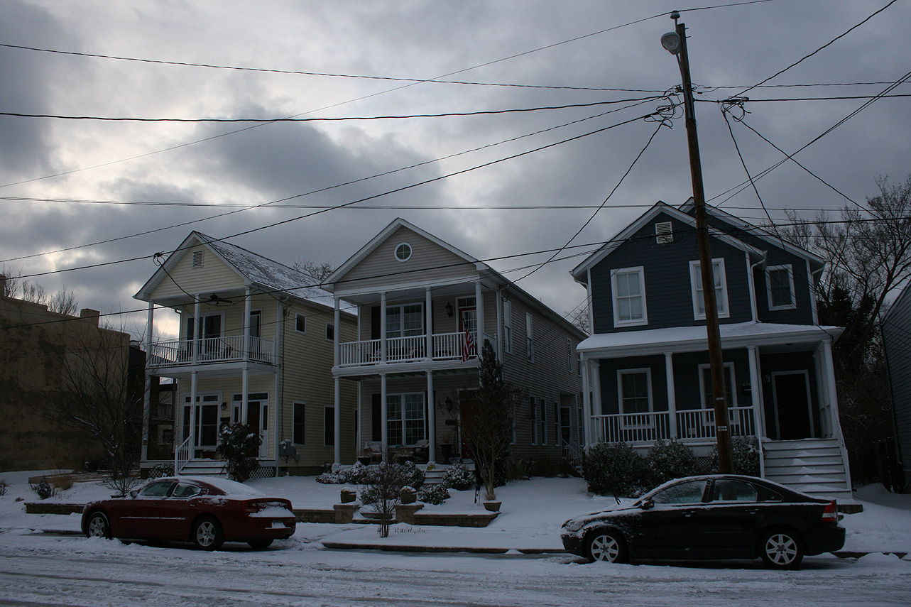
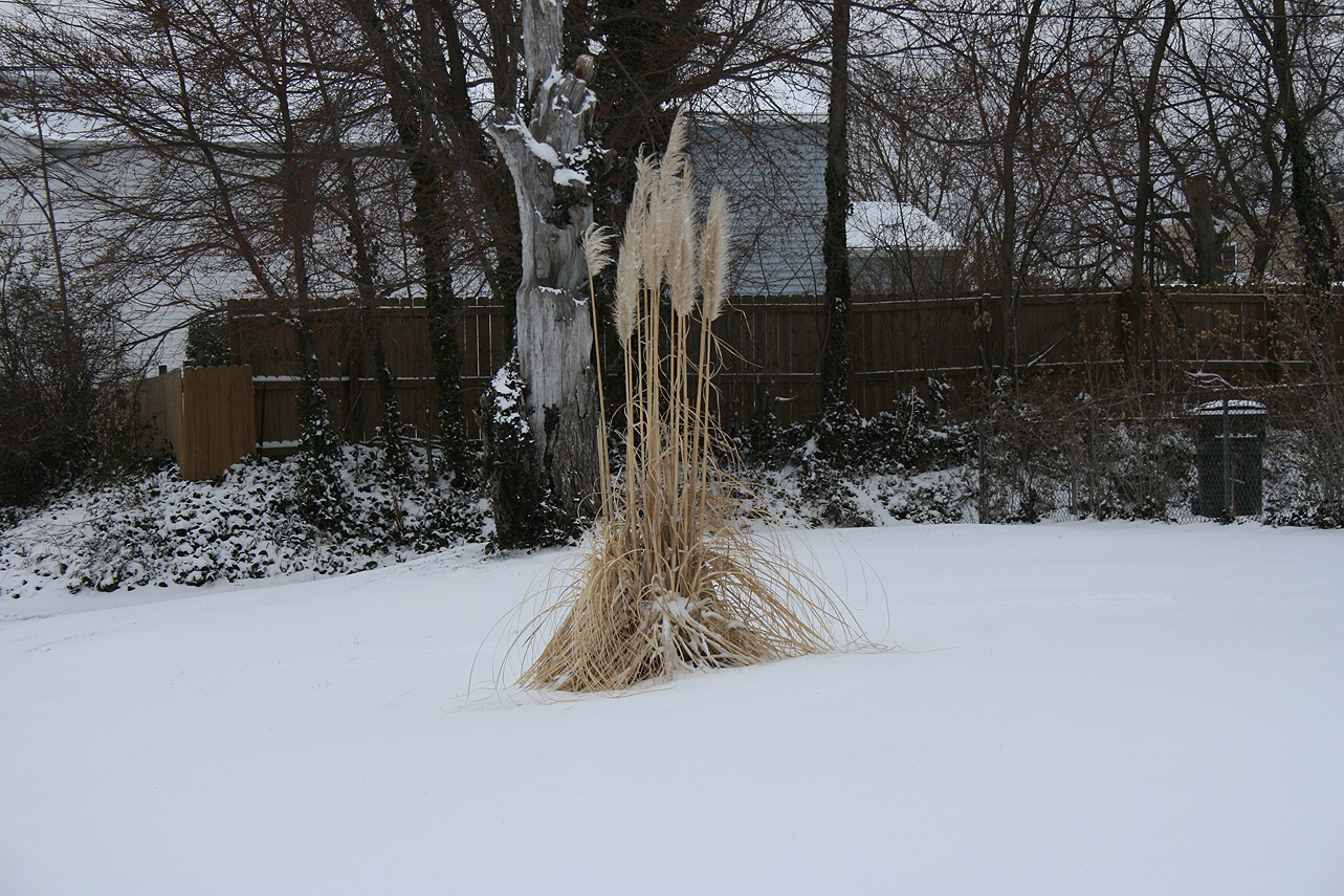
Snowfall Totals:
Photos:

Videos:
NWS Forecast, Day of Event:
A major winter storm is shaping up for the Ohio Valley and Northeast that will come through Central Virginia on Sunday into Monday. Trends now indicate that Richmond could even see some significant snowfall, per the NWS forecast this morning:

HAZARDOUS WEATHER OUTLOOK
NATIONAL WEATHER SERVICE WAKEFIELD VA
434 AM EST SAT MAR 1 2014

MDZ021>025-VAZ048-049-060>064-066>078-080>086-090-091-099-100-020945-
DORCHESTER-WICOMICO-SOMERSET-INLAND WORCESTER-MARYLAND BEACHES-
FLUVANNA-LOUISA-PRINCE EDWARD-CUMBERLAND-GOOCHLAND-HANOVER-CAROLINE-
LUNENBURG-NOTTOWAY-AMELIA-POWHATAN-CHESTERFIELD-HENRICO-KING WILLIAM-
KING AND QUEEN-ESSEX-WESTMORELAND-RICHMOND-NORTHUMBERLAND-LANCASTER-
DINWIDDIE-PRINCE GEORGE-CHARLES CITY-NEW KENT-GLOUCESTER-MIDDLESEX-
MATHEWS-JAMES CITY-YORK-ACCOMACK-NORTHAMPTON VA-
434 AM EST SAT MAR 1 2014

THIS HAZARDOUS WEATHER OUTLOOK IS FOR THE LOWER EASTERN SHORE OF
MARYLAND...CENTRAL VIRGINIA...EAST CENTRAL VIRGINIA...SOUTH CENTRAL
VIRGINIA...THE EASTERN SHORE OF VIRGINIA...THE MIDDLE PENINSULA OF
VIRGINIA...THE NORTHERN NECK OF VIRGINIA...THE PENINSULA OF
SOUTHEAST VIRGINIA AND THE PIEDMONT OF CENTRAL VIRGINIA.

.DAY ONE...TODAY AND TONIGHT.

HAZARDOUS WEATHER IS NOT EXPECTED AT THIS TIME.

.DAYS TWO THROUGH SEVEN...SUNDAY THROUGH FRIDAY.

A POTENT WINTER STORM SYSTEM WILL AFFECT THE REGION ON MONDAY.
SIGNIFICANT ACCUMULATIONS OF SNOW AND SLEET WILL BE POSSIBLE
DURING THE DAY MONDAY...BEFORE THE PRECIPITATION COMES TO AN END
MONDAY EVENING.

.SPOTTER INFORMATION STATEMENT...

SPOTTER ACTIVATION IS NOT EXPECTED AT THIS TIME.
Event Updates:
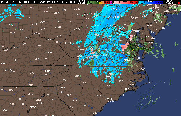
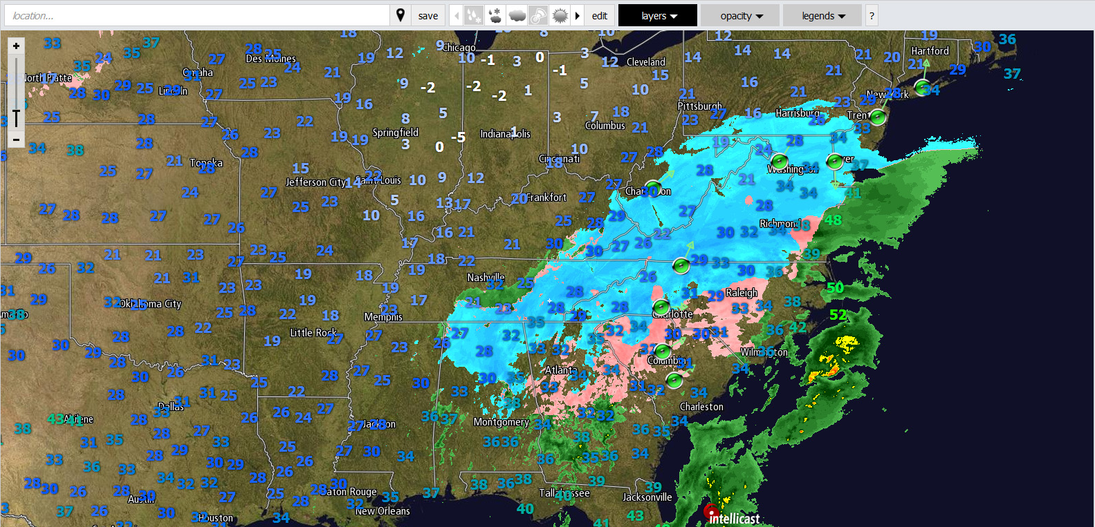
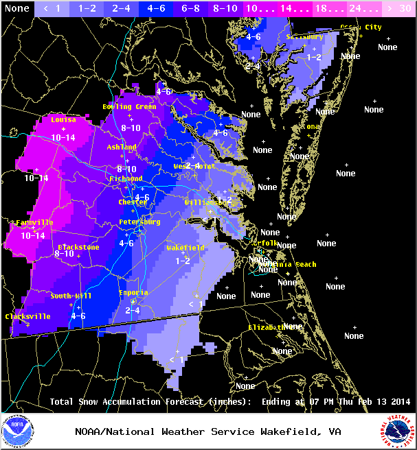
As of 3:30 PM on 2/13, there is approximately 1.5″ of snow/sleet on the majority of surfaces in Church Hill. Temperature continues to slowly fall and is hovering at 34 degrees Fahrenheit. Rain has changed to sleet and now snow.
Church Hill Storm Observation Summary:
* Place – Time: Church Hill, (2/13/2014)
* Temperature: 25-37, During Event
* Winter Weather Watch/Warning/Advisory: Warning
* Closings: Chesterfield Government Closed on 2/13/14
* Road Conditions: All roads covered during event, primary roads cleared by the morning of 2/13. However, secondary roads were still partially snow covered.
* Precipitation Description: Snow, sleet, freezing rain and rain. Initial snow was very fine and powdery snowflakes. Event transitioned from snow to sleet near 11 PM on 2/12. Sleet changed to freezing rain by 1:00 AM on 2/13/14. Rain and Drizzle followed during the early morning hours until 2 PM on 2/13/14. Sleet and the sleet to snow transitioned back into Richmond by 3:30 PM.
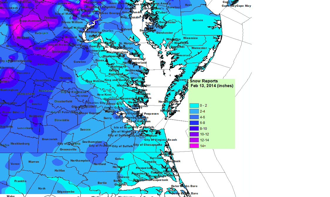
* Total Precipitation: 5.75″ (4.25” of snow on 2/12, 1.5″ of snow on 2/13). Approximately 0.25″ of sleet. Minor accumulations of freezing rain. 3.7″ inches of snow was reported at the airport on 2/12, 2.1″ inches of snow was reported at the airport on 2/12 for a total of 5.8″. Snowfall totals were heavier towards the peidmont and mountains in western Virginia (6-21” was common).
* Comments: Snow began near 4 PM at the Chesterfield Courthouse on 2/12/14. Nearly .75″ had accumulated by 5:30 PM when I left work. My commute home took nearly an hour, which is about twice as long as it normally takes. Heavy snow occurred for about an hour between 9-10 PM when about an inch of snow fell. The precipitation quickly transitioned to sleet. Freezing rain then set in late in the evening after I went to bed. As the storm wrapped up on 2/13, drizzle changed to a brief round of heavy sleet and rain with two loud rumbles of thunder. An hour later, the second round of precipatation hit with moderate to heavy snowfall. The snow tapered off by 7 PM dropping another 1.5″ of snow.
Snowfall Totals:
Videos:
NWS Special Weather Statement:
Special Weather Statement
SPECIAL WEATHER STATEMENT
NATIONAL WEATHER SERVICE WAKEFIELD VA
358 PM EST THU FEB 13 2014

VAZ063-070>072-080>083-132230-
HANOVER-CHESTERFIELD-HENRICO-KING WILLIAM-DINWIDDIE-PRINCE GEORGE-
CHARLES CITY-NEW KENT-
INCLUDING THE CITIES OF...ASHLAND...COLONIAL HEIGHTS...RICHMOND...
PETERSBURG...HOPEWELL
358 PM EST THU FEB 13 2014

...A BAND OF MODERATE TO HEAVY SNOW TO MOVE ACROSS THE INTERSTATE 95
CORRIDOR THROUGH 530 PM...

A BAND OF MODERATE TO HEAVY SNOW WILL MOVE ACROSS THE INTERSTATE
95 CORRIDOR FROM THE TRI-CITIES TO RICHMOND THRU 530 PM. THE SNOW
WILL COME DOWN HARD ENOUGH TO REDUCE THE VISIBILITY TO AROUND ONE
QUARTER MILE AND QUICKLY COVER ROAD SURFACES. A COATING TO UP TO ONE
INCH OF SNOW IS POSSIBLE WITH THIS BAND OF SNOW. MOTORISTS SHOULD
USE CAUTION AND SLOW DOWN IF TRAVELING LATE THIS AFTERNOON. BE
PREPARED FOR POOR VISIBILITIES AND SLIPPERY ROAD CONDITIONS.

$$

JM
Late evening update on the latest snowfall forecast from the NWS and their text on the Winter Storm Warning:
Winter Storm Warning Text:
URGENT - WINTER WEATHER MESSAGE
NATIONAL WEATHER SERVICE WAKEFIELD VA
551 PM EST TUE FEB 11 2014

VAZ065-066-070-071-079-080-121200-
/O.CON.KAKQ.WS.W.0003.140212T1800Z-140214T0000Z/
MECKLENBURG-LUNENBURG-CHESTERFIELD-HENRICO-BRUNSWICK-DINWIDDIE-
INCLUDING THE CITIES OF...SOUTH HILL...COLONIAL HEIGHTS...
RICHMOND...LAWRENCEVILLE
551 PM EST TUE FEB 11 2014

...WINTER STORM WARNING REMAINS IN EFFECT FROM 1 PM WEDNESDAY TO
7 PM EST THURSDAY...

A WINTER STORM WARNING REMAINS IN EFFECT FROM 1 PM WEDNESDAY TO
7 PM EST THURSDAY.

* LOCATIONS...PORTIONS OF CENTRAL VIRGINIA.

* TIMING...WEDNESDAY AFTERNOON THROUGH THURSDAY EVENING.

* HAZARDS...SNOW AND SLEET...POSSIBLY MIXED WITH FREEZING RAIN
  OVER SOUTHERN SECTIONS. A CHANGEOVER TO PLAIN RAIN IS POSSIBLE
  FOR A BRIEF PERIOD ALONG THE INTERSTATE 95 CORRIDOR EARLY
  THURSDAY.

* ACCUMULATIONS...SNOW ACCUMULATIONS OF 4 TO 8 INCHES...WITH THE
  HEAVIEST ACCUMULATIONS EXPECTED WEST OF INTERSTATE 95. A TRACE
  TO A TENTH OF AN INCH OF ICE ACCUMULATION IS ALSO POSSIBLE.

* IMPACTS...SNOW AND ICE CAN LEAD TO SLICK AND HAZARDOUS TRAVEL
  CONDITIONS AS IT ACCUMULATES ON ROADWAYS. THE SNOW IS EXPECTED
  TO BE HEAVY AND WET...AND MAY WEIGH DOWN ON TREE LIMBS AND
  POWER LINES. SPORADIC POWER OUTAGES ARE POSSIBLE.

PRECAUTIONARY/PREPAREDNESS ACTIONS...

A WINTER STORM WARNING MEANS SIGNIFICANT AMOUNTS OF SNOW...
SLEET...AND ICE ARE EXPECTED OR OCCURRING. STRONG WINDS ARE ALSO
POSSIBLE.  THIS WILL MAKE TRAVEL VERY HAZARDOUS OR IMPOSSIBLE.

&&

$$
NWS Forecast Discussion:
.SHORT TERM /6 PM THIS EVENING THROUGH SUNDAY/…
THE NEXT IN THE SERIES OF SHORTWAVES ALOFT APPROACHES FM THE WSW
TNGT…THEN TRACKS ACRS THE FA ON SAT. MDL TRENDS CONT TO SUGGEST
THAT THERE WILL BE A HI PROB FOR PCPN…BEGINNING LT TNGT W…AND
ACRS MUCH OF THE FA ON SAT. WK SFC LO PRES ONCE AGN PASSES BY WELL
S OF THE RGN ON SAT…WHILE SHEARED OUT S/W ALOFT CROSSES THE
NRN/CNTRL PORTION OF THE FA. WILL CONT W/ IDEA OF POPS FM HI CHC
TO LIKELY…W/ HIGHEST QPF ACRS SE VA/NE NC. P-TYPE WILL BE
CHALLENGING…AS BOUNDARY LAYER WILL BE NR/ABV 32F EXCEPT OVER
THE INTERIOR (EARLY) IN THE AM HRS. WILL HAVE MNLY RA FOR SE VA/NE
NC…W/ MIXED P-TYPE IN A NARROW RIBBON (FM ENE TO WSW) IN BETWEEN
THAT RA…AND A PD OF SN ACRS NRN SECTIONS OF THE FA. PCPN
COVERAGE XPCD TO DECREASE DURG SAT AFTN/EVE. SN ACCUMS ATTM (MNLY
ALG-NW OF A FVX TO SBY LN) LIMITED TO AN INCH OR LESS. OTRW…MNLY
CLDY FOR THE DAY…HI TEMPS FM THE U30S ACRS THE N…TO THE M40S
S.
No sleet or freezing rain was observed with this event. A batch of light rain moved though the area during the morning hours.