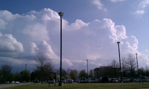
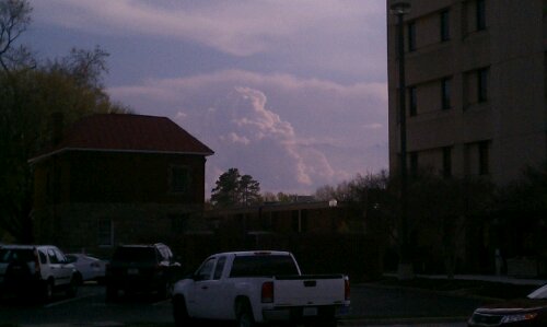
Looking south from the Chesterfield Courthouse.
Looking south from the Chesterfield Courthouse.
A period of light to moderate snow rolled through Central Virginia this morning giving most of the area a light dusting of snow. Areas located north of Midlothian typically saw 1/2″ to as much as 2″ of snow. Areas further north and east of town (Caroline & King William Counties) had reports of 4-6″ of snow. The main batch of snow tapered off around 8:30 AM and mixed with rain and snow showers for the rest of the day. After the initial burst of snow this morning, most of the accumulating snow melted by noon. Not an unusual event given that it is now March.

My Report (Church Hill):
* Place – Time: Church Hill, 10:44 AM (3/5/2012) *After the Event Update*
* Temperature: 33-34, During Storm Event
* Dewpoint: 30-32, During Storm Event
* Relative Humidity: 95%
* Pressure: N/A
* Trends: N/A
*Winter Weather Watch/Warning/Advisory: Advisory
* Road Conditions: Roads were all passable, no accumulation on primary or secondary roads.
* Precipitation Description: Light, moderate snow fell throughout the event. As snow tapered off, snow changed to drizzle and temperature rose considerably.
* Total Precip: 1.0″ of snow on elevated/grassy surfaces. Liquid Equivalent of 0.1″ fell during the event in Church Hill.
* Comments: Event was spurred by a Canadian clipper that dove down the Illinois and Kentucky and moved through Central Virginia. Precipitation started at 6:30 AM as light snow. The precipitation fell as light to occasionally moderate snow until about 8:30 AM. Snow covered all elevated surfaces. Dry slot as well as warmer air moved in by 9:00 AM. School systems closed in Chesterfield, Henrico & Richmond. No trace of snow at Chesterfield Courthouse by 11 AM. Rain and snow showers continued in the area until 6 PM.
Link to Gallery Images: http://www.612.richmondcitywatch.com/modules/gallery2/main.php?g2_itemId=2826
It looks like a potent clipper system diving through the upper midwest will be arriving in Central Virginia by 5 AM.The forecast is for around 1-3″ of snow. It’ll be interesting to see how much accumulation we get on Monday morning!


URGENT - WINTER WEATHER MESSAGE
NATIONAL WEATHER SERVICE WAKEFIELD VA
1029 PM EST SUN MAR 4 2012

NCZ012-VAZ060-061-065>071-079>081-087-088-092-051130-
/O.CON.KAKQ.WW.Y.0004.120305T0900Z-120305T1700Z/
NORTHAMPTON NC-PRINCE EDWARD-CUMBERLAND-MECKLENBURG-LUNENBURG-
NOTTOWAY-AMELIA-POWHATAN-CHESTERFIELD-HENRICO-BRUNSWICK-DINWIDDIE-
PRINCE GEORGE-GREENSVILLE-SUSSEX-SOUTHAMPTON-
INCLUDING THE CITIES OF...MARGARETTSVILLE...FARMVILLE...
SOUTH HILL...CREWE...COLONIAL HEIGHTS...RICHMOND...
LAWRENCEVILLE...PETERSBURG...HOPEWELL...EMPORIA...WAKEFIELD...
FRANKLIN
1029 PM EST SUN MAR 4 2012

...WINTER WEATHER ADVISORY REMAINS IN EFFECT FROM 4 AM TO NOON
EST MONDAY...

A WINTER WEATHER ADVISORY REMAINS IN EFFECT FROM 4 AM TO NOON EST
MONDAY.

* AREAS AFFECTED: THE EAST CENTRAL VIRGINIA PIEDMONT THROUGH
  SOUTH CENTRAL VIRGINIA AND NORTHAMPTON COUNTY NORTH CAROLINA.

* HAZARDS: SNOW

* ACCUMULATIONS: PRIMARILY 1 TO 2 INCHES...WITH ISOLATED AMOUNTS
  UP TO 3 INCHES IN THE SOUTH CENTRAL VIRGINIA PIEDMONT.

* TIMING: EARLY MONDAY MORNING...INCLUDING RUSH HOUR AND THROUGH
  MIDDAY.

* IMPACTS: SNOW SHOULD MAINLY ACCUMULATE ON NON-PAVED AND ELEVATED
  SURFACES SUCH AS BRIDGES AND OVERPASSES.

PRECAUTIONARY/PREPAREDNESS ACTIONS...

A WINTER WEATHER ADVISORY FOR SNOW MEANS THAT PERIODS OF SNOW
WILL CAUSE PRIMARILY TRAVEL DIFFICULTIES. BE PREPARED FOR SNOW
COVERED ROADS AND LIMITED VISIBILITY...AND USE CAUTION WHILE
DRIVING.