Official observation post for this weekend event.
12/11 – 6:30PM (23:30 UTC)
– Temp: 36.5* ↓
– RH: 89%, DP: 34* ↓
– Precip: 0.09″ ↑
– Pressure: 1018.6mb ↓
– Wx: Lt Rain ↔
– Wind: N 0-1 mph ↔
Official observation post for this weekend event.
12/11 – 6:30PM (23:30 UTC)
– Temp: 36.5* ↓
– RH: 89%, DP: 34* ↓
– Precip: 0.09″ ↑
– Pressure: 1018.6mb ↓
– Wx: Lt Rain ↔
– Wind: N 0-1 mph ↔
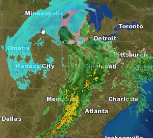
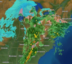
Well, this weekend’s system looks more and more like an all rain event for us here in the Richmond Metro area. Temperatures will remain in the low to mid 40’s and may warm up a bit more before some precipitation moves in some time after 1pm Saturday. This light rain will come up from the south, and is not from the main rain event.

This rain will bring showers to the area and become a steady light rain from 8pm until around 4 or 5am Sunday morning. The rain will become more steady and continue through the day Sunday until about 7 or 8pm.
A rapid drop in temperature will occur, dropping from about 47* at about 6pm Sunday, to around 26* by 6am Monday morning. Black ice will be an issue for early travelers.
There is still a slight chance of wraparound moisture from the system bringing a few flakes to the area. At most, a light dusting could occur for us here, while places east of I-95 may see slightly more.
Total rain amounts should vary between 0.5″ to 0.75″ in most places, with a few places see locally around 1.00″.
Read for real time updates during the event and for any changes in the forecast.
Next up: Next week’s big arctic blast and another storm? Could the timing be right for these to come together to bring Richmond Metro some snow and ice? Read later for more on this.
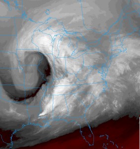
Cool WV Sat image of the storm. Classic coma shaped, with the front right behind that bright white band from LA to MI

Part 2
Well, the main storm hasn’t even arrived yet, but managed about 0.22″ of rain so far. The main wave will move in around late morning, and the rain will last through the early evening hours. Temperatures will remain well above freezing, getting into the low 40’s. As the system moves out, temperatures will drop as the cold front sweeps by. There may be enough moisture late evening to squeeze out a few flakes or a snow shower. These will mainly be hit-or-miss for Metro Richmond.
Storm Total Rain: 0.65″
Snow: Trace-0.25″
High Sunday: 46* dropping into the upper 20’s by early Monday AM

While on the way over to my brother’s house, a small rain/snow shower developed yesterday evening. I saw only rain coming from the clouds, but my brother saw rain and snow mix at this house for a few minutes. The event actually made the ground wet at his house. After it ended, the clouds parted and it became a mostly clear evening. None of the local meteorologists were calling for any precipitation yesterday evening.
The bigger news story is the Alberta clipper set to hit the area this evening into tonight. The forecast is as follows from NOAA:
_________________________
Today: A chance of sprinkles and flurries after 4pm. Increasing clouds, with a high near 42. Northwest wind between 6 and 8 mph.
Tonight: A chance of sprinkles and flurries before 7pm, then a chance of snow between 7pm and 4am. Mostly cloudy, with a low around 28. Calm wind becoming northwest around 6 mph. Chance of precipitation is 50%. New snow accumulation of less than a half inch possible.
_________________________
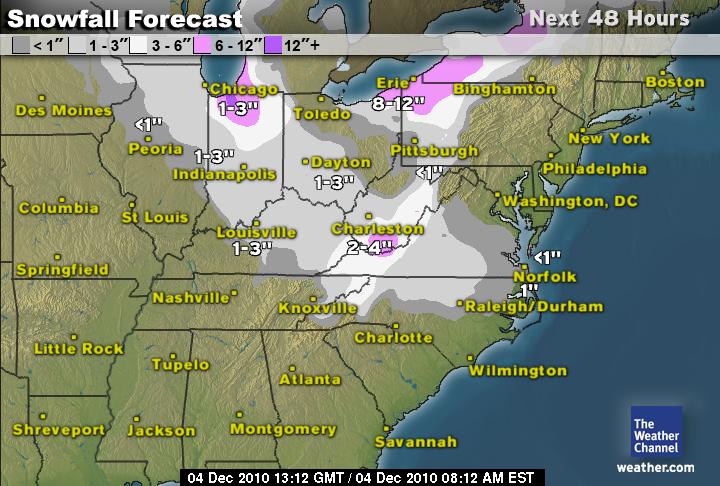
Snowfall Forecast from TWC:
