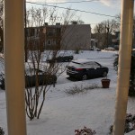
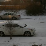
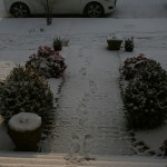
No initial sleet on 11/26 or snow (on 11/27) was seen in either Church Hill or the Chesterfield Courthouse.
Category Archives: Observation
November 12, 2013: Observations
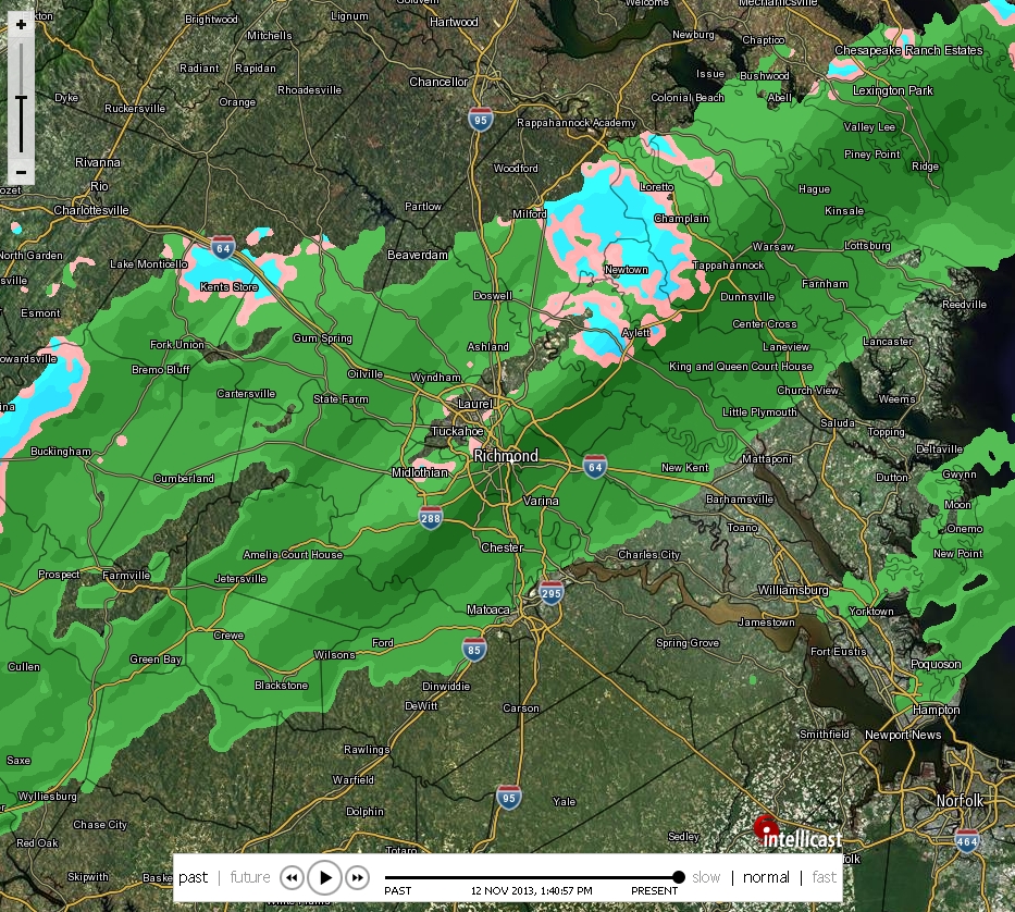
* Place – Time: Chesterfield Government Complex, 3:00 PM (11/12/2013)
* Temperature: 40-41, During Event
* Dewpoint: 29-30, During Event
* Relative Humidity: N/A%
* Pressure: N/A
* Trends: N/A
*Winter Weather Watch/Warning/Advisory: N/A
* Road Conditions: All roads remained passable, no accumulation.
* Precipitation Description: Light rain and snow showers persisted on and off during the afternoon hours.
* Total Precipitation: Trace of snow. Liquid equivalent of 0.0” fell during the event.
* Comments: A rain/snow mix started shortly after 1:15 PM. The snow persisted for about 20 minutes. Precipitation ended around 2 PM. No accumulation of snow was observed due to high air and ground temperatures. This was the first snow event of the 2013-2014 winter season.
Hurricane Sandy: Richmond Impacts

Hurricane Sandy blew to the east and north of Richmond before becoming a hybrid storm slamming into the New Jersey Coast on October.
My observations of the storm were pretty tame. In Church Hill, we encountered mostly light to moderate rain with sustained winds around 5-15 MPH. Wind gusts approaching 25-35 MPH were infrequent. Recorded rainfall at my house was 2.25″.

Below is a collection of photos I saved from the event.
Additional Information on Sandy and it’s impacts to the Wakefield Weather Office
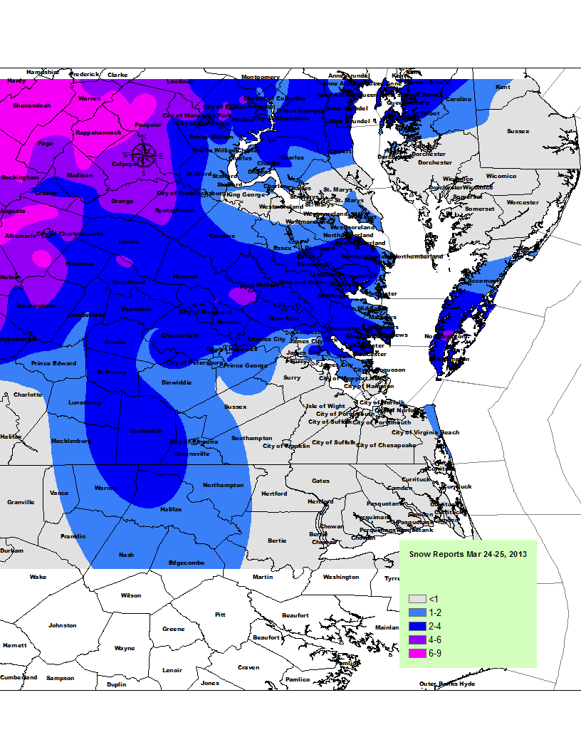
March 24, 2013: Forecast for Rain & Sleet to Snow
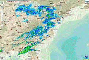
This storm was a pleasant early spring surprise since it was totally unexpected for me. I arrived back from a Hawaiian cruise on the March 24th. Josh and I had to drive from Dulles back to Richmond. As we approached Richmond on I-95, the steady rain turned to snow. The snow came down incredibly fast. Unfortunately, I forgot to do an official forecast and observation post for this event, but did take a measurement of 3.75″ at the end of the event. I’ve posted some videos below of the event as well as the NWS graphic depicting area totals.
March 6, 2013: Observation
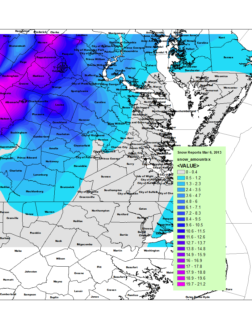
* Place – Time: Church Hill, 11:00 AM (3/7/2013) *After the Event Update*
* Temperature: 33-37, During Storm Event
* Dewpoint: 33-36, During Storm Event
* Relative Humidity: 100%
* Pressure: N/A
* Trends: N/A
*Winter Weather Watch/Warning/Advisory: Advisory
* Road Conditions: All roads had snow cover during the event. The morning after the event, secondary roads remained mostly clear in the city and south and eastern portions of the metro area. All major roads passable.
* Precipitation Description: Light, moderate and sometimes brief periods of heavy snow fell throughout the event.
* Total Precipitation: 1.5″ of snow (unconfirmed due to wet snow ratios and quick melting by the time I got home (1 PM), will use airport’s measurement in lieu of any actual measurements in Church Hill). Liquid Equivalent of 2.25″ fell during the event at my house. Liquid Equivalent of 2.1″ fell during the event at the airport.
* Comments: A rain/snow mix started shortly after 8 AM. The precipitation fell as a moderate rain/snow mix through most of my commute to work. By the time I reached the Courthouse area of Chesterfield, snow was quickly accumulating on all surfaces, even the roadways. Snow was wet and heavy, flakes were incredibly large as well. Reports of thunder snow were reported throughout the metro area in the morning. Snow remained heavy until 9:30 AM and became moderate to light in intensity for the rest of the morning. Snow and rain/snow mix occurred throughout the rest of the morning and afternoon hours. Accumulation of snow essentially stopped around 10 AM as temperatures climbed to 37 and snow began melting. Precipitation was spurred by an upper level low that transferred to a surface low on the Virginia/NC border. The NWS was forecasting little in the way of snow for the metro area and scrambled early in the morning with Winter Storm Warnings and Advisories for the region. Areas in western Chesterfield and Henrico saw upwards of 5” of snow from the event. Areas east and south of town saw much less. The airport reported 1.5” of snow.
February 22, 2013: Observations
Not much to report on this event, but there was a brief period of sleet and freezing rain on the morning of February 22nd:
Church Hill/Drive to Saint Francis in Chesterfield County: Very minor accumulations on raised surfaces. Mixed precipitation began around 7 AM and quickly changed over to rain by 8:45 AM.
January 25, 2013: Observations


My Report (Church Hill):
* Place – Time: Church Hill, 11:00 AM (2/3/2013) *After the Event Update*
* Temperature: N/A
* Dewpoint: N/A
* Relative Humidity: 100%
* Pressure: N/A
* Trends: N/A
*Winter Weather Watch/Warning/Advisory: Advisory
* Road Conditions: All roads had snow cover during the event. Both secondary and major roads had snow cover on them during and after the event.
* Precipitation Description: Light and moderate snow fell throughout the event.
* Total Precip: 1.25″ of snow. Liquid Equivalent of 0.11″ fell during the event at my home.
* Comments: Snow began around 1 PM on the 25th. The precipitation fell as light to occasionally moderate snow throughout the afternoon hours. The snow began to taper off by 5:30 PM. Snow was very dry and fluffy. The airport reported 1.4” of snow.
January 24, 2013: Observations
This ended up being a fairly minor event with approximately 0.2″ of snow accumulation.
My Report (Church Hill):
* Place – Time: Church Hill, 11:00 AM (2/3/2013) *After the Event Update*
* Temperature: N/A
* Dewpoint: N/A
* Relative Humidity: N/A
* Pressure: N/A
* Trends: N/A
*Winter Weather Watch/Warning/Advisory: None
* Road Conditions: All roads had snow cover during the event. The morning after the event, secondary roads remained covered. Most major roads cleared.
* Precipitation Description: Light snow fell throughout the event.
* Total Precip: 0.2″ of snow. Liquid Equivalent of a trace fell during the event at the airport.
* Comments: Snow started shortly after midnight on the 24th. The precipitation fell as light to occasionally moderate snow throughout the early morning hours. The airport reported 0.2” of snow.
January 5, 2013: First Winter Weather Precipitation
At about 11 PM on January 5th, a small batch of sleet and rain mix fell on Metro Richmond. No accumulation of sleet occurred. However, this was the first appearance of winter weather in the 2012-2013 winter season.
June 1, 2012: Forecast & Observations
Storm threat looms for the evening hours over the mid-atlantic:


MESOSCALE DISCUSSION 1004
NWS STORM PREDICTION CENTER NORMAN OK
1203 PM CDT FRI JUN 01 2012
AREAS AFFECTED…NC…VA…WV…MD…DC…PA
CONCERNING…SEVERE POTENTIAL…TORNADO WATCH LIKELY
VALID 011703Z – 011830Z
PROBABILITY OF WATCH ISSUANCE…80 PERCENT
SUMMARY…THUNDERSTORMS WILL INCREASE THROUGH THE AFTERNOON IN A
VERY MOIST AND INCREASINGLY UNSTABLE AIRMASS FROM NC NWD ACROSS
VA…SRN PA…WV PNHDL…AND MD/DC AREA. RECENT TRENDS SUGGEST THAT
ISOLATED STORMS WILL FIRST POSE A THREAT FOR ISOLATED SEVERE WEATHER
IN THE FORM OF HAIL/WIND OVER PARTS OF NERN NC AND SERN VA WHERE
INSTABILITY IS GREATEST BUT SHEAR AND FORCING WILL REMAIN LIMITED
FOR A TIME. ADDITIONAL SEVERE STORMS ARE LIKELY AS A FORCED SQUALL
LINE DEVELOPS EAST OF THE APPALACHIANS LATER THIS AFTERNOON. DEEP
SHEAR AND TORNADO POTENTIAL MAY INCREASE ACROSS THE ENTIRE REGION
FROM LATE AFTERNOON INTO EVENING AND ONE OR MORE TORNADO WATCHES
WILL LIKELY BE ISSUED OVER THE NEXT 1-2 HOURS.
DISCUSSION…STRONG FORCED ASCENT WITH A LARGE SCALE TROUGH WAS
LIKELY RESULTING IN AN INCREASE IN LOW-TOPPED CONVECTION ALONG A
COLD FRONT NOW SITUATED FROM ERN OH SWD ACROSS WV…EXTREME SWRN VA
AND ERN TN. EXPECT THAT THIS CONVECTION WILL CROSS THE SPINE OF THE
APPALACHIANS OVER THE NEXT 2 HOURS. AS THIS FORCING BEGINS TO
INTERACT WITH GREATER INSTABILITY EAST OF THE MOUNTAINS…MORE
VIGOROUS STORM DEVELOPMENT IN THE FORM OF BOWING/LEWPING SEGMENTS
CAN BE EXPECTED. A WEAK FRONTAL WAVE MAY ALSO TAKE FORM WITH TIME
COINCIDENT WITH AN INCREASE IN STORMS ALONG A WARM FRONT EXTENDING
ACROSS SRN PA AND INTO THE DELMARVA REGION. IN ADDITION TO WIND
DAMAGE THREAT WITH STORMS ALONG THE ADVANCING FRONT…AN ENHANCED
BUT FOCUSED TORNADO THREAT MAY EVOLVE NEAR THE FRONTAL WAVE AND WARM
FRONT. ONE TORNADO WATCH WILL LIKELY BE NEEDED FROM SRN PA ACROSS
WRN VA WITHIN THE NEXT HOUR OR SO.
ANOTHER WATCH WILL LIKELY BE NEEDED FROM THE ONGOING STORMS OVER NRN
NC NWD ACROSS THE VA TIDEWATER AREA. STORMS IN THIS AREA ARE
DEVELOPING WITH HEATING OF THE DAY AND PERHAPS THE LARGER SCALE
ASCENT DEVELOPING EAST WITH THE TROUGH. WHILE INSTABILITY IS GREATER
IN THIS CORRIDOR…DEEP SHEAR AND FORCING ARE LIKELY MORE MARGINAL
TO SUPPORT A MORE WIDESPREAD IMMEDIATE THREAT OF SEVERE TSTMS
WIND/TORNADOES. NONETHELESS…SHEAR WILL LIKELY INCREASE
SUFFICIENTLY WITH TIME ACROSS THIS AREA TO WARRANT A TORNADO WATCH
AND THIS WATCH WILL LIKELY BE COORDINATED SHORTLY.