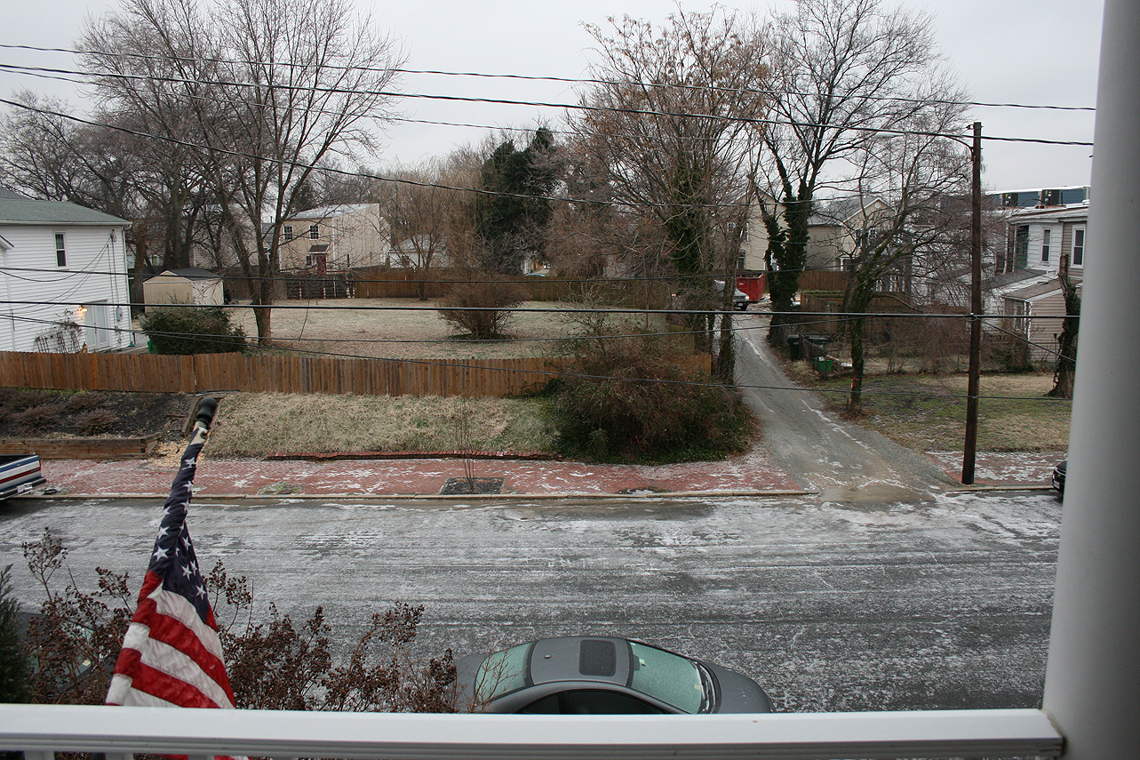
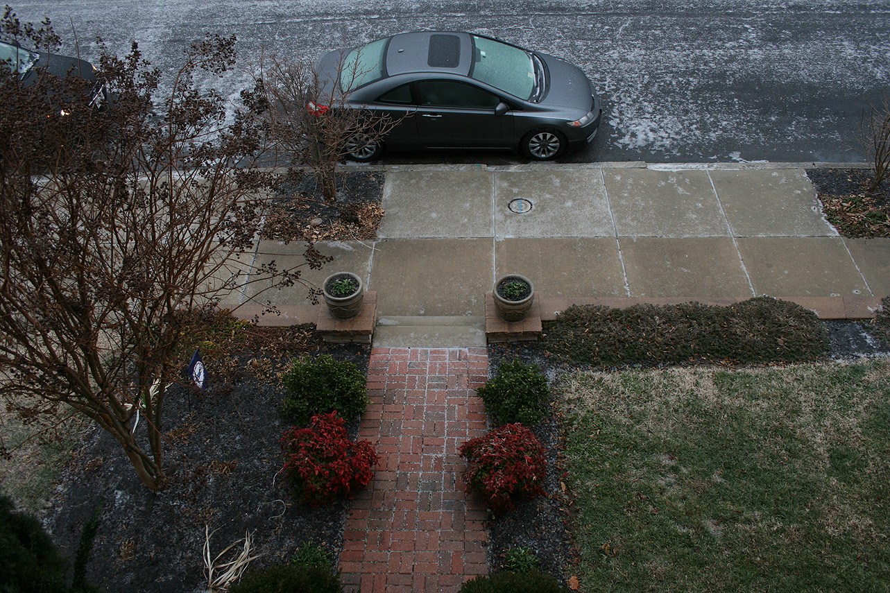
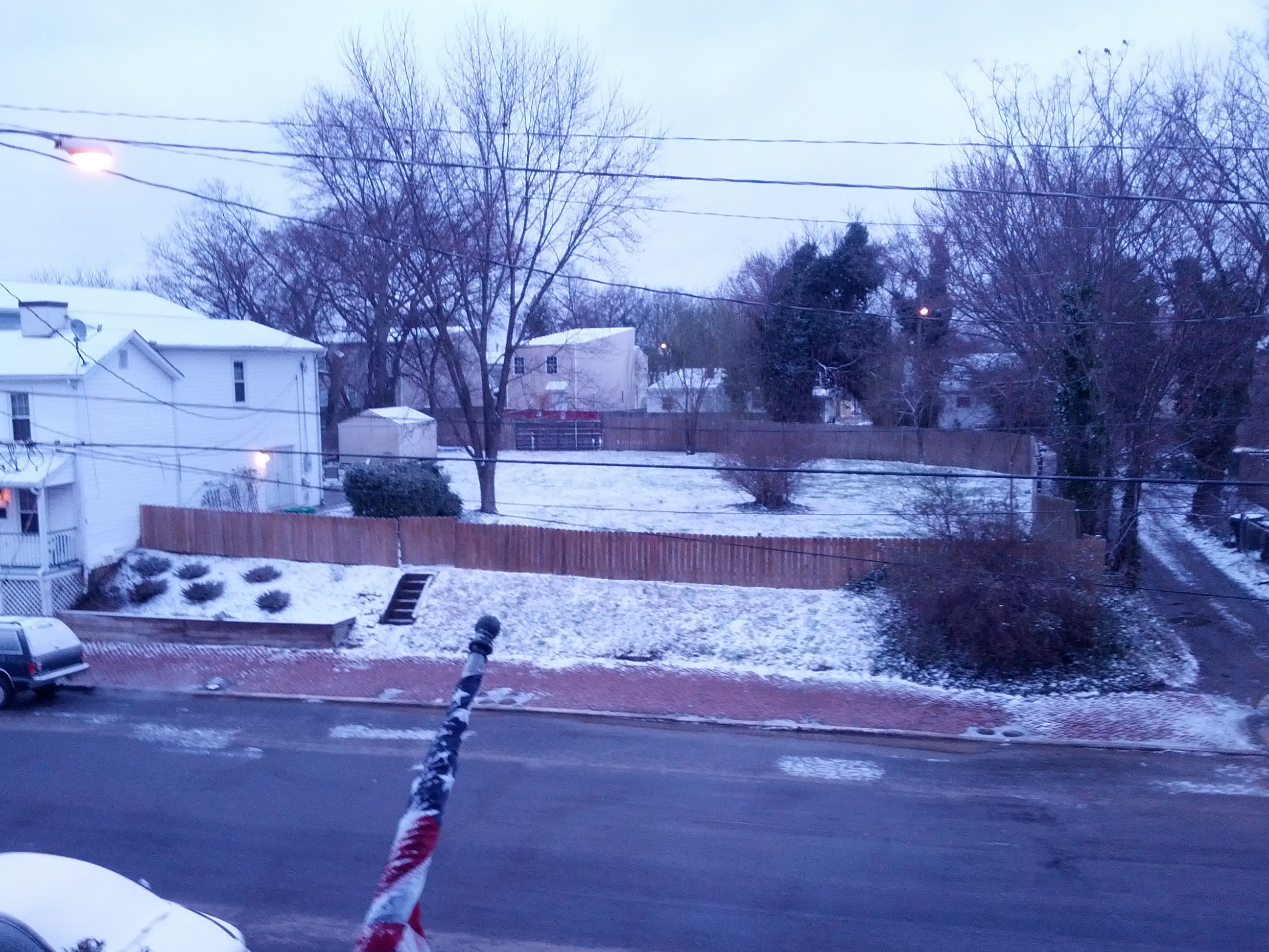
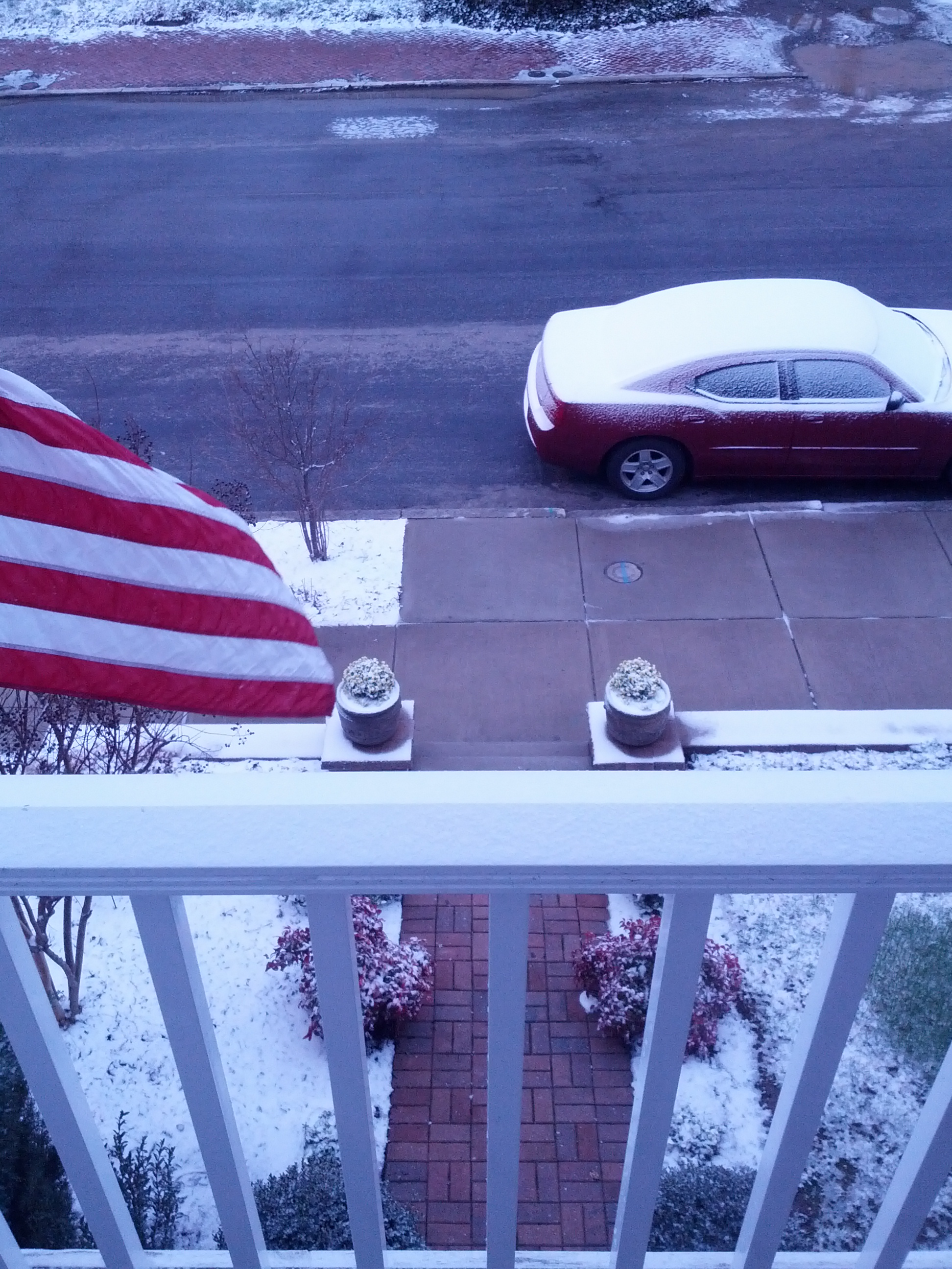
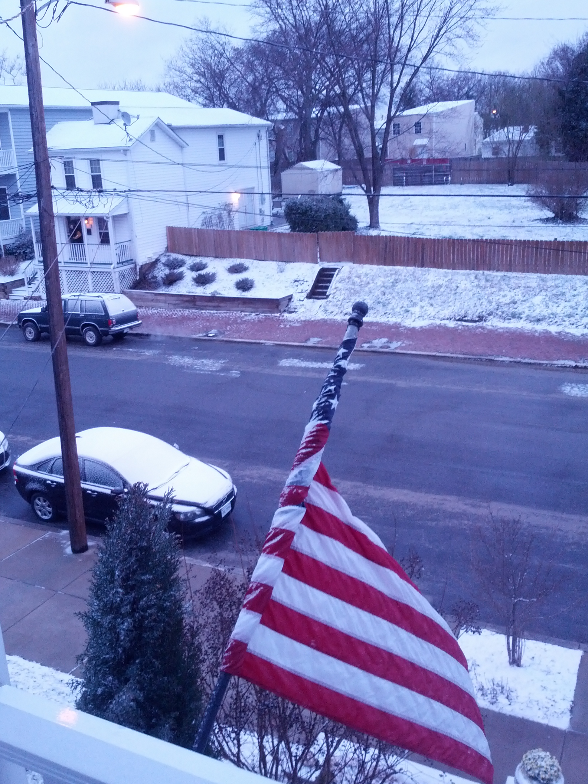
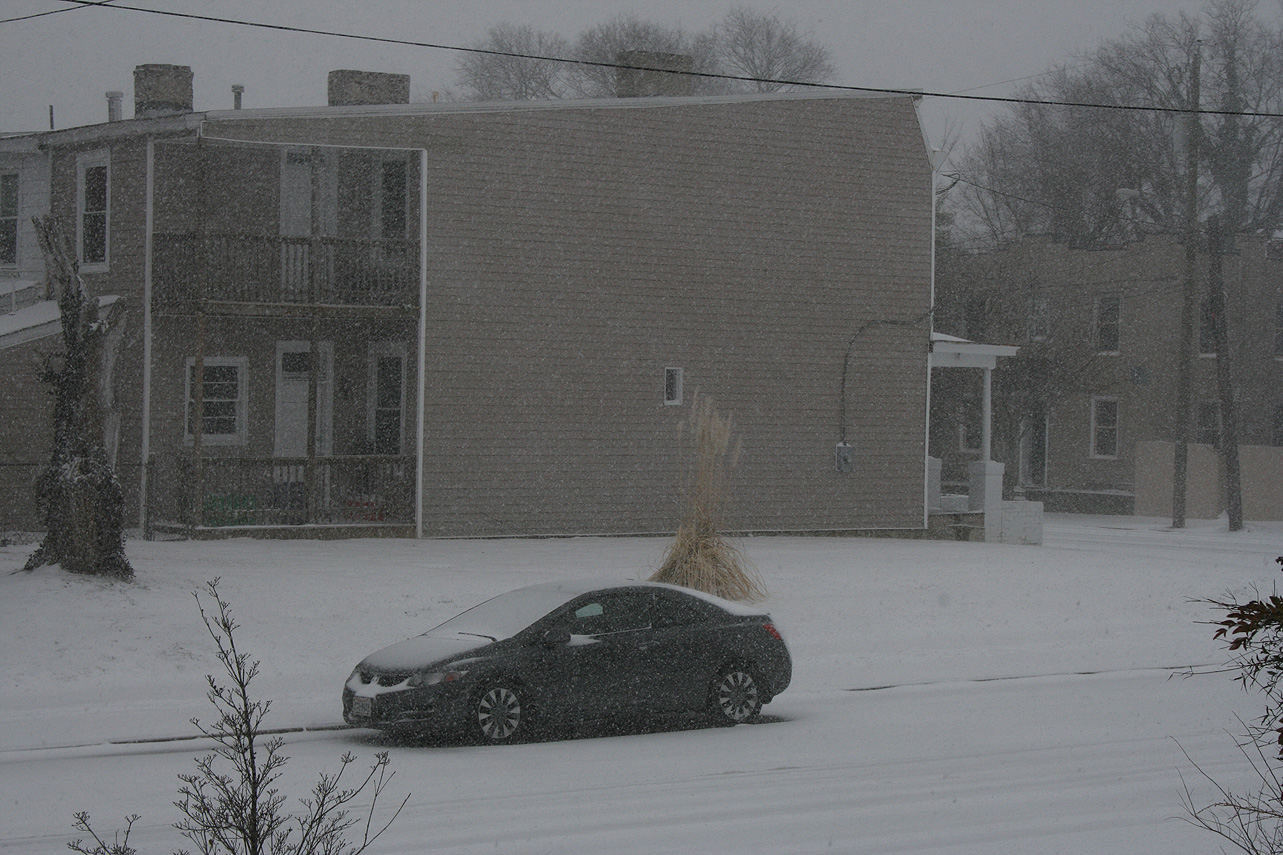
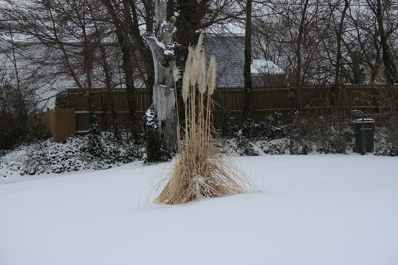
Church Hill Storm Observation Summary:
* Place – Time: Church Hill, (1/15/2015)
* Temperature: 30-32, During Event
* Winter Weather Watch/Warning/Advisory: None
* Closings: All local school districts had a delayed opening or were closed, Chesterfield County Government had a delayed opening for 10:00 AM.
* Predicted Totals: Dusting of snow.
* Road Conditions: All roads had varying amounts of snow, mostly in areas where previous ice from the 14th had not melted. Streets cleared by 10 AM.
* Precipitation Description: Snow.
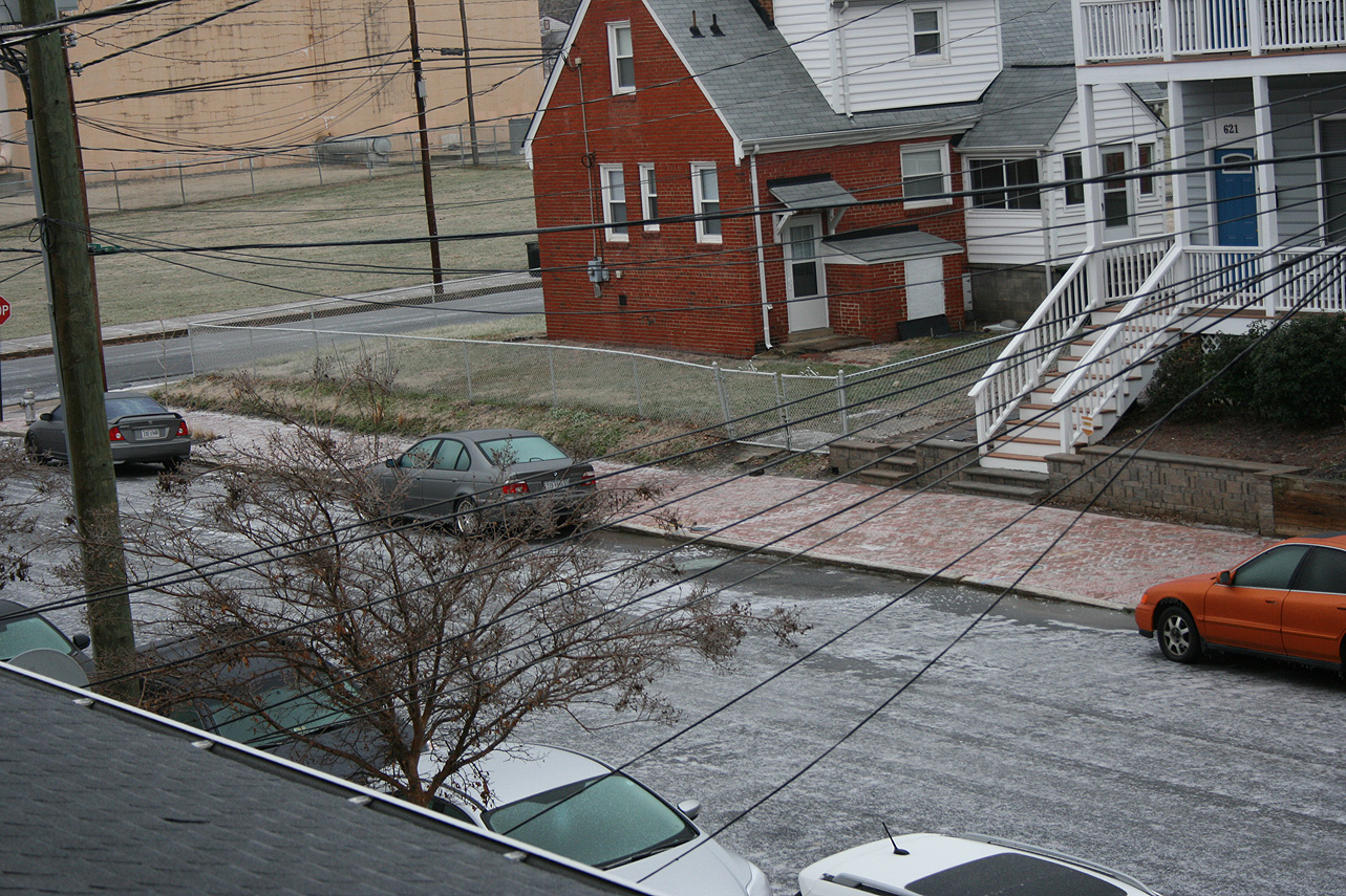
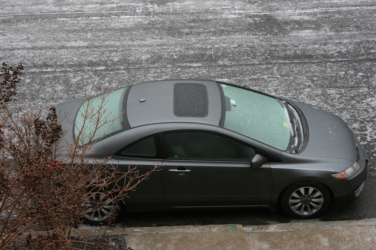
* Total Precipitation: Trace of snow accumulation (light dusting). Snow on most surfaces. 0.00″ of liquid equivalent was reported at the Richmond airport.
* Comments: Low-level moisture from a surprise system overnight (12 AM – 3 AM) left a layer of light snow on most surfaces. The chance of snow was not discussed in the forecast.
Category Archives: Observation
January 14, 2015: Observations
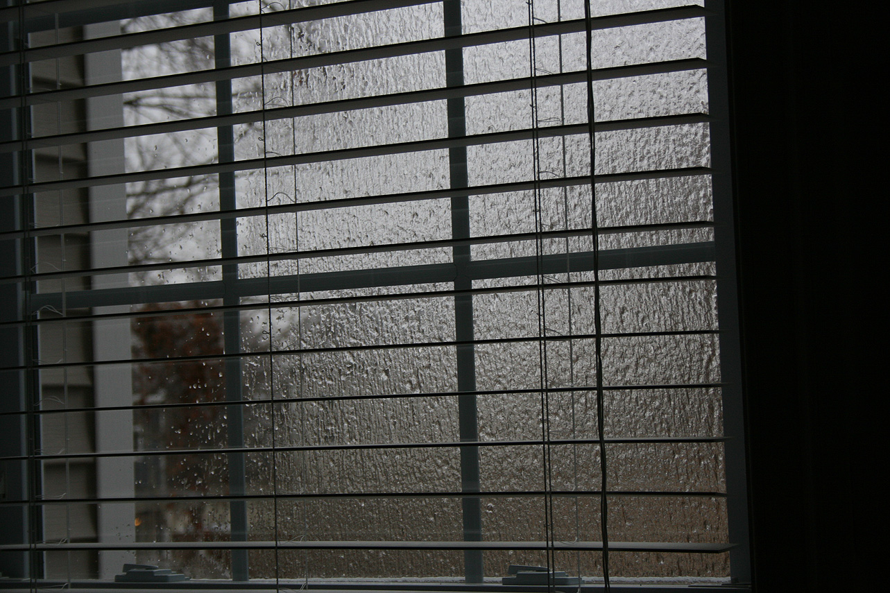
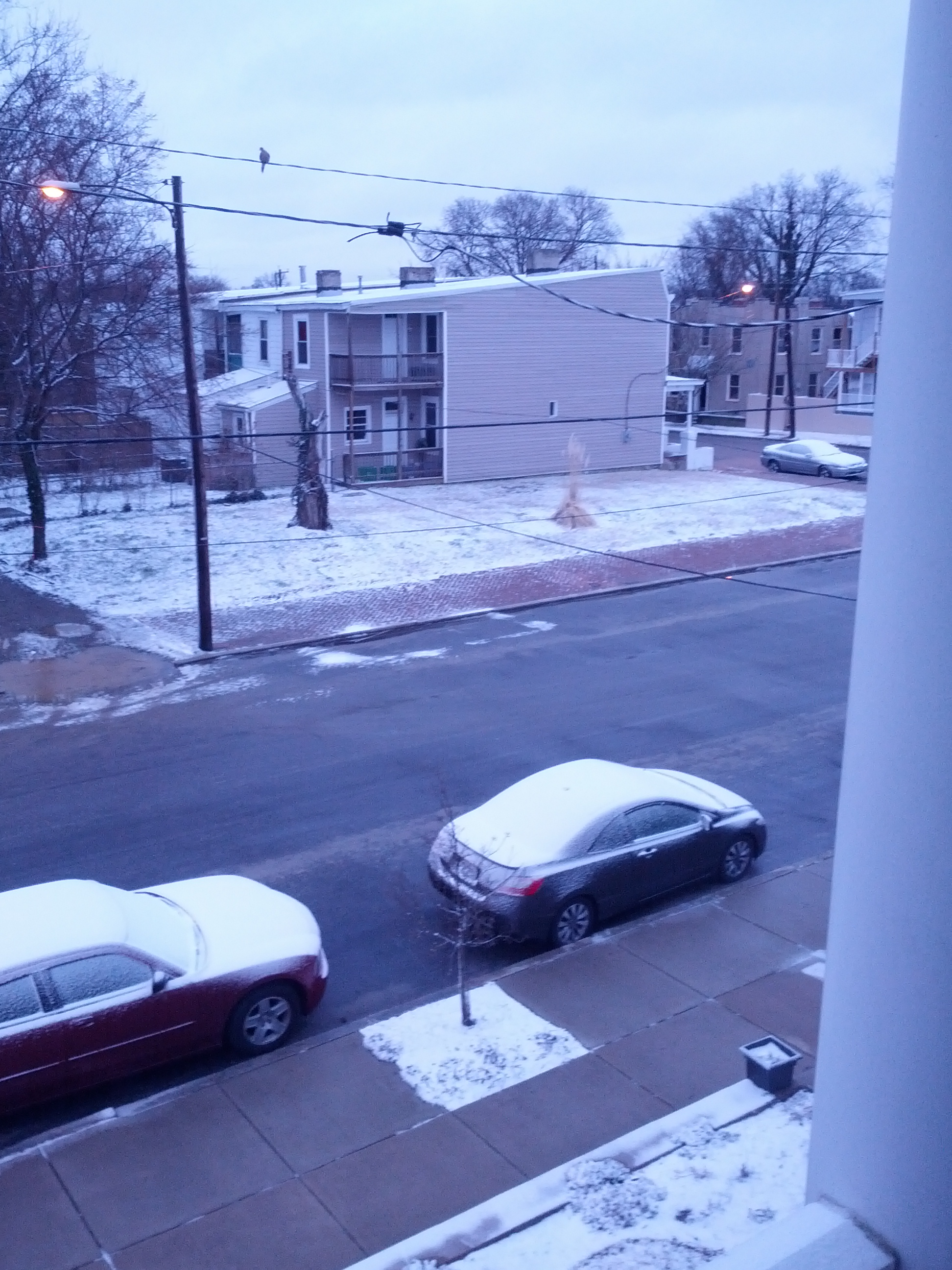
Church Hill Storm Observation Summary:
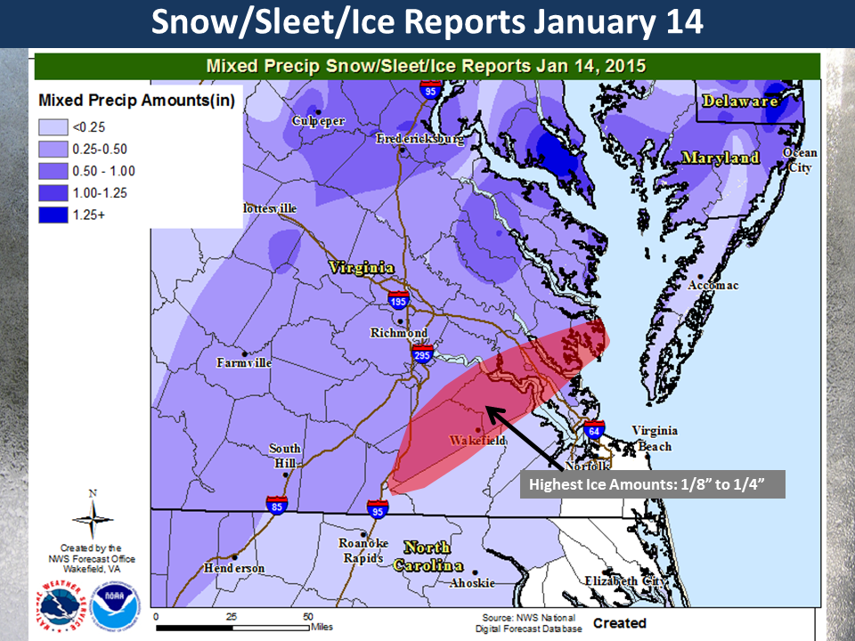
* Place – Time: Church Hill, (1/14/2015)
* Temperature: 27-28, During Event
* Winter Weather Watch/Warning/Advisory: Advisory, which was issued towards end of the event
* Closings: All local school districts closed, Chesterfield County Government had a delayed opening for 10:30 AM. Government closed for the day at 10:00 AM.
* Predicted Totals: Very light accumulation of freezing rain and sleet.
* Road Conditions: All roads had varying amounts of ice and sleet that accumulated on them. Local streets were very poor most of the day.
* Precipitation Description: A mix of freezing drizzle, freezing rain and brief periods of sleet from 12 AM to 6 AM.
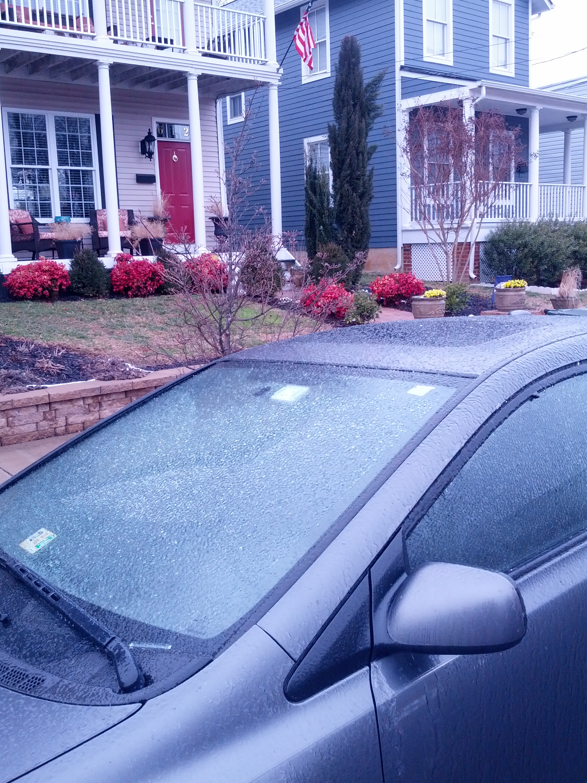
* Total Precipitation: Approximately 0.14″ of sleet and ice accumulation. Sleet and freezing rain accumulated on all surfaces. 0.21″ of liquid equivalent was reported at the Richmond airport. It took an extensive amount of time to melt the ice from my car.
* Comments: A low developed off the Florida coast and quickly bypassed the area off the Carolina coast. A fresh wave of cold air provided more than adequate temperatures to support sleet and freezing rain at the surface. Periods of sleet and freezing rain occurred during the early morning hours, before tapering off by sunrise. Impacts from snow and ice to the Richmond area were moderate from this storm.
Snowfall Totals:
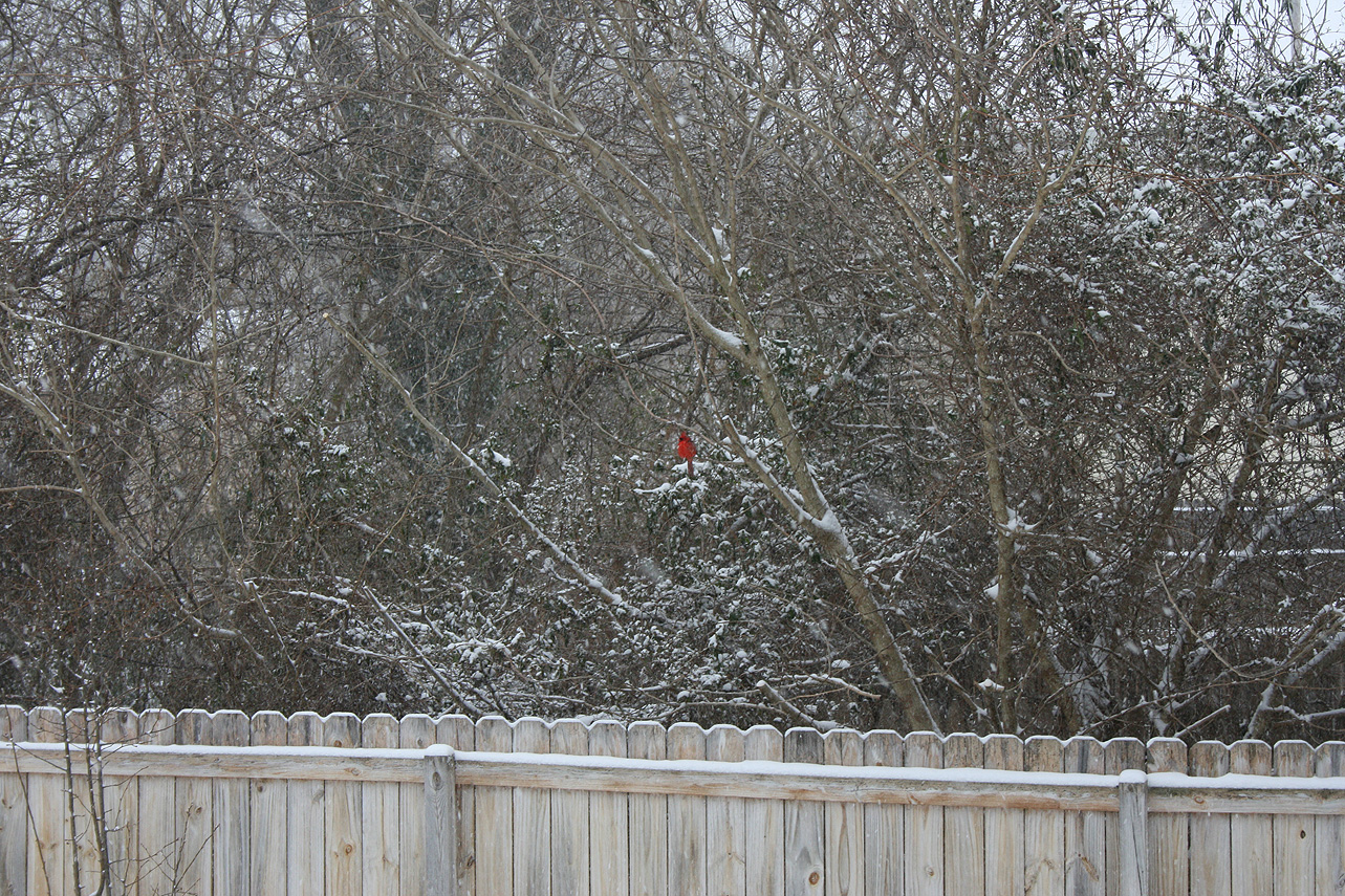
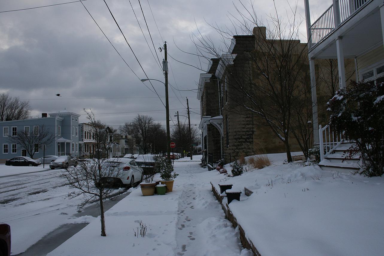
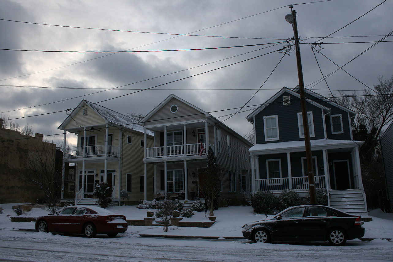
Photos:
November 26, 2014: Rain to Snow?
A low-pressure system is expected to develop off the Florida coast Tuesday that will run up the eastern seaboard on Wednesday, causing a wide variety of precipitation types in Virginia. The precipitation could end as a period of rain/snow or even snow. At this point, there is no expected accumulation.
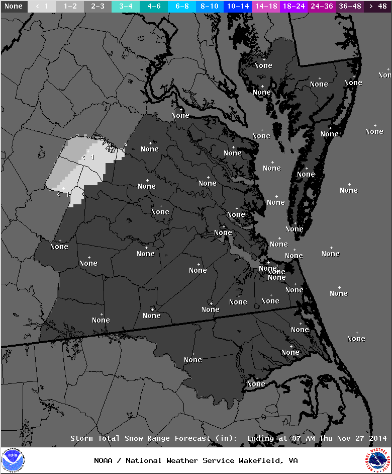
Observation Update: A changeover to some snow and rain occurred for about an hour on 11/26/14 from 3-4 PM. No measurable precipitation fell.
First Freeze of 2014 Fall Season
The first freezing temperature for the fall of 2014 occurred on November 3 (32.8 in Church Hill). The first freeze for the airport occurred on November 3 with a low of 30.
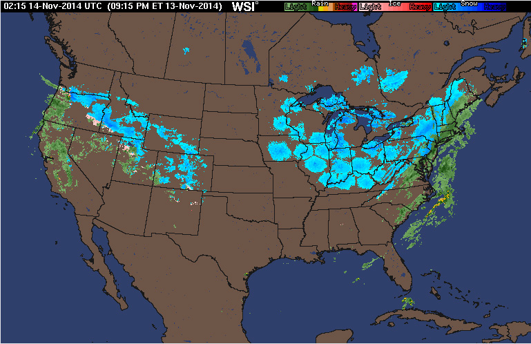
November 13, 2014: Rain to Snow?
A quick batch of rain, mixed with sleet and some snow, came in behind an arctic front during the evening hours. No accumulation was observed. This serves as the first wintry precipitation observed for the 2014-2015 winter season.
March, 17, 2014: Observations
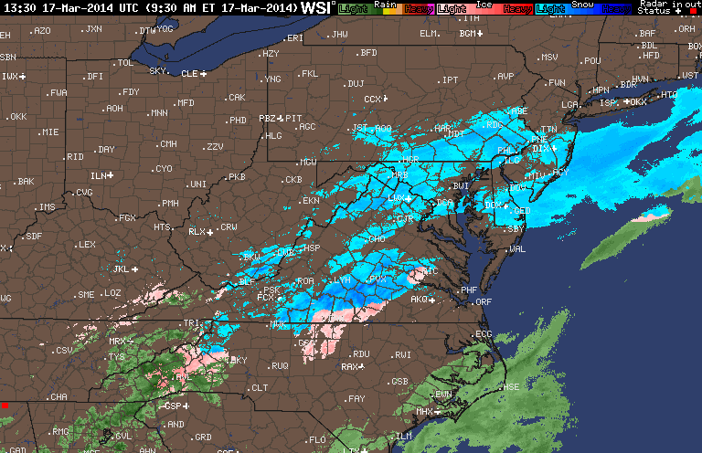
Church Hill Storm Observation Summary:
* Place – Time: Church Hill, (3/17/2014)
* Temperature: 29-35, During Event
* Winter Weather Watch/Warning/Advisory: Watch & Advisory
* Closings: None
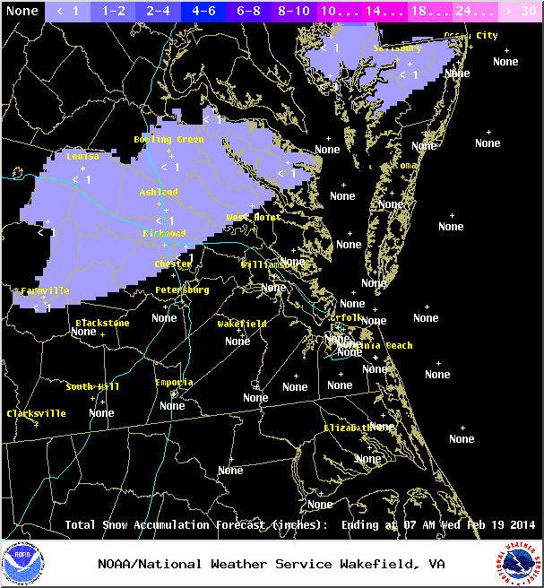
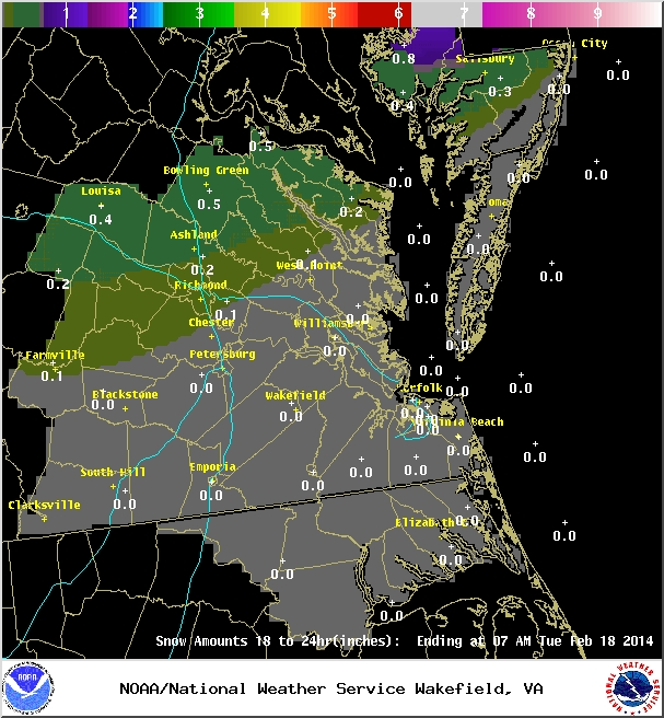
* Predicted Totals: Ranged from 2-4” initialed, downgraded to less than 1” on Sunday night.
* Road Conditions: All roads were primarily wet during the event.
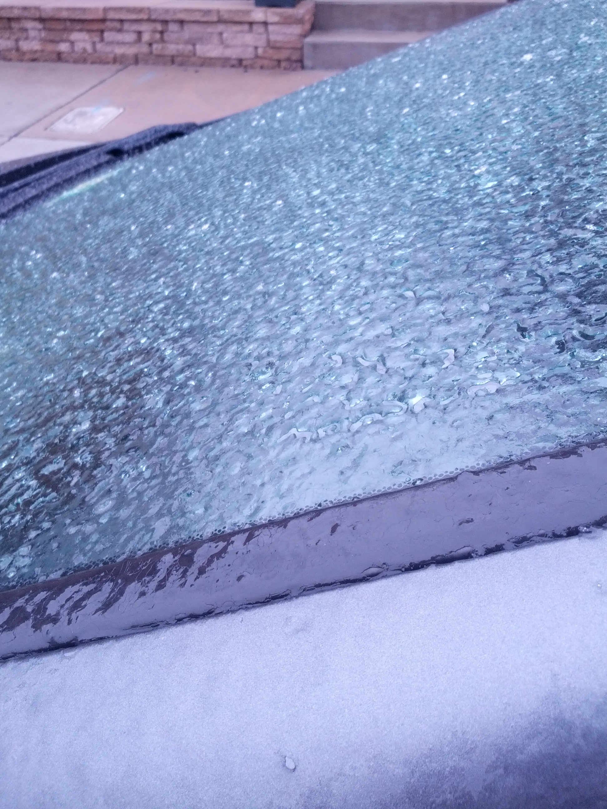
* Precipitation Description: A mix of rain to sleet, followed by freezing rain, sleet and snow during the overnight hours. Additional freezing rain and sleet fell during the morning hours of 3/17/2014.
* Total Precipitation: Approximately 0.5″ of snow, sleet and ice accumulation. Snow, sleet and freezing rain accumulated on elevated surfaces. 0.6″ was reported at Richmond airport.
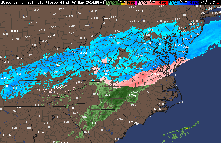
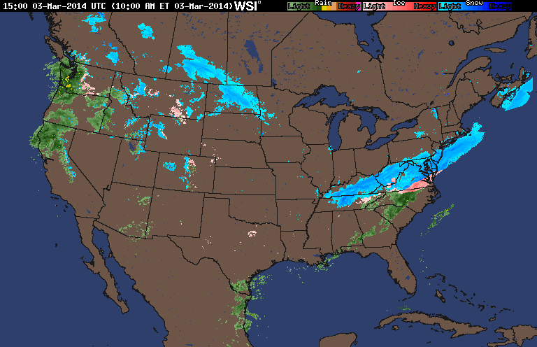
* Comments: A low sliding through the Tennessee Valley towards the coast of Virginia delivered a late season winter storm event to the Richmond area. A cold air wedge developed on Sunday afternoon that slowly changed rain over to sleet during the late evening and overnight hours. Periods of sleet, snow, freezing rain and rain continued through the morning and early afternoon hours. Impacts from snow and ice to the Richmond area were minimal from this storm. However, areas to the north saw increased snow totals between 2-8” towards Fredericksburg & DC.
Snowfall Totals:
Photos:
NWS Forecast, Day of Event:
March 7, 2014: Observations
Church Hill Storm Observation Summary:
* Place – Time: Church Hill, (3/7/2014)
* Temperature: 32-33, During Event
* Winter Weather Watch/Warning/Advisory: Advisory
* Closings: None
* Road Conditions: All roads were wet during the event.
* Precipitation Description: Sleet, transitioned to freezing rain and then rain by 8 AM. Sleet began around 4:00 AM and quickly turned over to a mix of sleet and freezing rain by 7 AM.
* Total Precipitation: Less than 0.1″ of ice accumulation. Freezing rain accumulated on elevated surfaces.
* Comments: A low coming out of the Gulf of Mexico tracked up the east coast, delivering a severe snow and ice storm to western North Carolina and southwest Virginia. Impacts from ice to the Richmond area were minimal from this storm.

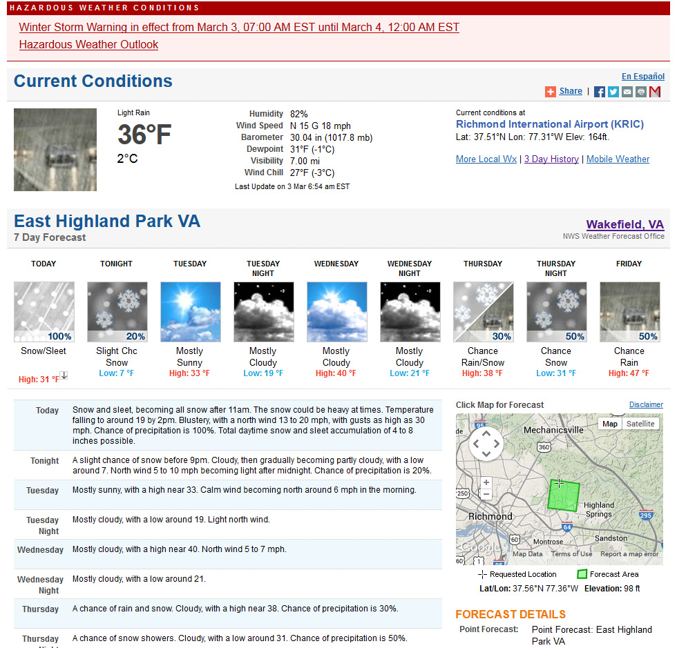
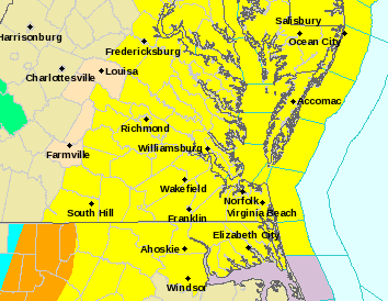
March 3, 2014: Observations
Church Hill Storm Observation Summary:
* Place – Time: Church Hill, (3/3/2014)
* Temperature: 24-36, During Event
* Winter Weather Watch/Warning/Advisory: Warning
* Closings: Chesterfield Government Closed on 3/3/14 at 10:30 AM, Delayed opening on 3/4/14 for 10:30 AM.
* Road Conditions: All roads covered during event.
* Precipitation Description: Snow, sleet, and rain. Rain and sleet began around 6:30 AM and quickly turned over to all sleet by 7 AM. Snow began to mix in with the sleet by 8 AM. All snow by 9 AM where heavy snow fell for almost 2 hours. Snow tapered off by noon as a large dry slot infiltrated the area. Flurries and light snow continued until 4 PM with no real additional accumulation.
* Total Precipitation: 3.1″. Approximately 0.1″ of sleet. 3.0″ inches of snow was reported at the airport on 3/3/14. Snowfall totals were fairly consistent across central Virginia with totals between 2-5″.
* Comments: Initial forecast for the storm shifted the axis of snow from the Midwest/upper mid-Atlantic to central Virginia on Saturday (3/1). Snow was expected to develop along a backdoor cold front that would create a cold air damning wedge. Afternoon high temperatures reached 72 on Sunday in Richmond, with the temperature plummeting to 11 on March 4th. Sleet, moderate to heavy at times, quickly transitioned to heavy snow. The dry slot quickly stopped the snow by midday, making the higher forecast totals of 7-8″ unattainable. Even higher forecasts of 8-12″ towards Fredericksburg busted due to this dry slot. The sun peaked out briefly before the sun set on 3/3/2014.
Snowfall Totals:
Photos:

Videos:
NWS Forecast, Day of Event:
February 21, 2014: Severe Weather Threat

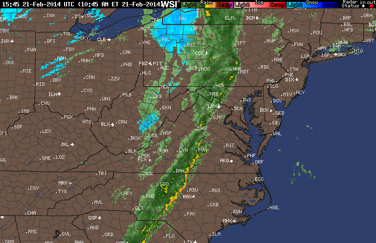
MESOSCALE DISCUSSION 0140
NWS STORM PREDICTION CENTER NORMAN OK
0757 AM CST FRI FEB 21 2014AREAS AFFECTED…CNTRL VA THROUGH CNTRL AND SERN NC AND NERN SC
CONCERNING…SEVERE POTENTIAL…WATCH LIKELY
VALID 211357Z – 211500Z
PROBABILITY OF WATCH ISSUANCE…80 PERCENT
SUMMARY…STORMS ARE EXPECTED TO INCREASE THROUGH NERN SC…CNTRL NC
AND CNTRL VA THROUGH THE MORNING. DAMAGING WIND AND A FEW TORNADOES
WILL BE THE MAIN THREATS. WW WILL LIKELY BE NEEDED BY 15Z.DISCUSSION…BROKEN LINE OF LOWER TOPPED CONVECTION EXTENDS FROM
SWRN VA THROUGH WCNTRL NC MOVING EAST AT AROUND 35 KT. DOWNSTREAM
FROM THE LINE A WARM FRONT HAS BEEN ADVANCING NWD THROUGH VA WITH
DEWPOINTS GENERALLY IN THE LOW 60S IN THE WARM SECTOR. THE 12Z RAOBS
FROM GREENSBORO NC AND CHARLESTON SC SHOW ONLY A VERY SHALLOW
NEAR-SURFACE STABLE LAYER AS WELL AS A WEAK MID-LEVEL INVERSION
CENTERED AROUND 600 MB. THOUGH DIABATIC WARMING WILL BE TEMPERED BY
WIDESPREAD CONVECTIVE DEBRIS…TEMPERATURES ONLY IN THE LOW 70S WILL
BE NEEDED TO SUPPORT SURFACE BASED PARCELS. WITH TIME THE MID-LEVEL
INVERSION WILL ALSO LIKELY BE ELIMINATED AS ZONE OF DEEP ASCENT
ALONG THE CONVEYOR BELT SHIFTS EWD. STORMS ARE EXPECTED TO INTENSIFY
AS THEY ENCOUNTER GREATER INSTABILITY /UP TO 1000 J/KG MUCAPE/.
STRONG 0-1 KM SHEAR ASSOCIATED WITH THE MIGRATORY 60 KT SLY LLJ AND
STRONG EFFECTIVE BULK SHEAR WILL SUPPORT ORGANIZED STRUCTURES WITHIN
THE LINE…INCLUDING EMBEDDED MESOCYCLONES AND BOWING SEGMENTS.
ALSO…STORMS MAY DEEPEN FARTHER EAST ALONG PRE-FRONTAL CONVERGENCE
BANDS EMANATING FROM THE GULF.
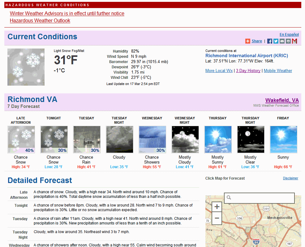
February 17-18, 2014: Snow, Ice & Rain
A quick system brushed across Central Virginia around 11 PM on 2/17 into the early morning hours of 2/18 that dropped a brief batch of snow, graupel, and ice. Accumulations were minor (Less than 0.1″ of snow/graupel and ice) and occurred mostly on elevated surfaces.