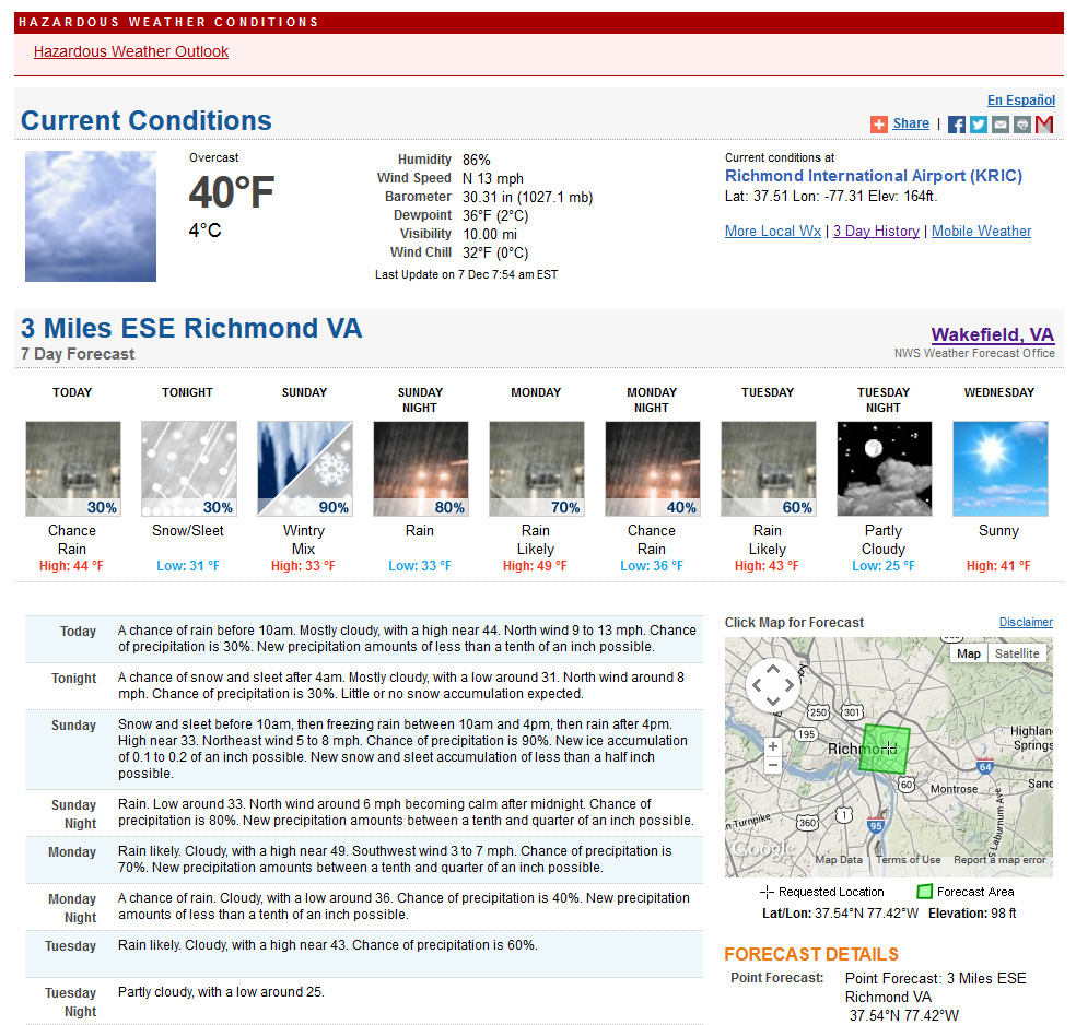
Storm Report (Church Hill):
* Place – Time: Church Hill, 12:00 PM (12/9/2013) *After the Event Update*
* Temperature: 32-34, During Event
* Dewpoint: 31-34, During Event
* Relative Humidity: N/A%
* Pressure: N/A
* Trends: N/A
*Winter Weather Watch/Warning/Advisory: Advisory
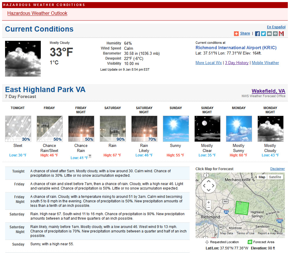
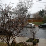
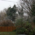
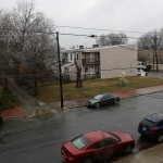
* Road Conditions: All roads remained passable, no accumulation of ice on roadways.
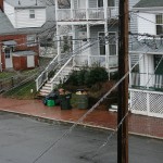
* Precipitation Description: Light rain and snow showers persisted on and off during the afternoon hours.
* Total Precipitation: Trace of sleet. Freezing rain measured at approximately 0.05”. Liquid equivalent of 1.05” fell during the event.
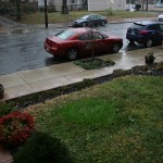
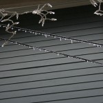
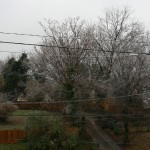
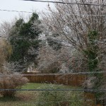
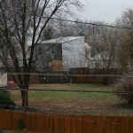
* Comments: A mix of sleet and freezing rain started shortly after 6:30 AM. The sleet lasted for about 20-30 minutes. Freezing rain lasted until 11 AM as temperatures crept above 32 degrees. Precipitation was intermittent throughout the day with different periods of light to heavy rain in the afternoon. Light accumulation of ice was seen on trees, power lines and exposed elevated surfaces, even into the afternoon and evening. Melting of ice started overnight Sunday into Monday. No observed power outages were seen in the neighborhood.
NWS Advisory issued during event:
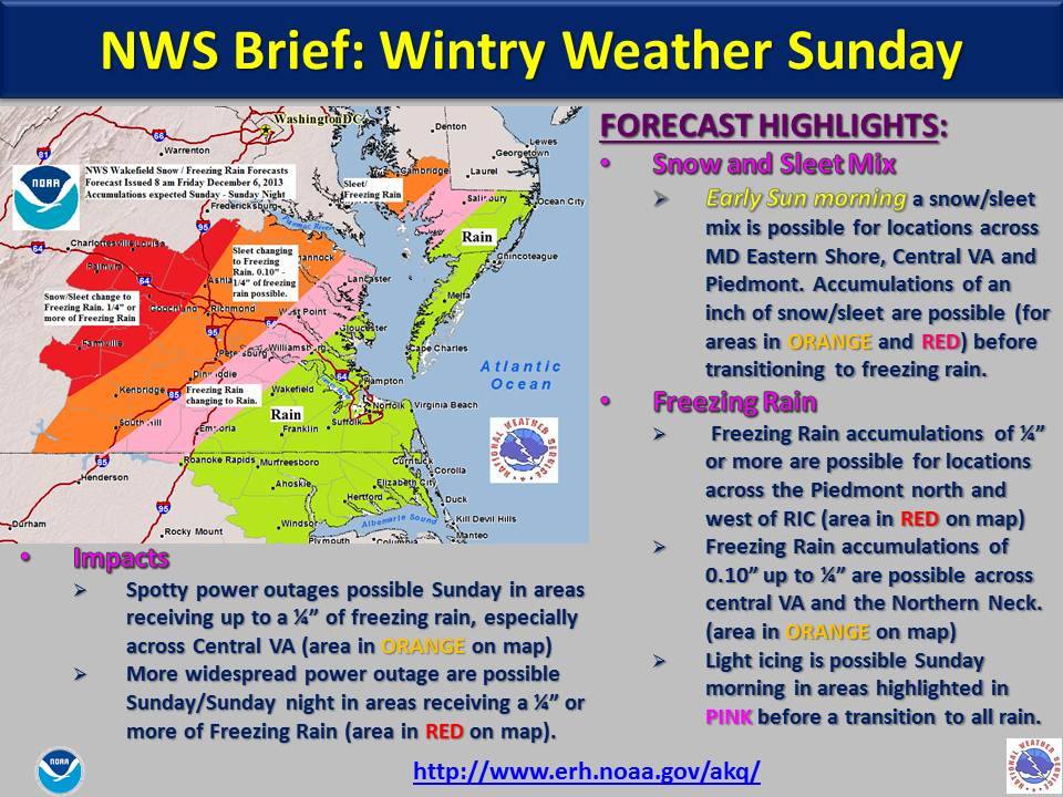
Winter Weather Advisory
URGENT – WINTER WEATHER MESSAGE
NATIONAL WEATHER SERVICE WAKEFIELD VA
430 AM EST SUN DEC 8 2013
VAZ065>068-070-071-081730-
/O.CAN.KAKQ.WW.Y.0011.000000T0000Z-131209T0000Z/
/O.NEW.KAKQ.WW.Y.0012.131208T1200Z-131209T0000Z/
MECKLENBURG-LUNENBURG-NOTTOWAY-AMELIA-CHESTERFIELD-HENRICO-
INCLUDING THE CITIES OF…SOUTH HILL…CREWE…COLONIAL HEIGHTS…
RICHMOND
430 AM EST SUN DEC 8 2013
…WINTER WEATHER ADVISORY IN EFFECT UNTIL 7 PM EST THIS
EVENING…
* AREAS AFFECTED: INCLUDE MECKLENBURG…LUNENBURG AND NOTTOWAY.
* ACCUMULATIONS: A TENTH OF AN INCH OF ICE IS EXPECTED ALONG
WITH A LIGHT ACCUMULATION SLEET.
* TIMING: A MIX OF SLEET…AND FREEZING RAIN IS EXPECTED TO BEGIN
AFTER SUNRISE…THEN CHANGE TO ALL FREEZING RAIN LATE IN THE
MORNING. FREEZING RAIN IS EXPECTED TO CHANGE OVER TO RAIN LATE
THIS AFTERNOON.
* TEMPERATURES: 30 TO 33 DEGREES.
* IMPACTS: TRAVEL CONDITIONS COULD BECOME HAZARDOUS SUNDAY
MORNING AND SUNDAY AFTERNOON DUE TO ICY CONDITIONS ON ROADWAYS
AND SIDEWALKS.
PRECAUTIONARY/PREPAREDNESS ACTIONS…
A WINTER WEATHER ADVISORY MEANS THAT PERIODS OF SLEET AND
FREEZING RAIN WILL CAUSE SOME TRAVEL DIFFICULTIES. BE PREPARED
FOR SLIPPERY ROADS AND USE CAUTION WHILE DRIVING.
Photos from Church Hill:
PUBLIC INFORMATION STATEMENT
SPOTTER REPORTS
NATIONAL WEATHER SERVICE WAKEFIELD VA
515 PM EST SUN DEC 08 2013
THE FOLLOWING ARE UNOFFICIAL OBSERVATIONS TAKEN DURING THE PAST 24
HOURS FOR THE STORM THAT HAS BEEN AFFECTING OUR REGION. APPRECIATION
IS EXTENDED TO HIGHWAY DEPARTMENTS...COOPERATIVE OBSERVERS...SKYWARN
SPOTTERS AND MEDIA FOR THESE REPORTS. THIS SUMMARY IS ALSO AVAILABLE
ON OUR HOME PAGE AT WEATHER.GOV/WAKEFIELD
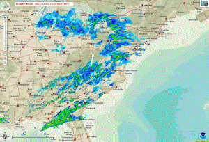
***********************STORM TOTAL ICE***********************
LOCATION STORM TOTAL TIME/DATE COMMENTS
ICE OF
/INCHES/ MEASUREMENT
MARYLAND
...DORCHESTER COUNTY...
CAMBRIDGE 0.20 440 PM 12/08 911 CALL CENTER
VIRGINIA
...CAROLINE COUNTY...
BOWLING GREEN 0.10 838 AM 12/08 PUBLIC
...CHESTERFIELD COUNTY...
MIDLOTHIAN 0.10 834 AM 12/08 PUBLIC
...CUMBERLAND COUNTY...
CUMBERLAND 0.50 325 PM 12/08 911 CALL CENTER
...FLUVANNA COUNTY...
PALMYRA 0.25 345 PM 12/08 911 CALL CENTER
...HANOVER COUNTY...
ASHLAND 0.10 1229 PM 12/08 TRAINED SPOTTER
...HENRICO COUNTY...
LAKESIDE 0.10 800 AM 12/08 TRAINED SPOTTER
1 NNE BRIDLEWOOD 0.10 1210 PM 12/08 TRAINED SPOTTER
...LOUISA COUNTY...
LOUISA 0.10 843 AM 12/08 PUBLIC
...LUNENBURG COUNTY...
VICTORIA 0.10 320 PM 12/08 911 CALL CENTER
...NOTTOWAY COUNTY...
CREWE 0.10 839 AM 12/08 PUBLIC
...PRINCE EDWARD COUNTY...
FARMVILLE 0.25 300 PM 12/08 911 CALL CENTER
$$
LALEXAND