Deprecated: Optional parameter $selected declared before required parameter $args is implicitly treated as a required parameter in /home/richmon/domains/richmondcitywatch.com/public_html/rvawx_test/wp-content/plugins/archives-calendar-widget/arw-settings.php on line 178

Deprecated: Optional parameter $view declared before required parameter $args is implicitly treated as a required parameter in /home/richmon/domains/richmondcitywatch.com/public_html/rvawx_test/wp-content/plugins/archives-calendar-widget/arw-widget.php on line 480

Deprecated: Optional parameter $archiveMonth declared before required parameter $args is implicitly treated as a required parameter in /home/richmon/domains/richmondcitywatch.com/public_html/rvawx_test/wp-content/plugins/archives-calendar-widget/arw-widget.php on line 480

Warning: Trying to access array offset on value of type bool in /home/richmon/domains/richmondcitywatch.com/public_html/rvawx_test/wp-content/plugins/archives-calendar-widget/archives-calendar.php on line 64
RVAWX.com | Current & Historical Weather Events in Richmond, Virginia | Page 2

January 17, 2016: Observation


Church Hill Storm Observation Summary:
* Place – Time: Church Hill, (1/17/2016)
* Temperature: 33-35, During Event
* Winter Weather Watch/Warning/Advisory: None
* Closings: N/A (Sunday Event)
* Predicted Totals: Dusting to 1″.
* Road Conditions: Minor snow accumulations on pavement, mostly clear roads.
* Precipitation Description: Snow, which began at 8:00 AM and ended around 1:30 PM.
* Total Precipitation: 1.125″ of snow. 0.7″ of snow was reported at the Richmond airport. Totals higher to the east and north of Richmond.
* Comments: A low pressure system developed along the gulf coast and subsequently redeveloped off the Carolina coast. Snowfall came down at light to moderate rates during the morning hours.

Snowfall Totals:

Not available.

Photo Gallery:

March 5, 2015: Observations

Church Hill Storm Observation Summary:
* Place – Time: Church Hill, (3/5/2015)
* Temperature: 28-34, During Event
* Winter Weather Watch/Warning/Advisory: Advisory
* Closings: All local school districts were closed on 3/5 and 3/6, Chesterfield County Government closed early on 3/5 and a 2-hour delay on 3/6.
* Predicted Totals: Between 2-3″ and 1-2″ the day before and day of the event.
* Road Conditions: All roads had snow and ice accumulation on them.
* Precipitation Description: Sleet, which began at 11:30 AM on 3/5, ended around 8 PM on 3/5.
* Total Precipitation: 0.5″ of snow. 0.3″ of snow was reported at the Richmond airport. Locally heavier snow to the north and west of Richmond.
* Comments: An arctic front crossed the region during the early morning hours of 3/5. Rain transitioned to sleet and freezing rain for several hours in the early afternoon. Precipitation transitioned to snow for the last hour of precipitation, dropping a 0.3-0.4″ of snow on top of the sleet accumulation. The temperature plunged to 15.7 degrees the following morning on 3/6.

Snowfall Totals:

NWS Snow Totals for 3/5/15 Event

Photo Gallery:

March 1, 2015: Observations

Church Hill Storm Observation Summary:
* Place – Time: Church Hill, (3/1/2015)
* Temperature: 27-32, During Event
* Winter Weather Watch/Warning/Advisory: Advisory
* Closings: None.
* Predicted Totals: Less than ¼”.
* Road Conditions: Minor accumulation on roads. Roads were mainly wet during the event.
* Precipitation Description: Sleet and Freezing Rain/Drizzle, which began around 10:00 AM on 3/1 and ended around 5 PM that afternoon. Sleet quickly changed to all freezing rain/rain by 11 AM.
* Total Precipitation: 0.03″ of primarily freezing rain. 0.16″ of precipitation was reported at the Richmond airport. A system overriding a recent cold surge into the Virginia Piedmont created a minor ice event for the Richmond metro area. Elevated surfaces and trees accumulated the most ice. A winter storm advisory was issued the evening before the event to notify residents of minor ice accumulations. No major power outages were associated with this storm.

Photo Gallery:

March 1, 2015: Ice to Rain?

NWS Forecast, 3/1/2015
URGENT - WINTER WEATHER MESSAGE
NATIONAL WEATHER SERVICE WAKEFIELD VA
532 AM EST SUN MAR 1 2015

VAZ070>076-079-080-083-011845-
/O.CON.KAKQ.WW.Y.0007.000000T0000Z-150301T2100Z/
CHESTERFIELD-HENRICO-KING WILLIAM-KING AND QUEEN-ESSEX-
WESTMORELAND-RICHMOND-BRUNSWICK-DINWIDDIE-NEW KENT-
INCLUDING THE CITIES OF...COLONIAL HEIGHTS...RICHMOND...
TAPPAHANNOCK...LAWRENCEVILLE
532 AM EST SUN MAR 1 2015

...WINTER WEATHER ADVISORY REMAINS IN EFFECT UNTIL 4 PM EST THIS
AFTERNOON...

A WINTER WEATHER ADVISORY REMAINS IN EFFECT UNTIL 4 PM EST THIS
AFTERNOON.

* AREAS AFFECTED: PORTIONS OF CENTRAL AND SOUTHERN VIRGINIA.

* HAZARDS: PRIMARILY SLEET AND FREEZING RAIN.

* ACCUMULATIONS: LITTLE OR NO SNOW ACCUMULATION. A TRACE TO LESS
  THAN ONE TENTH OF AN INCH OF ICE ACCUMULATION.

* TEMPERATURES: STARTING IN THE MID 20S EARLY THIS MORNING...
  THEN RISING INTO THE LOWER TO MID 30S THIS AFTERNOON.

* TIMING: LIGHT SNOW AND SLEET BECOMING SLEET AND FREEZING RAIN
  LATER THIS MORNING...THEN TRANSITIONING TO ALL RAIN DURING THE
  AFTERNOON HOURS.

* IMPACTS: HAZARDOUS TRAVEL DUE TO ICE COVERED ROADS...BRIDGES
  AND OVERPASSES.

PRECAUTIONARY/PREPAREDNESS ACTIONS...

A WINTER WEATHER ADVISORY MEANS THAT PERIODS OF SNOW...SLEET...OR
FREEZING RAIN WILL CAUSE TRAVEL DIFFICULTIES. BE PREPARED FOR
SLIPPERY ROADS AND LIMITED VISIBILITIES...AND USE CAUTION WHILE
DRIVING.

&&

$$

February 26, 2015: Observations

Church Hill Storm Observation Summary:
* Place – Time: Church Hill, (2/26/2015)
* Temperature: 30-32, During Event
* Winter Weather Watch/Warning/Advisory: Watch & Warning
* Closings: All local school districts were closed on 2/26 and 2/27, Chesterfield County Government closed on 2/26.
* Predicted Totals: Between 3-6″ and 4-8″ the day before and day of the event.
* Road Conditions: All roads had snow accumulation on them. Local streets were covered at the onset of the snow.
* Precipitation Description: Snow, which began at 1:30 AM on 2/26, ended around 10 AM on 2/26.
* Total Precipitation: 5.75″ of snow. 5.0″ of snow was reported at the Richmond airport. Locally heavier snow to the south and east of Richmond.
* Comments: A southern slider system that originated along the gulf coast, dubbed “Remus”, developed and slide up along the Carolina coast, east of Virginia Beach. Snow broke out after midnight and was heavy for 3-4 hours. The heaviest snow and accumulation occurred between 2 AM and 7 AM. This was a wetter snow, which allowed it to cling to the trees and power lines. Impacts from snow to the Richmond area were significant from this storm.

Snowfall Totals:

NWS Snow Totals
NWS Snow Totals

Photo Gallery:

February 26, 2015: Snow from Southern Slider?

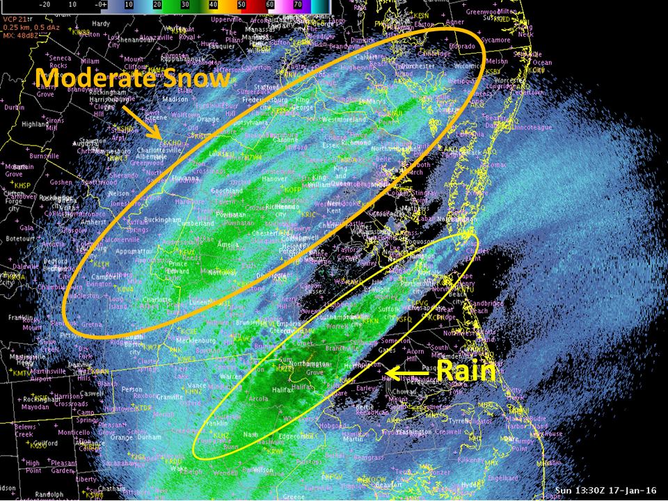
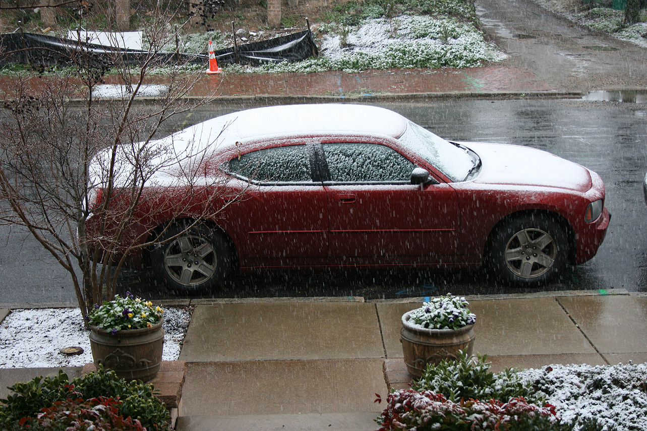
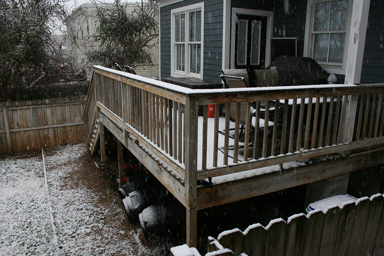
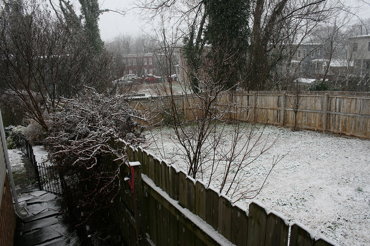
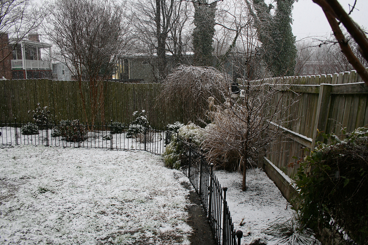
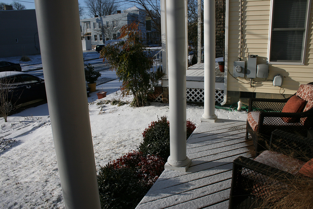
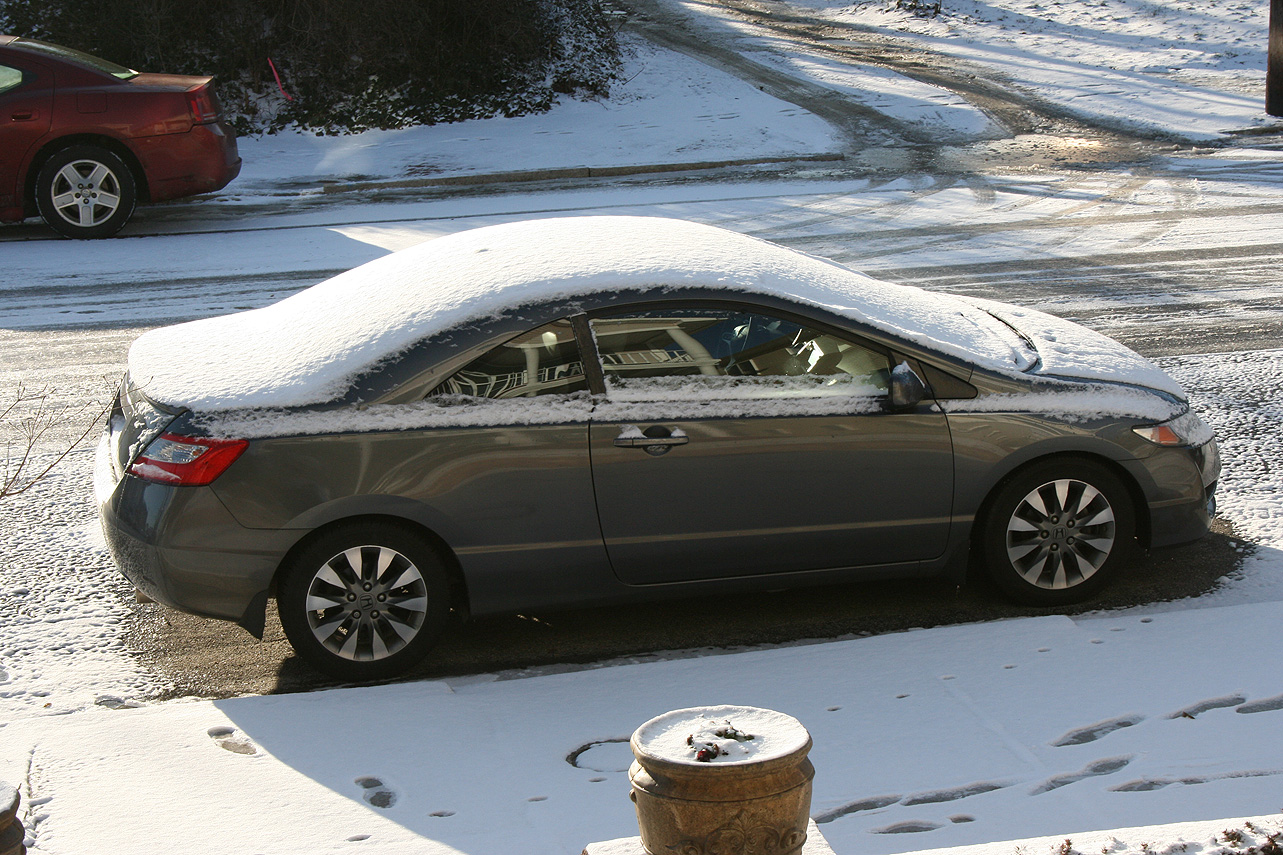
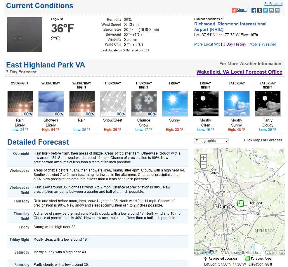
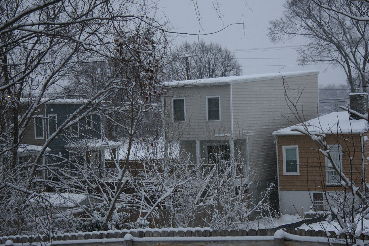
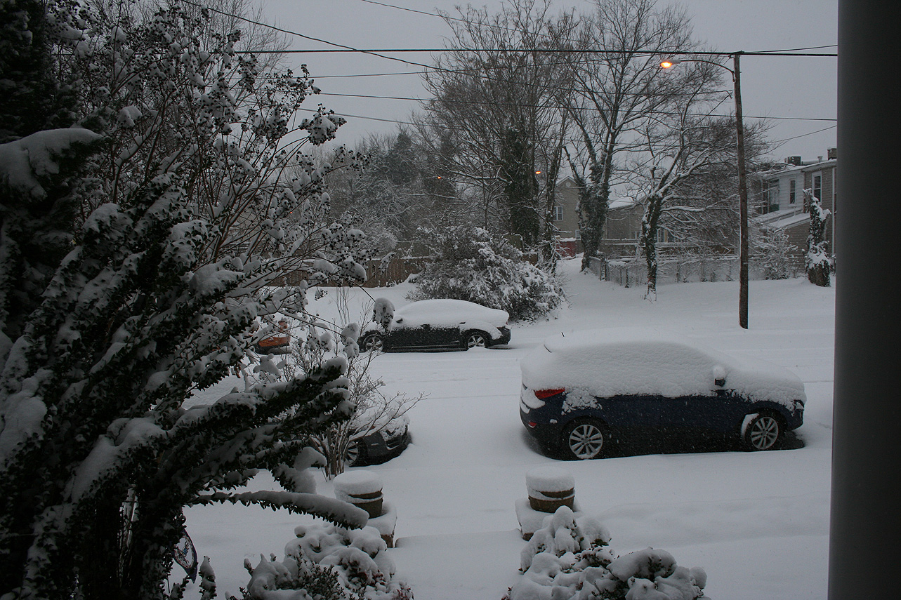
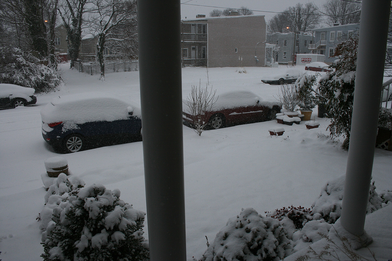
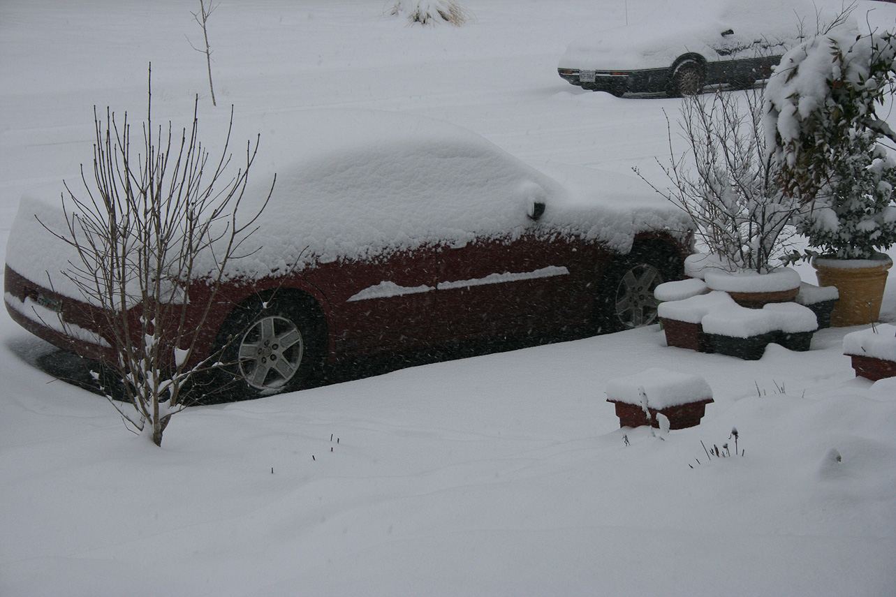
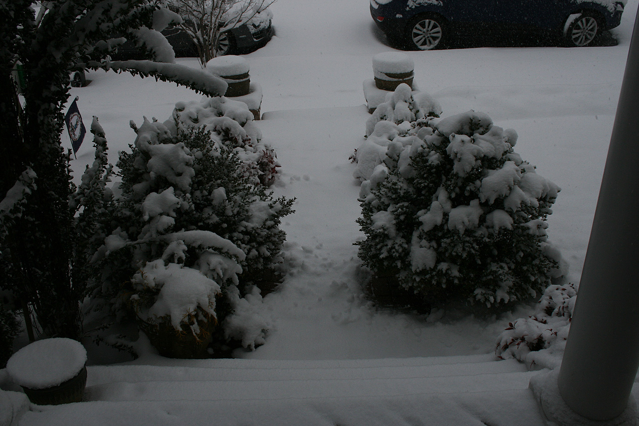
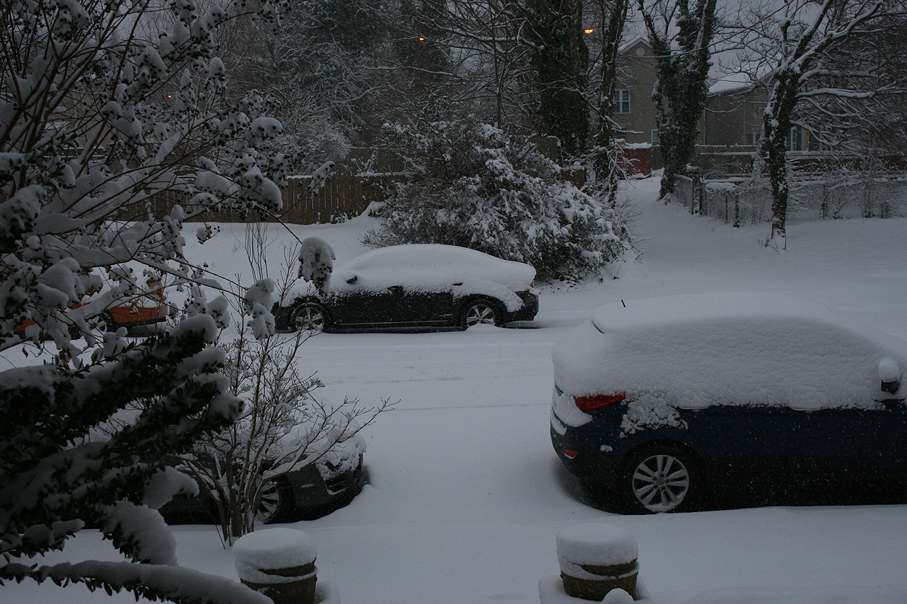
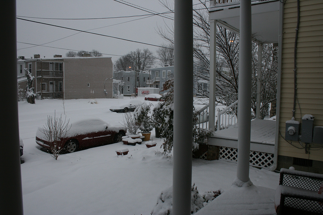
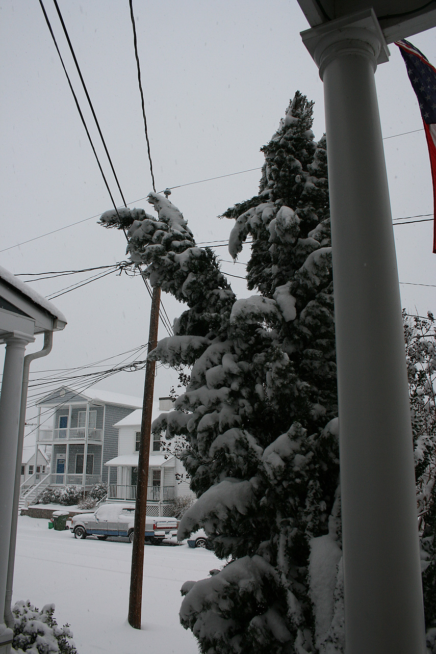
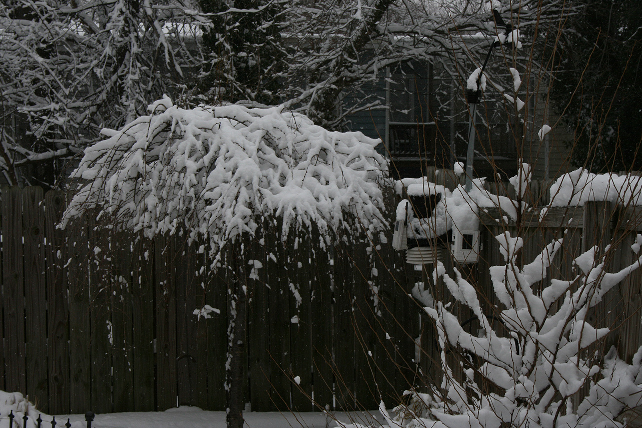
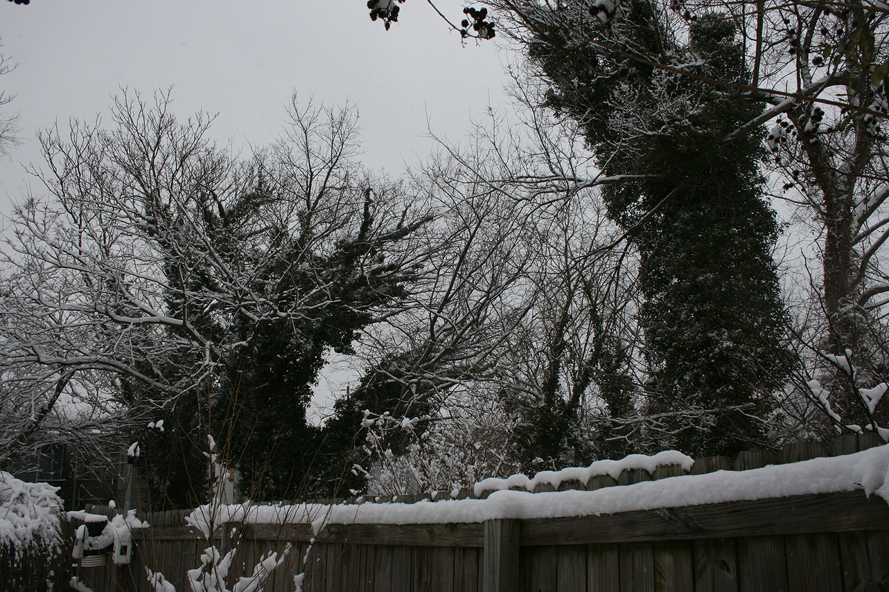
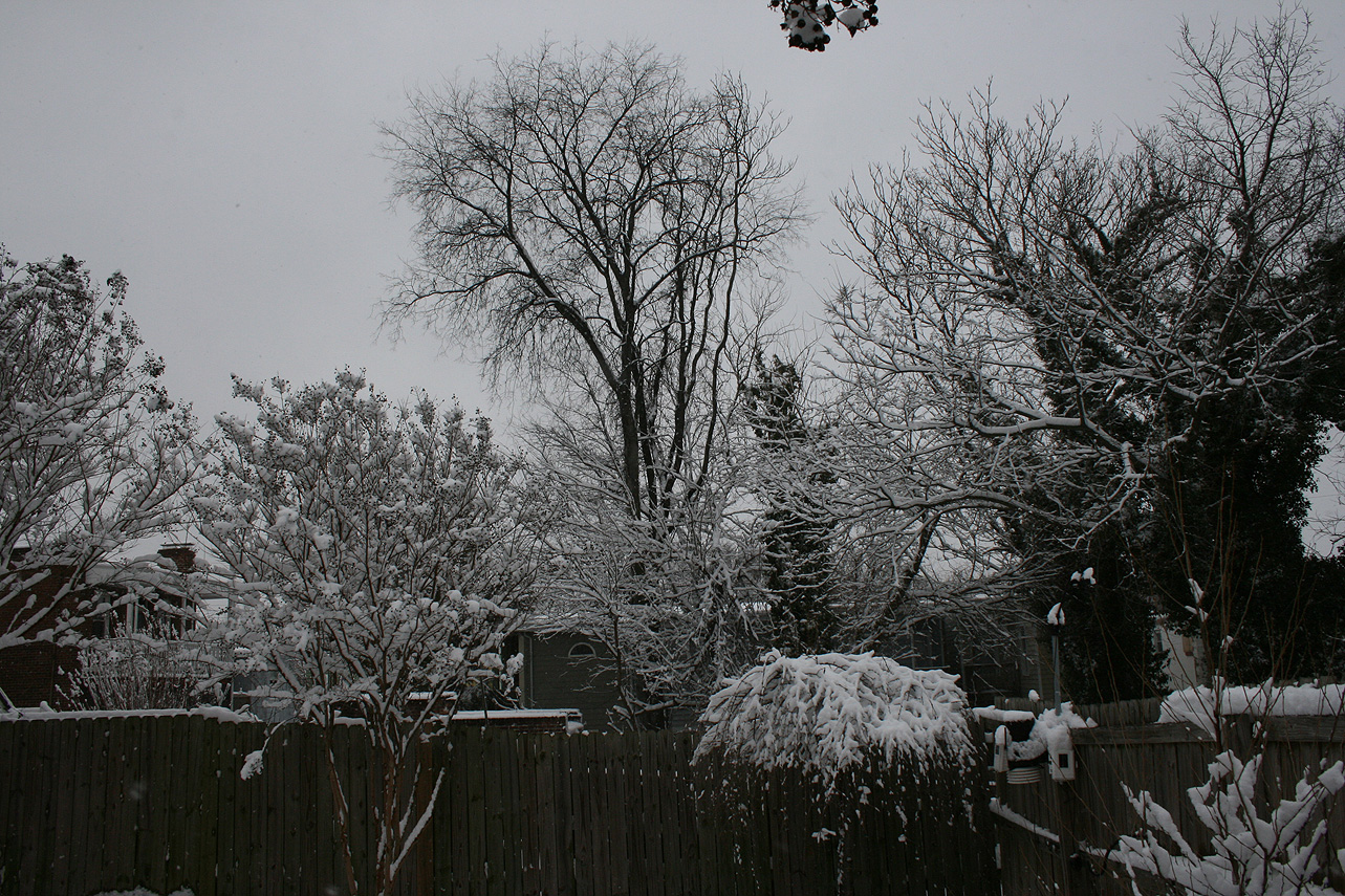
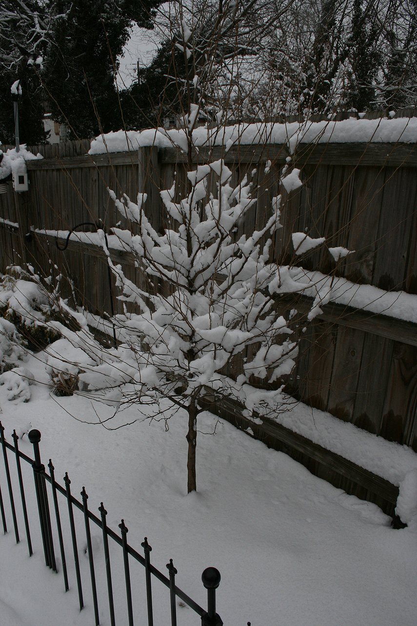
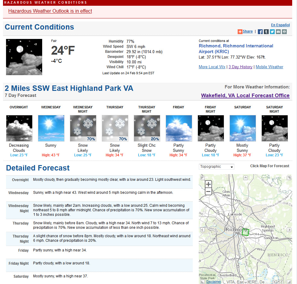
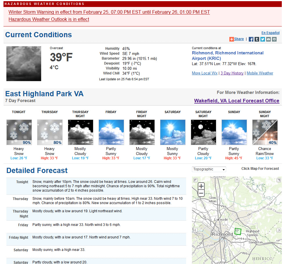
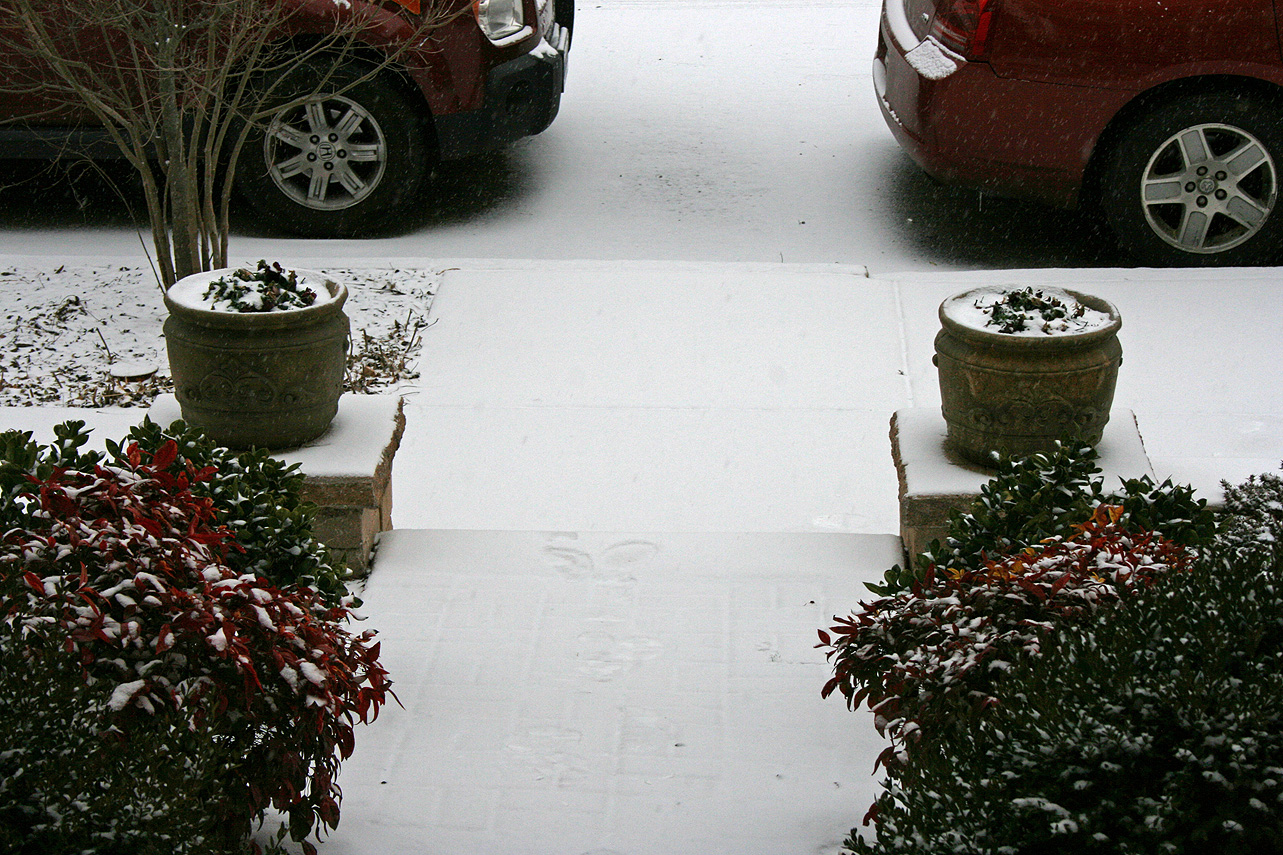
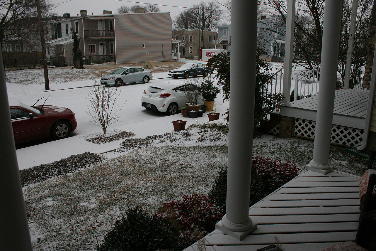
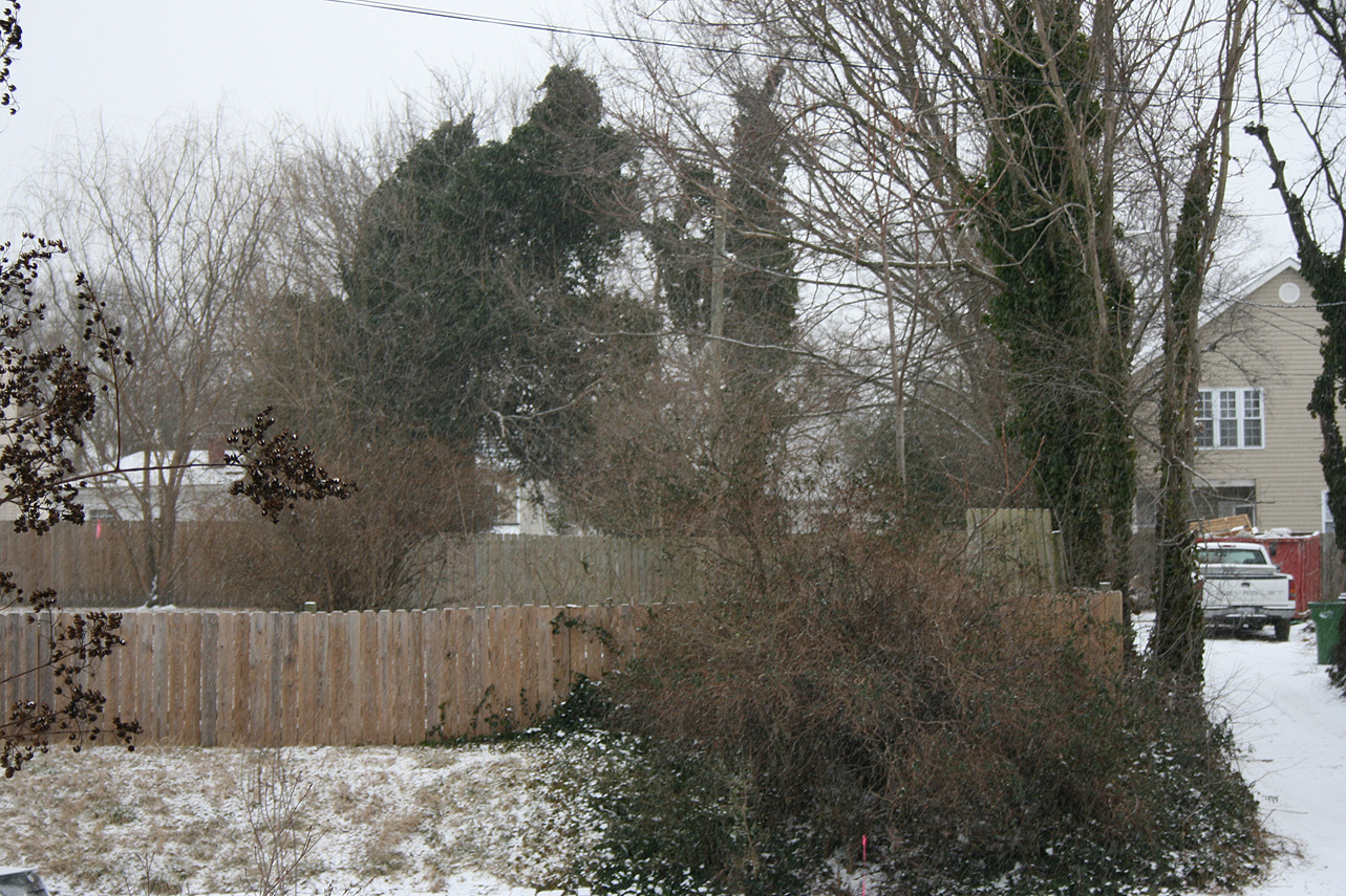
A moderate intensity storm system will be brushing central Virginia late Wednesday night into Thursday morning. A system rounding the corner of a fresh arctic plunge on the east coast will skirt from the Gulf Coast across the Carolinas and bring a snow event that ranges from 1-4 inches in central Virginia to almost a foot in Hampton Roads. Current forecast and trends are posted below.

NWS Forecast on 2/24/15


Snowfall Forecast, NWS (2/24/15)

Update on 2/25/15:

Winter Storm Watch
URGENT – WINTER WEATHER MESSAGE
NATIONAL WEATHER SERVICE WAKEFIELD VA
430 AM EST WED FEB 25 2015

VAZ060-061-067>073-078-082-083-085-251730-
/O.EXB.KAKQ.WS.A.0004.150226T0000Z-150226T1800Z/
PRINCE EDWARD-CUMBERLAND-NOTTOWAY-AMELIA-POWHATAN-CHESTERFIELD-
HENRICO-KING WILLIAM-KING AND QUEEN-LANCASTER-CHARLES CITY-
NEW KENT-MIDDLESEX-
INCLUDING THE CITIES OF…FARMVILLE…CREWE…COLONIAL HEIGHTS…
RICHMOND
430 AM EST WED FEB 25 2015

…WINTER STORM WATCH IN EFFECT FROM THIS EVENING THROUGH
THURSDAY AFTERNOON…

THE NATIONAL WEATHER SERVICE IN WAKEFIELD HAS ISSUED A WINTER
STORM WATCH…WHICH IS IN EFFECT FROM THIS EVENING THROUGH
THURSDAY AFTERNOON.

* LOCATIONS: PORTIONS OF CENTRAL AND EASTERN VIRGINIA INCLUDING
METRO RICHMOND.

* HAZARDS: ACCUMULATING SNOW.

* ACCUMULATIONS: 2 TO 5 INCHES.

* TIMING: LIGHT SNOW WILL OVERSPREAD THE REGION LATE THIS EVENING…AND
MAY BECOME HEAVY AT TIMES AFTER MIDNIGHT. THE SNOW IS EXPECTED
TO TAPER OFF TO LIGHT SNOW SHOWERS THURSDAY MORNING…WITH
LITTLE ADDITIONAL ACCUMULATION EXPECTED AFTER 7 AM.

PRECAUTIONARY/PREPAREDNESS ACTIONS…

A WINTER STORM WATCH MEANS THERE IS A POTENTIAL FOR SIGNIFICANT
SNOW…SLEET…OR ICE ACCUMULATIONS THAT MAY IMPACT TRAVEL.
CONTINUE TO MONITOR THE LATEST FORECASTS.

&&

$$

——————————————————————————–

Hazardous Weather Outlook
HAZARDOUS WEATHER OUTLOOK
NATIONAL WEATHER SERVICE WAKEFIELD VA
553 AM EST WED FEB 25 2015

VAZ060-061-067>073-078-082>086-099-261100-
PRINCE EDWARD-CUMBERLAND-NOTTOWAY-AMELIA-POWHATAN-CHESTERFIELD-
HENRICO-KING WILLIAM-KING AND QUEEN-LANCASTER-CHARLES CITY-NEW KENT-
GLOUCESTER-MIDDLESEX-MATHEWS-ACCOMACK-
553 AM EST WED FEB 25 2015

…WINTER STORM WATCH IN EFFECT FROM THIS EVENING THROUGH THURSDAY
AFTERNOON…

THIS HAZARDOUS WEATHER OUTLOOK IS FOR CENTRAL VIRGINIA…EAST
CENTRAL VIRGINIA…SOUTH CENTRAL VIRGINIA…THE EASTERN SHORE OF
VIRGINIA…THE MIDDLE PENINSULA OF VIRGINIA…THE NORTHERN NECK OF
VIRGINIA AND THE PIEDMONT OF CENTRAL VIRGINIA.

.DAY ONE…TODAY AND TONIGHT.

PLEASE LISTEN TO NOAA WEATHER RADIO OR GO TO WEATHER.GOV ON THE
INTERNET FOR MORE INFORMATION ABOUT THE FOLLOWING HAZARDS.

WINTER STORM WATCH.

.DAYS TWO THROUGH SEVEN…THURSDAY THROUGH TUESDAY.

PLEASE LISTEN TO NOAA WEATHER RADIO OR GO TO WEATHER.GOV ON THE
INTERNET FOR MORE INFORMATION ABOUT THE FOLLOWING HAZARDS.

WINTER STORM WATCH.

.SPOTTER INFORMATION STATEMENT…

SPOTTER ACTIVATION IS NOT EXPECTED AT THIS TIME.

$$

——————————————————————————–

——————————————————————————–

Winter Storm Watch
URGENT – WINTER WEATHER MESSAGE
NATIONAL WEATHER SERVICE WAKEFIELD VA
430 AM EST WED FEB 25 2015

VAZ060-061-067>073-078-082-083-085-251730-
/O.EXB.KAKQ.WS.A.0004.150226T0000Z-150226T1800Z/
PRINCE EDWARD-CUMBERLAND-NOTTOWAY-AMELIA-POWHATAN-CHESTERFIELD-
HENRICO-KING WILLIAM-KING AND QUEEN-LANCASTER-CHARLES CITY-
NEW KENT-MIDDLESEX-
INCLUDING THE CITIES OF…FARMVILLE…CREWE…COLONIAL HEIGHTS…
RICHMOND
430 AM EST WED FEB 25 2015

…WINTER STORM WATCH IN EFFECT FROM THIS EVENING THROUGH
THURSDAY AFTERNOON…

THE NATIONAL WEATHER SERVICE IN WAKEFIELD HAS ISSUED A WINTER
STORM WATCH…WHICH IS IN EFFECT FROM THIS EVENING THROUGH
THURSDAY AFTERNOON.

* LOCATIONS: PORTIONS OF CENTRAL AND EASTERN VIRGINIA INCLUDING
METRO RICHMOND.

* HAZARDS: ACCUMULATING SNOW.

* ACCUMULATIONS: 2 TO 5 INCHES.

* TIMING: LIGHT SNOW WILL OVERSPREAD THE REGION LATE THIS EVENING…AND
MAY BECOME HEAVY AT TIMES AFTER MIDNIGHT. THE SNOW IS EXPECTED
TO TAPER OFF TO LIGHT SNOW SHOWERS THURSDAY MORNING…WITH
LITTLE ADDITIONAL ACCUMULATION EXPECTED AFTER 7 AM.

PRECAUTIONARY/PREPAREDNESS ACTIONS…

A WINTER STORM WATCH MEANS THERE IS A POTENTIAL FOR SIGNIFICANT
SNOW…SLEET…OR ICE ACCUMULATIONS THAT MAY IMPACT TRAVEL.
CONTINUE TO MONITOR THE LATEST FORECASTS.

&&

$$


2/25/2015: Evening Update

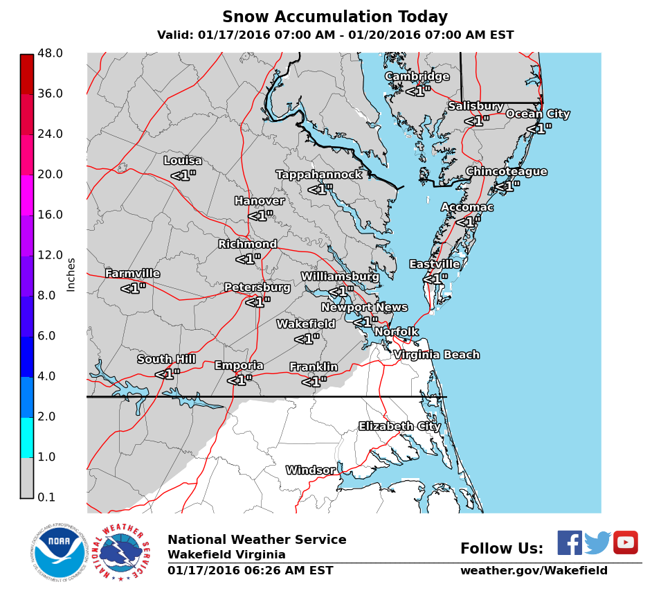
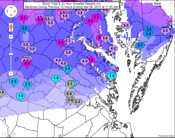
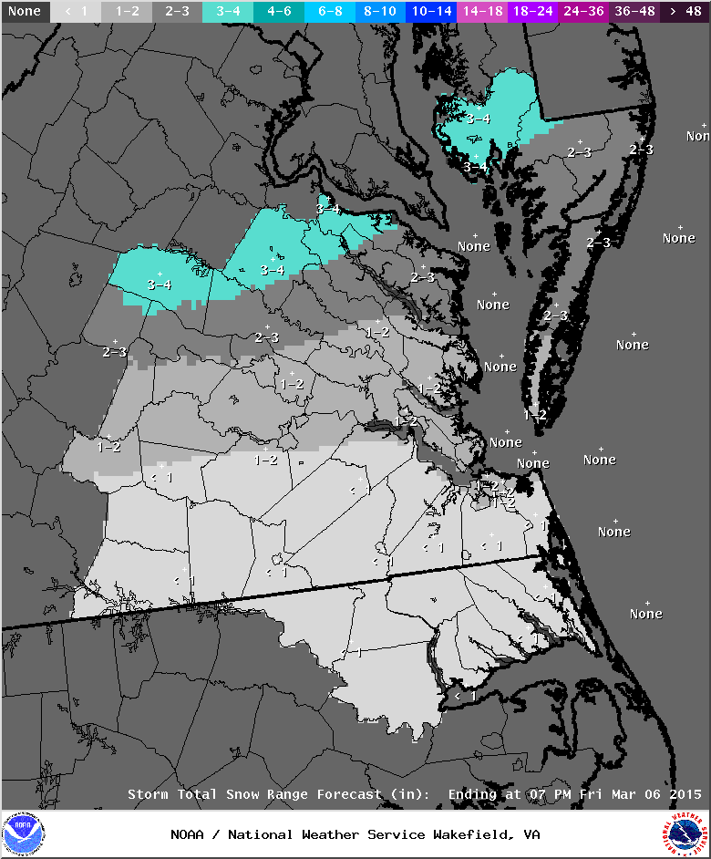
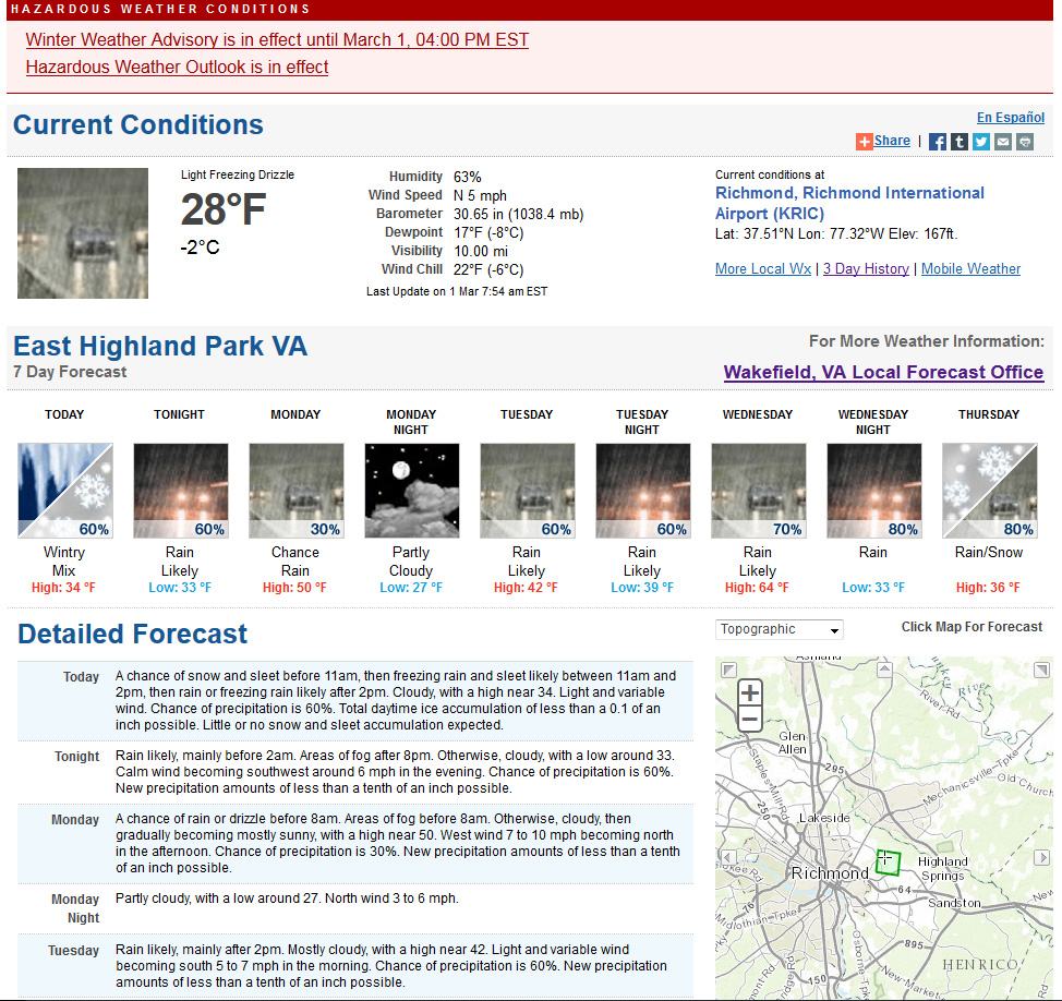
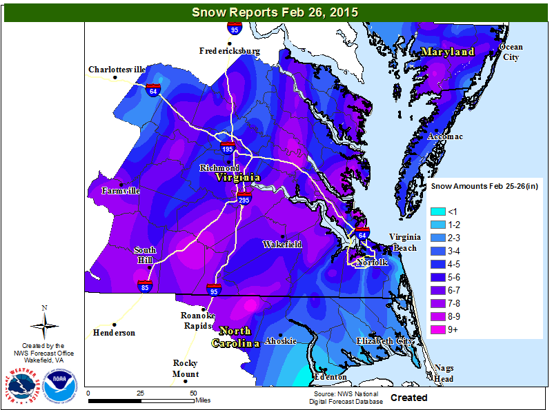
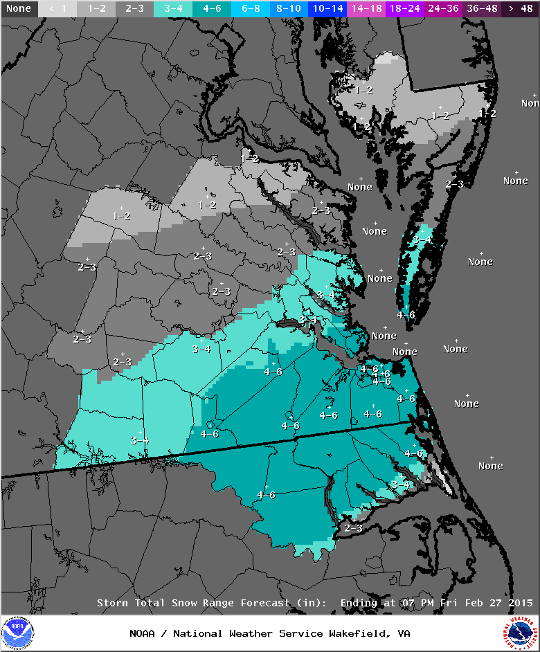
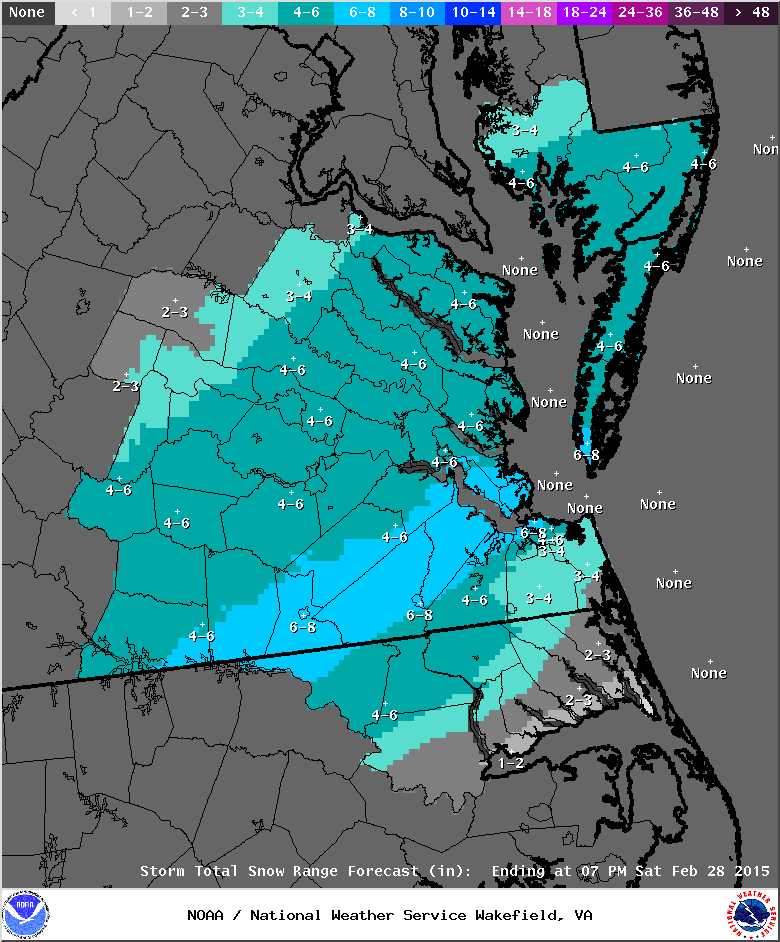
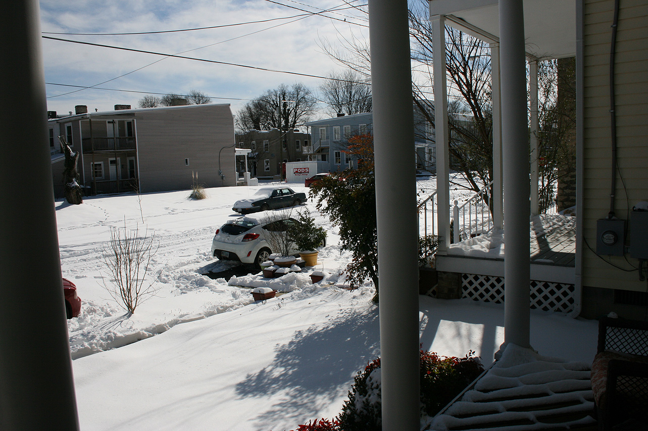
Forecast models and the local stations have been increasing totals throughout the day. Storm totals range from 4-6 (NWS), 4-8 (NBC12), 4-8 (WxRisk) to 5-10 (ABC8). The NWS graphic is posted below. Of course, a Winter Storm Warning is now in effect:

NWS Snow Forecast, 2.25.15 (Evening)
NWS Snow Forecast, 2/25/15 (Evening)


NWS Evening Forecast, 2/25/15


radar_02.25.15_01


URGENT - WINTER WEATHER MESSAGE...CORRECTED
NATIONAL WEATHER SERVICE WAKEFIELD VA
256 PM EST WED FEB 25 2015

VAZ060-061-067>073-078-082>086-260415-
/O.UPG.KAKQ.WS.A.0004.150226T0000Z-150226T1800Z/
/O.COR.KAKQ.WS.W.0002.150226T0000Z-150226T1800Z/
PRINCE EDWARD-CUMBERLAND-NOTTOWAY-AMELIA-POWHATAN-CHESTERFIELD-
HENRICO-KING WILLIAM-KING AND QUEEN-LANCASTER-CHARLES CITY-
NEW KENT-GLOUCESTER-MIDDLESEX-MATHEWS-
INCLUDING THE CITIES OF...FARMVILLE...CREWE...COLONIAL HEIGHTS...
RICHMOND
256 PM EST WED FEB 25 2015

...WINTER STORM WARNING IN EFFECT FROM 7 PM THIS EVENING TO 1 PM
EST THURSDAY...

THE NATIONAL WEATHER SERVICE IN WAKEFIELD HAS ISSUED A WINTER
STORM WARNING FOR HEAVY SNOW...WHICH IS IN EFFECT FROM 7 PM THIS
EVENING TO 1 PM EST THURSDAY. THE WINTER STORM WATCH IS NO LONGER
IN EFFECT.

* LOCATIONS: PORTIONS OF CENTRAL AND EASTERN VIRGINIA...INCLUDING
  THE METRO RICHMOND AREA.

* HAZARDS: SNOW.

* ACCUMULATIONS: 3 TO 6 INCHES...WITH LOCALLY HIGHER AMOUNTS
  POSSIBLE.

* TEMPERATURES: UPPER 20S.

* WINDS: NORTHEAST 5 TO 10 MPH.

* TIMING: LIGHT SNOW WILL OVERSPREAD THE REGION LATE THIS EVENING
  OR AROUND MIDNIGHT...THEN INCREASES IN COVERAGE AND INTENSITY
  AFTER MIDNIGHT. THE SNOW IS EXPECTED TO TAPER OFF TO LIGHT SNOW
  SHOWERS BY LATE THURSDAY MORNING...WITH LITTLE ADDITIONAL
  ACCUMULATION EXPECTED AFTER 10 AM.

PRECAUTIONARY/PREPAREDNESS ACTIONS...

A WINTER STORM WARNING FOR HEAVY SNOW MEANS SEVERE WINTER WEATHER
CONDITIONS ARE EXPECTED OR OCCURRING.  SIGNIFICANT AMOUNTS OF
SNOW ARE FORECAST THAT WILL MAKE TRAVEL DANGEROUS. ONLY TRAVEL IN
AN EMERGENCY. IF YOU MUST TRAVEL...KEEP AN EXTRA FLASHLIGHT...
FOOD...AND WATER IN YOUR VEHICLE IN CASE OF AN EMERGENCY.

&&

$$

February 16-17, 2015: Observations

Church Hill Storm Observation Summary:
* Place – Time: Church Hill, (2/17/2015)
* Temperature: 17-20, During Event
* Winter Weather Watch/Warning/Advisory: Watch & Warning
* Closings: All local school districts closed on 2/17, Chesterfield County Government closed early on 2/16, and closed on 2/17. Delayed opening on 2/18.
* Predicted Totals: Between 6-10″ and 9-14″ the day before and day of the event.
* Road Conditions: All roads had snow accumulation on them. Local streets were covered at the onset of the snow.
* Precipitation Description: Snow, which began at 1 PM on 2/16 and ended around 7 AM on 2/17. Sleet mixed in overnight after 12 AM on 2/17.
* Total Precipitation: 6.0″ of snow. 6.9″ of snow was reported at the Richmond airport. Locally heavier snow to the west of Richmond. Sleet likely compacted measurement total in Richmond.
* Comments: A southern slider system that originated in Missouri/Arkansas, dubbed “Octavia”, developed and slide east through the Tennessee Valley, south of Virginia. Snow broke out during the day on 2/16 and was light until 6 and 7 PM. The heaviest snow and accumulation occurred between 7 PM and 12 AM. Sleet mixed with snow overnight, which limited snow totals. Impacts from snow and ice to the Richmond area were significant from this storm.

Snowfall Totals:

NWS Storm Totals
NWS Storm Totals

Photo Gallery:

Current & Historical Weather Events in Richmond, Virginia