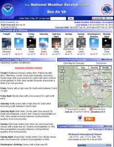
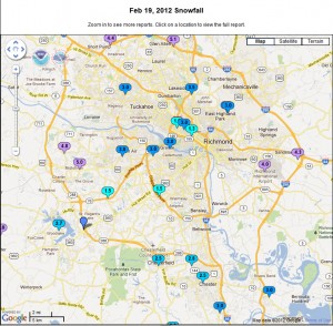
The first real substantial storm of the winter season struck on Sunday, prior to President’s Day. The precipitation started around 9:00 AM and remained light and intermittent until 5:00 PM.Moderate to heavy snow was reported at the airport from 6 PM to 12 PM that evening. A total of 3.9″ was reported at the airport. To date, this was the largest snow event of the season and largest event since the Christmas Day storm of 2010.
The forecast for this storm remained tricky up to the day of the event. Models shifted course the night before the event, drastically reduced snowfall forecasts from 3-6″ to 2-4″ for Richmond and the surrounding counties. A winter storm watch had been issued on Saturday for the a large portion of central Virginia. My Sunday morning, the watch was converted to an advisory with the likelihood that snow totals would not exceed 2″ of snow. Storm totals for Metro Richmond ranged from 1.5″ to 5″ of snow. A snow burst moved through Metro Richmond between 5:30 and 7:30 PM, which gave some areas up to 2″ of snow in two hours!


My Report (Church Hill):
* Place – Time: Church Hill, 11:35 PM (2/19/2012) *After the Event Update*
* Temperature: 33-42, During Storm Event
* Dewpoint: 25-33, During Storm Event
* Relative Humidity: 95%
* Pressure: N/A
* Trends: N/A
*Winter Weather Watch/Warning/Advisory: Watch & Advisory
* Road Conditions: All roads had snow cover during the event. The morning after the event on President’s Day, secondary roads slushy. Major roads passable.
* Precipitation Description: Light, moderate and sometimes heavy snow fell throughout the event. Rain, sleet and gropple fell during the event, especially towards the beginning.
* Total Precip: 4.0″ of snow. Liquid Equivalent of 0.83″ fell during the event at the airport.
* Comments: Precipitation started at 10:00 AM as a light mix of flurries and drizzle. The precipitation fell as light to occasionally moderate snow throughout the morning and early afternoon hours. Little to no accumulation through 5 PM. The precipitation quickly changed to moderate and heavy snow by 6 PM where local roads began to get covered. About 1 and ½ hours of heavy snow was reported in and around RIC airport around 6-7 PM. The snow began to taper off by 12 AM on Monday morning. Snow was very wet, with ratios close to 6:1. Precipitation was spurred by an upper level low that tracked up from the gulf coast to off the Hatteras coast. No winter storm warning was issued, only a winter weather advisory was issued for Sunday afternoon and Monday morning. On Saturday, the day before the event, highs were in the mid-60’s in Central Virginia. The airport reported 3.9” of snow.
Photo Gallery Link: http://www.612.richmondcitywatch.com/modules/gallery2/main.php?g2_itemId=2788