Could Metro Richmond be in store for a President’s Day storm in 2012? The likelihood of a possible winter weather event for Central Virginia is gaining traction today. A lot of caution needs to be placed on the table as the models for this event have been all over the board this week. On Sunday and Monday, the lower Middle Atlantic seemed to be in the cross-hairs of a potential major storm for this weekend. By mid-week, the threat shifted north and east of Central Virginia to include DC through NYC. The models (for the time being) have reined in the idea of a coastal storm exiting Carolina coast and cruising up the eastern seaboard. Now, the storm stays suppressed and hammers the majority of the wintery precipitation through WVA, VA and parts of MD and DE. Still a lot of time for the models and overall model consensus on this storm to shift. In the meantime, Richmond has a slight chance of having our first major winter storm of the season.
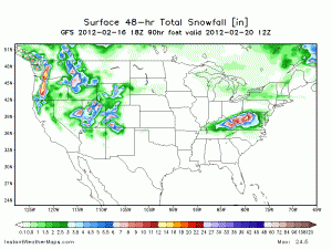
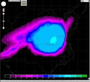
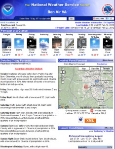
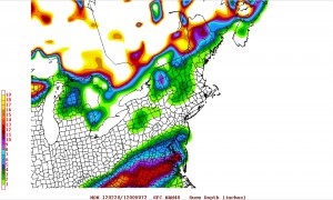
Below are some current predictions based on the models this afternoon:


Updates for 2/17/2012:
The chances for accumulating snow Sunday afternoon, evening and early Monday are increasing. The NAM this morning buried Richmond with 8-11″ of snow. I’m still unsure if this will pan out, but it looks like we have something fun to watch! Also, the 12Z GFS today still shows 3-4″ of snow for Richmond. The trend looks to be our friend if you are a snow lover!

HAZARDOUS WEATHER OUTLOOK
NATIONAL WEATHER SERVICE WAKEFIELD VA
425 PM EST THU FEB 16 2012
MDZ021>023-VAZ048-049-060>091-172130-
DORCHESTER-WICOMICO-SOMERSET-FLUVANNA-LOUISA-PRINCE EDWARD-
CUMBERLAND-GOOCHLAND-HANOVER-CAROLINE-MECKLENBURG-LUNENBURG-NOTTOWAY-
AMELIA-POWHATAN-CHESTERFIELD-HENRICO-KING WILLIAM-KING AND QUEEN-
ESSEX-WESTMORELAND-RICHMOND-NORTHUMBERLAND-LANCASTER-BRUNSWICK-
DINWIDDIE-PRINCE GEORGE-CHARLES CITY-NEW KENT-GLOUCESTER-MIDDLESEX-
MATHEWS-GREENSVILLE-SUSSEX-SURRY-JAMES CITY-YORK-
425 PM EST THU FEB 16 2012
THIS HAZARDOUS WEATHER OUTLOOK IS FOR THE LOWER EASTERN SHORE OF
MARYLAND…CENTRAL VIRGINIA…EAST CENTRAL VIRGINIA…INTERIOR
SOUTHEAST VIRGINIA…SOUTH CENTRAL VIRGINIA…THE MIDDLE PENINSULA
OF VIRGINIA…THE NORTHERN NECK OF VIRGINIA…THE PENINSULA OF
SOUTHEAST VIRGINIA AND THE PIEDMONT OF CENTRAL VIRGINIA.
.DAY ONE…TONIGHT.
NO HAZARDOUS WEATHER IS EXPECTED.
.DAYS TWO THROUGH SEVEN…FRIDAY THROUGH WEDNESDAY.
RAIN IS EXPECTED TO MIX WITH AND CHANGE TO SNOW FROM LATE SUNDAY
AFTERNOON THROUGH SUNDAY EVENING. SOME SNOW ACCUMULATION WILL BE
POSSIBLE…MAINLY SUNDAY EVENING.
.SPOTTER INFORMATION STATEMENT…
SPOTTER ACTIVATION IS NOT EXPECTED AT THIS TIME.
2/17/2012…
.DAYS TWO THROUGH SEVEN…SATURDAY THROUGH THURSDAY.
RAIN IS EXPECTED TO MIX WITH SLEET AND SNOW SUNDAY
AFTERNOON…CHANGING TO ALL SNOW SUNDAY EVENING. LIGHT SNOW
ACCUMULATIONS AROUND ONE INCH WILL BE POSSIBLE…MAINLY SUNDAY
EVENING.
.SPOTTER INFORMATION STATEMENT…
SPOTTER ACTIVATION IS NOT EXPECTED AT THIS TIME.