Click below for a link to my snow observations from home or work since 2009. I’ll work on something a little easier to keep updated shortly.
Daily Archives: December 10, 2018
December 9, 2018: Observations
Franconia Farm Storm Observation Summary:
* Place – Time: Franconia Road, (12/9/2018)
* Temperature: 30-32, During Event
* Winter Weather Watch/Warning/Advisory: Watch & Warning
* Closings: All local school districts were closed on 12/9, Chesterfield County Government was closed on 12/9.
* Predicted Totals: 1-4″ the day before the storm. Between 6-12″ the morning of the storm.
* Road Conditions: All roads had substantial snow accumulation on them by midday on 12/9.
* Precipitation Description: Snow. Snow began around 7:30 AM . Snow transitioned to gropel and snow flurries around 8 PM before ending.
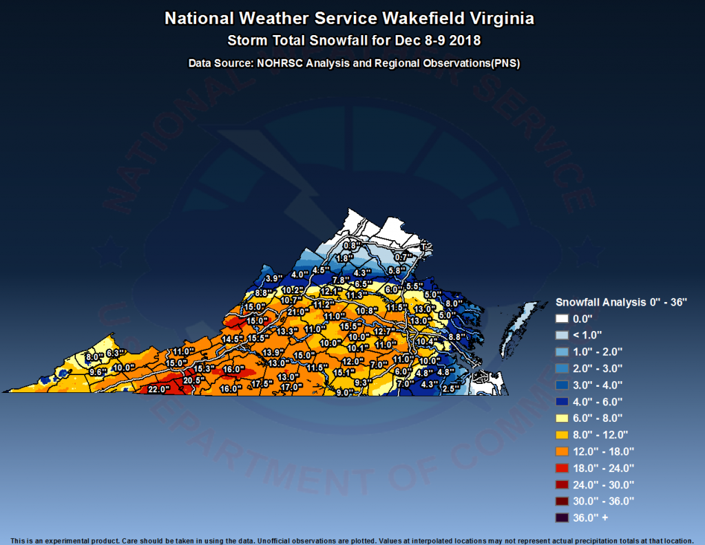
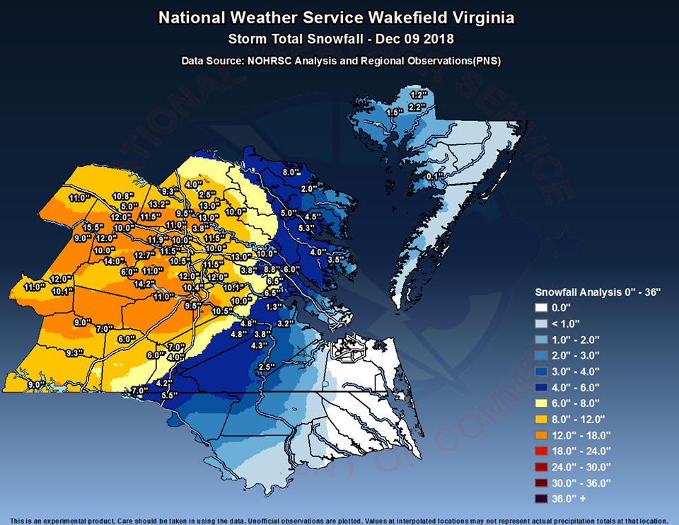
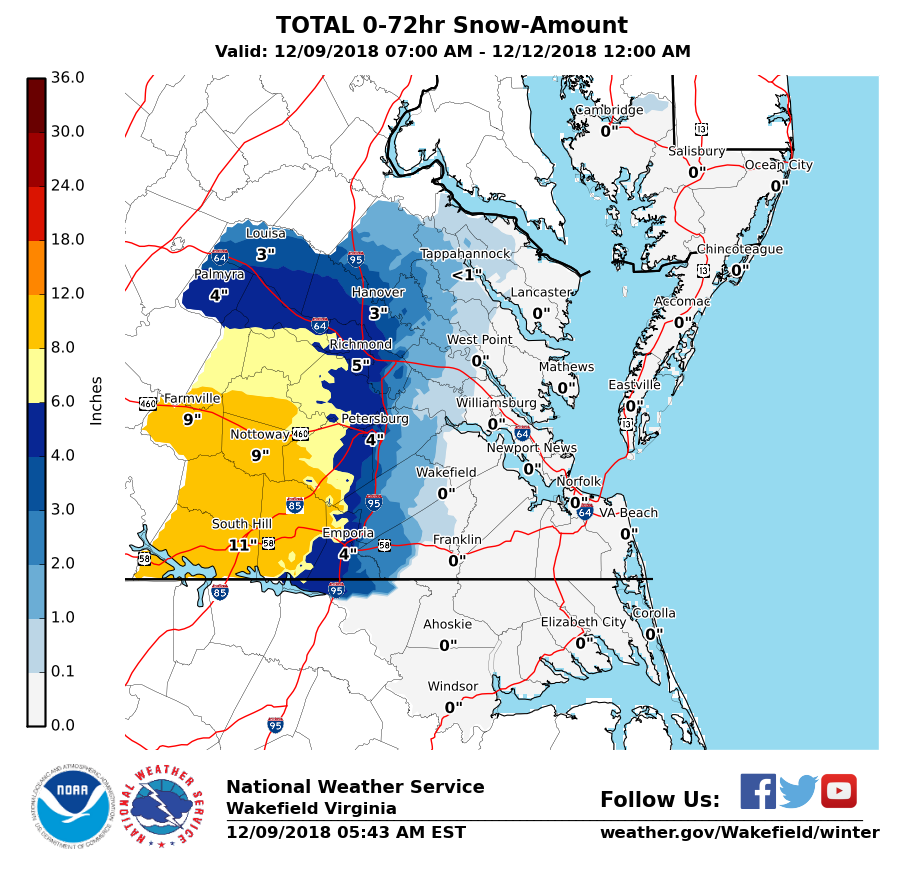
* Total Precipitation: 13.25″ of snow. 11.5″ of snow was reported at the Richmond airport. Locally heavier snow to the south and west of Richmond.
* Comments: A complex storm system tracked across the lower portion of the country, including a multi-phased low-pressure system that transitioned from the Gulf Coast to a low-pressure system off the South and North Carolina coasts. The low-pressure system then tracked ENE into the Atlantic Ocean, causing snow to overspread into Central Virginia. Snow was light to moderate for the until 2-3 PM. Two very heavy snow bands moved in during the afternoon and evening hours. Between 6:26 PM and 6:56 PM, we got 2.5″ of snow, which equates to over 3″ an hour! Reports of lightening and thunder snow were reported in Richmond my brother, David. Snow tapered off by 9 PM on Sunday night (12/9).
Snow impacted Oklahoma up to northern Virginia. This storm was known as “Diego” by TWC . Impacts in western Virginia and North Carolina were extreme, where totals ranged between 1 – 2 feet of snow.
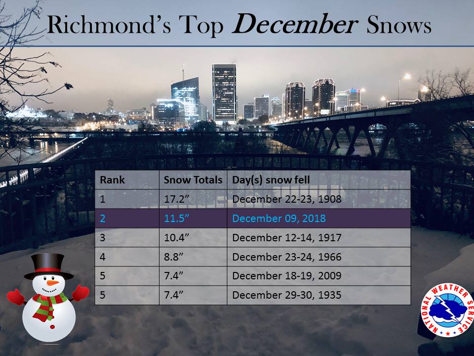
Snowfall Totals & Records:
Photos & Videos
December 9, 2018: Forecast
Diego was a major winter storm that developed off the coast of California the week of December 3rd. The storm traveled across the southern tier of the country and redeveloped along the Gulf Coast on December 8th. By Sunday, it regenerated off the Carolina coast, pushing copious amounts of moisture and wintry precipitation into North Carolina and Virginia. It’s track closely followed a “Miller A” type setup for a winter storm.
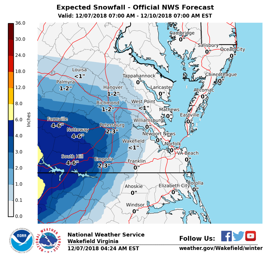
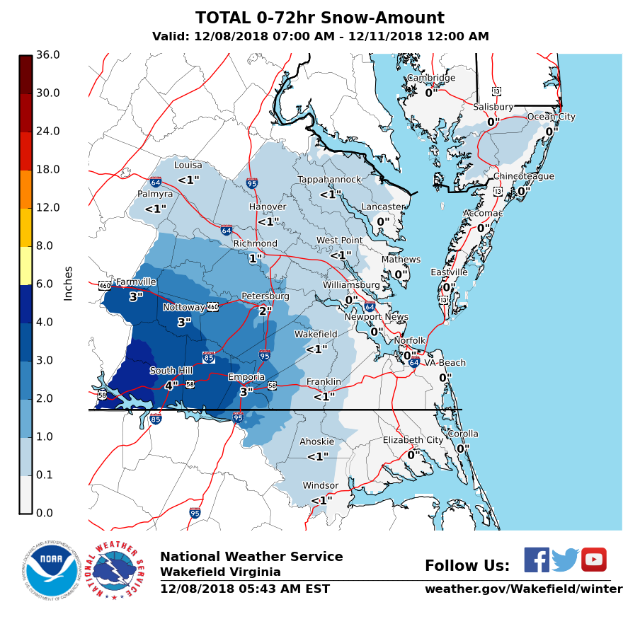
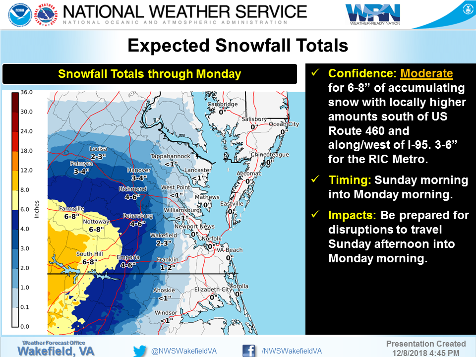
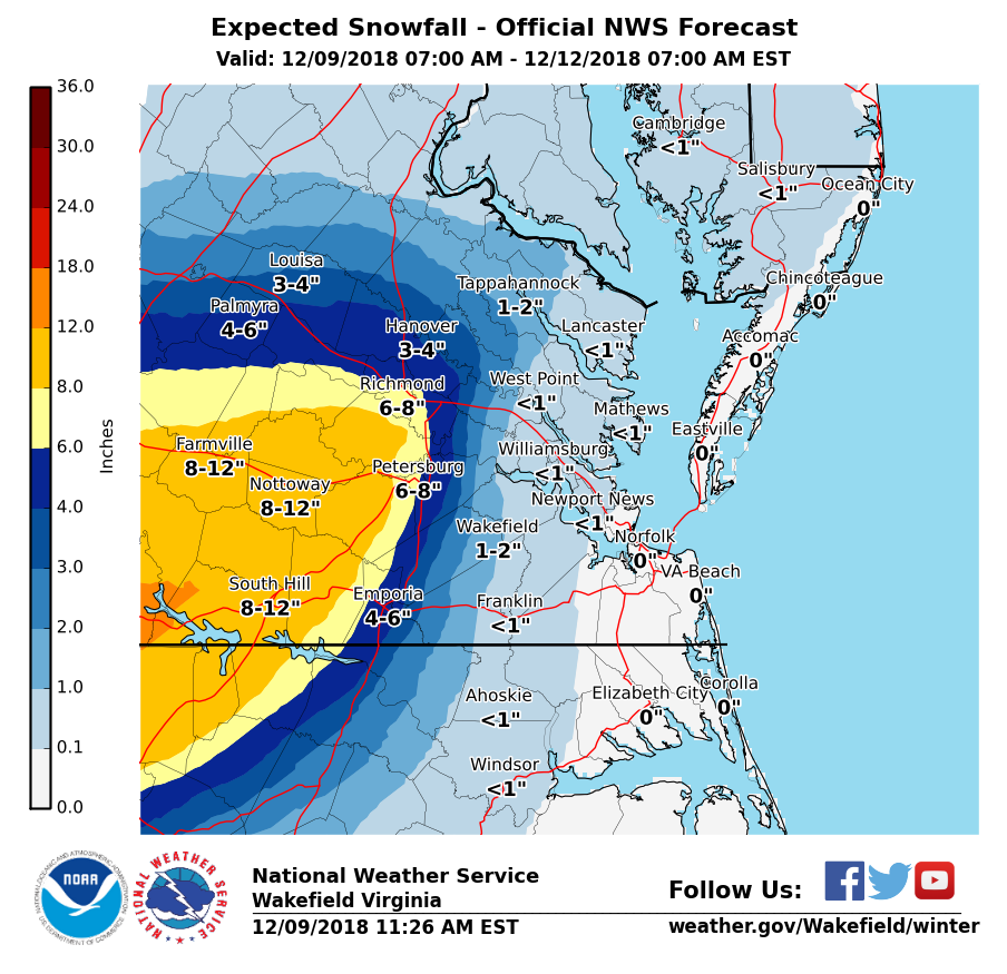
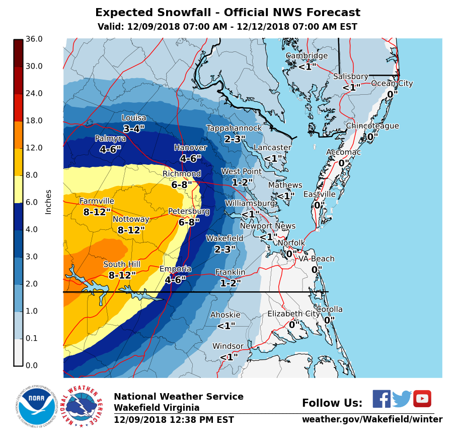
In retrospect, the majority of folks forecasting this event underestimated the amount of snow Central Virginia would receive. Days before the event, snow totals were quite low. The NWS out of Wakefield only significantly increased snow totals on the morning of the 9th. A progression of the snowfall forecast is shown below:
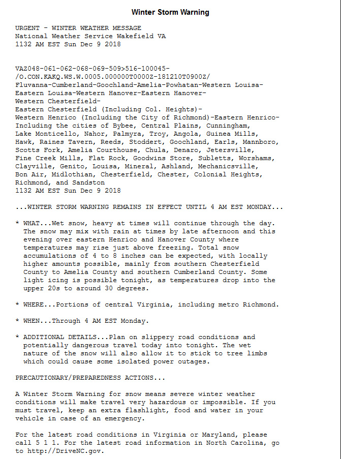
Watches and warnings posted on Saturday, December 8th:
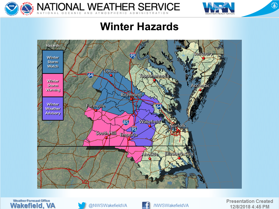
By the morning of the 9th, Winter Storm Warnings were issued for the watch areas. The NWS forecast for Richmond the morning of the event.
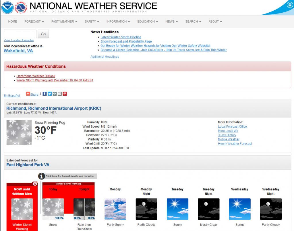
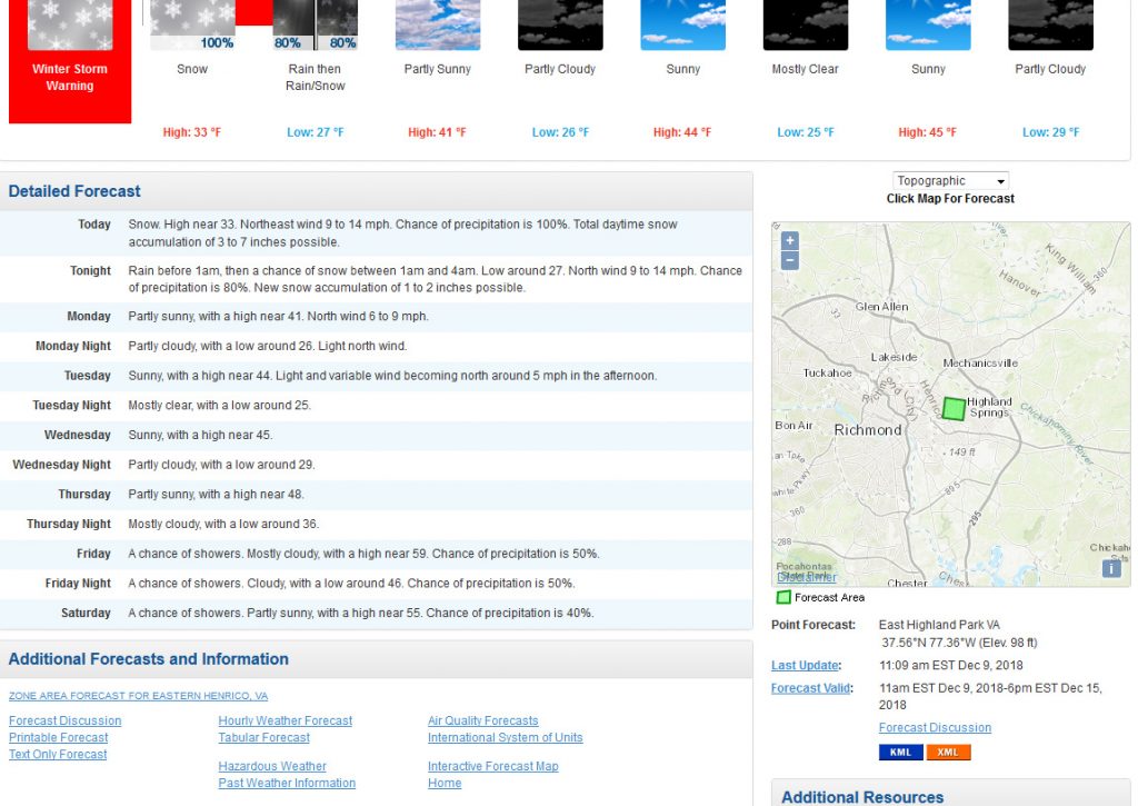
The winter storm warning language: