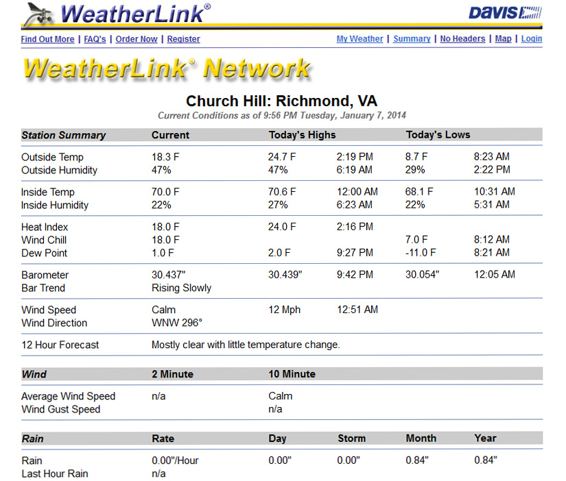
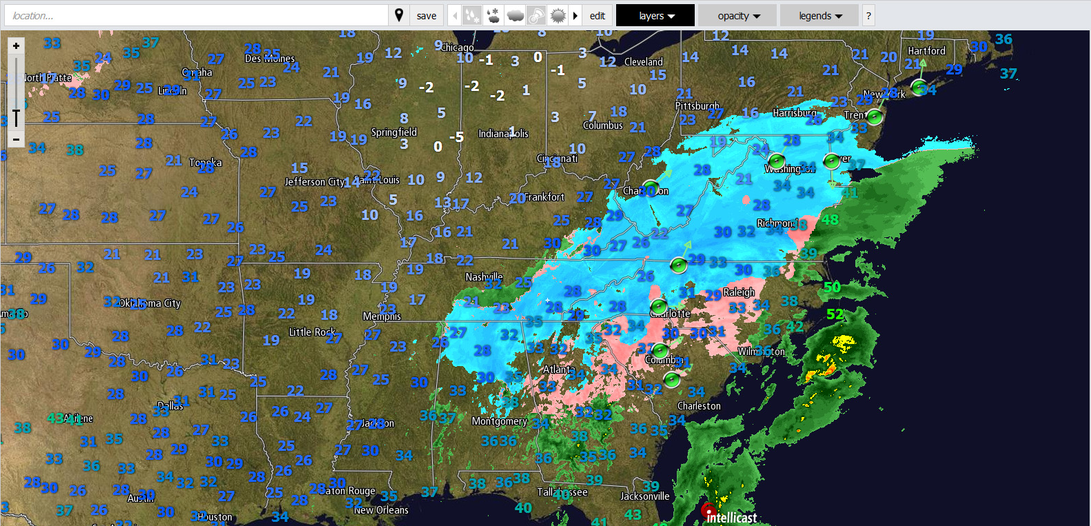
Category Archives: Observation

February 12-13, 2014: Observations (Pax)

Event Updates:

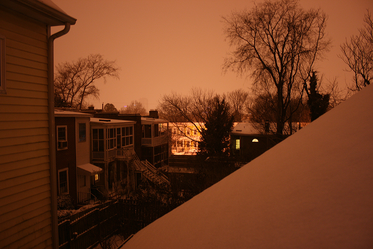
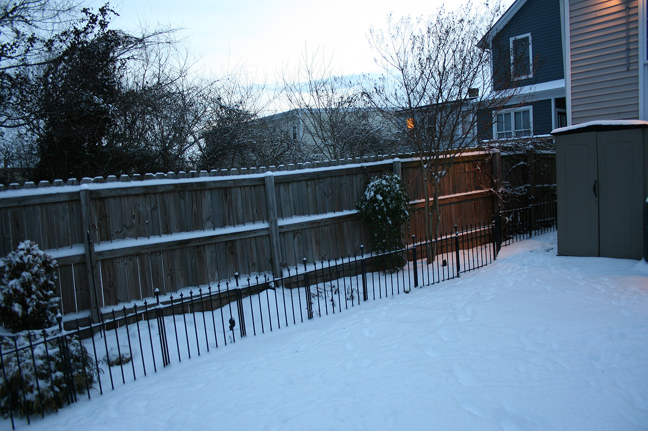
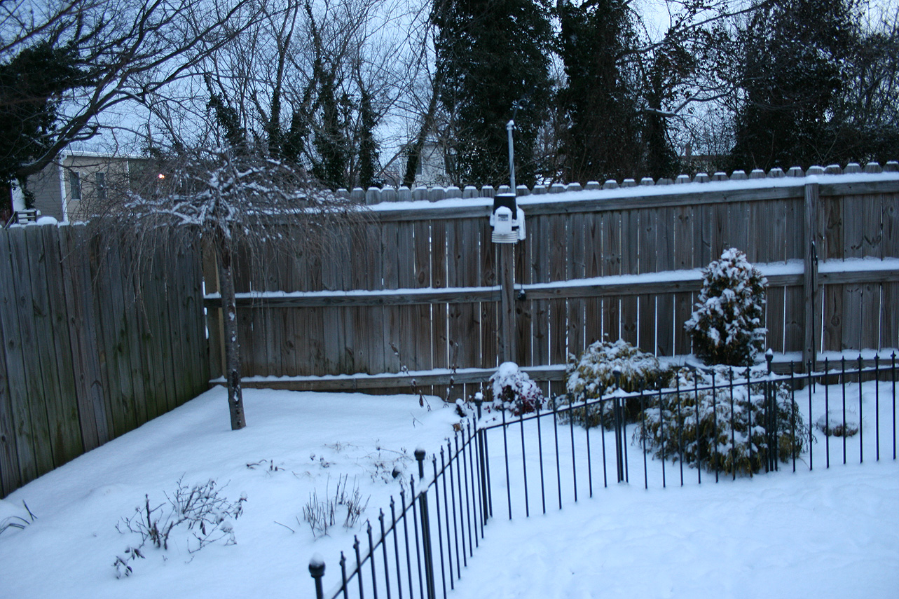
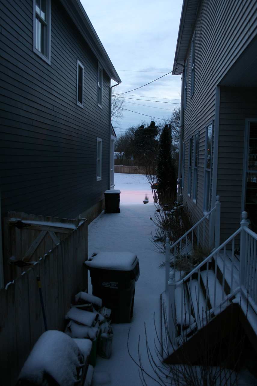
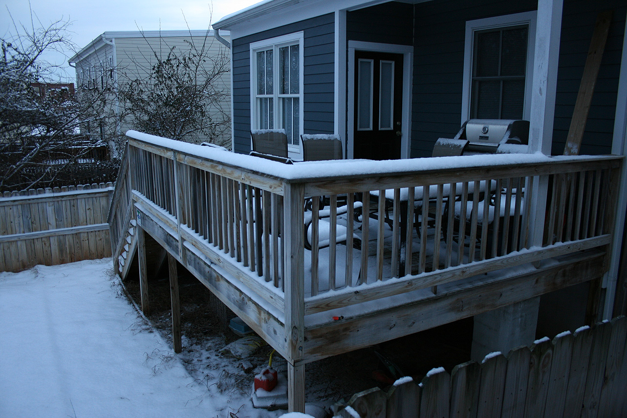
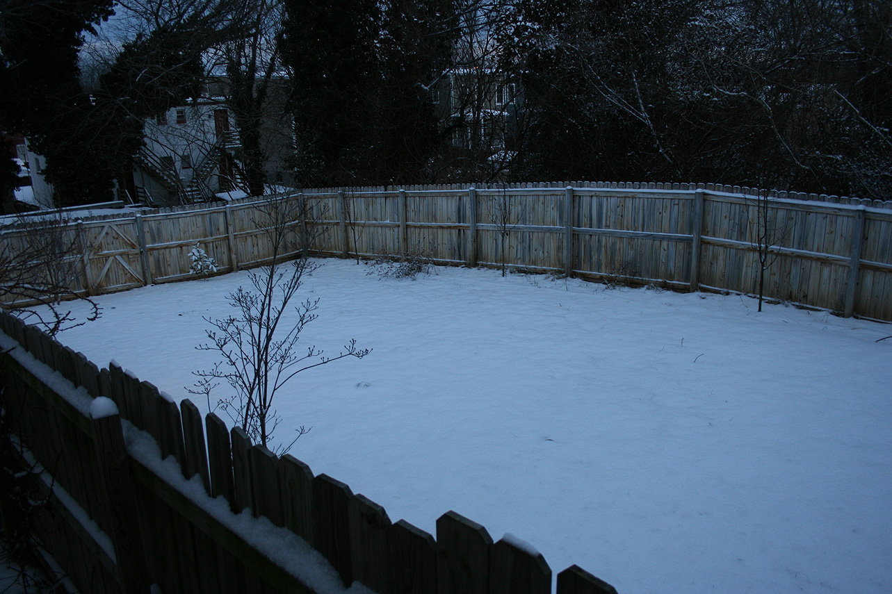
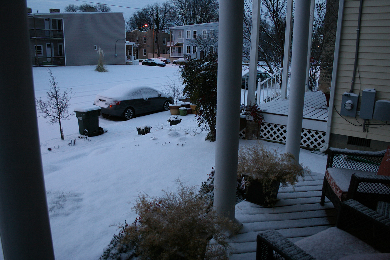
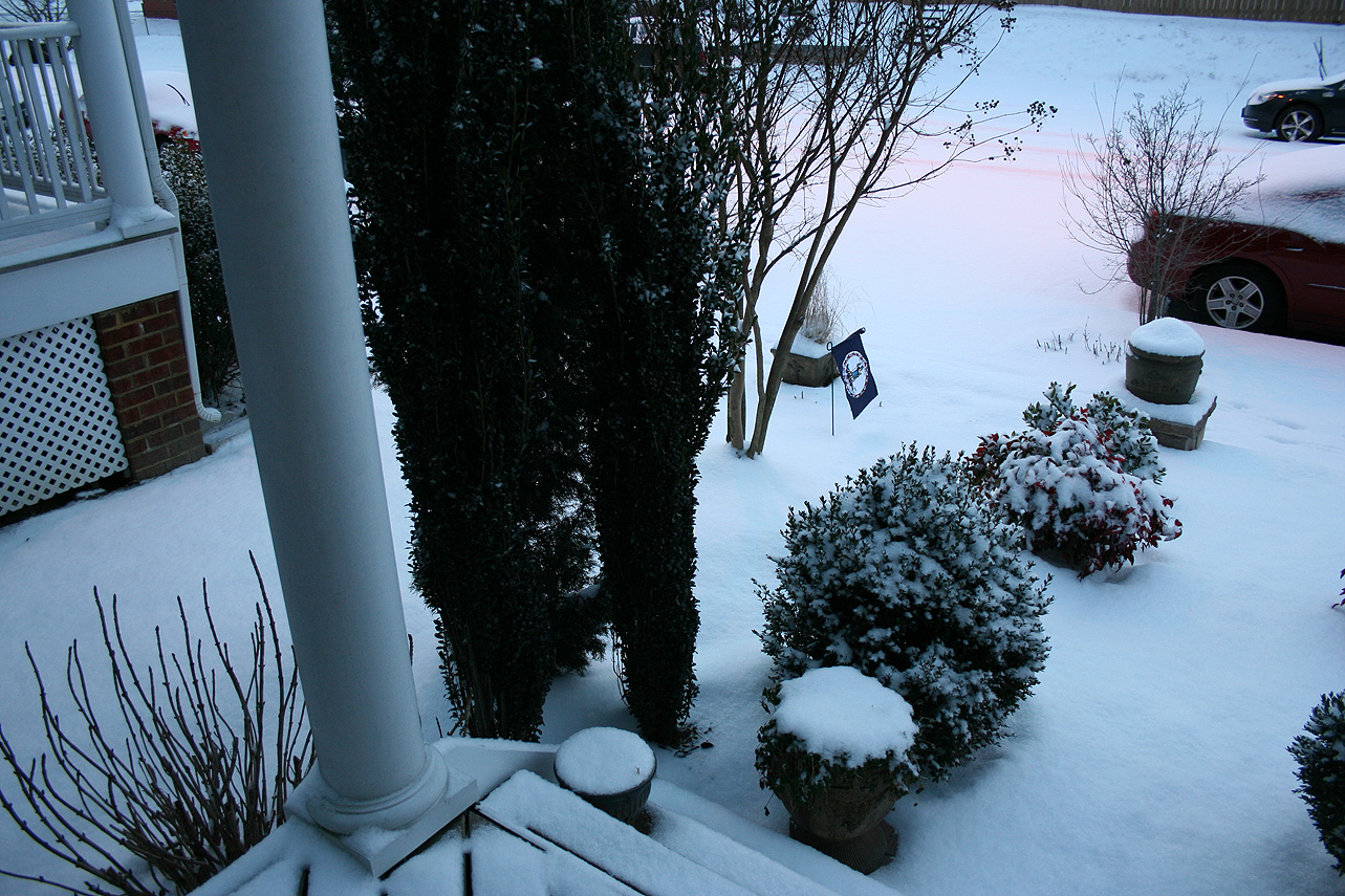
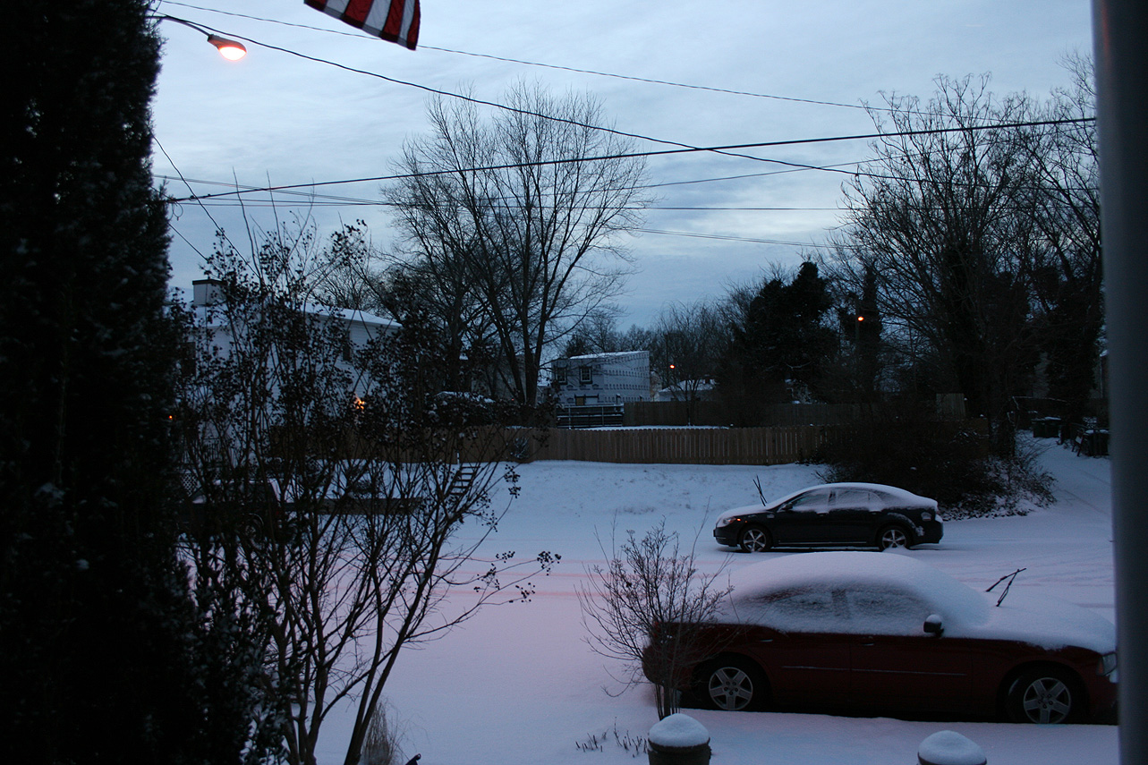
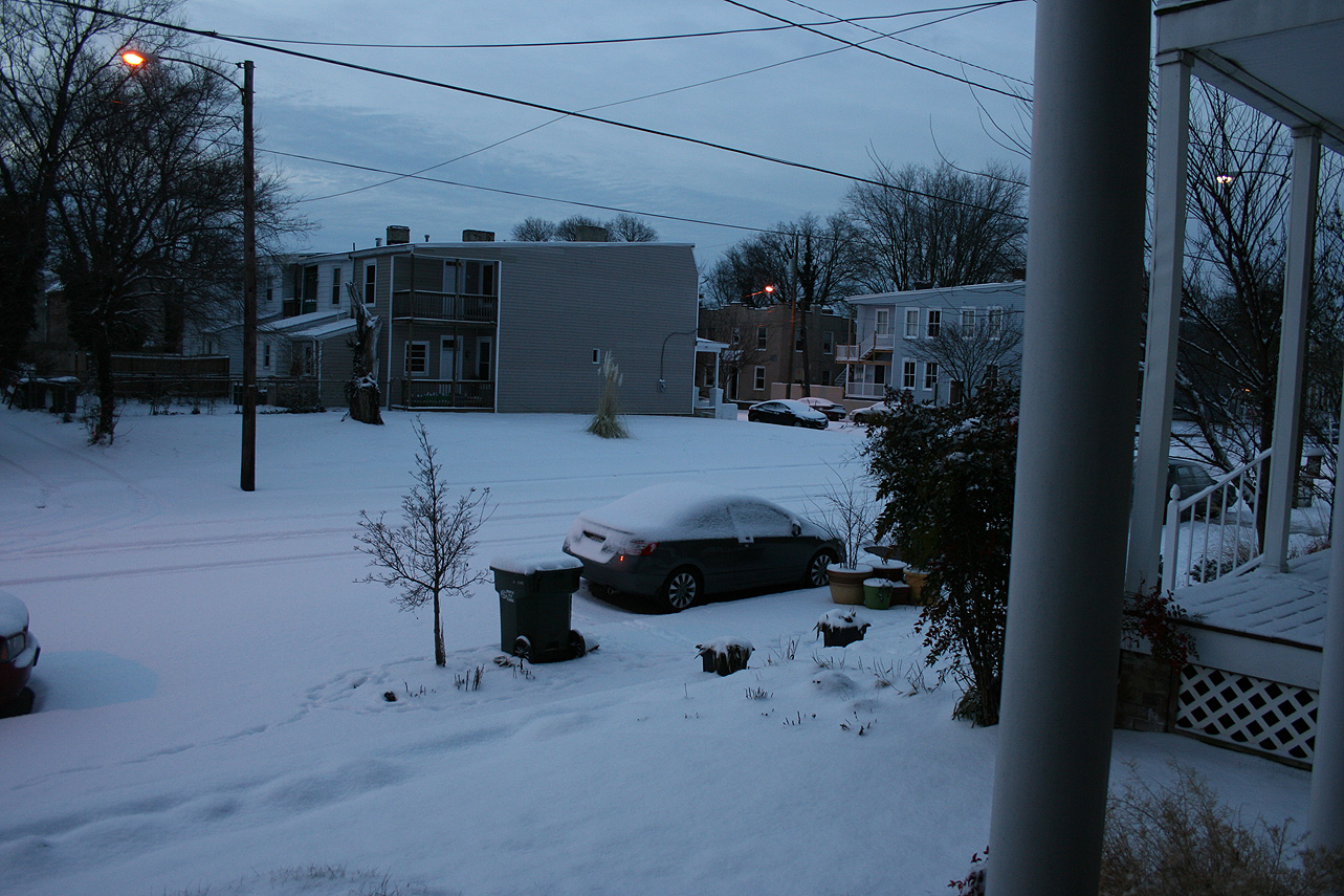
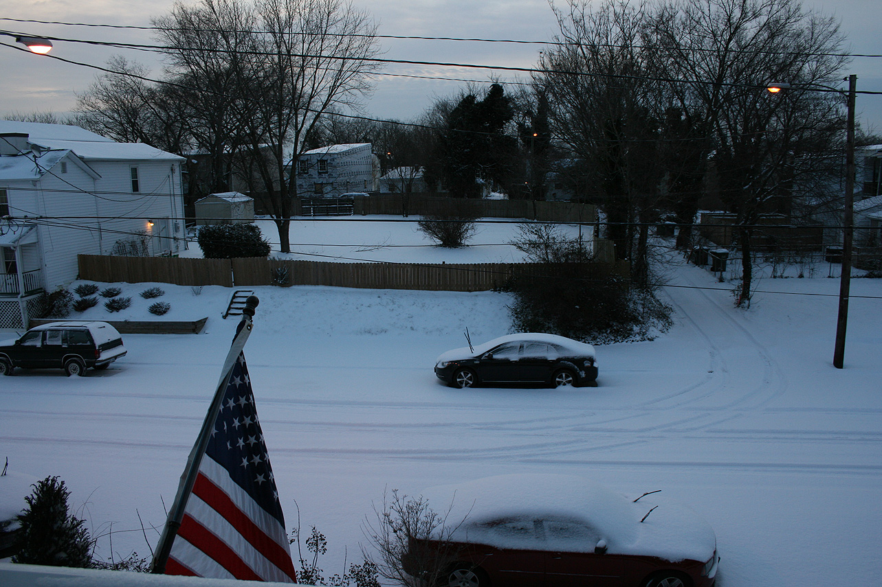
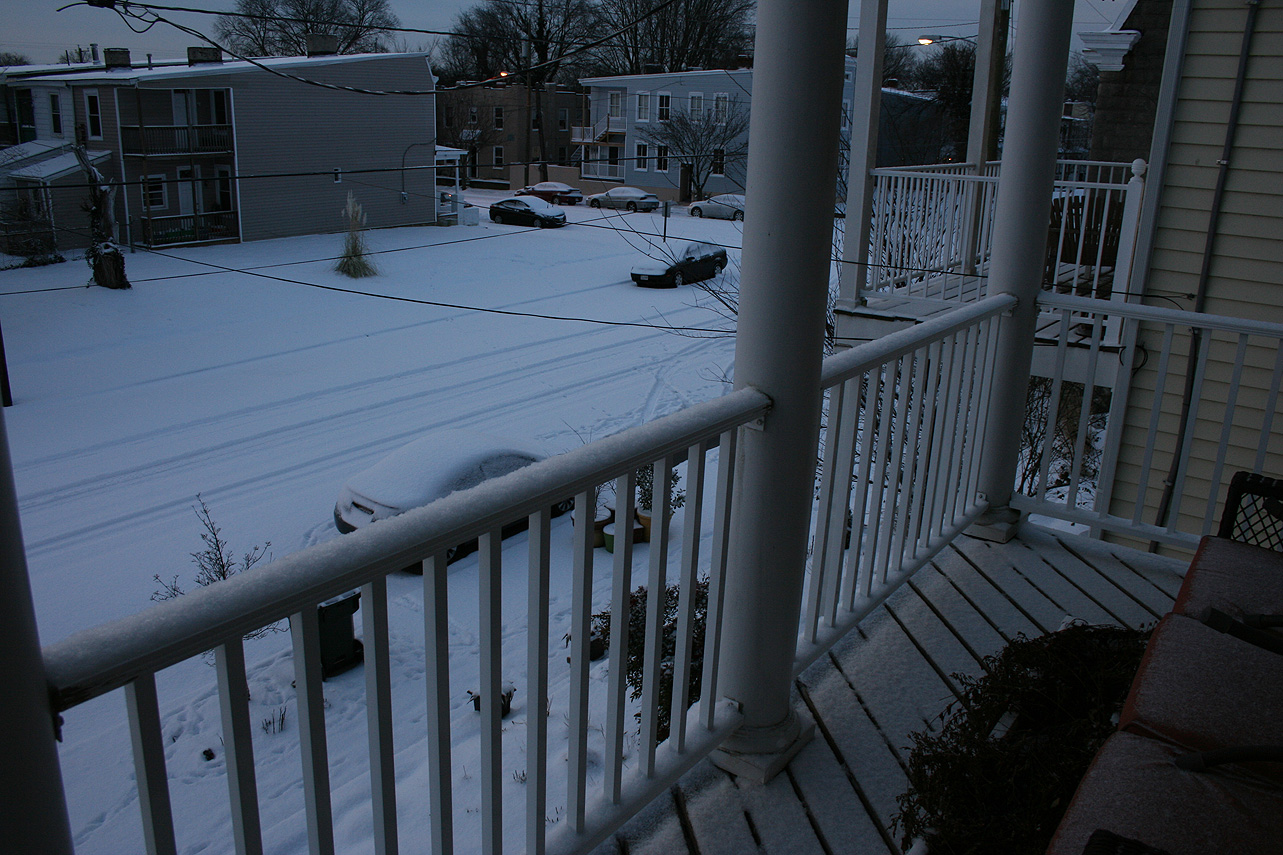
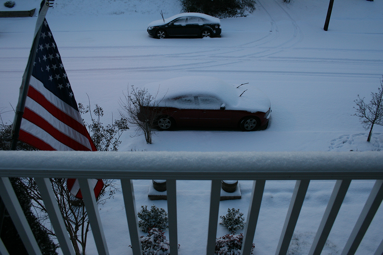
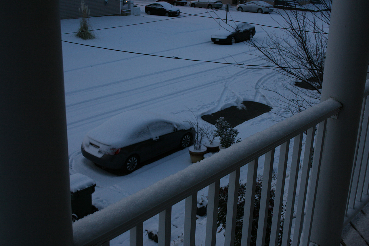
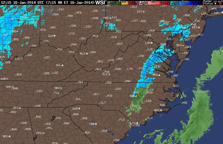
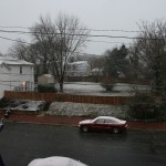
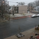
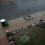
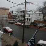
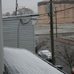
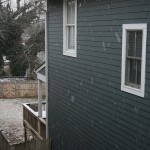
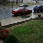
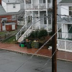
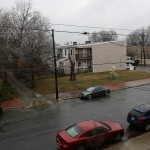
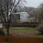
As of 3:30 PM on 2/13, there is approximately 1.5″ of snow/sleet on the majority of surfaces in Church Hill. Temperature continues to slowly fall and is hovering at 34 degrees Fahrenheit. Rain has changed to sleet and now snow.

Radar from afternoon of 2/13/2014

Radar from evening of 2/12/2014

Church Hill Storm Observation Summary:
* Place – Time: Church Hill, (2/13/2014)
* Temperature: 25-37, During Event
* Winter Weather Watch/Warning/Advisory: Warning
* Closings: Chesterfield Government Closed on 2/13/14
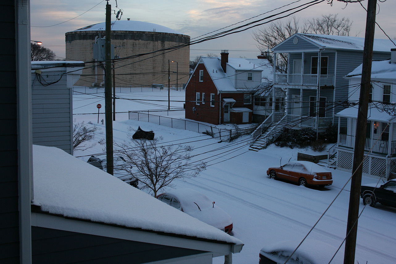
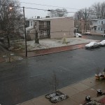
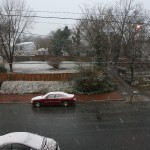
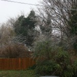
* Road Conditions: All roads covered during event, primary roads cleared by the morning of 2/13. However, secondary roads were still partially snow covered.
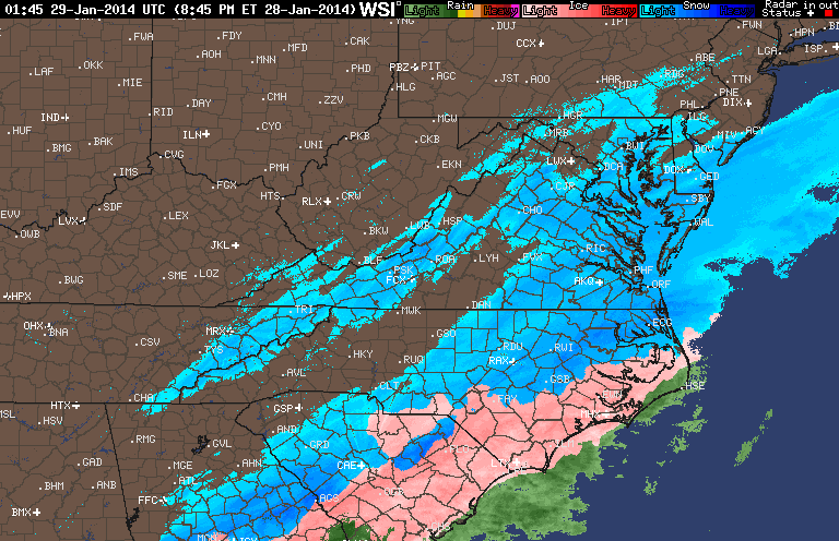
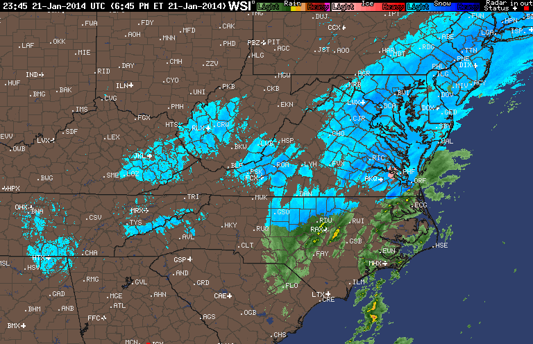
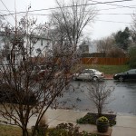
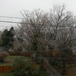
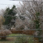
* Precipitation Description: Snow, sleet, freezing rain and rain. Initial snow was very fine and powdery snowflakes. Event transitioned from snow to sleet near 11 PM on 2/12. Sleet changed to freezing rain by 1:00 AM on 2/13/14. Rain and Drizzle followed during the early morning hours until 2 PM on 2/13/14. Sleet and the sleet to snow transitioned back into Richmond by 3:30 PM.
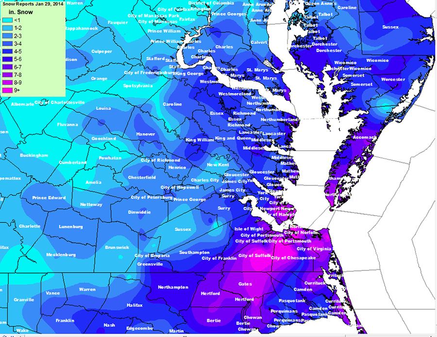
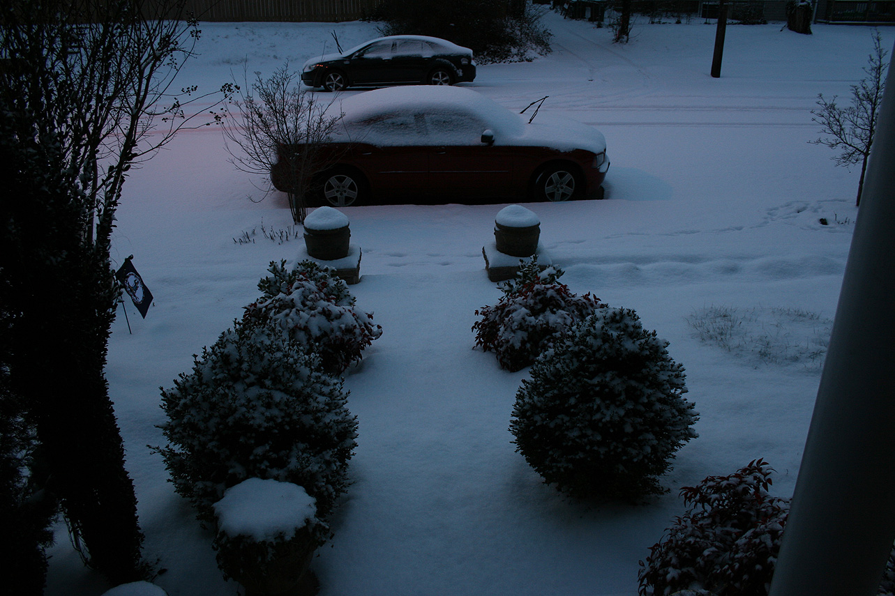
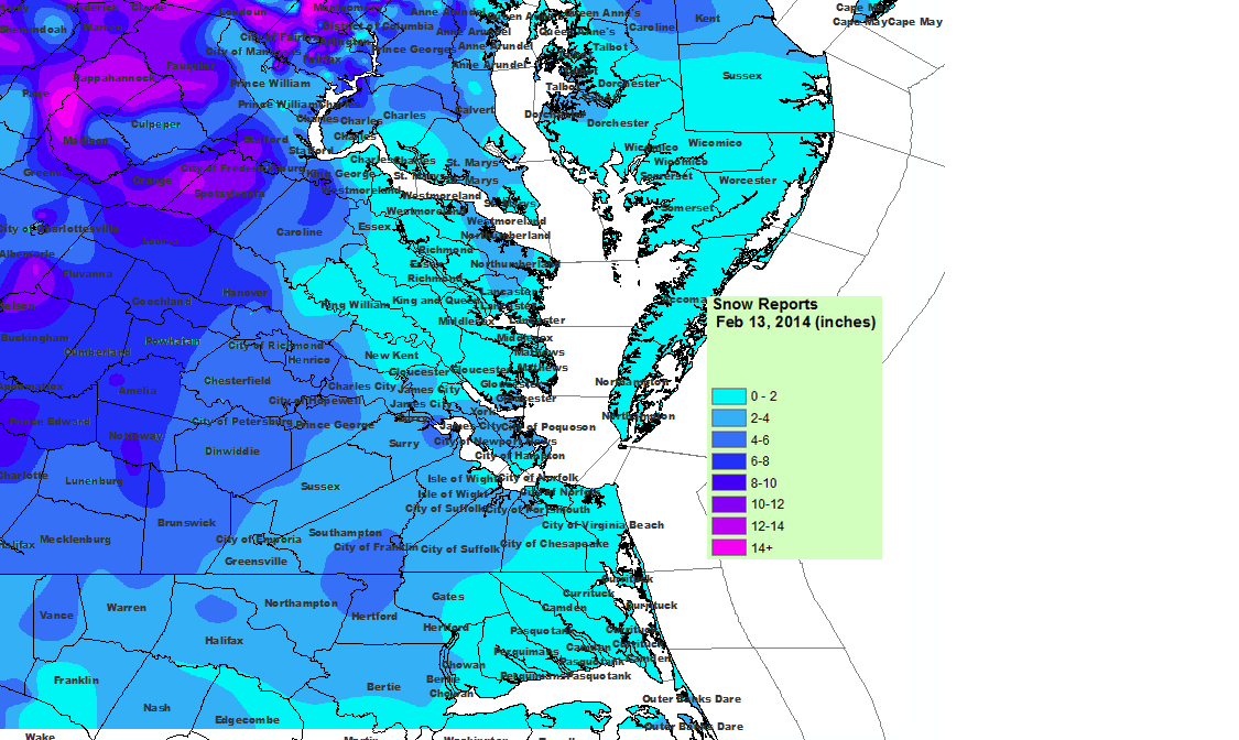
* Total Precipitation: 5.75″ (4.25” of snow on 2/12, 1.5″ of snow on 2/13). Approximately 0.25″ of sleet. Minor accumulations of freezing rain. 3.7″ inches of snow was reported at the airport on 2/12, 2.1″ inches of snow was reported at the airport on 2/12 for a total of 5.8″. Snowfall totals were heavier towards the peidmont and mountains in western Virginia (6-21” was common).
* Comments: Snow began near 4 PM at the Chesterfield Courthouse on 2/12/14. Nearly .75″ had accumulated by 5:30 PM when I left work. My commute home took nearly an hour, which is about twice as long as it normally takes. Heavy snow occurred for about an hour between 9-10 PM when about an inch of snow fell. The precipitation quickly transitioned to sleet. Freezing rain then set in late in the evening after I went to bed. As the storm wrapped up on 2/13, drizzle changed to a brief round of heavy sleet and rain with two loud rumbles of thunder. An hour later, the second round of precipatation hit with moderate to heavy snowfall. The snow tapered off by 7 PM dropping another 1.5″ of snow.

Snowfall Totals:

NWS Updated Snowfall Map for 2/12-2/13

Videos:

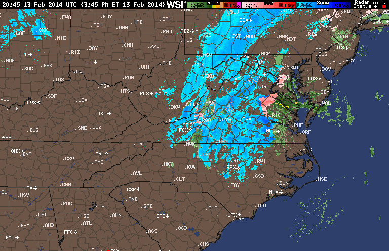
NWS Special Weather Statement:

Special Weather Statement

SPECIAL WEATHER STATEMENT
NATIONAL WEATHER SERVICE WAKEFIELD VA
358 PM EST THU FEB 13 2014

VAZ063-070>072-080>083-132230-
HANOVER-CHESTERFIELD-HENRICO-KING WILLIAM-DINWIDDIE-PRINCE GEORGE-
CHARLES CITY-NEW KENT-
INCLUDING THE CITIES OF...ASHLAND...COLONIAL HEIGHTS...RICHMOND...
PETERSBURG...HOPEWELL
358 PM EST THU FEB 13 2014

...A BAND OF MODERATE TO HEAVY SNOW TO MOVE ACROSS THE INTERSTATE 95
CORRIDOR THROUGH 530 PM...

A BAND OF MODERATE TO HEAVY SNOW WILL MOVE ACROSS THE INTERSTATE
95 CORRIDOR FROM THE TRI-CITIES TO RICHMOND THRU 530 PM. THE SNOW
WILL COME DOWN HARD ENOUGH TO REDUCE THE VISIBILITY TO AROUND ONE
QUARTER MILE AND QUICKLY COVER ROAD SURFACES. A COATING TO UP TO ONE
INCH OF SNOW IS POSSIBLE WITH THIS BAND OF SNOW. MOTORISTS SHOULD
USE CAUTION AND SLOW DOWN IF TRAVELING LATE THIS AFTERNOON. BE
PREPARED FOR POOR VISIBILITIES AND SLIPPERY ROAD CONDITIONS.

$$

JM

January 28-29, 2014: Observations

Event Updates:

As of 9:00 PM on 1/28, there is approximately 1″ of snow on all surfaces in Church Hill. Temperature continues to slowly fall and is hovering at 15.4 degrees Fahrenheit.

Radar at 9 PM on 1/28/2014

Church Hill Storm Observation Summary:
* Place – Time: Church Hill, (1/30/2014)
* Temperature: 12-20, During Event
* Dewpoint: 1-10, During Event
* Relative Humidity: N/A%
* Winter Weather Watch/Warning/Advisory: Advisory
* Road Conditions: All roads covered during event, primary roads cleared by the morning of 1/22. However, secondary roads were still partially snow covered for 2-3 days after event.
* Precipitation Description: Very small snowflakes. Event remained all snow. Snow was so light that it could be swept off of hard surfaces.
* Total Precipitation: 2 and 1/2” (2.5”) of snow. Liquid equivalent of 0.14” fell during the event, which equates to a snow ration of 1:17.9! 2″ to 3″ fell across metro area. 3.1 inches of snow was reported at the airport. Snowfall totals were heavier towards the Bay and Hampton Roads area (6-10” was common).
* Comments: The snow began around the metro area around 3:30-4 PM. Temperatures dropped during the day (due to the passage of an arctic front) and snowfall was light during the entire event. A low tracking off the NC coast spread precipitation into most of Virginia. Wind during the event, averaging 5 MPH or less, was light. Accumulations were present on most surfaces. Snow was measured in the backyard of the house. Snow continued until about 4 AM on January 29th where the temperature dropped to nearly 10 degrees. By far, one of the coldest snow events I’ve witnessed. There was a 1.5 hour delay for Chesterfield County Government Offices.

Snowfall Totals:

NWS Snowfall Totals for 1/29/2014

Videos:

Photos:

January 21, 2014: Observations

Church Hill Storm Observation Summary:

* Place – Time: Church Hill, 10:00 PM (1/21/2014)
* Temperature: 22-34, During Event
* Dewpoint: 29-33, During Event
* Relative Humidity: N/A%
* Winter Weather Watch/Warning/Advisory: Watch & Warning
* Road Conditions: All roads covered during event, primary roads cleared by the morning of 1/22. However, secondary roads were still partially snow covered.
* Precipitation Description: Light rain transitioned to snow showers during the overnight hours.
* Total Precipitation: 2 and 3/4” (2.75”) of snow. Liquid equivalent of 0.12” fell during the event, which equates to a snow ration of 1:22.9! 1″ to 3″ fell across metro area. Two (2) inches of snow was reported at the airport, which also set the daily record for snowfall on January 21st. Snowfall totals were heavier towards the Bay and Hampton Roads area.
* Comments: An initial band of snow showers and flurries rolled through the metro area around 11 AM with no accumulation. Dropping temperatures (due to the passage of an arctic front) and snowfall began around 3:30 PM at the Chesterfield Government Complex. Snow turned heavier by 5:30-6 PM. Winds gusts between 25-30 MPH were recorded at the airport during the snow event. By 7 AM on 1/16, snow was still falling at a light rate. Accumulations were present on most surfaces. Snow was measured in the field near the tennis courts at Ethel Bailey Furman Memorial Park. Snow continued until about 2 AM on January 22nd.

Images:

NWS Mesoscale Graphic
Radar from the evening of the storm.

Videos:

Other Resources:

Wx_Gang_Storm_Overview for 1/21/2014

January 16, 2014: Observation

Radar from 7:30 AM, 1/16/14
NWS Snowfall Graphic for 1/16/2014

* Place – Time: Church Hill, 8:00 AM (1/16/2014)
* Temperature: 32-33, During Event
* Dewpoint: 29-33, During Event
* Relative Humidity: N/A%
* Pressure: N/A
* Trends: N/A
*Winter Weather Watch/Warning/Advisory: None
* Road Conditions: All roads remained passable, no accumulation of snow on roadways.
* Precipitation Description: Light rain transitioned to snow showers during the overnight hours.
* Total Precipitation: 3/8” (0.375”) of snow, mostly on elevated surfaces. Liquid equivalent of 0.15” fell during the event. 0.5″ to 2″ fell across metro area.
* Comments: Rain showers from late in the evening on 1/15 transitioned to snow showers around midnight. By 7 AM on 1/16, snow was still falling at a light rate. Accumulations were mostly confined to elevated and grassy surfaces. Snow was measured on top of my car, where accumulations were heaviest. Snow continued until 9 AM.


December 8, 2013: Observations

Storm Report (Church Hill):

* Place – Time: Church Hill, 12:00 PM (12/9/2013) *After the Event Update*
* Temperature: 32-34, During Event
* Dewpoint: 31-34, During Event
* Relative Humidity: N/A%
* Pressure: N/A
* Trends: N/A
*Winter Weather Watch/Warning/Advisory: Advisory
* Road Conditions: All roads remained passable, no accumulation of ice on roadways.
* Precipitation Description: Light rain and snow showers persisted on and off during the afternoon hours.
* Total Precipitation: Trace of sleet. Freezing rain measured at approximately 0.05”. Liquid equivalent of 1.05” fell during the event.
* Comments: A mix of sleet and freezing rain started shortly after 6:30 AM. The sleet lasted for about 20-30 minutes. Freezing rain lasted until 11 AM as temperatures crept above 32 degrees. Precipitation was intermittent throughout the day with different periods of light to heavy rain in the afternoon. Light accumulation of ice was seen on trees, power lines and exposed elevated surfaces, even into the afternoon and evening. Melting of ice started overnight Sunday into Monday. No observed power outages were seen in the neighborhood.

NWS Advisory issued during event:

Winter Weather Advisory

URGENT – WINTER WEATHER MESSAGE

NATIONAL WEATHER SERVICE WAKEFIELD VA

430 AM EST SUN DEC 8 2013


VAZ065>068-070-071-081730-

/O.CAN.KAKQ.WW.Y.0011.000000T0000Z-131209T0000Z/

/O.NEW.KAKQ.WW.Y.0012.131208T1200Z-131209T0000Z/

MECKLENBURG-LUNENBURG-NOTTOWAY-AMELIA-CHESTERFIELD-HENRICO-

INCLUDING THE CITIES OF…SOUTH HILL…CREWE…COLONIAL HEIGHTS…

RICHMOND

430 AM EST SUN DEC 8 2013


…WINTER WEATHER ADVISORY IN EFFECT UNTIL 7 PM EST THIS

EVENING…


* AREAS AFFECTED: INCLUDE MECKLENBURG…LUNENBURG AND NOTTOWAY.


* ACCUMULATIONS: A TENTH OF AN INCH OF ICE IS EXPECTED ALONG

WITH A LIGHT ACCUMULATION SLEET.


* TIMING: A MIX OF SLEET…AND FREEZING RAIN IS EXPECTED TO BEGIN

AFTER SUNRISE…THEN CHANGE TO ALL FREEZING RAIN LATE IN THE

MORNING. FREEZING RAIN IS EXPECTED TO CHANGE OVER TO RAIN LATE

THIS AFTERNOON.


* TEMPERATURES: 30 TO 33 DEGREES.


* IMPACTS: TRAVEL CONDITIONS COULD BECOME HAZARDOUS SUNDAY

MORNING AND SUNDAY AFTERNOON DUE TO ICY CONDITIONS ON ROADWAYS

AND SIDEWALKS.


PRECAUTIONARY/PREPAREDNESS ACTIONS…


A WINTER WEATHER ADVISORY MEANS THAT PERIODS OF SLEET AND

FREEZING RAIN WILL CAUSE SOME TRAVEL DIFFICULTIES. BE PREPARED

FOR SLIPPERY ROADS AND USE CAUTION WHILE DRIVING.


Photos from Church Hill:


PUBLIC INFORMATION STATEMENT
SPOTTER REPORTS
NATIONAL WEATHER SERVICE WAKEFIELD VA
515 PM EST SUN DEC 08 2013

THE FOLLOWING ARE UNOFFICIAL OBSERVATIONS TAKEN DURING THE PAST 24
HOURS FOR THE STORM THAT HAS BEEN AFFECTING OUR REGION. APPRECIATION
IS EXTENDED TO HIGHWAY DEPARTMENTS...COOPERATIVE OBSERVERS...SKYWARN
SPOTTERS AND MEDIA FOR THESE REPORTS. THIS SUMMARY IS ALSO AVAILABLE
ON OUR HOME PAGE AT WEATHER.GOV/WAKEFIELD

***********************STORM TOTAL ICE***********************

LOCATION          STORM TOTAL     TIME/DATE   COMMENTS
                          ICE           OF
                     /INCHES/   MEASUREMENT

MARYLAND

...DORCHESTER COUNTY...
   CAMBRIDGE             0.20   440 PM 12/08  911 CALL CENTER

VIRGINIA

...CAROLINE COUNTY...
   BOWLING GREEN         0.10   838 AM 12/08  PUBLIC

...CHESTERFIELD COUNTY...
   MIDLOTHIAN            0.10   834 AM 12/08  PUBLIC

...CUMBERLAND COUNTY...
   CUMBERLAND            0.50   325 PM 12/08  911 CALL CENTER

...FLUVANNA COUNTY...
   PALMYRA               0.25   345 PM 12/08  911 CALL CENTER

...HANOVER COUNTY...
   ASHLAND               0.10  1229 PM 12/08  TRAINED SPOTTER

...HENRICO COUNTY...
   LAKESIDE              0.10   800 AM 12/08  TRAINED SPOTTER
   1 NNE BRIDLEWOOD      0.10  1210 PM 12/08  TRAINED SPOTTER

...LOUISA COUNTY...
   LOUISA                0.10   843 AM 12/08  PUBLIC

...LUNENBURG COUNTY...
   VICTORIA              0.10   320 PM 12/08  911 CALL CENTER

...NOTTOWAY COUNTY...
   CREWE                 0.10   839 AM 12/08  PUBLIC

...PRINCE EDWARD COUNTY...
   FARMVILLE             0.25   300 PM 12/08  911 CALL CENTER

$$

LALEXAND